Denver Weather: Winter storm impacts on the way

We have some changes afoot, arriving a little Wednesday but mostly Thursday into Friday morning with the arrival of wintry weather for the metro areas and the state.
A quick look at the hourly planner makes things look interesting soon:
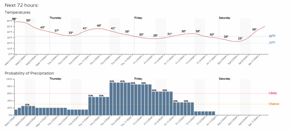
Warm temperatures erode into a cool day Friday with rain and snow in between.
Here are some snapshots covering the next 48 hours. These will show you when and where to look for rain and snow.
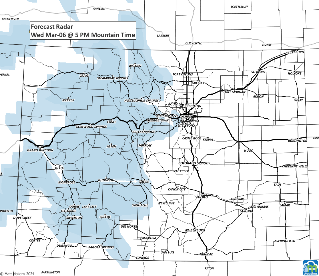
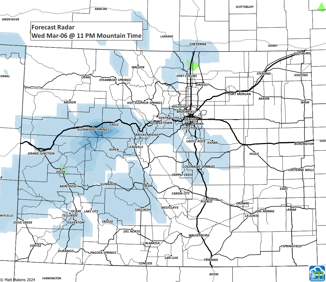
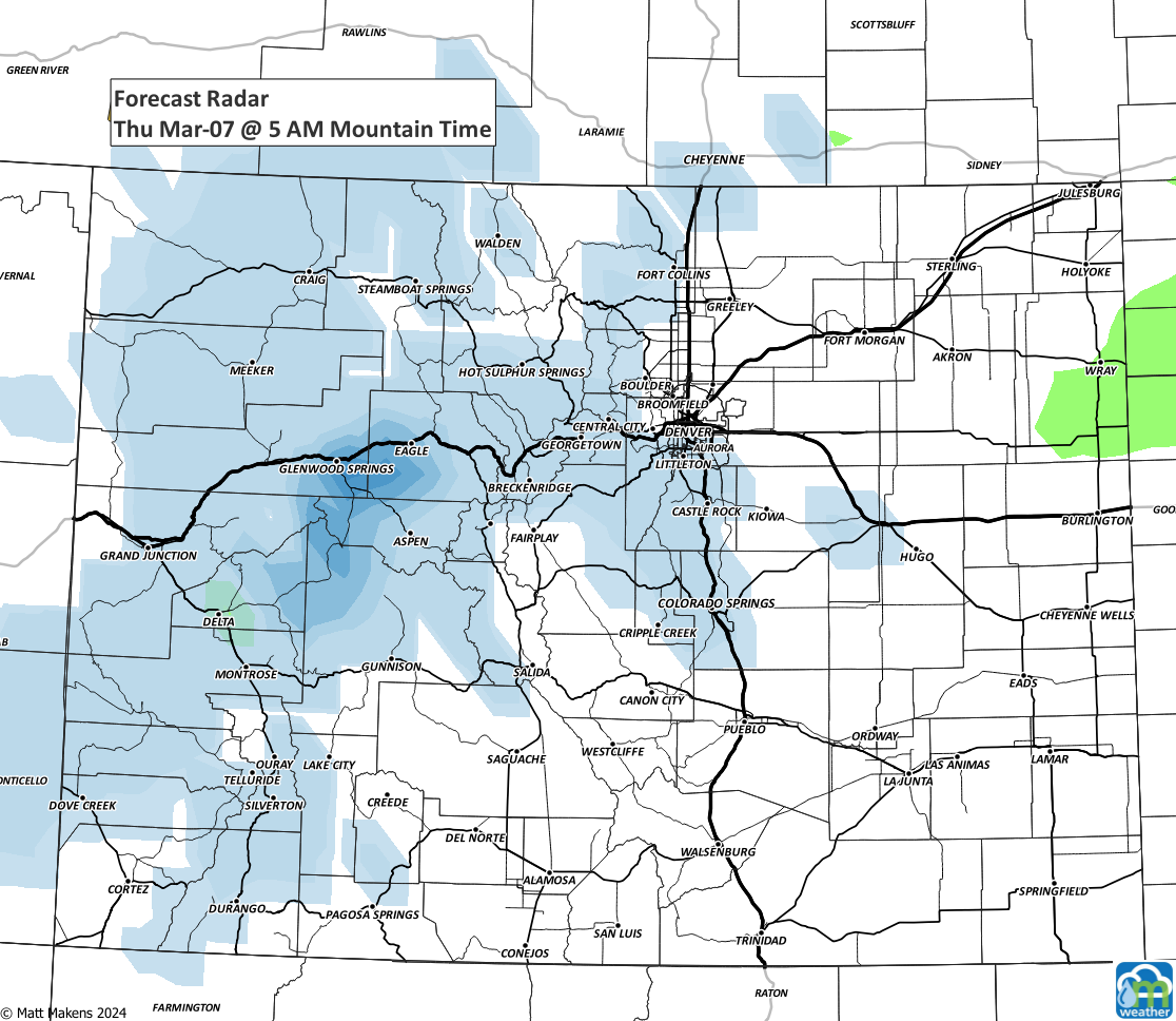
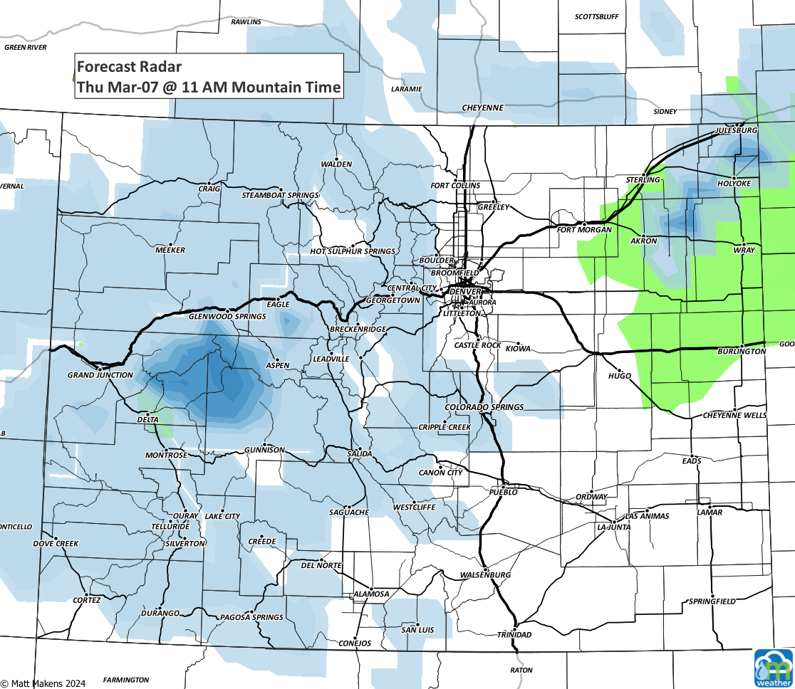
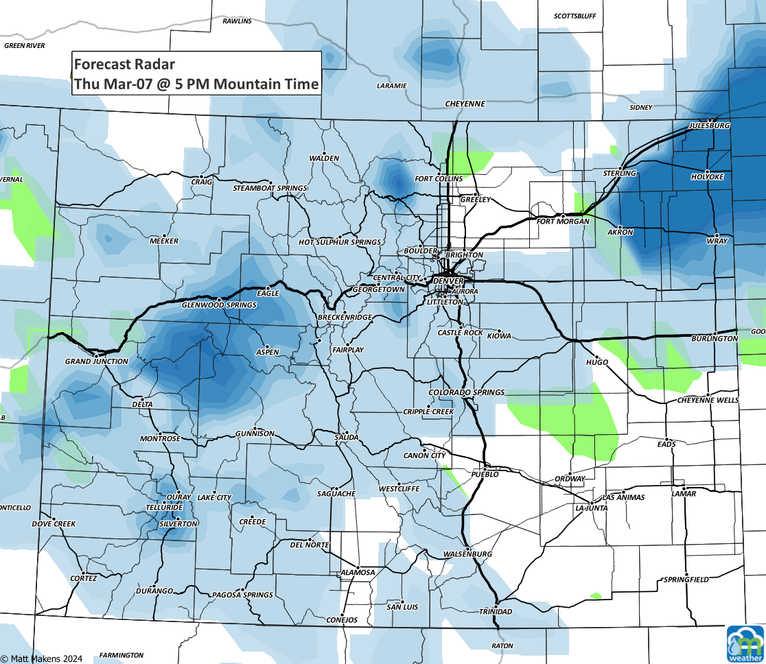
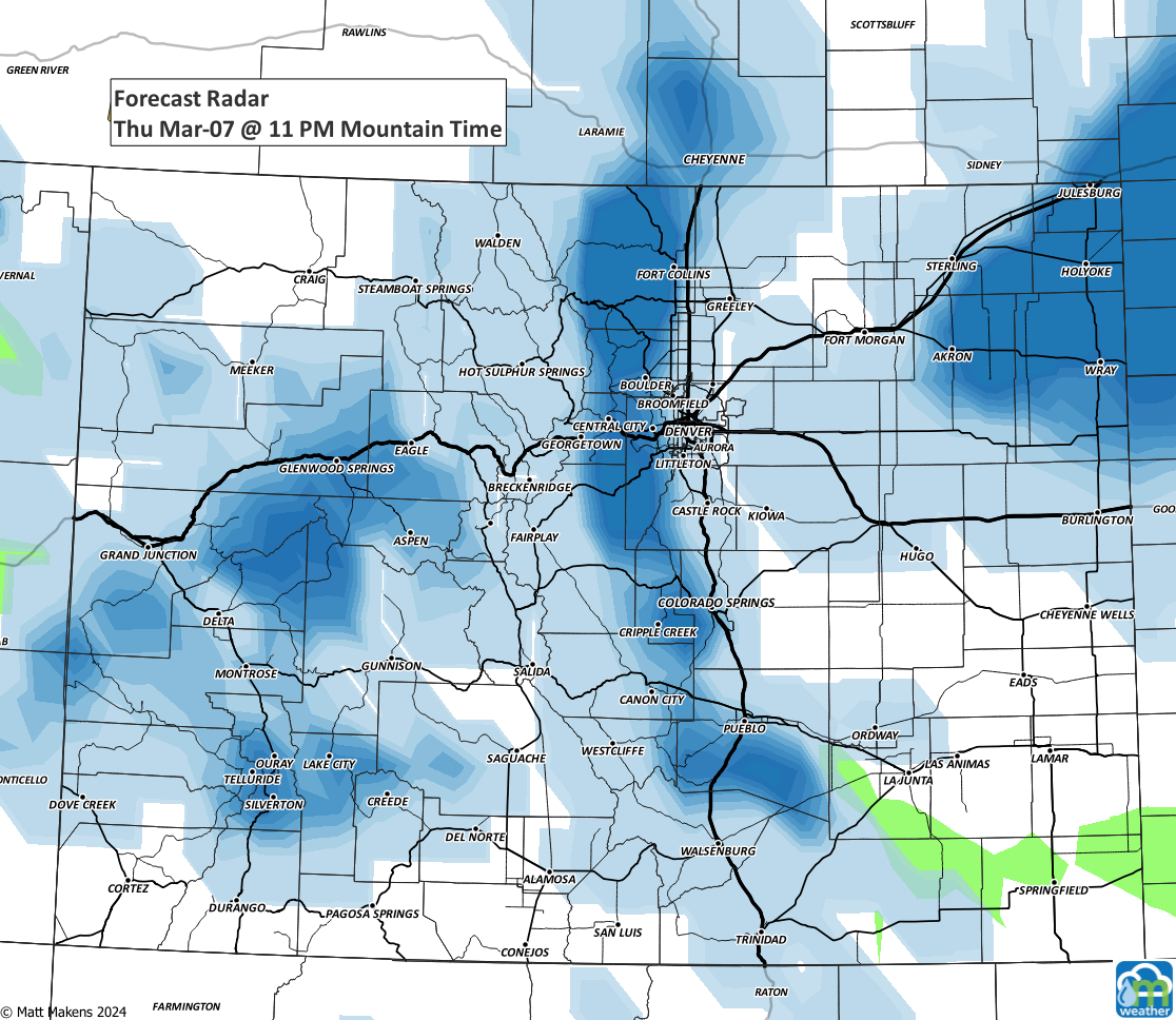
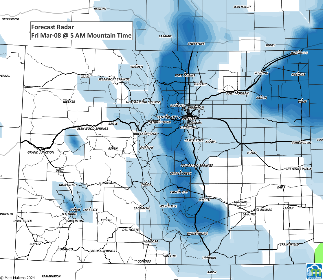
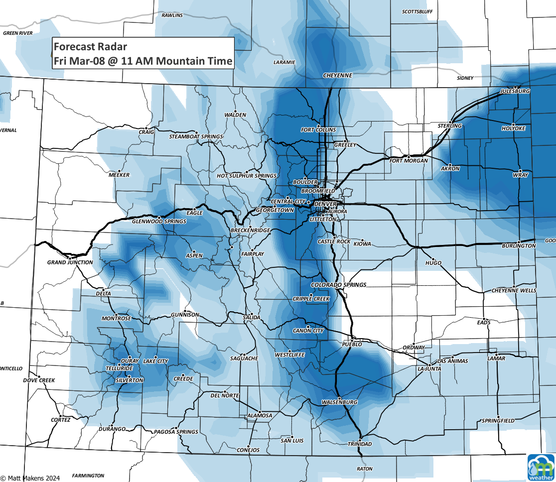
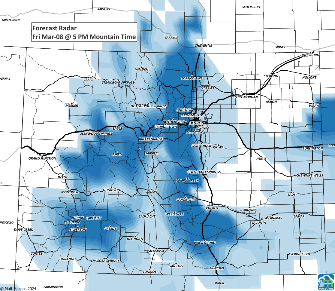
From those images, you can see the line of deepest blues that develops from late Thursday into Friday morning. This will be the main focus of the heaviest snowfall for those of us in the Denver area.
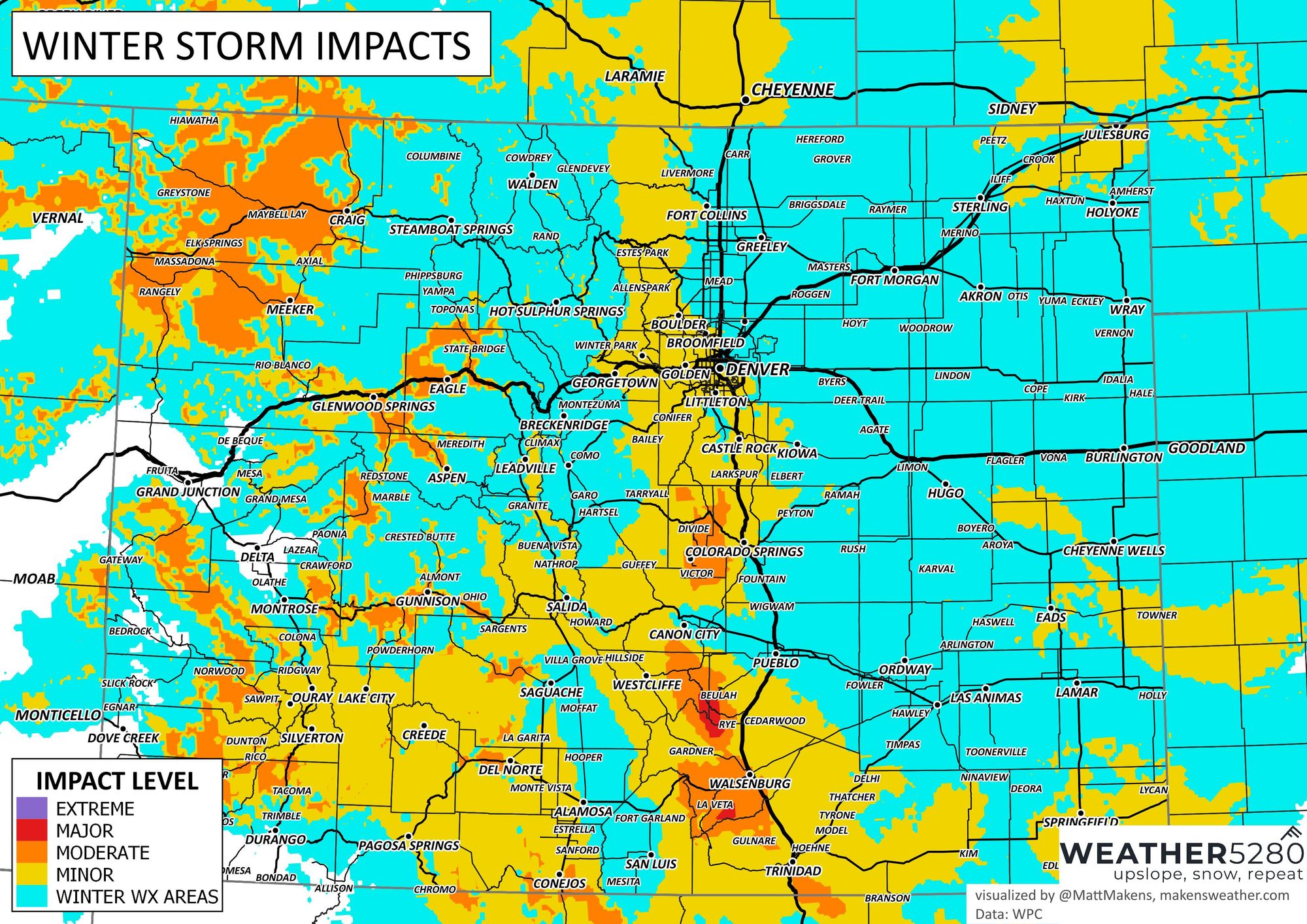
From potentially wet roads earlier Thursday, to worsening road conditions later Thursday through midday Friday - we can wrap this all up into an impact map:

So, yeah, we could have some slower/icy drives in parts of the metro areas as this system swings through. How much does it leave behind? Well, we are leaning toward this outcome:
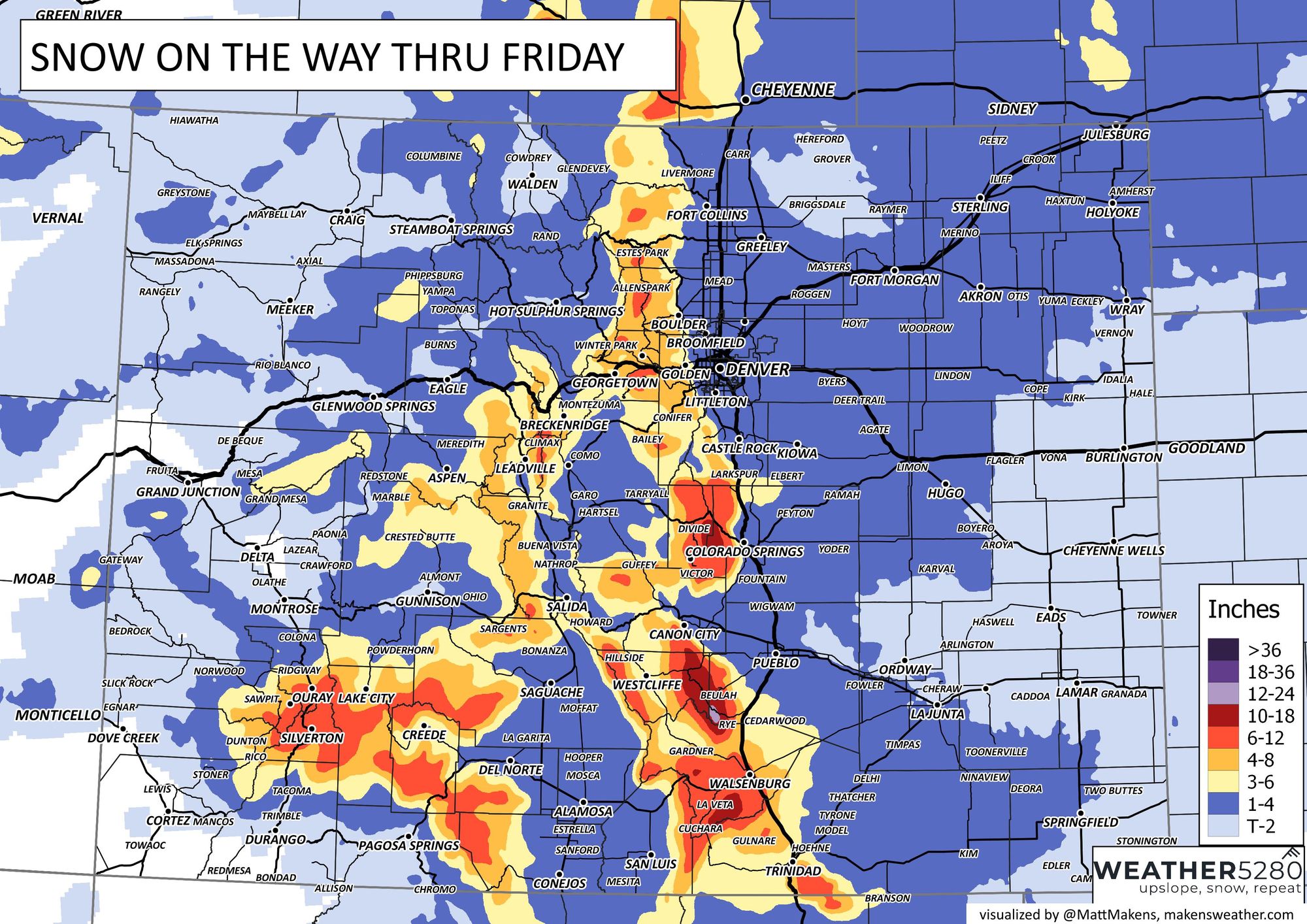
There's potential for more out on the Palmer Divide near Castle Rock and on the plains; areas like Sterling and down in SE Colorado but we are trying to account for some of that snow to melt or be sacrificed to rainfall instead of snow.
Those heavier snowfall totals may be made clearer by data that arrives overnight an update may be warranted Thursday morning. So, make sure you're subscribed to the e-mail list to get updates to your inbox!