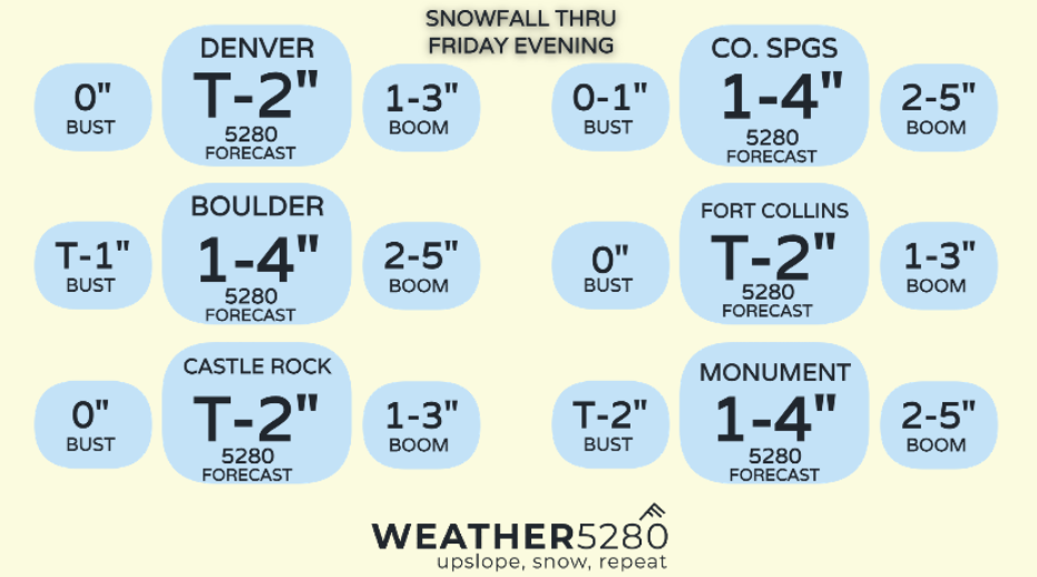
Colorado storm likely to underperform for many

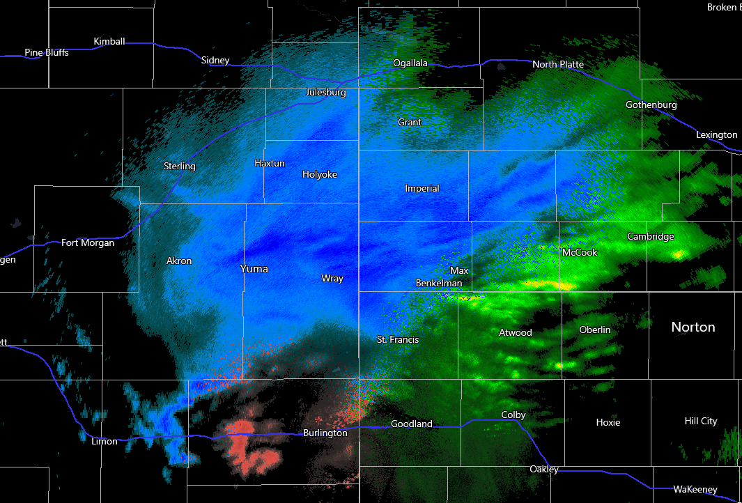
Really no other way to cut it. This system really had trouble getting its act together and as such, will likely underperform expected snow totals. As of 1:00pm, heavy snow has line up along and south of the South Platte River valley. Snow between 3-6" had already fallen in this area through the late morning.
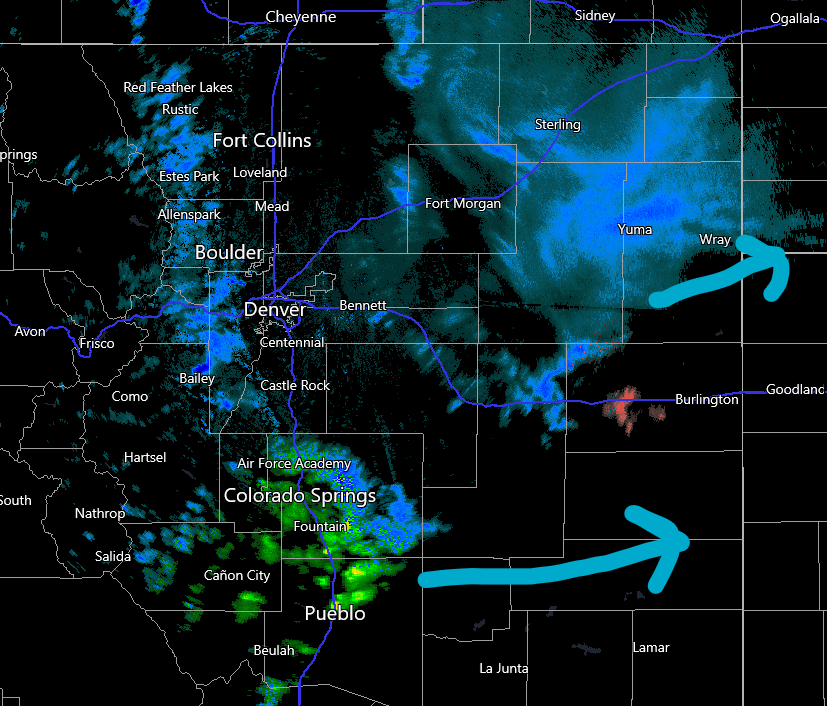
A wider view shows very meager precip along the Urban Corridor. Although, areas around Colorado Springs have seen reports of rain, snow, graupel and even lightning and thunder. Based on the latest hi-res guidance, snow should fill in a bit more along the foothills and rampart range, but anything along and east of I-25 is likely to underperform any impactful totals.
The latest snowfall projection from the HRRR shows mostly less than 1" from FOCO to Denver from tonight through Friday morning. Perhaps with the light scattered nature, we might have to worry about fog/freezing drizzle without much lift in the atmosphere. That could still cause problems tonight through the Friday morning commute– something to be aware of.
Most of what falls around Colorado Springs looks to be driven by convection firing around the Pikes Peak Region this afternoon. Pinpointing snow potential in that area will be tough, but right now, as of early afternoon, the hotspot is near the Air Force Academy, east towards Banning Lewis Ranch.
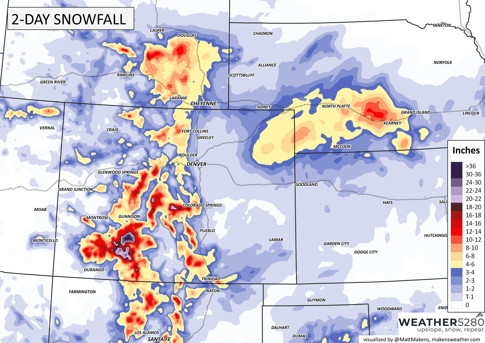
That big bullseye over northeast Colorado will be the best spot for heavier snow east of the hills. On top of the 3-6" that has already fallen, an additional 5-8" is possible according to the HRRR... some double digit totals looking likely out in that area.
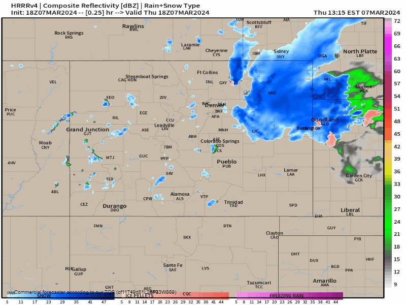
Here is a radar loop of potential rain and snow from this afternoon, all the way through midnight Friday. Best chance for moisture in metro Denver/Fort Collins will be between dinner time Thursday through the morning Friday, and another burst of light snow possible around lunchtime and early afternoon Friday.
For Colorado Springs, scattered rain and snow showers will continue on and off through dinner time tonight, with light snow possible up to about 1 or 2am early Friday morning.
Overall, not a very impressive system to say the least. Lack of an organized circulation, marginal temperatures and inconsistencies with convection are making for a lackluster forecast.
For now, this might be the last update in terms of a forecast, but we'll try to bring you a current/nowcast update come tomorrow to see how things fared out.