
Denver weather: Overnight data continues with significant snow event for Wednesday through Thursday

Data analyzed Monday night through Tuesday morning has been... impressive to say the least. A significant storm continues to keep Colorado in its sight, and for Denver, this remains a consequential storm to watch. Speaking of "watch," the Weather Service issued one for the Denver metro areas, Palmer Divide, and Front Range Mountains. Warnings and Advisories are in place to the west. At this time, Colorado Springs is not in a watch but northern and western El Paso County are.
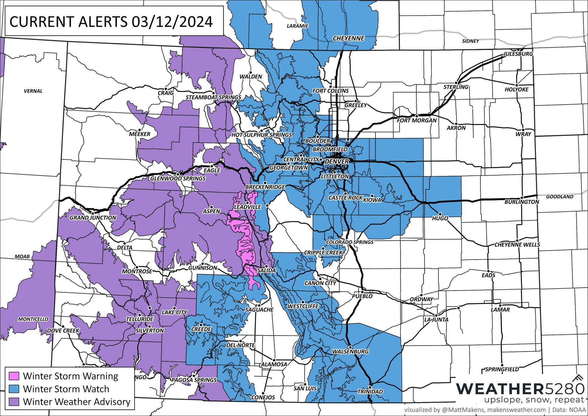
From the NWS:
...WINTER STORM WATCH REMAINS IN EFFECT FROM WEDNESDAY EVENING THROUGH LATE THURSDAY NIGHT...
* WHAT...Heavy snow possible. Total snow accumulations between 6 and 12 inches possible, highest amounts expected near the foothills and Palmer Divide. Winds could gust as high as 35 mph.
* WHERE...Boulder and the Denver metro area, Byers, and Limon.
* WHAT...Heavy snow possible. Total snow accumulations between 1 to 2 feet, with isolated totals up to 3 feet possible. Heaviest amounts expected along the eastern slopes of the Front Range, lesser amounts will occur west of the Continental Divide. Winds could gust as high as 35 mph.
* WHERE...Rocky Mountain National Park and the Medicine Bow Range, the Mountains of Summit County, the Mosquito Range, the Indian Peaks, and the Front Range Foothills.
* WHEN...From Wednesday evening through late Thursday night.
* IMPACTS...Travel could be very difficult to impossible. The hazardous conditions could impact the Wednesday evening and Thursday morning commutes.
PRECAUTIONARY/PREPAREDNESS ACTIONS... Monitor the latest forecasts for updates on this situation. Considerable uncertainty still exists with the details of the storm, but confidence is increasing that impactful snowfall will develop.
In other words, here's a picture to show the type of snowfall totals we are concerned with:
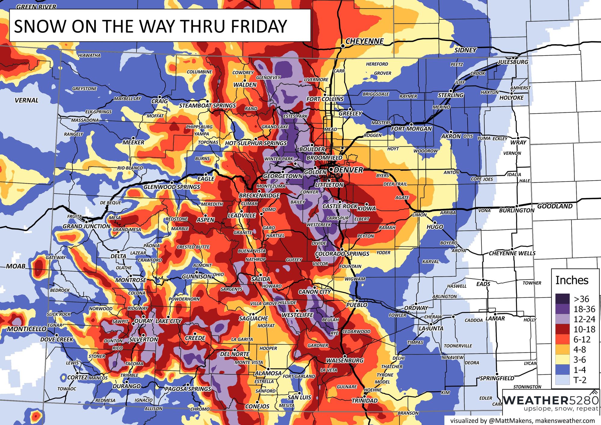
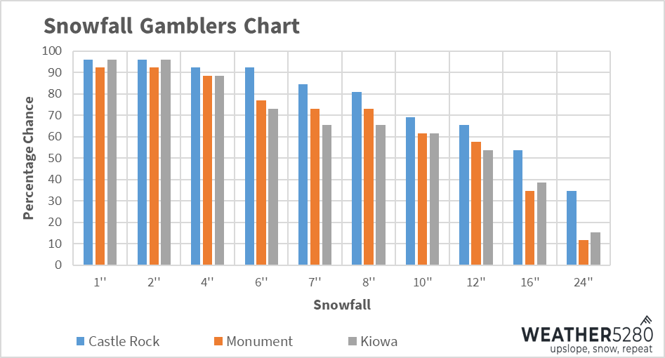
Pretty good totals forecast along the urban corridor, but in particular across the immediate foothills west of town and along the Western Palmer Divide. Here are the latest gamblers for the Palmer – wow!
With this storm coming into position today through tomorrow, we have some time to refine the details. However, data has been remarkably consistent on a high impact for the area. Although we will see rain and then snow before the main event, and lingering snow after the storm exits, this storm's impact increases quickly from midday Wednesday through the evening and culminates on Thursday. This map shows areas that are better off to change plans and stay home if able:
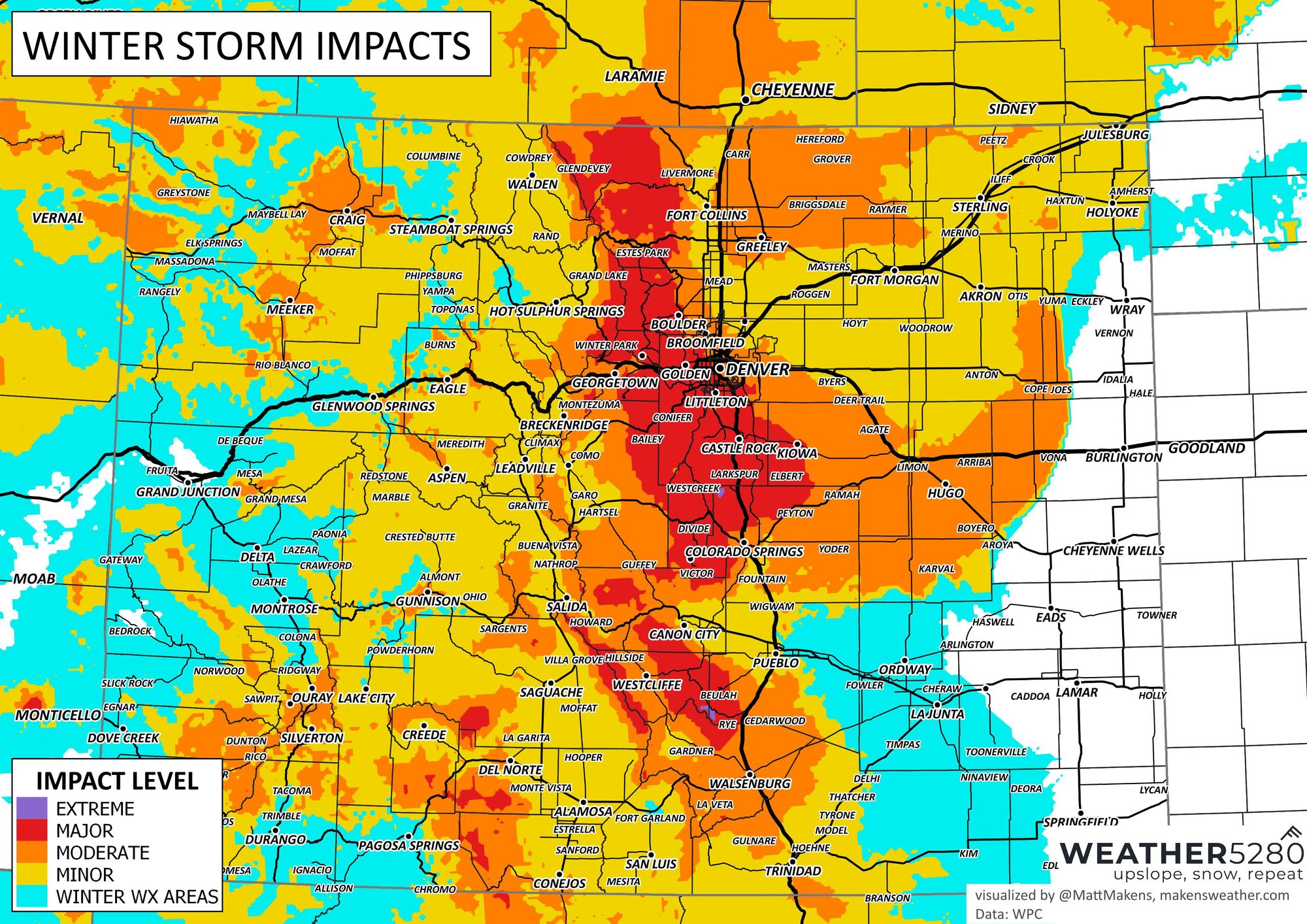
Yes, that's one of very few "Major" impacts on the metro area this season to date; again, the biggest impact is sunset Wednesday through Thursday into Friday morning. Here is a more specific planner for hourly temperatures and chances for moisture:
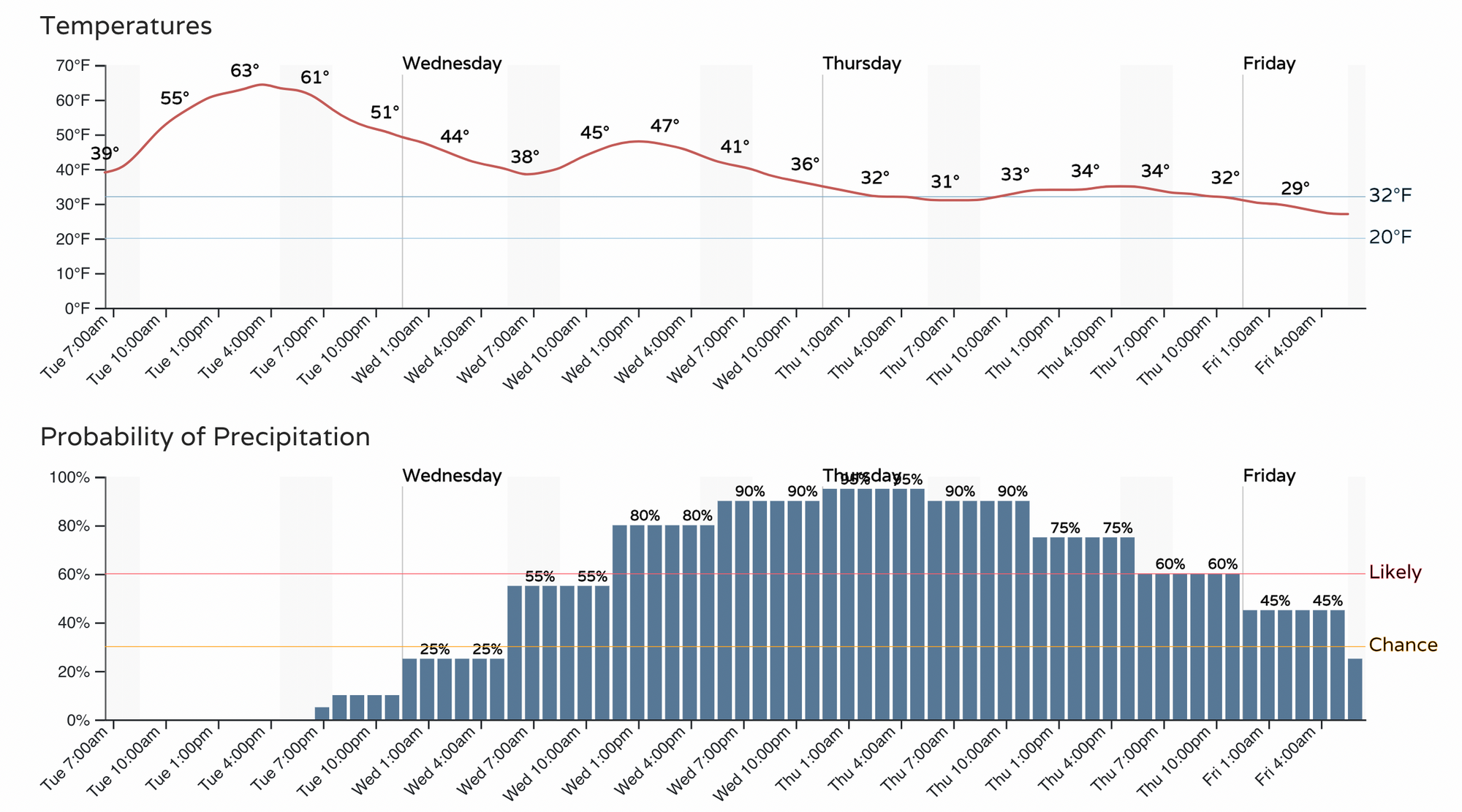
So, Tuesday is the warm before the storm. The wind starts to increase.
Wednesday will bring rapid changes. Some of those changes will include gusty wind, but it's about the rain and then snow—yes, rain first, which will limit and/or prohibit how much CDOT and public works can prep for the event.
Wednesday night through Thursday - whoa, doggy, it's snowing like crazy. "We are so bored." - my kids home during their snow day ;-)
Friday - clearing up.
Sure, this storm still has room to tank on us, but data has been quite consistent, so confidence is higher this morning. We will continue to watch that data pour in today and will have another update for you later on Tuesday. Enjoy talking about it at the office, and if you own a grocery store... you are welcome!
With an impactful storm on the way, please stay weather-aware and, as always, subscribe to stay ahead of the incoming storm!