Winter Storm Warnings posted for Denver area, snow storm moves into Colorado on Wednesday night, latest snowfall forecast

Our biggest storm since the Pi Day Blizzard of March 14, 2021 looks to be on track to arrive Wednesday night into Thursday... and fittingly, Thursday is the 3-year anniversary of that storm.
This storm looks to begin impacting us Wednesday afternoon, potentially lasting into Friday morning south of the Palmer Divide.
Let's get right into the details of this thing!
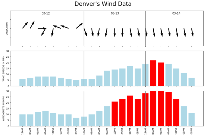
Snowfall and timing
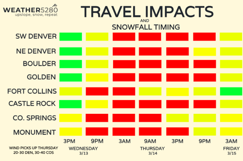
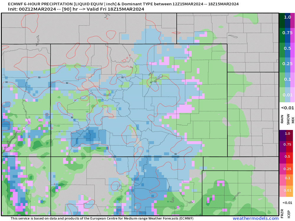
Wednesday 9AM - 3PM
Should be a fine start to Wednesday morning, but skies will quickly become unsettled by lunch, with scattered showers popping up in the foothills and quickly moving east into the mid-afternoon.
We'll likely see snow-levels above 7,500 ft at this time, so most of us are seeing rain/graupel and perhaps a few wet snowflakes mixing down early.
Wednesday 3PM - 9PM
Rain and snow will continue to increase in coverage and intensity through the rest of the evening, especially along south of the Palmer Divide. Snow could be heavy at times for areas like Colorado Springs, Castle Rock, Woodland Park, Monument and Black Forest. Rain and snow will be tough to changeover in Pueblo.
Rain and snow will also continue for metro Denver, up along I-25, with snow in the foothills and the west side of Denver into Golden.
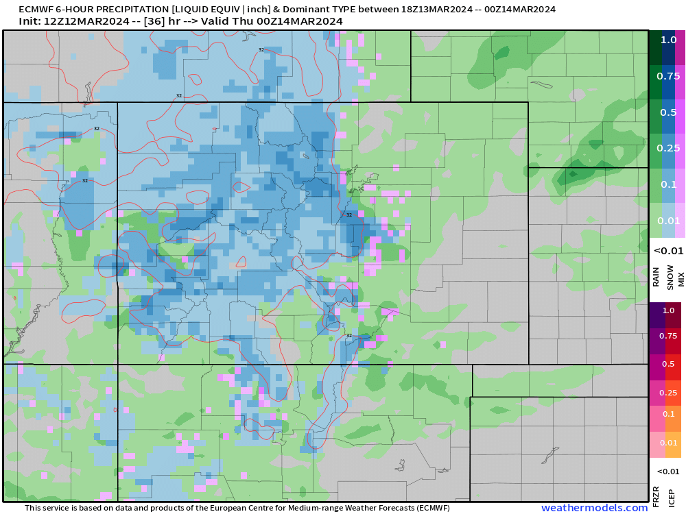
At this point for most, the roads are still probably doing OK... but that will quickly change as the surface low wraps up and strong upslope takes over after midnight.
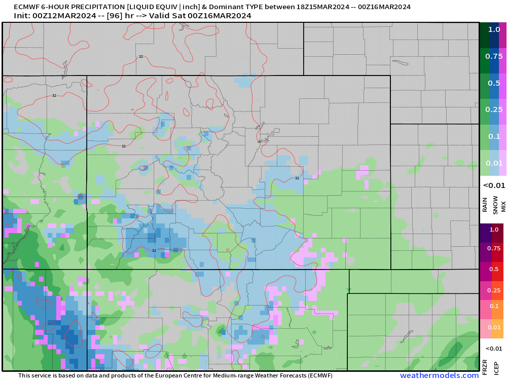
Wednesday 9PM - 3AM
At this point, our storm is really starting to take shape as a strong surface gradient develops across eastern Colorado. This should increase upslope, especially in the foothills and across the Denver Metro.
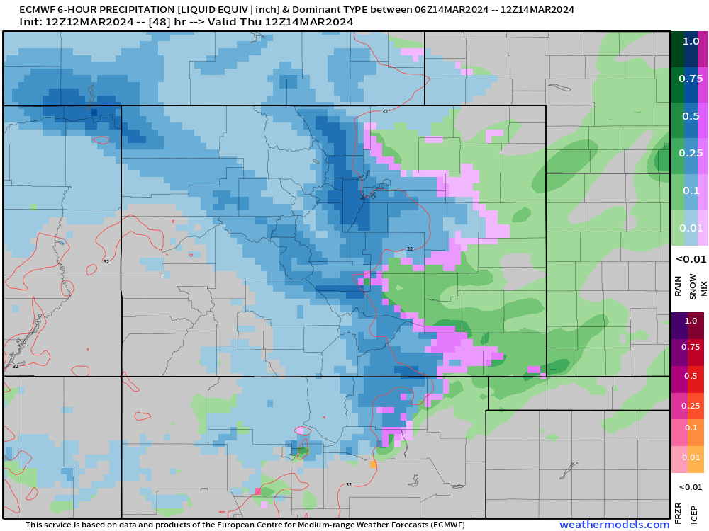
This will coincide with a potent mid-level jet that develops to help enhance upslope through Thursday morning. As this jet continues to strengthen through Thursday morning, wind will start to become a problem, along with falling snow!
Thursday 3AM - 9AM
Snow will be flying fast and heavy for many after midnight Thursday. As mentioned above, wind will likely start to pick up during this time to. We're expecting roads to go downhill fast during this time.
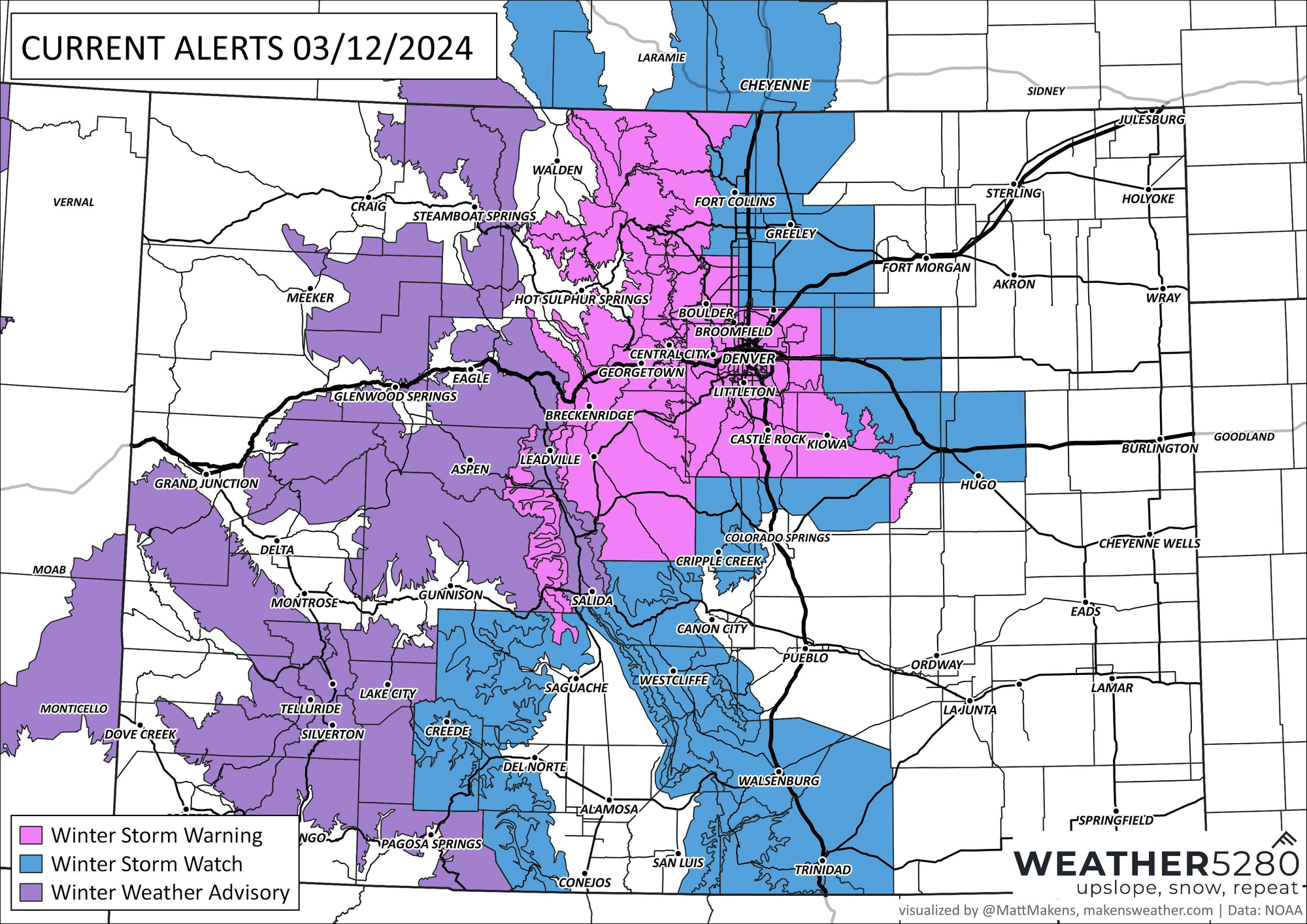
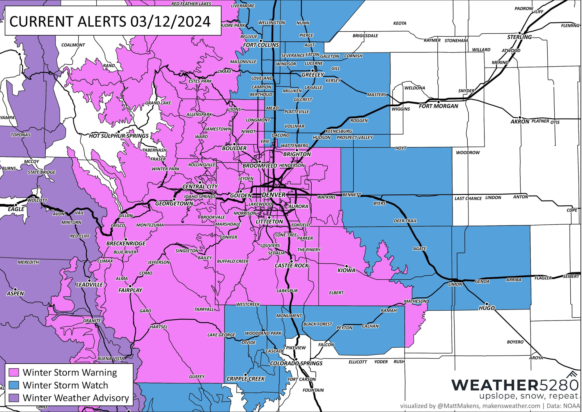
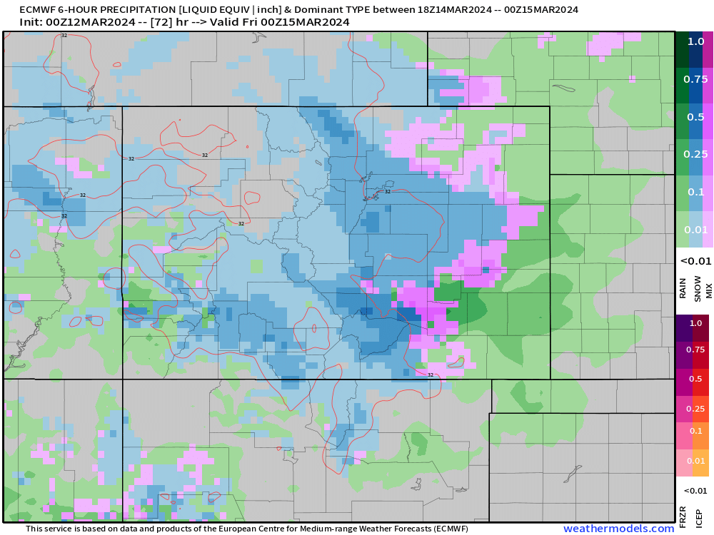
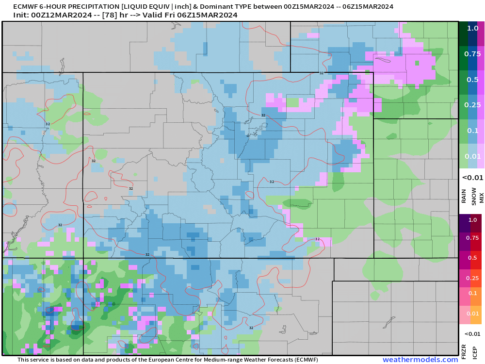
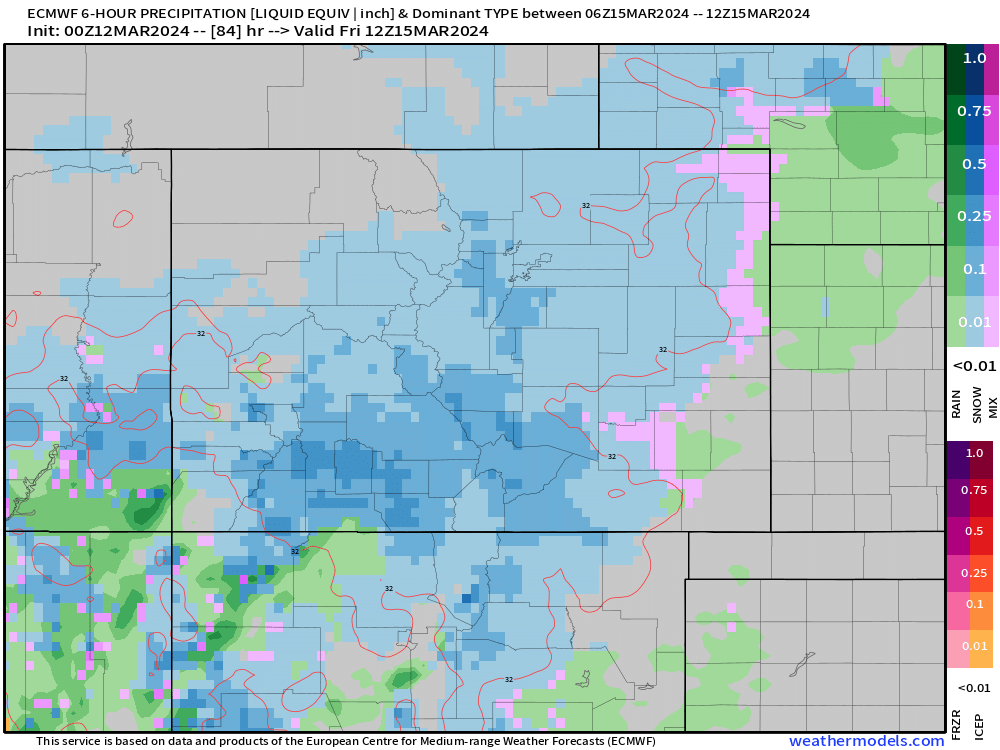
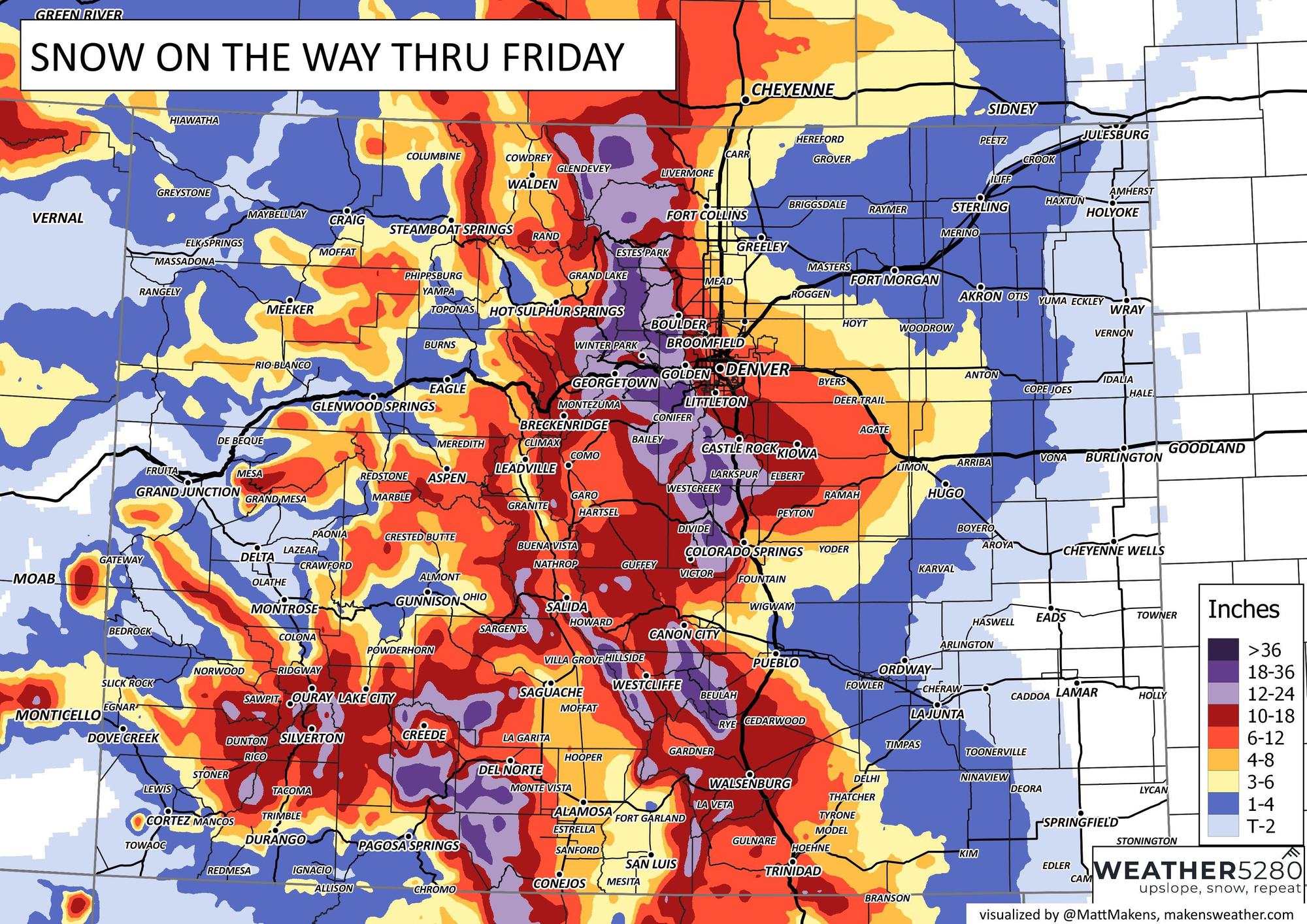
Below is a map when winds are cranking their hardest... likely some time between 6am and 1pm Thursday. You'll see heavier snow likely taper off around Colorado Springs as the north winds get stronger. However, areas north like Monument and Black Forest will see less of an issue with downsloping.
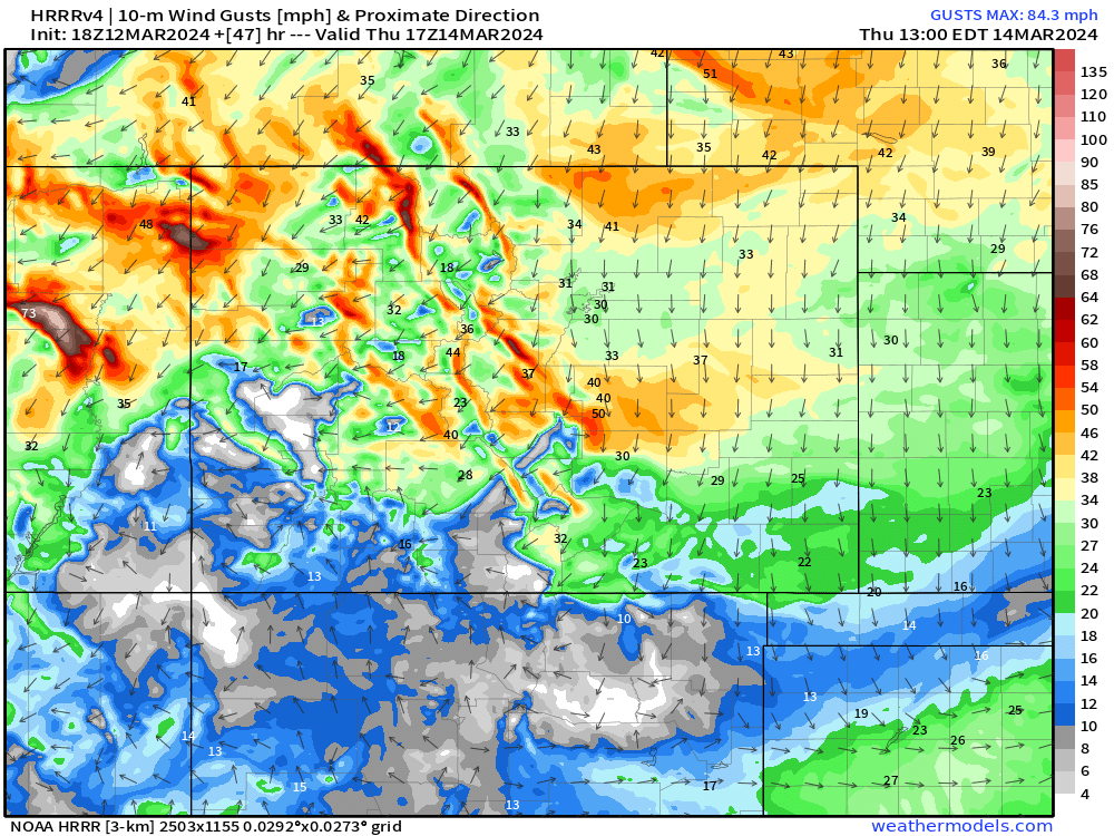
Wind and snow is going to make any travel between Denver and Colorado Springs VERY difficult most of Thursday. In fact, most places in Colorado will be stuff you want to avoid.
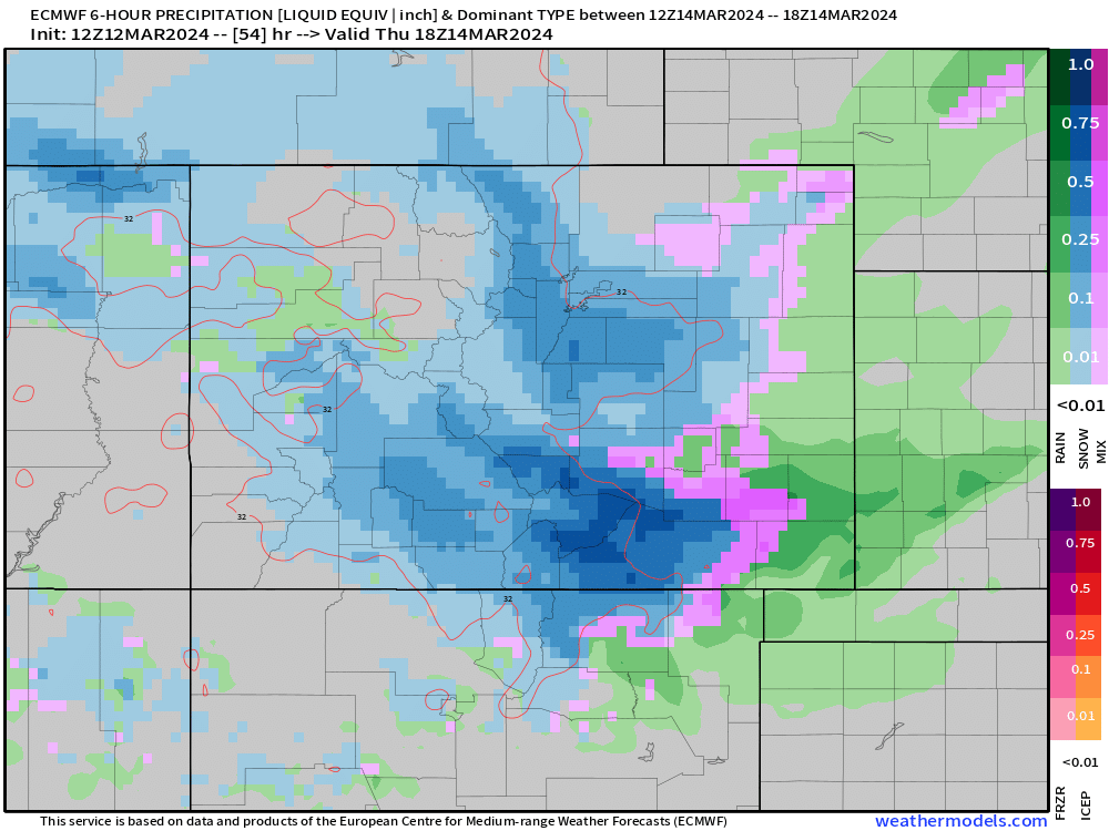
Thursday 9AM - 3PM
Through lunch on Thursday, we're going to see snow still coming down, likely not the heavy stuff from the morning, but still at a moderate and accumulating pace.
Travel will still be really rough in many areas. You'll want to stay in if you can through the mid-afternoon.
Thursday 3PM - 9PM
Moderate to heavy snow will slowly begin to taper off during the evening "commute" and into the overnight hours. We'll also see temps get a bit colder too. For much of this system we're riding in the upper 20s and low 30s. By evening Thursday, many folks are starting to tank into the 20s.
That means road conditions will stay tough to navigate, even without a ton of accumulating snow.
Thursday 9PM - 3AM
Light snow will be persistent Thursday night into early Friday morning. Expect road conditions to improve a bit in places that plows can get to. Side roads and less traveled areas likely remain a mess.
Friday 3AM - 9AM
We'll see a chance of flakes continuing to fly through about lunch time before we gradual see precip end by early Friday afternoon. Road conditions should see some decent improvement after the sunrises on Friday... but be wary... the loss of an hour of morning sunlight means residual morning commute impacts may be tough to shake off.
Friday 9AM - 3PM
This thing finally takes a breather... and so can we. We're expecting any leftovers to wrap up by Friday evening.
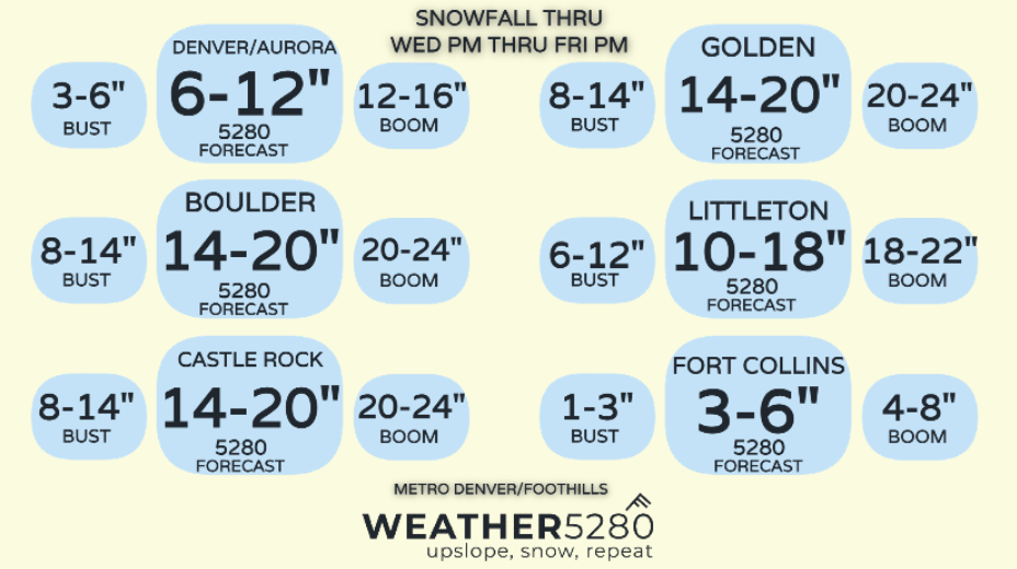
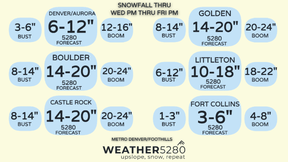
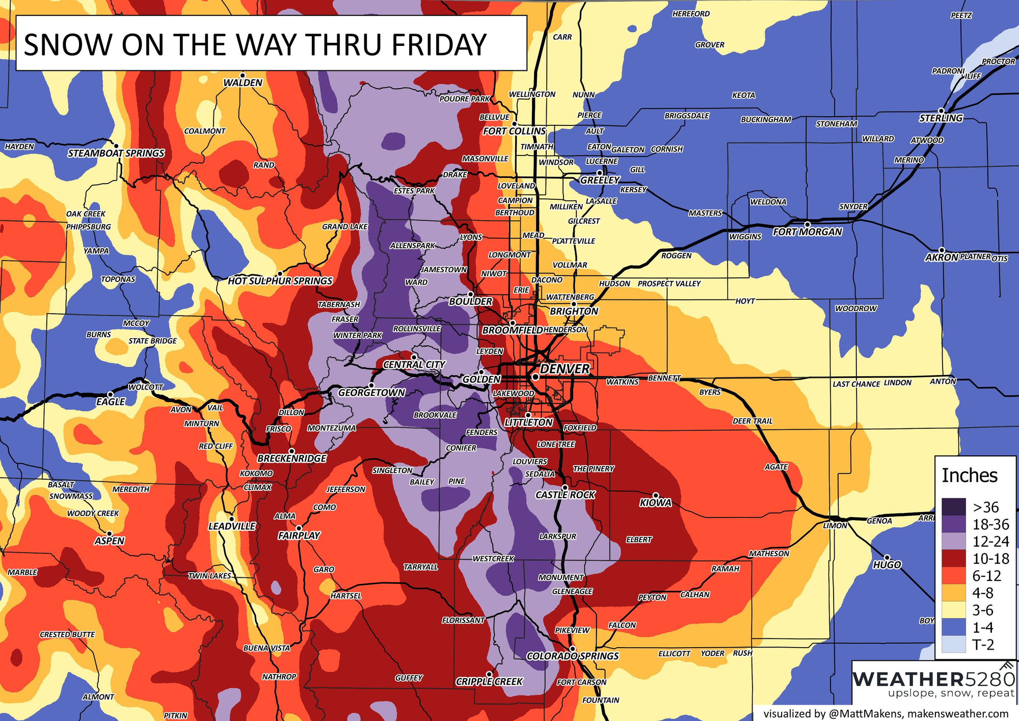
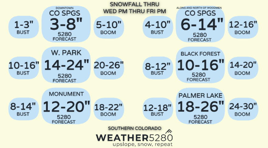
Snowfall forecast
Here's what we're thinking in terms of snowfall totals... keep in mind some wide ranges, heavy totals, especially for higher elevations. There will be some melting and compaction... issues with mixing, especially early, but with a large chunk of this storm really ripping during the overnight hours will help overcome some of those challenges.
Downsloping issues take over quick for parts of Colorado Springs and Fort Collins with a strong north wind.
Foothills, Palmer Divide and the Ramparts should see a very high impact storm, with tree damage and power outages possible. Hopefully we can keep those issues out of the immediate Metro Denver area... but it's a thing we're watching for...
Closures look likely Thursday... delays likely Friday with closures possible. Flights will likely be impacted too.
We'll likely get pretty cold Friday night into Saturday morning with all this snow on the ground.
We'll keep an eye on things and pass along updates as needed! We look forward to your storm reports and photos in the comments, and always – subscribe to our mailing list to stay one step ahead of the storm!