Double-digit snowfall totals, for some the first in decades, falls across Front Range before weekend warming trend

Things are going to melt quickly, but we have a lot to melt. Let's start with a look at snowfall reports from this latest storm, and then we will look at the warming temperatures for the week ahead.
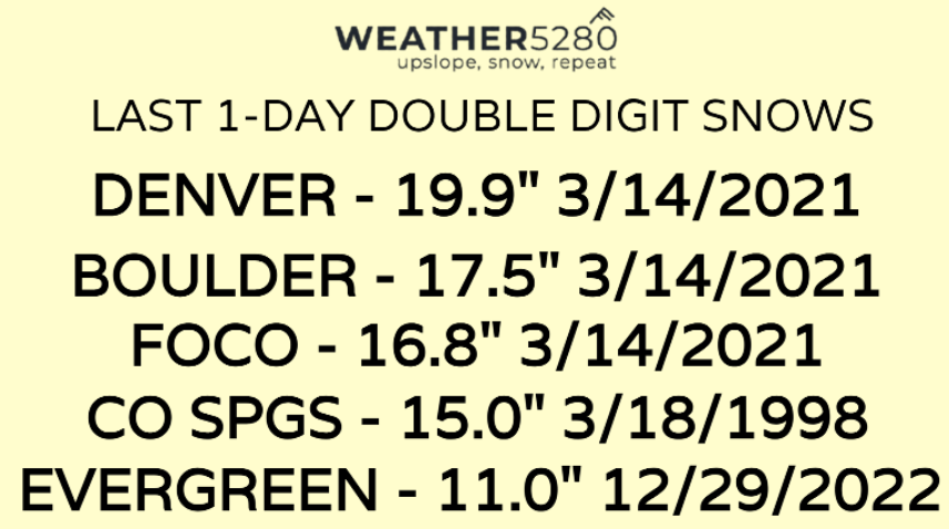
First, snowfall reports and observations were compiled for the following maps, and for some locations this was the first double-digit snowfall in a long time. From a previous post this week, here are some of the dates of last double-digit snowfalls for a single day. Officially Denver did not qualify...5.7" was the official tally for the city this storm...womp womp.

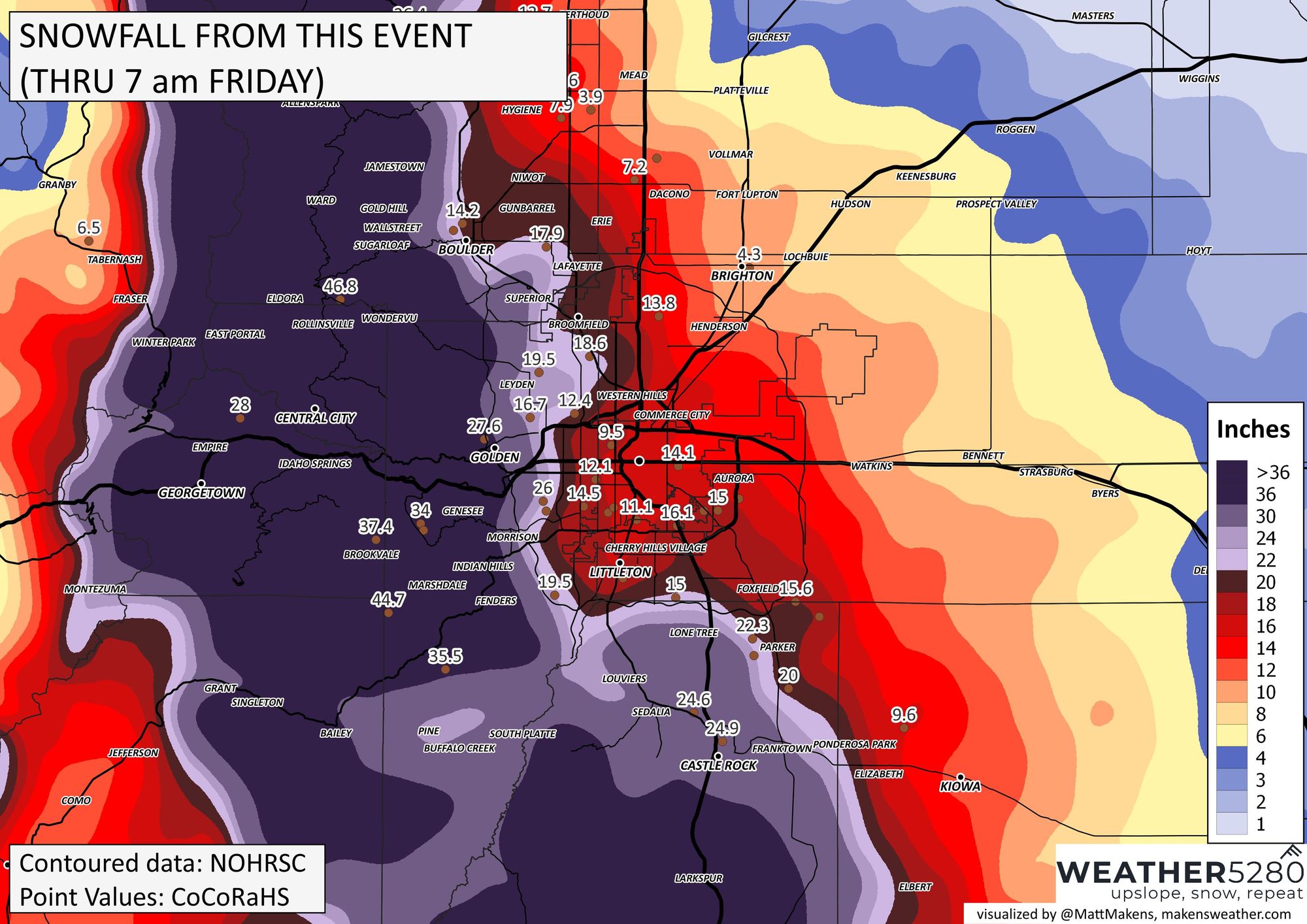
Denver Metro Area:
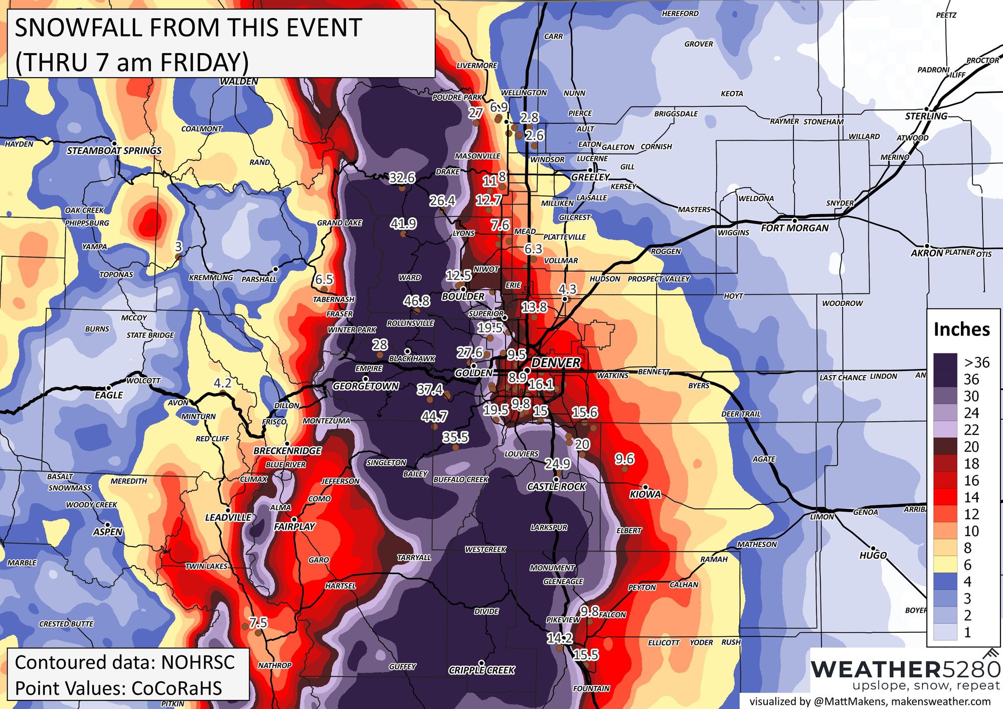
Northern Front Range:
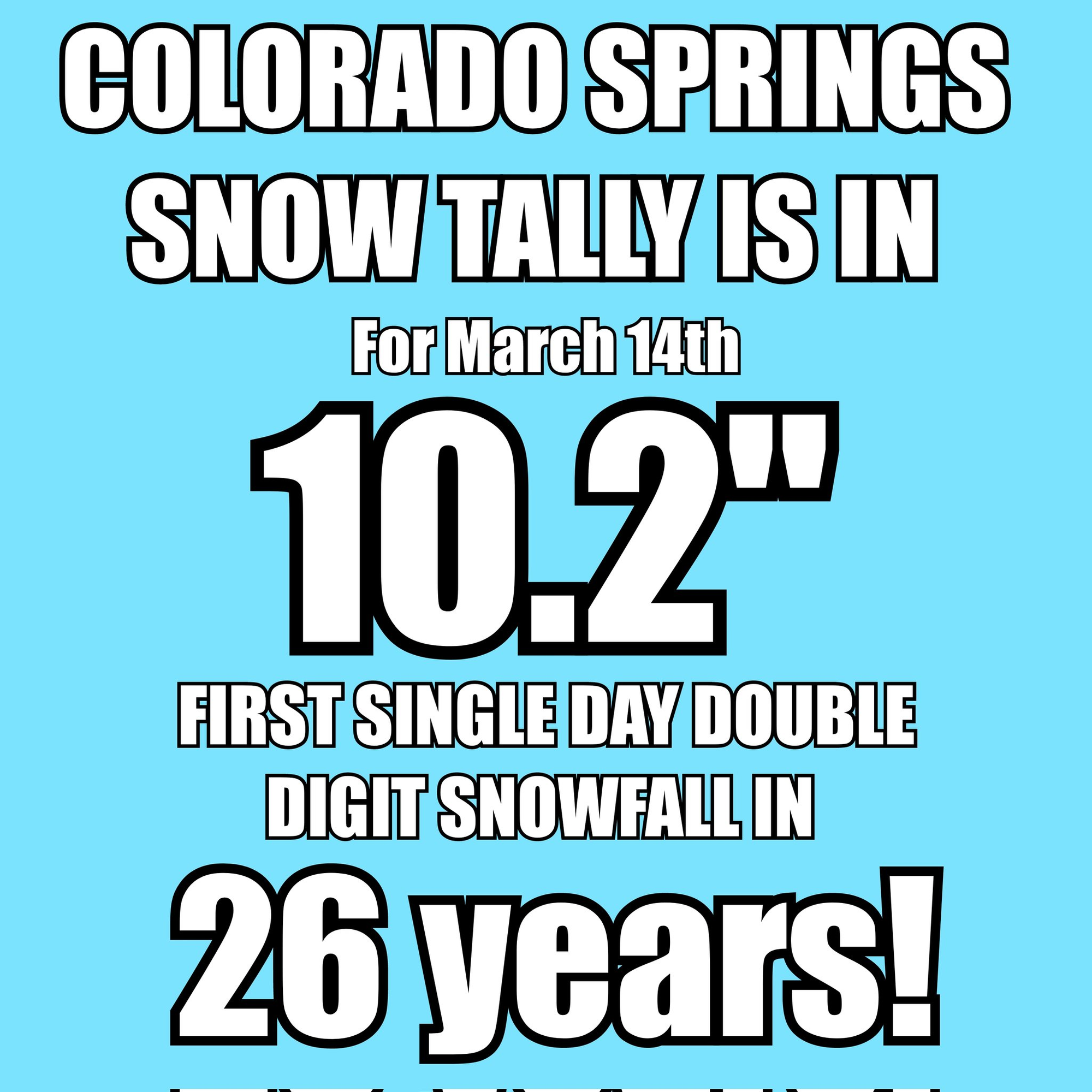
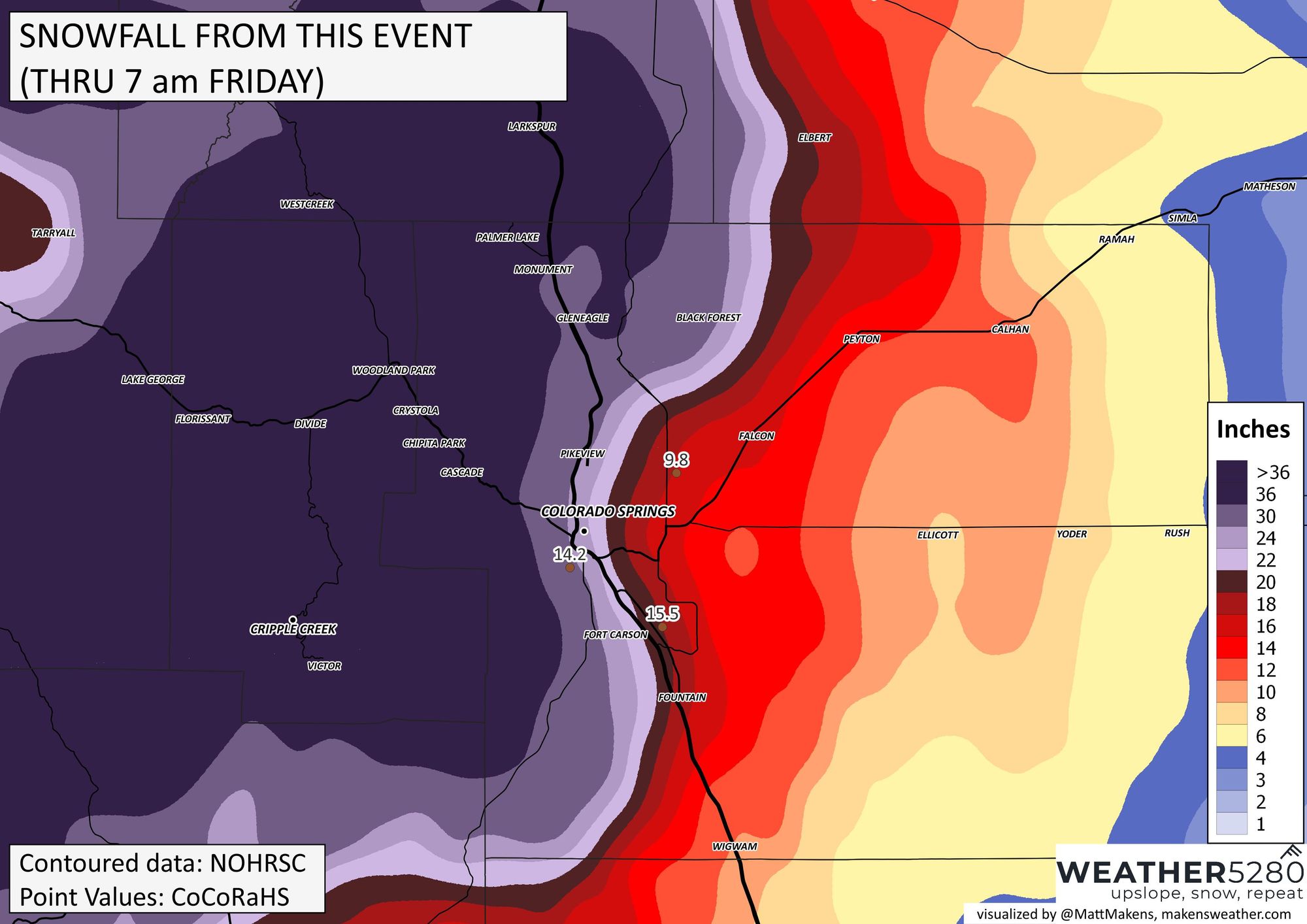
Colorado Springs metro area:
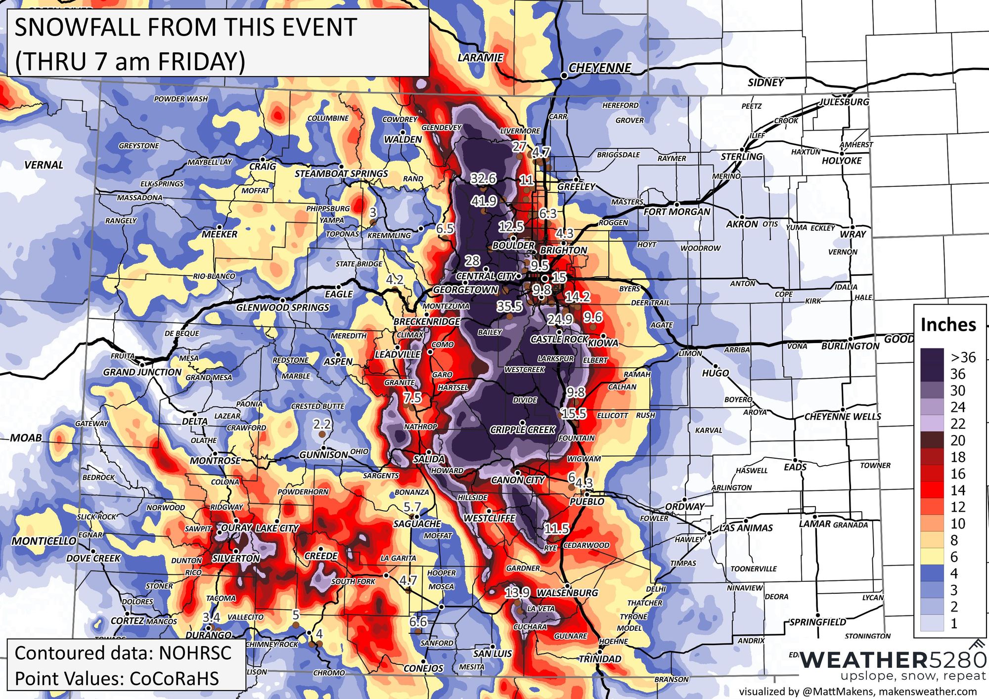
Colorado:
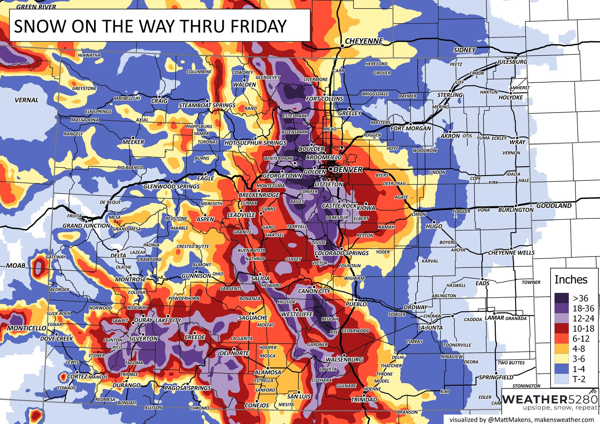
Compare that image to the snowfall forecast provided this week...A lot of verification wins on that map!
Okay, enough of that. I'm tired, you are tired, and our backs are sore...so, when can the sunshine and warmth help loosen us up and help remove some snow? Here is the hourly planner through the weekend:
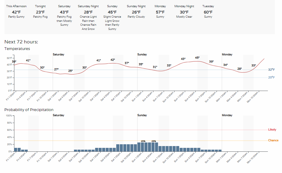
You see, we do warm-up with 30s and 40s through the next three days, but what is that on the chance of precipitation line? Yep, we may see chances for a few more showers floating around (both rain and snow), but you can also see the chance is relatively low for the Denver area.
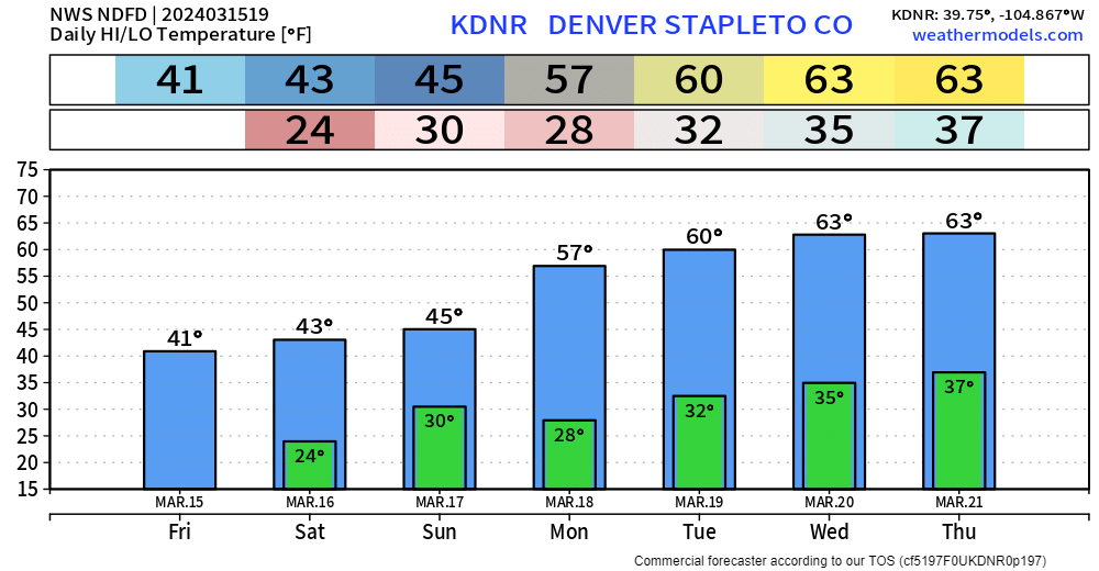
Take a longer look ahead, and guess what? 60s are back...boom.
Denver weather is always exciting... I love the snow but it is nice to warm up after one is a doozy like this one was - for Weather5280 HQ that is.
Have a great weekend. Don't be caught unknowingly by the next storm, please subscribe, and you will receive forecasts in your inbox.