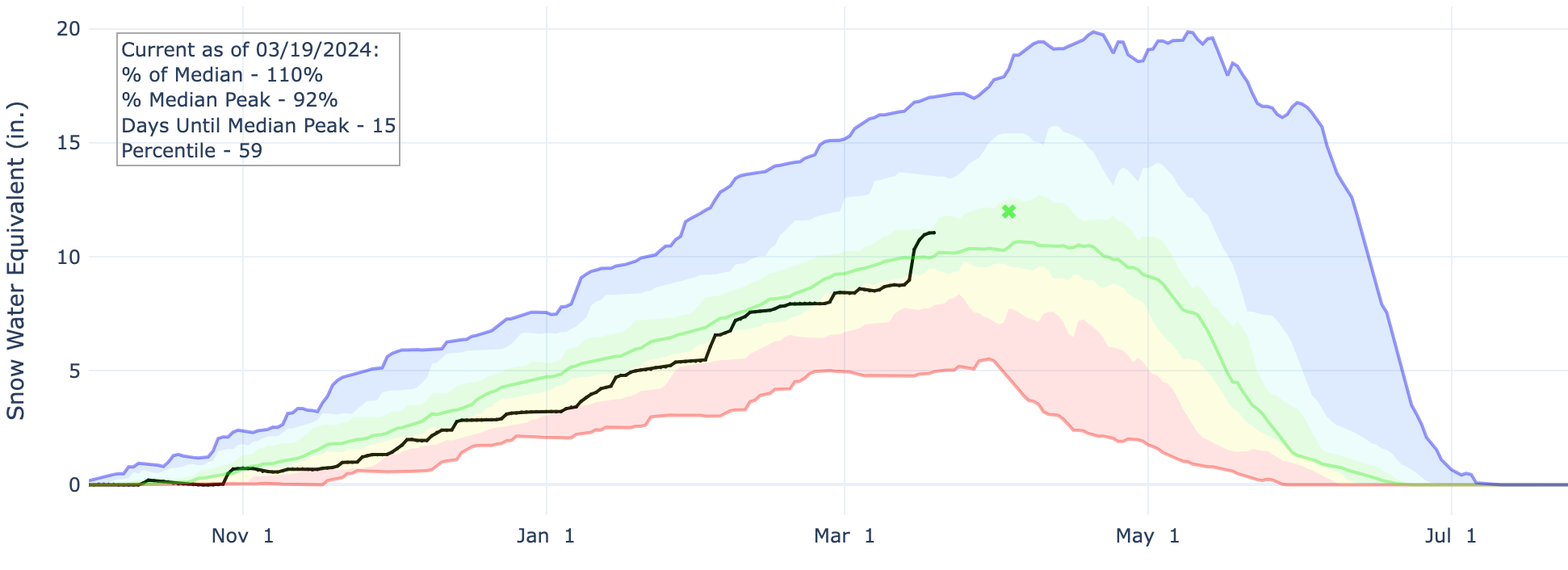
Colorado snowpack above average as we approach average peak date

As many communities continue to dig out after last week's monster snow, let's take a quick look at snowpack across the state and see what kind of impact the storm had on numbers across the South Platte Basin.
The statewide snow water equivalent (SWE) now sits at 108% of the median for the date, and 90% of the median peak snowpack which is about 20 days away. Last week's storm is quite evident in the black line (2024) below, and puts us well ahead of 2021 (red) and 2022 (green) but behind last year's impressive snowpack (purple).
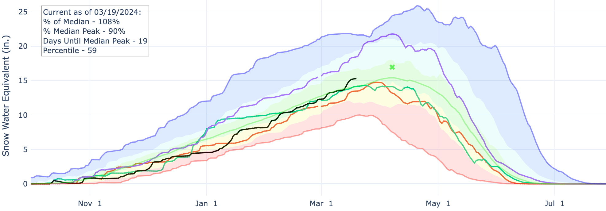
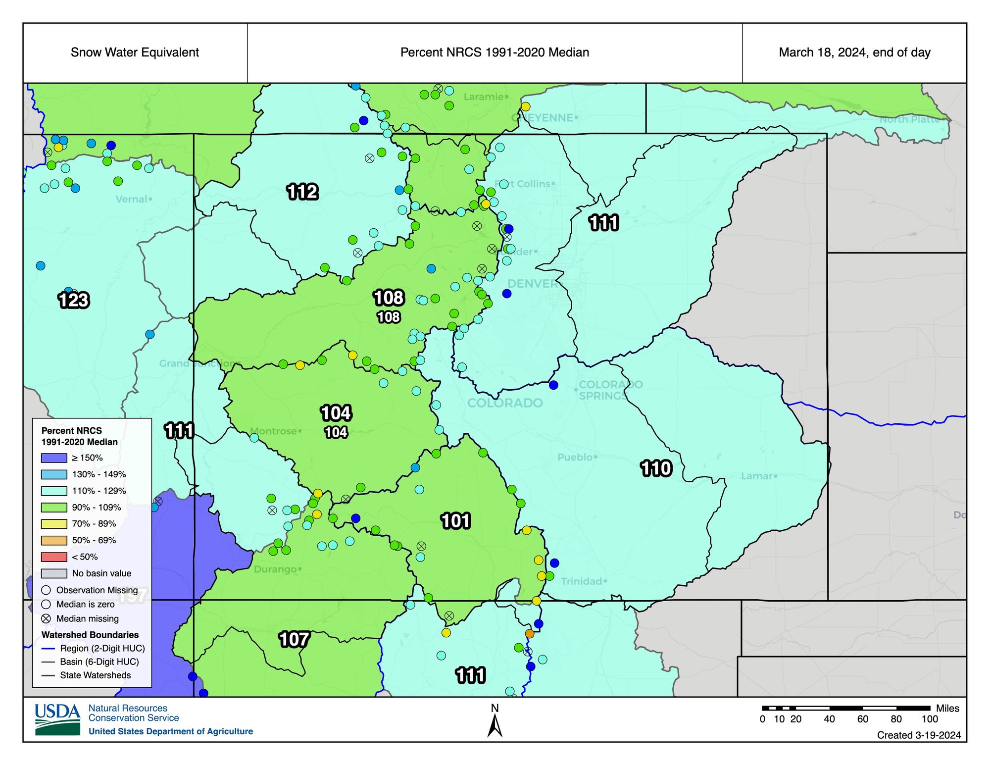
Across the South Platte basin we see an incredible jump in snowpack from the storm – it has since leveled off of course, but we now sit comfortably at 112% of the median for the date:
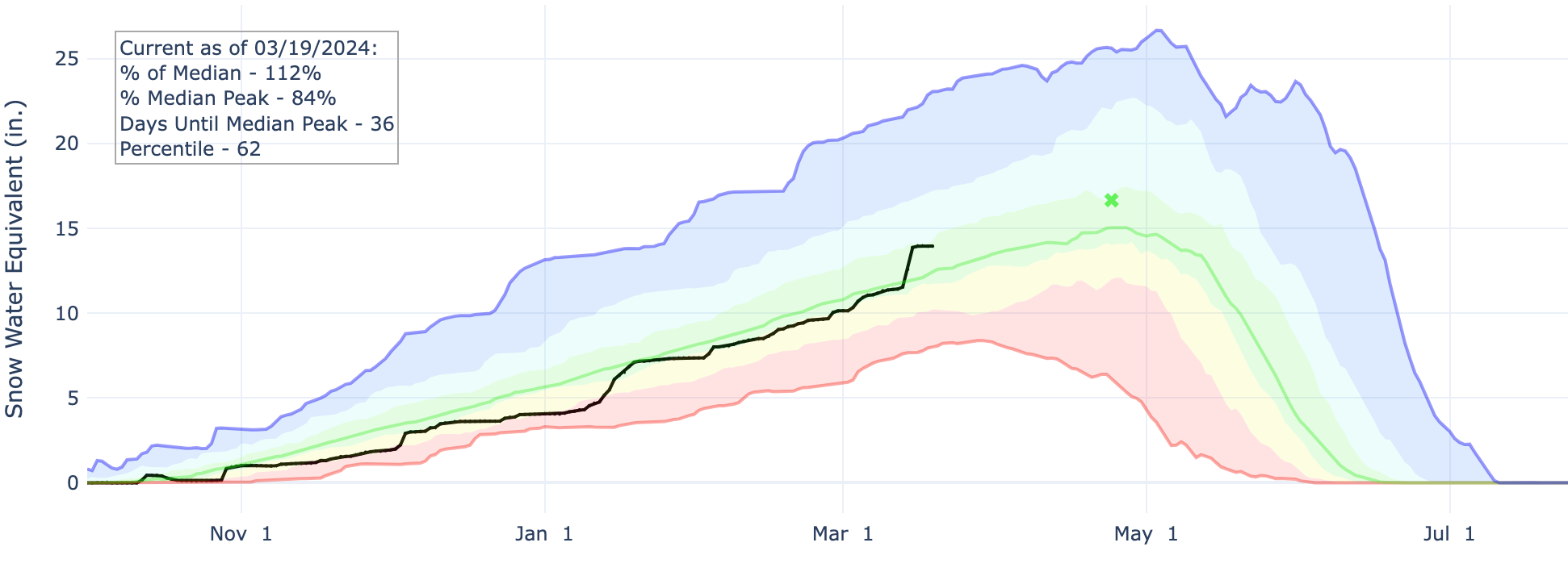
Thankfully, the Arkansas basin also saw a huge bump last week as numbers across southeast Colorado were in even worse shape. It's good to see SWE sitting above 100% as we begin the transition to La Niña, knowing this part of the state is particularly susceptible to drought during La Niña events.

And here's a map of basin snowpack numbers across the state. Fantastic.
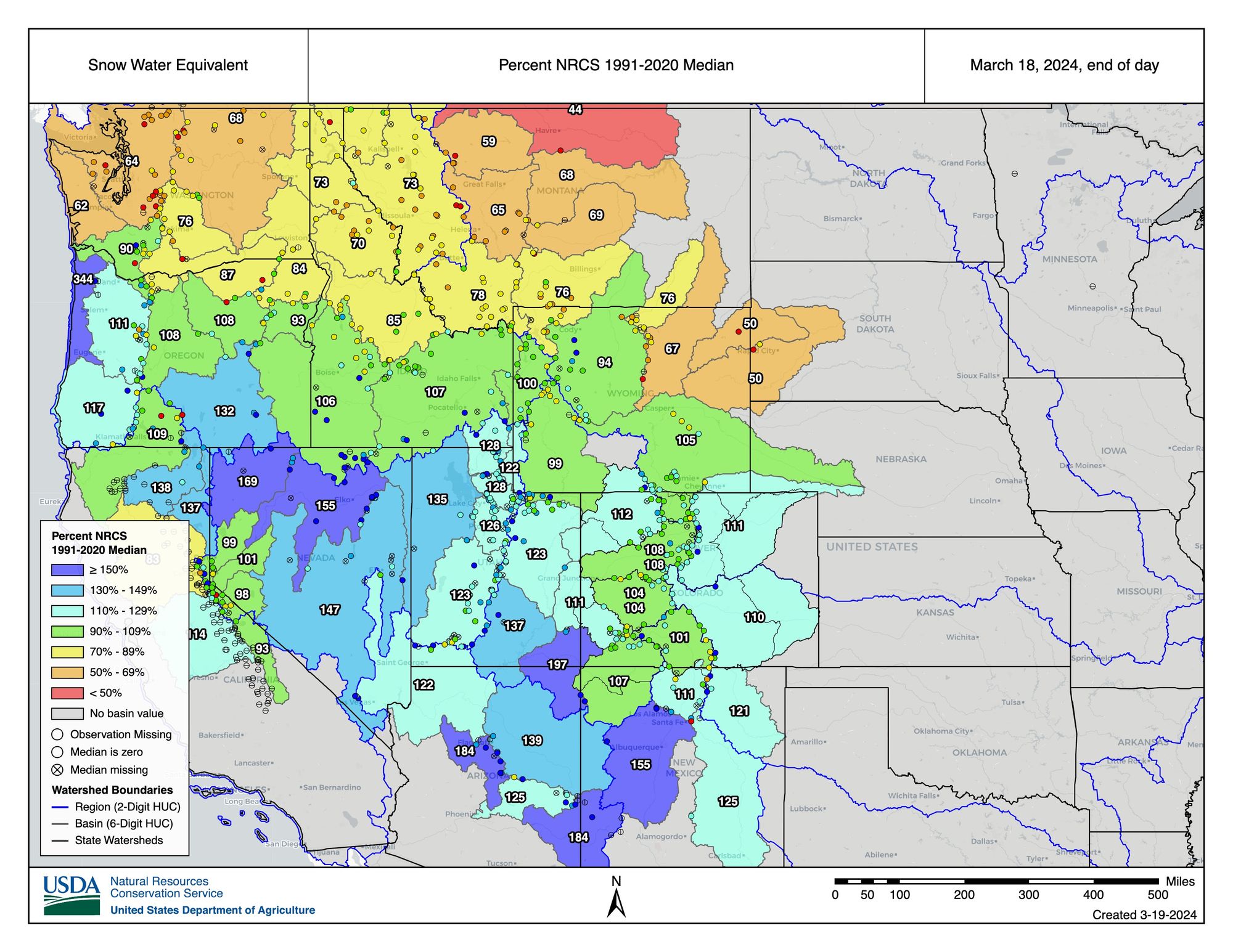
And a quick look across the west shows that the storm track as really favored the southern basins (👋 El Niño anyone?) with snowpack hurting across the Pacific Northwest and northern tier.
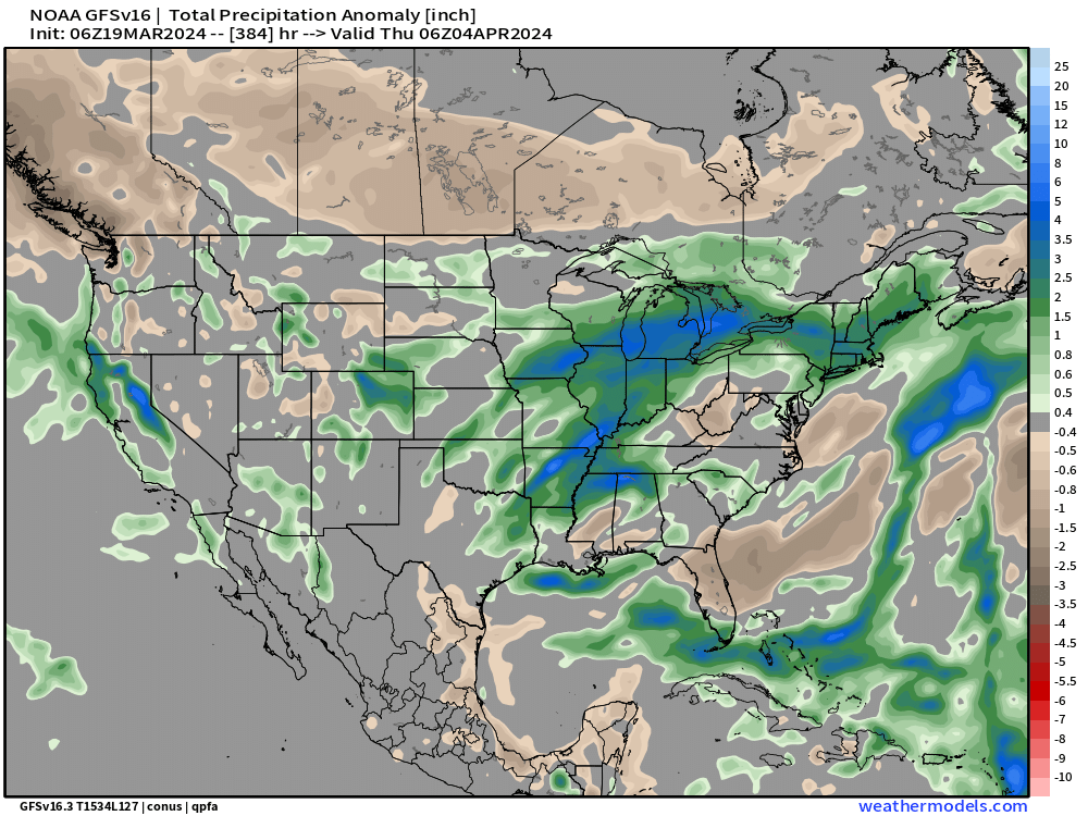
Guidance keeps a pretty active pattern going across the West and really much of the country through the end of the month and into early April. We'll have more on what this could mean for snowfall potential along the Front Range down the road, but for now a national look from the European ensemble shows quite a few areas of above average (green) precipitation expected over the next 15 days across the CONUS.
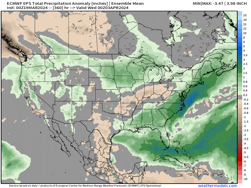
This particular model has a bias toward average or drier than average across the Plains, but a good setup for our mountains to see more snowfall as we inch near the season's average peak snowpack in early April.
I'd also stress a bit of caution here too, as we see a lot of storms rolling in from the west over the next couple of weeks, and all it would take is one ending up in the right spot to flip eastern CO green vs what's above. Some of the operational models are sniffing out just that, so ... stay tuned!