Colorado spring storm possible this Sunday: Forecast

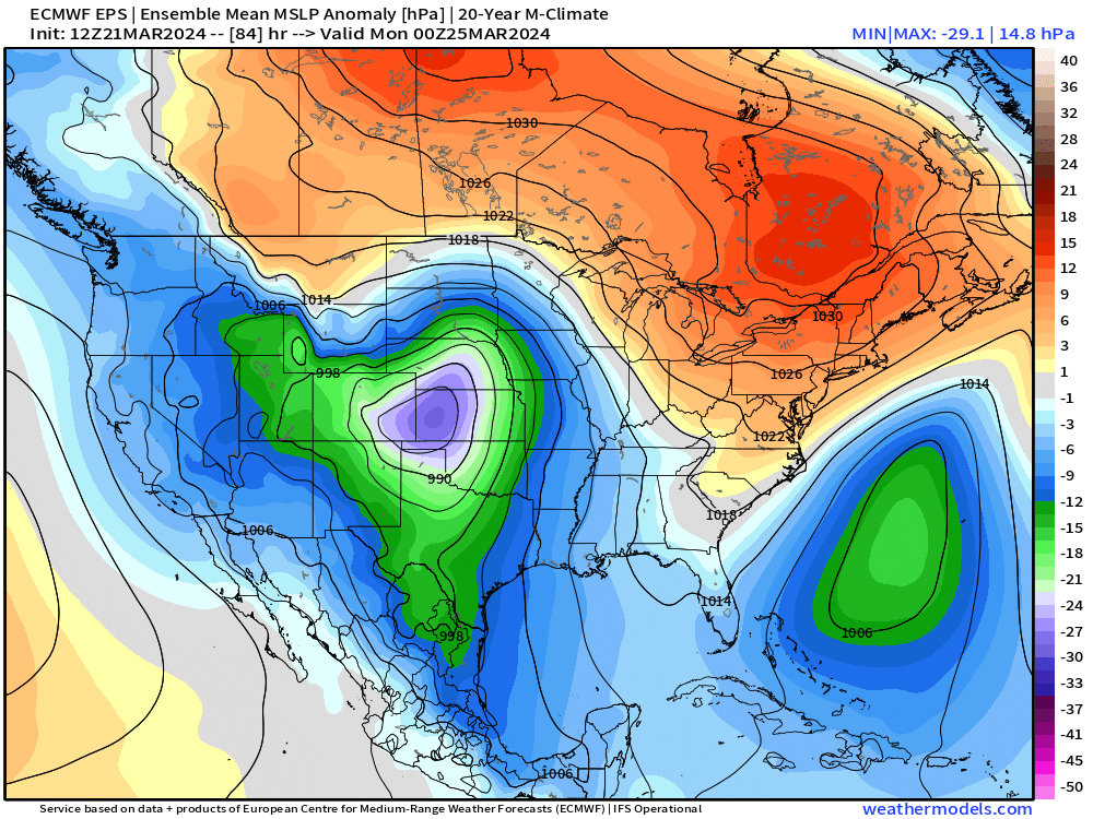
After a major snow storm last week, we've settled out nicely the last several days with plenty of snowmelt. We don't expect many change to this pattern through Saturday, but by Sunday another powerful spring storm looks to spin up east of the rockies.
Timing and storm setup
There's some pretty start differences from last week's storm vs this weekend. The speed of this storm looks much quicker, so lingering impacts aren't as likely. This also means snow totals will likely be lower.
There's also a bit of cold air this with this system, so wind and slick roads could be a bit more apparent than the melty, non-windy mess we saw for a majority of last week's storm.
This storm will be a much more "classic" spring setup for us.
The loop below takes us from Saturday evening through Monday evening. For the front range, the great potential for snow conditions will be after sunset Sunday, through the Monday morning commute. We may even see a few afternoon showers/storms along the front range on Sunday!
We'll likely do most of the "snow damage" from 9pm to 4am, but lingering impacts of light snow, wind, and slick roads look to slow you down Monday morning.
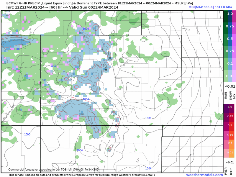
High terrain travel will become tough as early as Saturday night, so keep that in mind if you're going to be in the mountains this weekend. Conditions back to the I-25 corridor stay rough for most of the day Sunday.
Snowfall potential (Yes we know it's early!)
We're actually seeing fairly decent agreement from the EURO and GFS in terms of location of impactful snow. As you'd expect, the Palmer Divide should do well with this system. The EURO seems a bit more measured with totals... A few spots getting double digits wouldn't be surprising. The GFS is likely a bit too aggressive with upwards of 20" near Elbert 🤦♂️ – but you get the idea, travel between Denver and Colorado Springs has a good chance of being nasty come Monday morning.
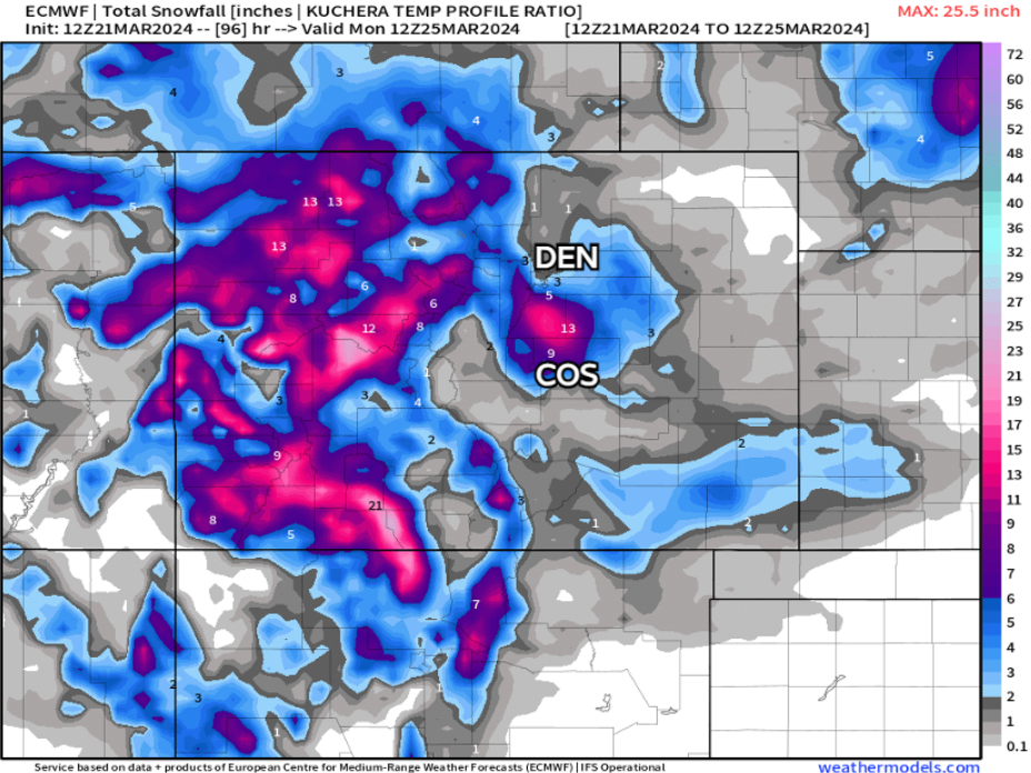
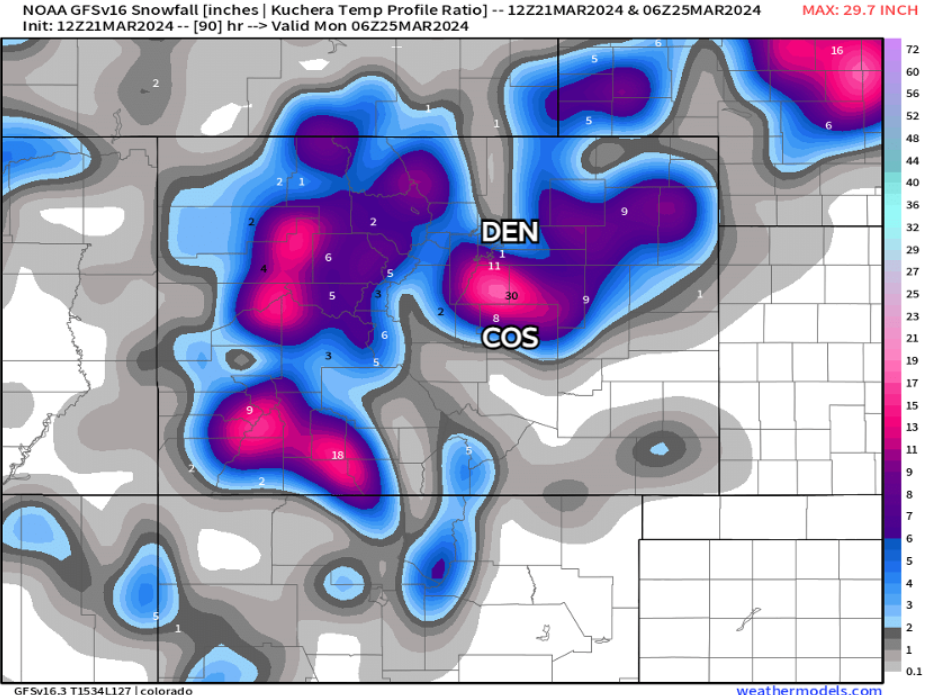
Totals look like they'll quickly fall off into the Denver metro, with areas around Colorado Springs seeing a steep gradient from north to south too. Southwest Denver, into Castle Rock look to win out too. Foothills may be a bit too far north for this one. FOCO snow hole... snow hole-ing...
Mountain snowfall will likely be a foot or more in favored areas, and another great shot of snow for the ski resorts.
Some early ideas on this storm...
Denver International: 1-4"
Downtown Denver: T-3"
Centennial: 3-8"
Castle Rock: 5+"
Boulder: 1-4"
Arvada: 1-4"
Golden: 3-6"
FOCO: T-1"
Monument: 5+"
N Colorado Springs: 3-8"
Downtown COS: 2-5"
Black Forest: 5+"
Woodland Park: 5+"
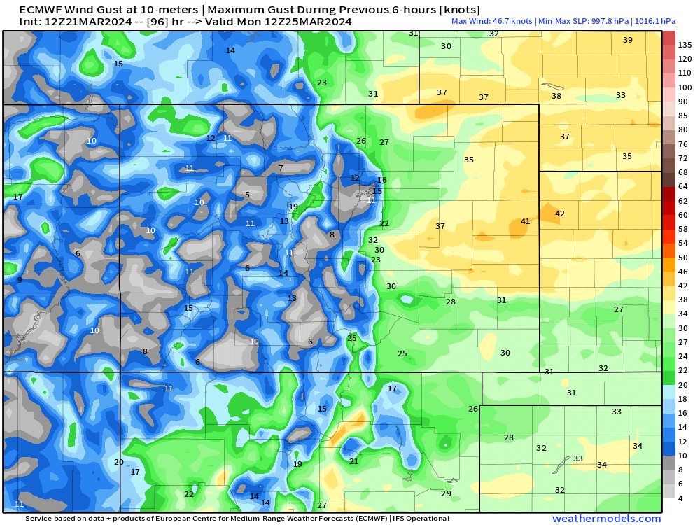
Wind will also be a bit of a problem as the snow falls Sunday night into Monday morning. Moderate to heavy snow with 20-40mph wind gusts could create visibility problems.
Overall this looks like much less of a problem than last week's system, but still one worth monitoring for it's proximity to the commute Monday AM. We'll fine tune some snow maps for you tomorrow.