Spring storm will bring wind, rain, snow, and thunderstorms to Denver area, Eastern Colorado on Sunday

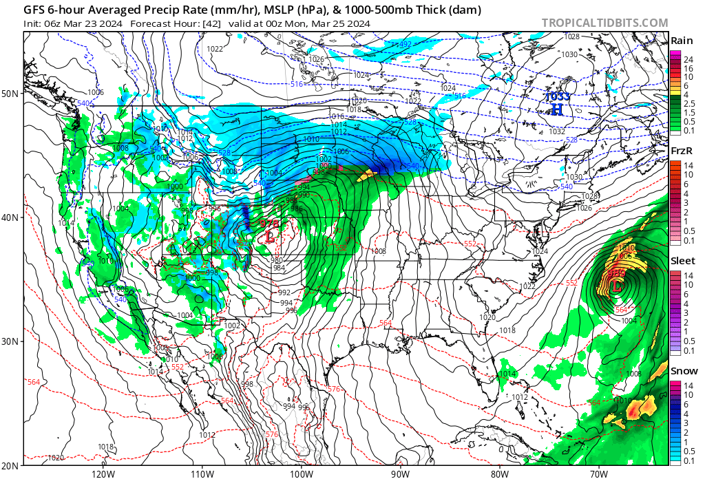
A quick-moving but pretty juiced storm system will swing through the state Sunday and bring many weather conditions to the area as it does.
First, a timeline. After another mild day today, look for highs to cool about 10°F on Sunday (or perhaps more, depending on the speed of the cold front) and then to dip considerably Sunday night behind the passage of an arctic front set to move through during the afternoon hours on Sunday.
The timeline below for Denver shows pretty good precipitation probabilities when temperatures are still quite mild. So precipitation should start as rain (perhaps some thunderstorms!) before transitioning to snow by Sunday evening. At higher elevations south/southeast/and west of Denver, that transition will be quicker.
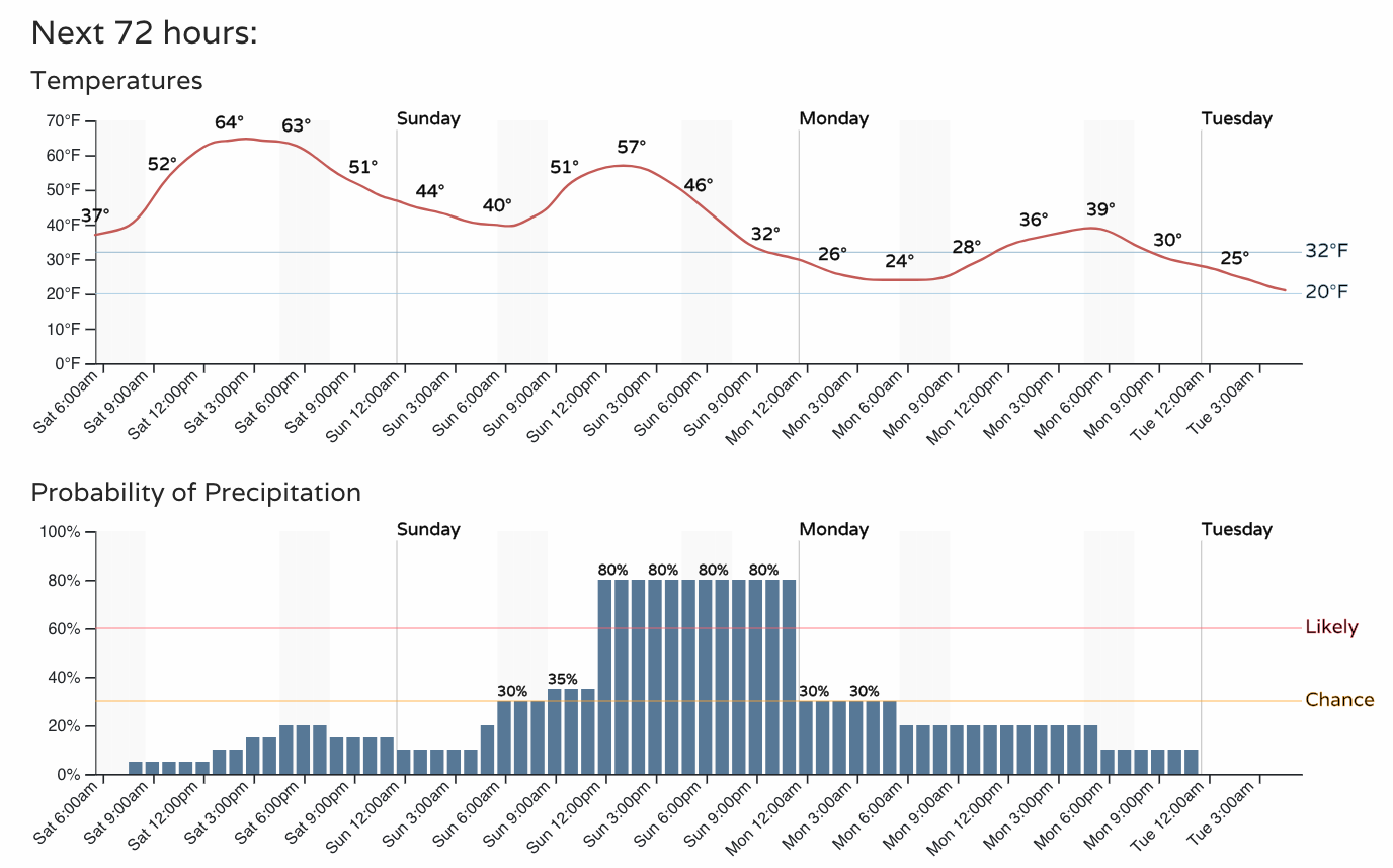
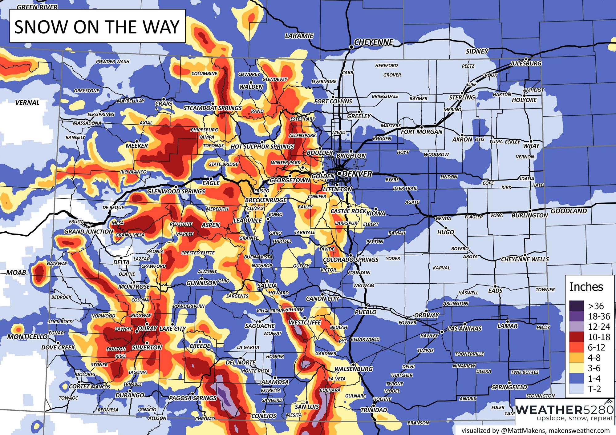
With some pretty cold air moving in Sunday evening, the longer we keep precipitation going into Sunday night, the more snow we will likely see. Right now, folks along and south of I-70 through the metro area will see the greatest chance for accumulating snow from this event.
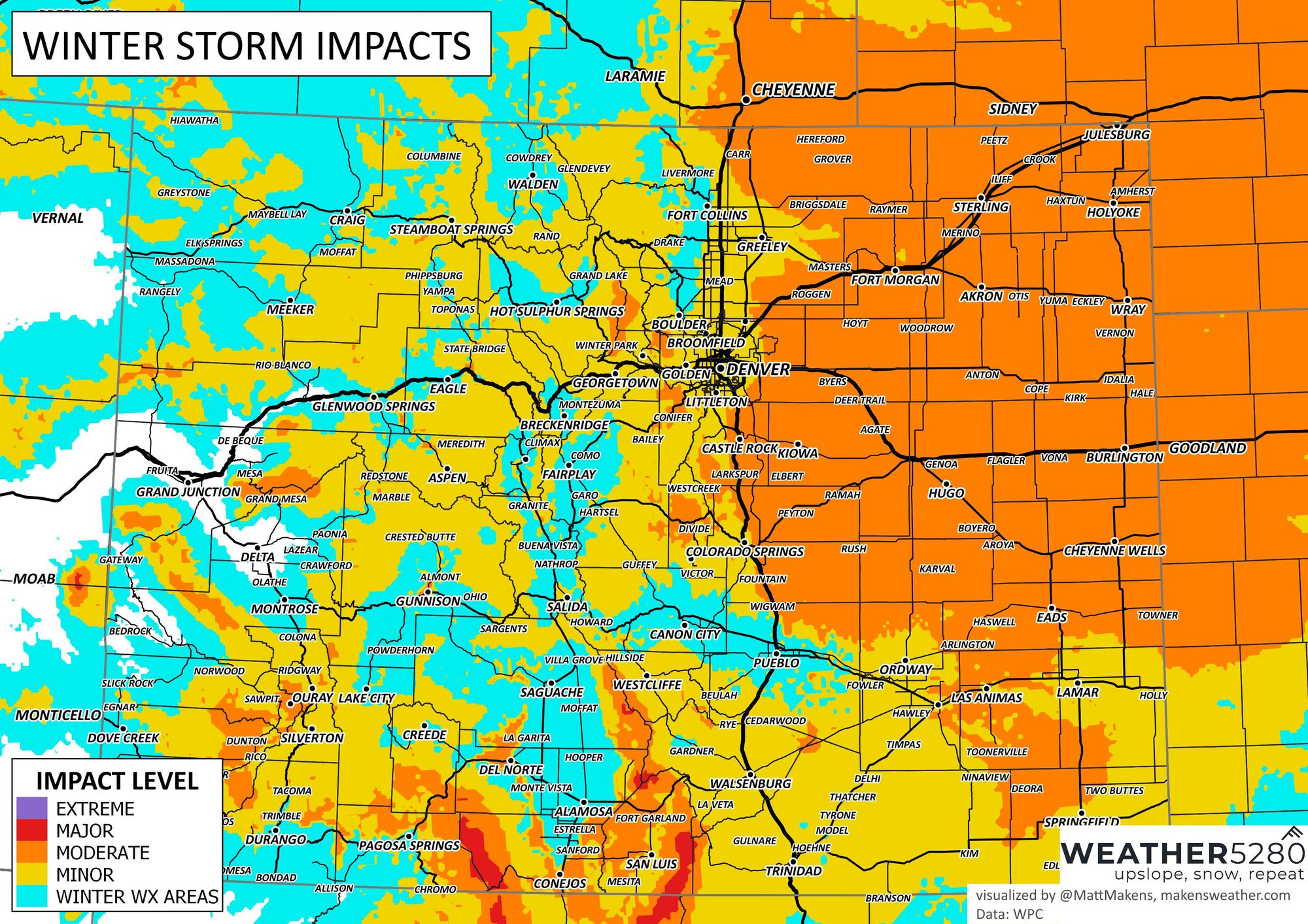
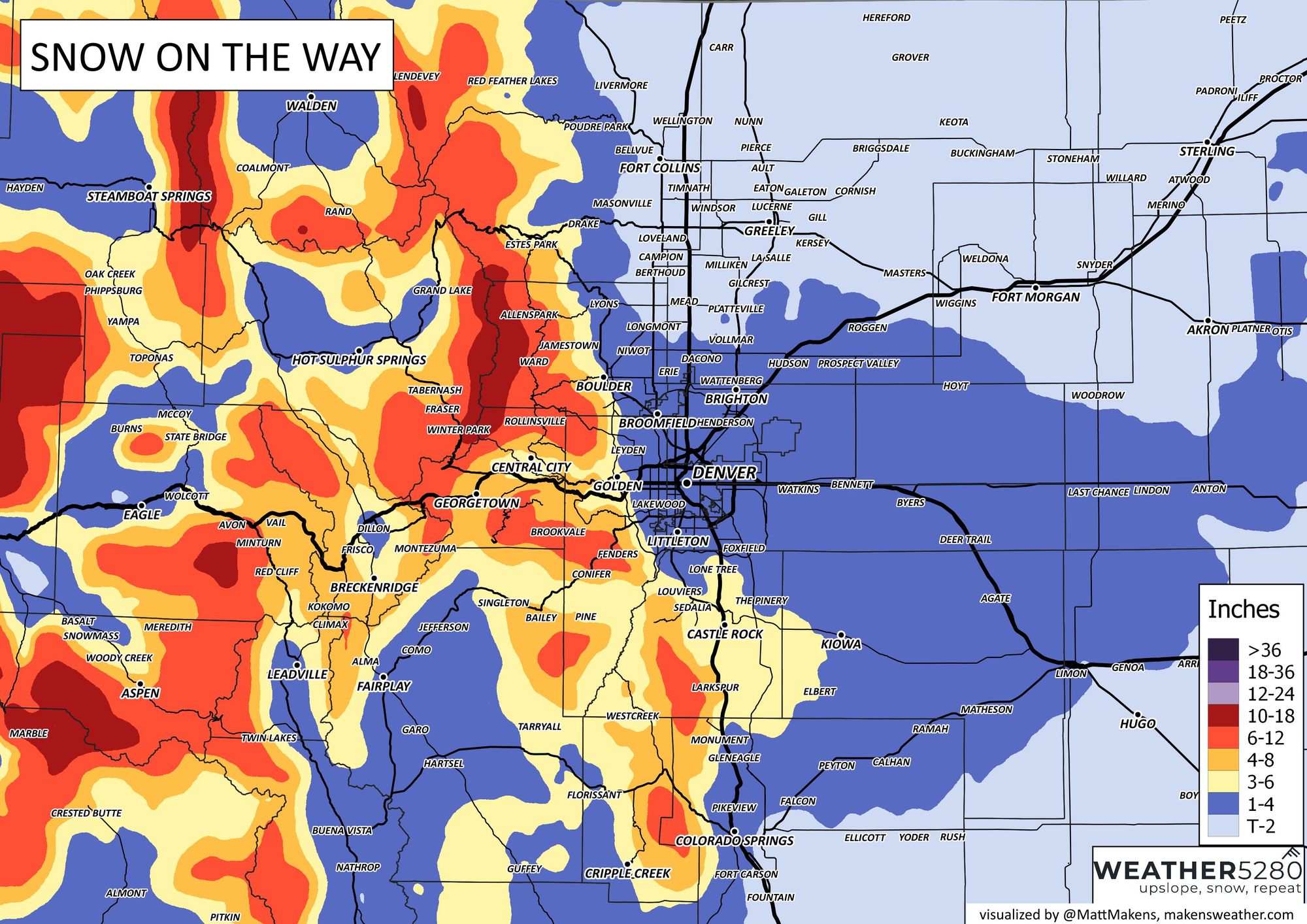
With the timing of the snow coming Sunday evening and into Sunday night, look for the morning commute Monday to be impacted – especially at higher elevations on the western and southern portions of the metro area and northern COS vicinity. Here is the latest impact map for this event:
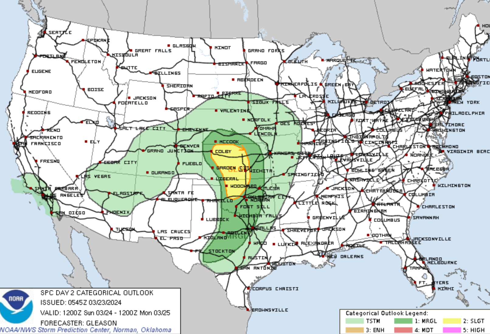
This system will have a convective nature across eastern Colorado. While we expect most severe weather associated with the system to stay east of the state on Sunday, that doesn't rule out the possibility of a stronger storm or two across the area as things ramp up – we are quickly entering that time of year! Here's the latest outlook from the SPC, with T-Storm activity in the outlook across the area:
At the surface, look for a pretty healthy low to set up over eastern Colorado Sunday afternoon/evening, and as it does, we should see rain, snow, and wind pick up in earnest across the area. For the foothills, Palmer Divide, and perhaps portions of the eastern plains just east/southeast of Denver, look for the potential for a few hours of moderate to heavy snowfall to develop late in the day Sunday and Sunday night before gradually coming to an end early Monday morning.
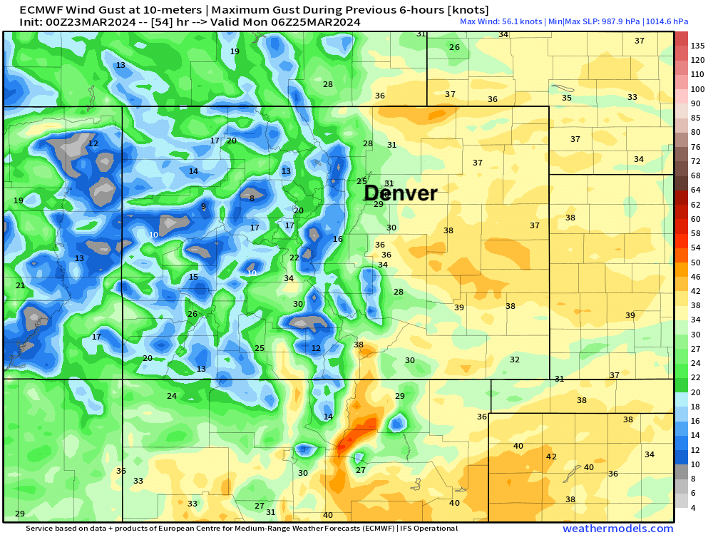
The tightly packed lines in the map above over northeast Colorado indicate a pretty windy system, so folks who see snow will be dealing with blowing snow as well—especially Sunday night as winds turn out of the north and gust to 3o - 40 mph at times.
Here's a look at forecast wind gusts for Sunday night across the state from the European model:
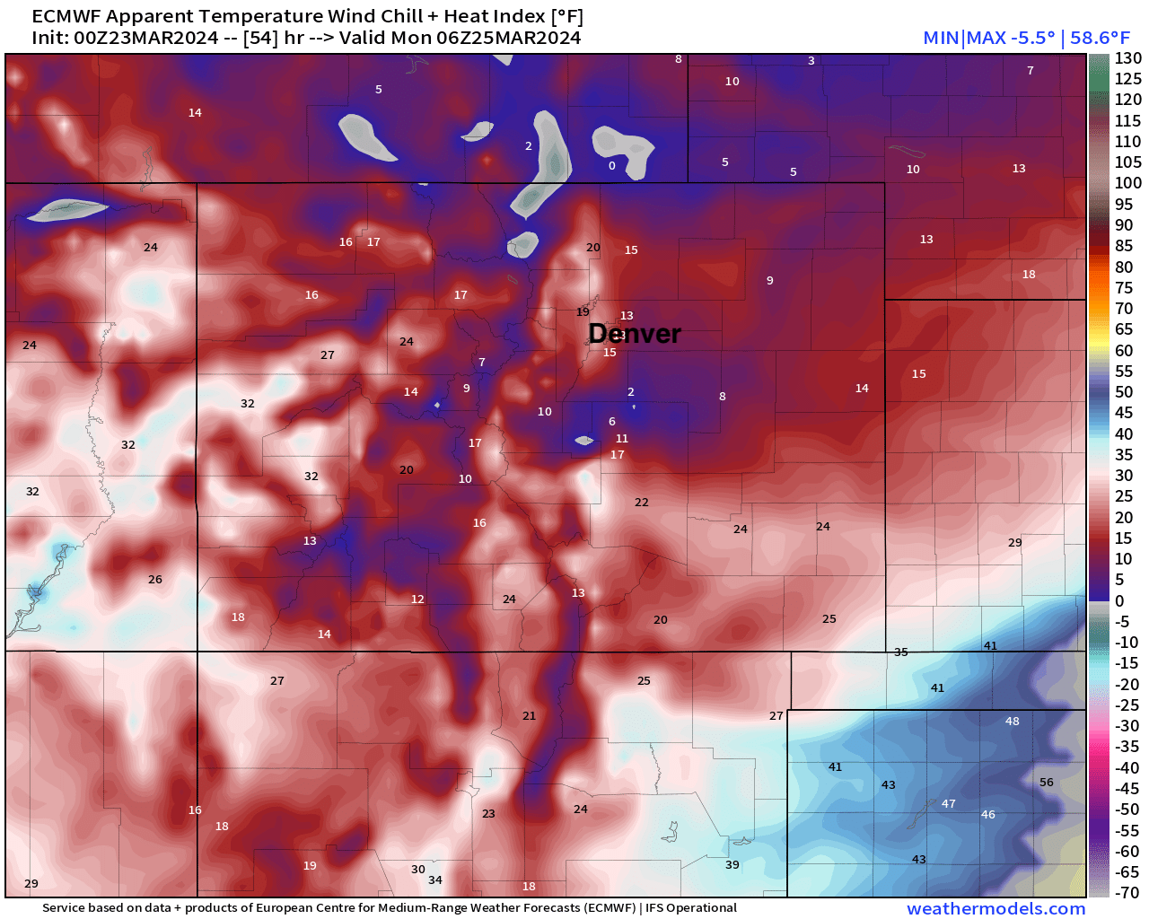
With wind chills in the teens and single digits!
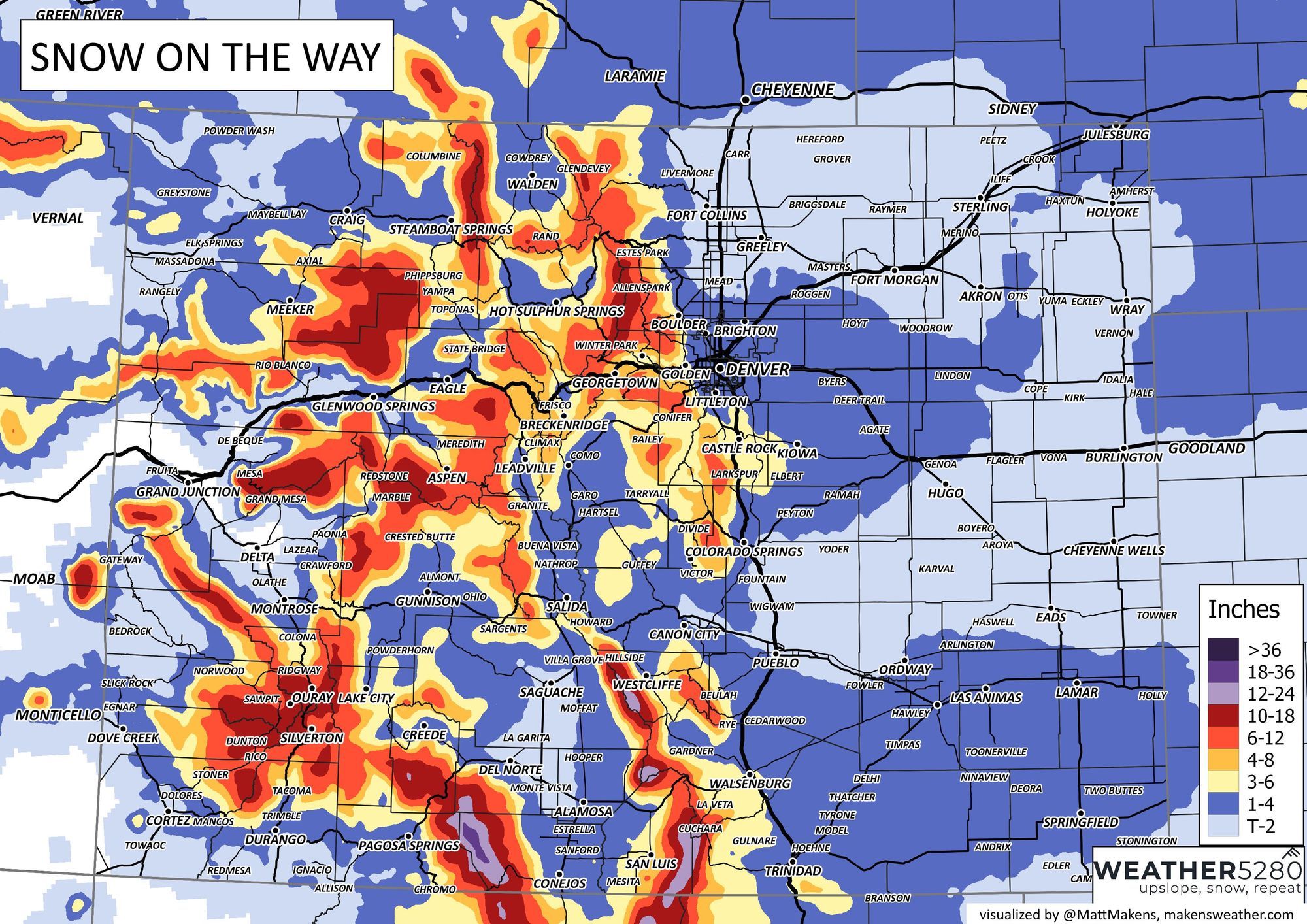
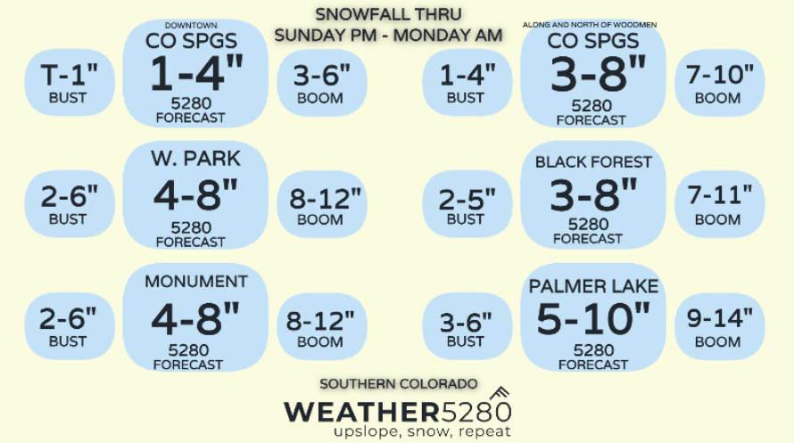
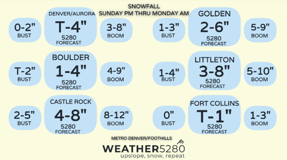
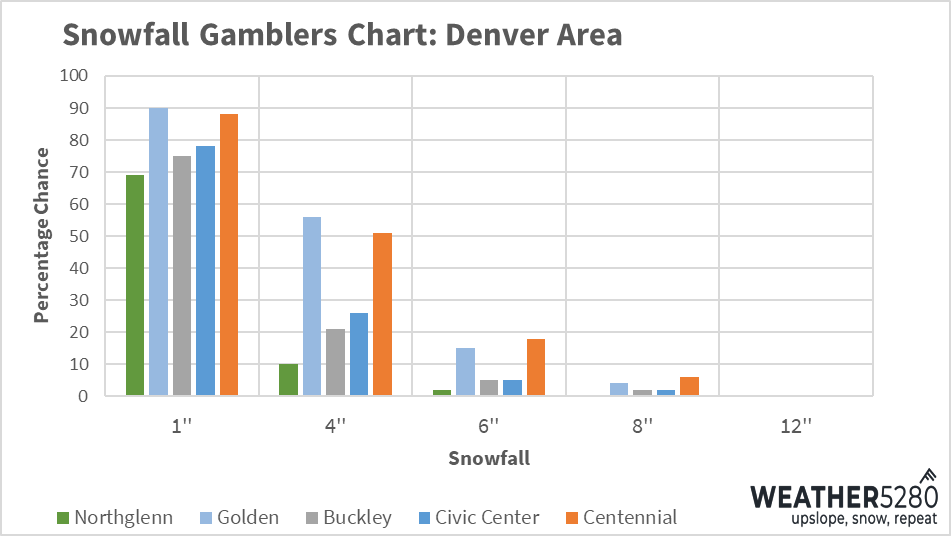
So, how much snow?
Most of the numbers we put out in our last update still hold up pretty well, but we've made some adjustments:
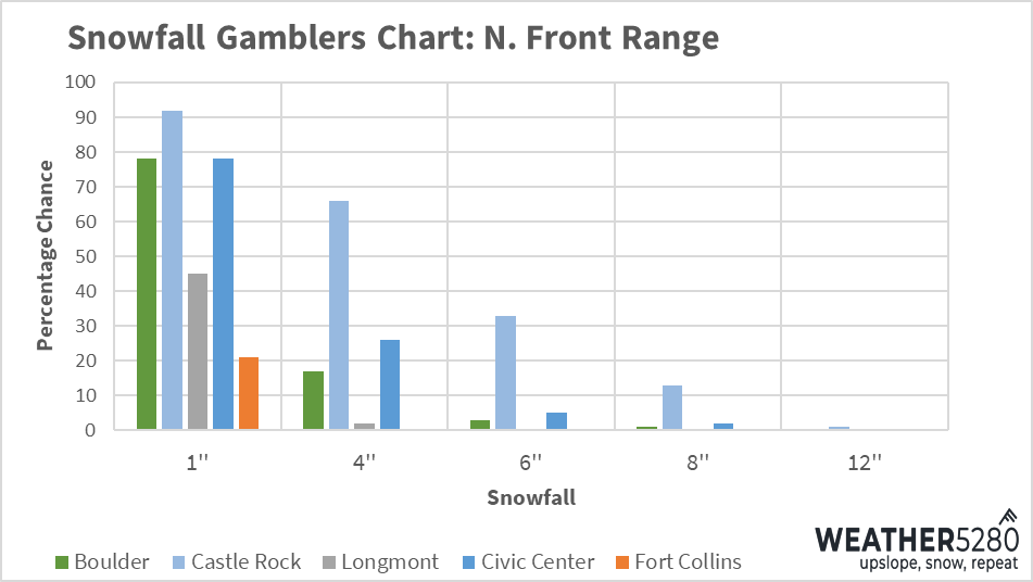
Snowfall Gambler Charts
We'll keep tracking things and offer an update as needed ahead of the storm. Enjoy the warmth today and prepare for a quick change in the weather on Sunday.
As always, subscribe to weather5280 to stay ahead of the storm!