Blizzard warnings issued for parts of the Denver metro area; Advisory posted for Denver

A potent, and quick-hitting system will arrive later today and deliver a wallop of snowfall to some locations. No, not like the big storm a little over a week ago, but enough to be a pain for drivers on Sunday evening when returning from spring break or kicking off their vacation. This will also leave a mess for some of the commuters Monday morning. Keep an ear tuned in...you may hear some thunder as this rolls through. (Thunder, indicating convection, means we could create some small pockets of heavier rain/snow than indicated below).
First, here are the active alerts for the state, quite numerous!
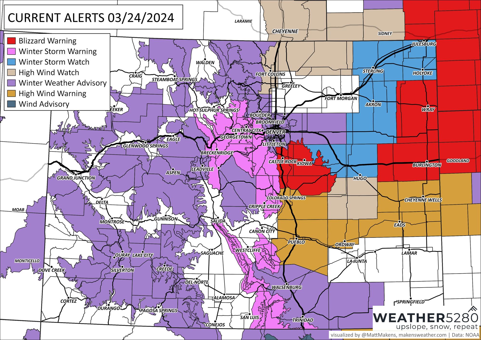
Denver is in a winter weather advisory as of this post, which means:
...WINTER WEATHER ADVISORY IN EFFECT FROM 6 PM THIS EVENING TO 9 AM MDT MONDAY...
* WHAT...Snow expected. Winds gusting as high as 50 mph, especially east of I-25.
* WHERE...Boulder and the western suburbs of Denver, Denver, and Byers. * WHEN...From 6 PM this evening to 9 AM MDT Monday.
* IMPACTS...Snow and blowing snow will reduce visibility to a quarter mile or less. Travel could be difficult. The hazardous conditions could impact the Monday morning commute.
As we zoom that alert map into the Front Range, you'll see a blizzard warning indicated for portions of Douglas, Elbert, and El Paso Counties and widespread on the plains.
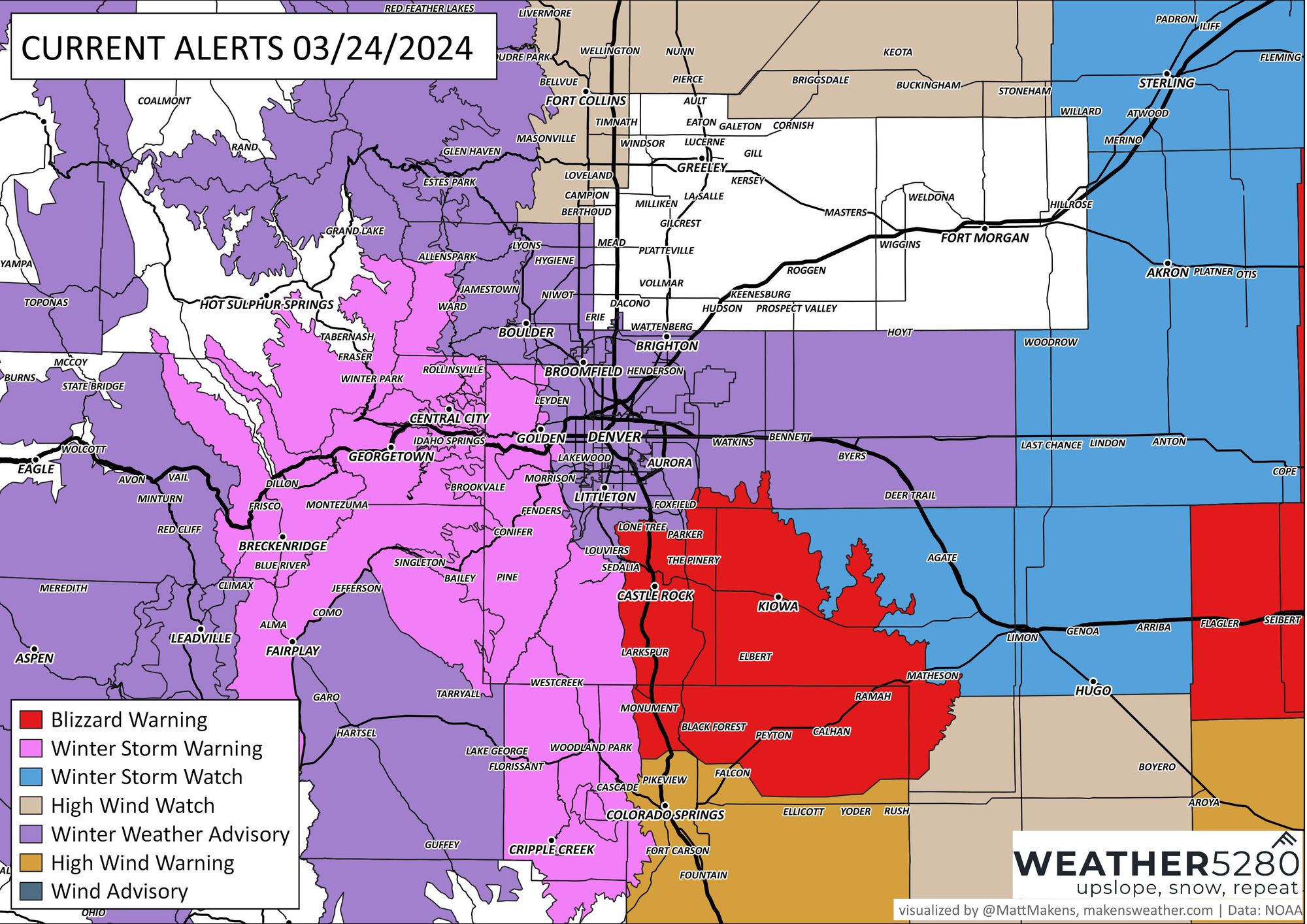
That blizzard warning means:
...BLIZZARD WARNING IN EFFECT FROM 6 PM THIS EVENING TO 9 AM MDT MONDAY...
* WHAT...Blizzard conditions expected. Winds gusting as high as 60 mph.
* WHERE...Castle Rock.
* WHEN...From 6 PM this evening to 9 AM MDT Monday.
* IMPACTS...Visibilities may drop below 1/4 mile due to falling and blowing snow. Travel could be very difficult. Widespread blowing snow could significantly reduce visibility. The hazardous conditions could impact the Monday morning commute.
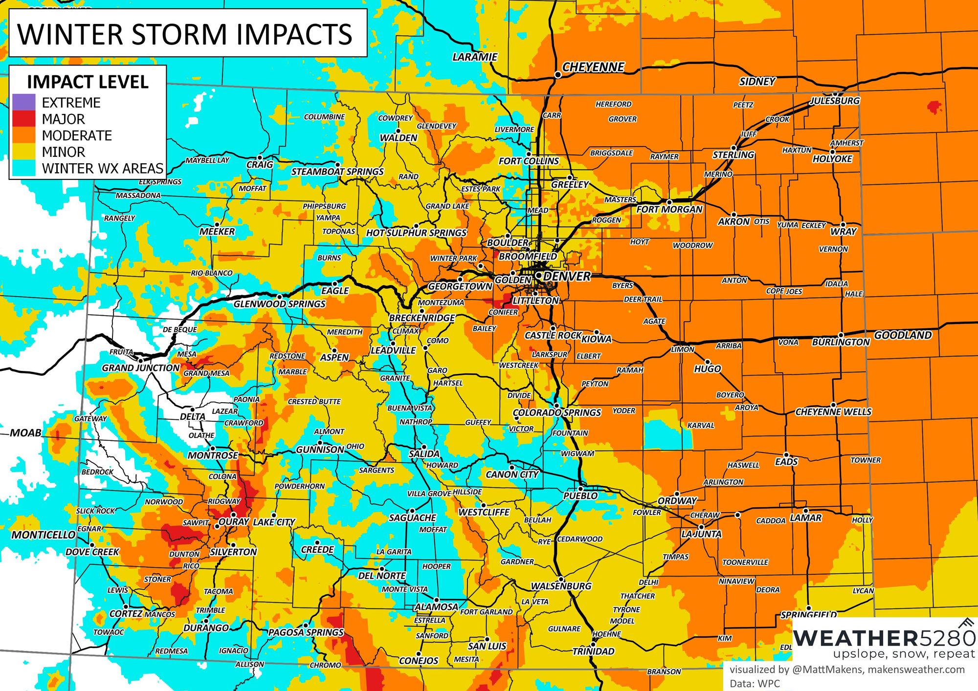
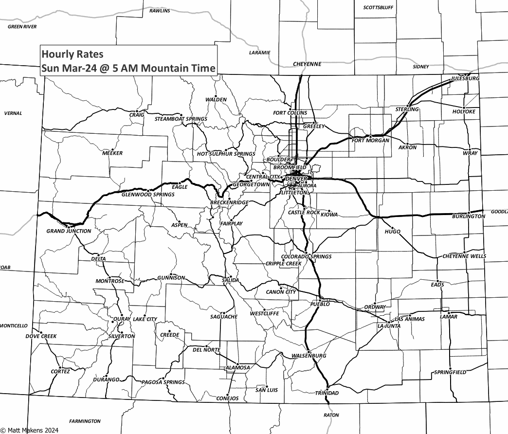
The overall impact can be assessed using this map. This includes snowfall totals, rates, weight, wind, etc., into one threat guidance.
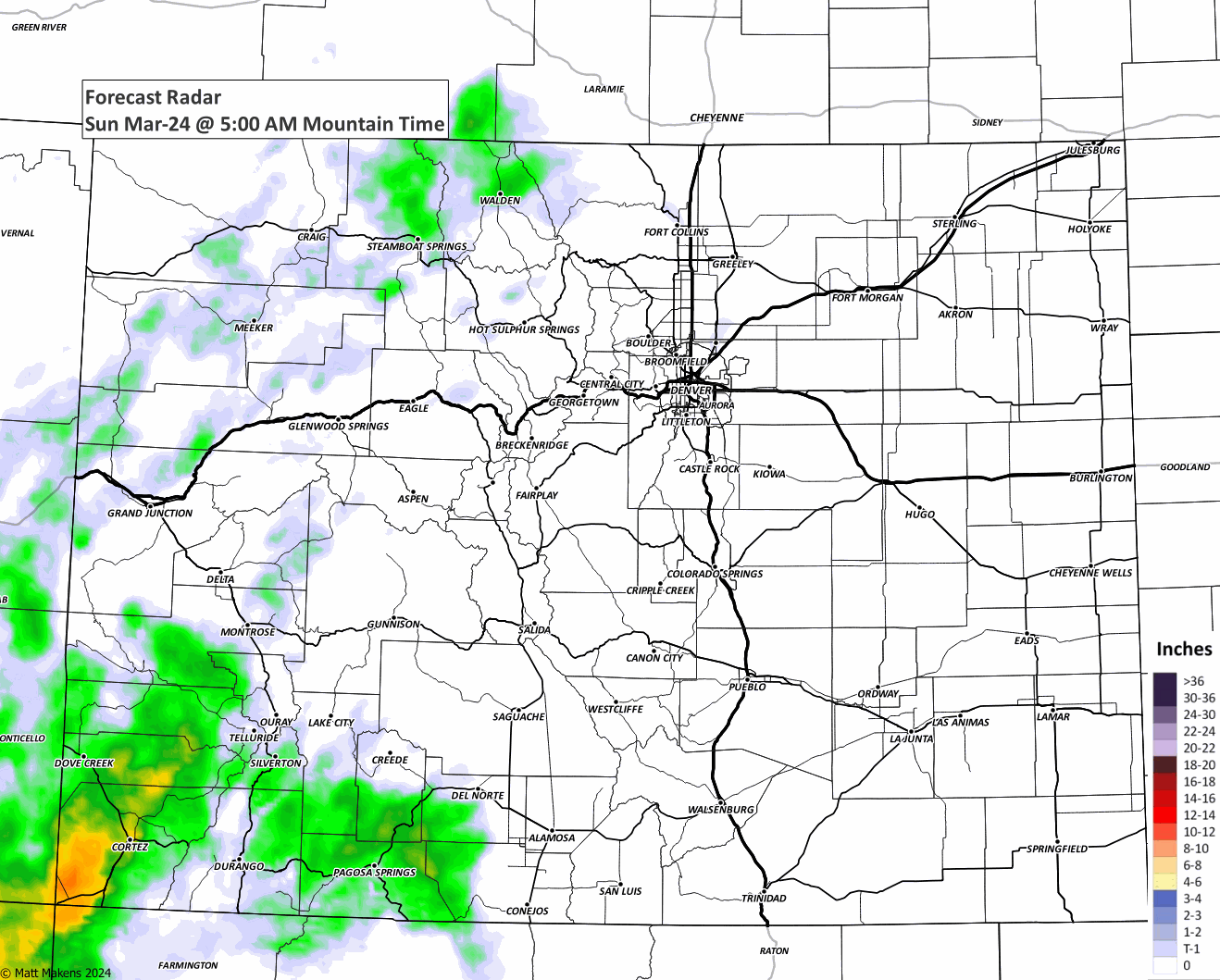
Let's get to a timeline of the storm's precipitation. This animation can walk you through the showers (both rain and snow, possibly statewide today and tonight).
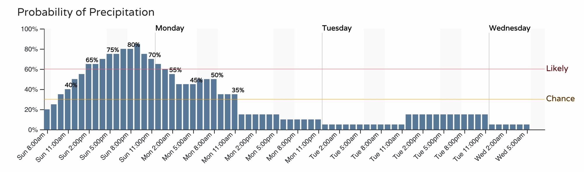
More specifically, an hourly timeline for Denver:
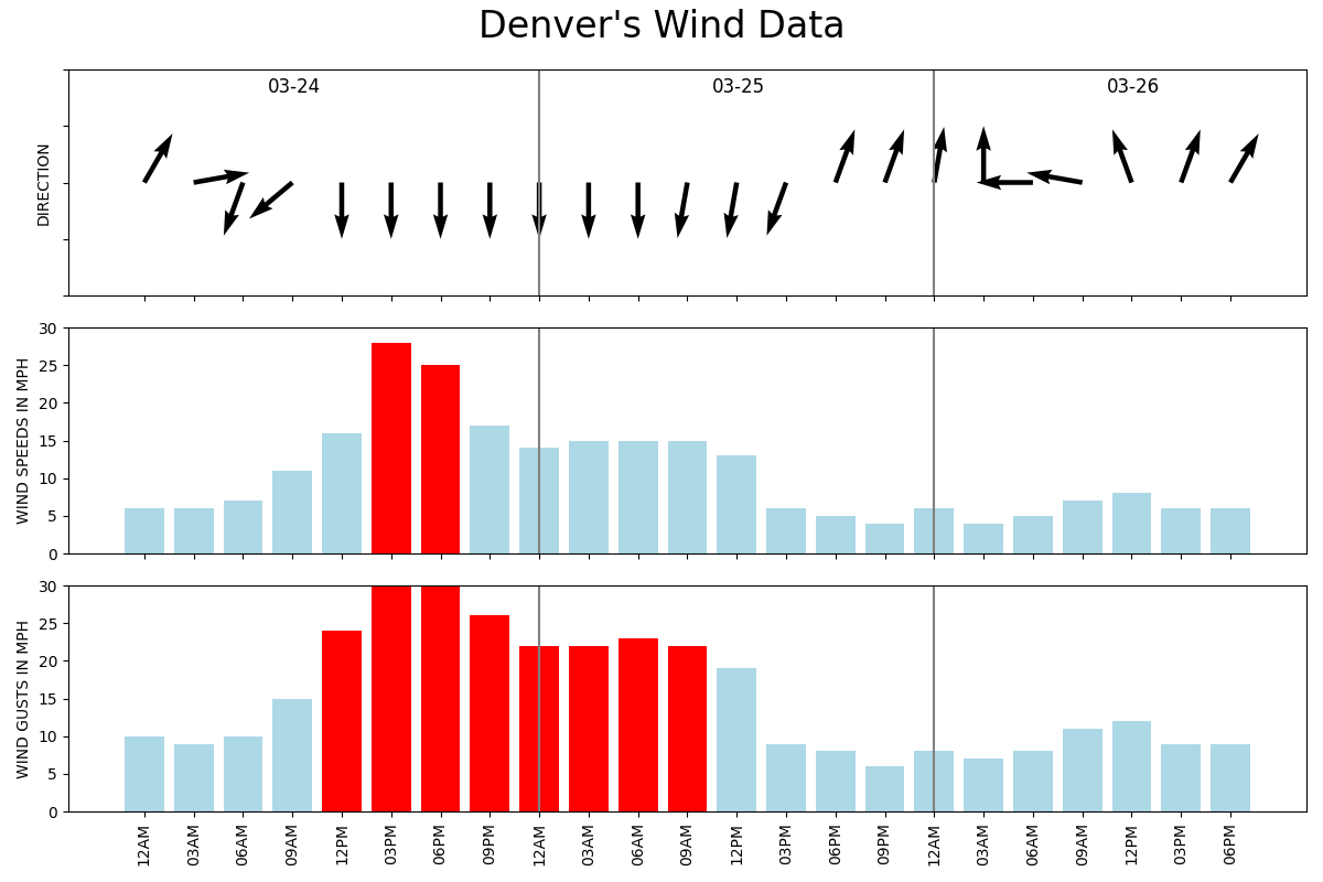
And the strongest winds set to arrive later today and tonight:
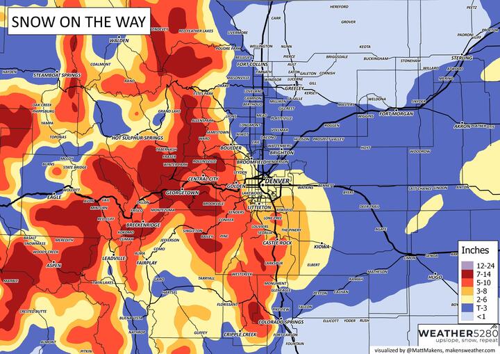
Let's look at a timeline again, but just the areas of heaviest snowfall.
That hourly animation will show quite a focus of snowfall on the Palmer Divide and Raton Mesa, in addition to the mountains by the Monday morning commute and school time.
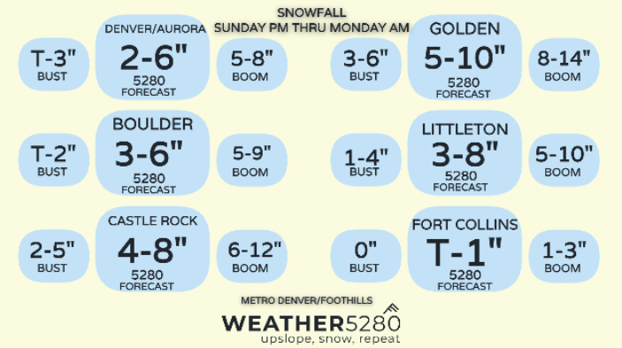
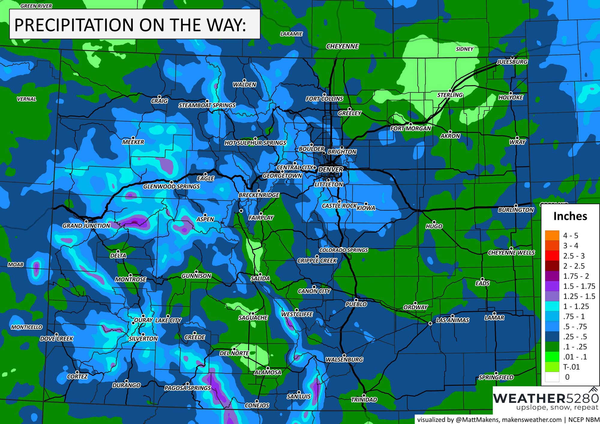
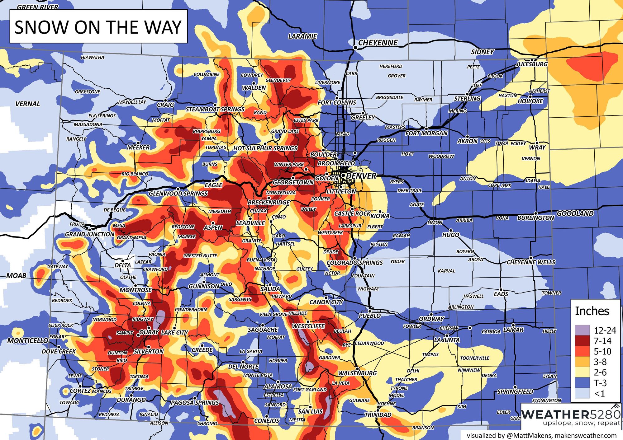
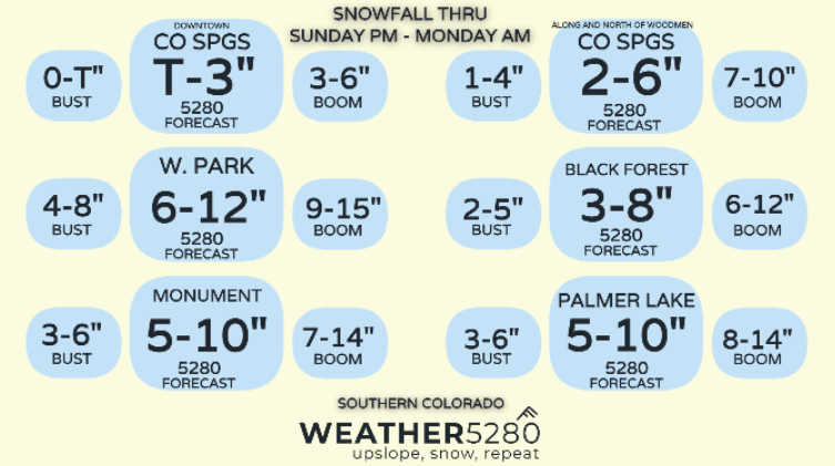
Okay, so to the totals and potentials. Let's look at total precipitation first, then snow and drill down into the metro locations from Colorado Springs to Fort Collins. Note we've updated snowfall totals a bit from our previous outlook!
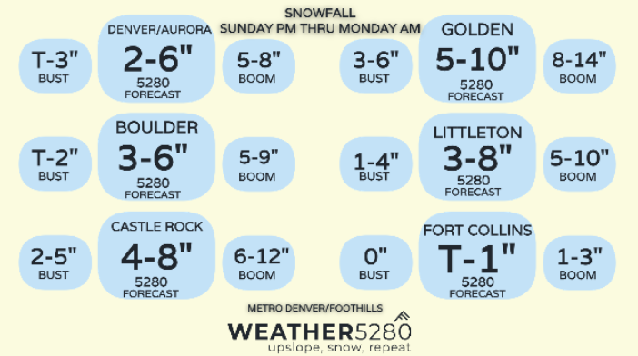
Here are some boom and bust tables...
Okay, that's the skinny for now. We can update you later if things get "cray." ;-)
As always, subscribe to weather5280 to stay ahead of the storm!