Denver will try for 70°F this weekend and when the next storm system is set to arrive

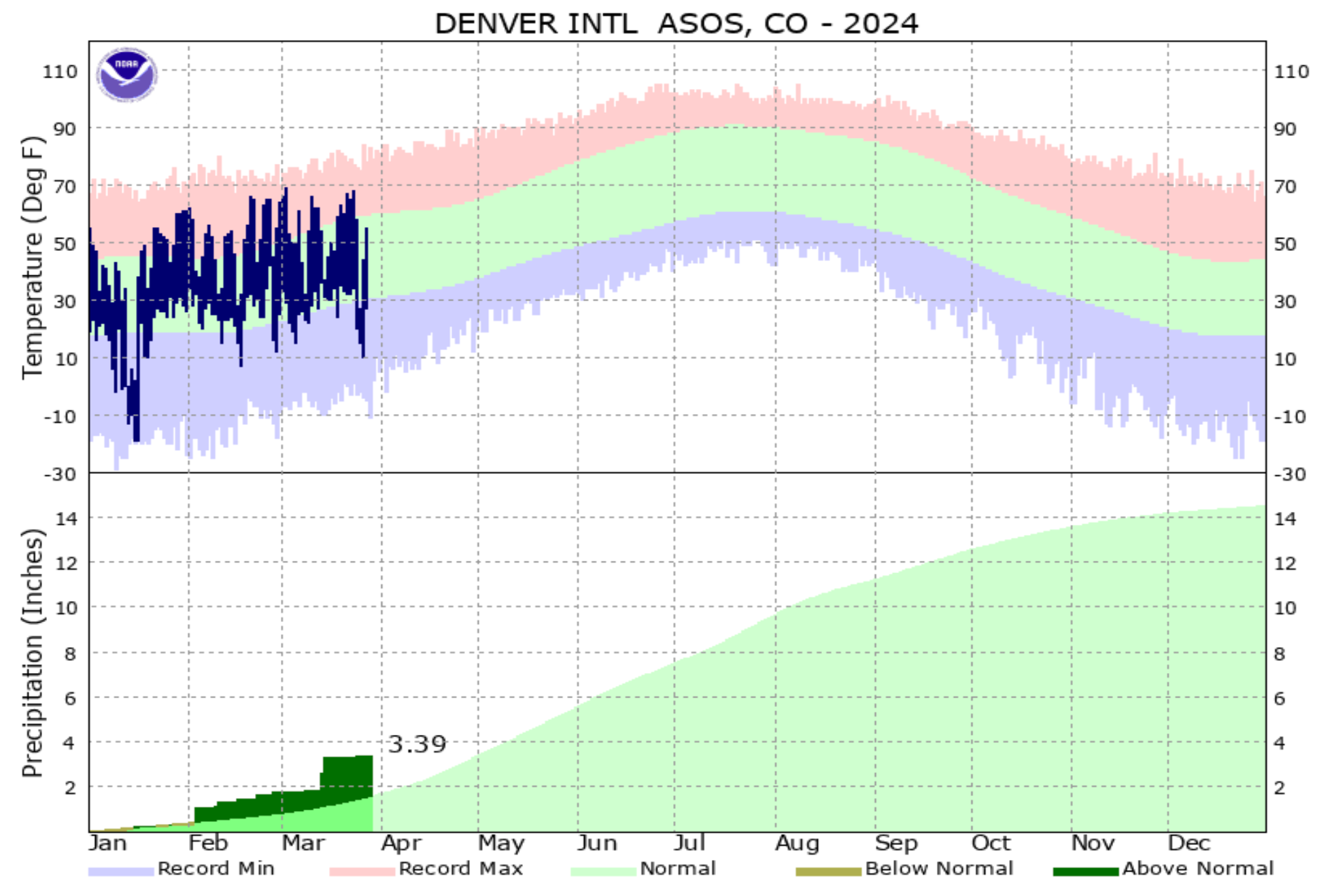
Oh what a start to the year it's been across the region. Thanks to this month's monster snow, the Denver area is boasting a huge surplus for accumulated precipitation year to date. The city (DIA) has picked up 3.39" since January 1, which is more than double the 1.54" we see on average through March 27th, and and the second wettest start to the year for the city in the last 20 years.
We also have yet to hit the 70°F mark in Denver this year. The last time we reached 70°F was on December 6, 2023 with a high of 71°F in the city. We've got a shot at it this weekend, though most guidance suggests we'll fall a degree or two (or 3?) shy of it on Sunday. Last year our first 70°F day came on March 15th, the longterm average is March 9th.
If we don't manage 70°F this weekend we'll have another shot later next week – but not until after the passage of a storm system early next week.
Next system(s) to watch
Temperature topple a bit briefly on Friday as we see some rain and snow traverse the state. Still, overall mild for the cities, with highs in the mid 50s Friday and overnight lows in the mid 30s for Denver.
While Denver warms up this weekend, things stay unsettled in the high country. If you are headed west, expect some lower elevation rain and higher elevation snow at times through the duration of the weekend.
By Monday, the next more meaningful trough will pass overhead and bring us a bit of a more meaningful cooldown (perhaps) and a better chance for precipitation east of the hills – both rain and snow.
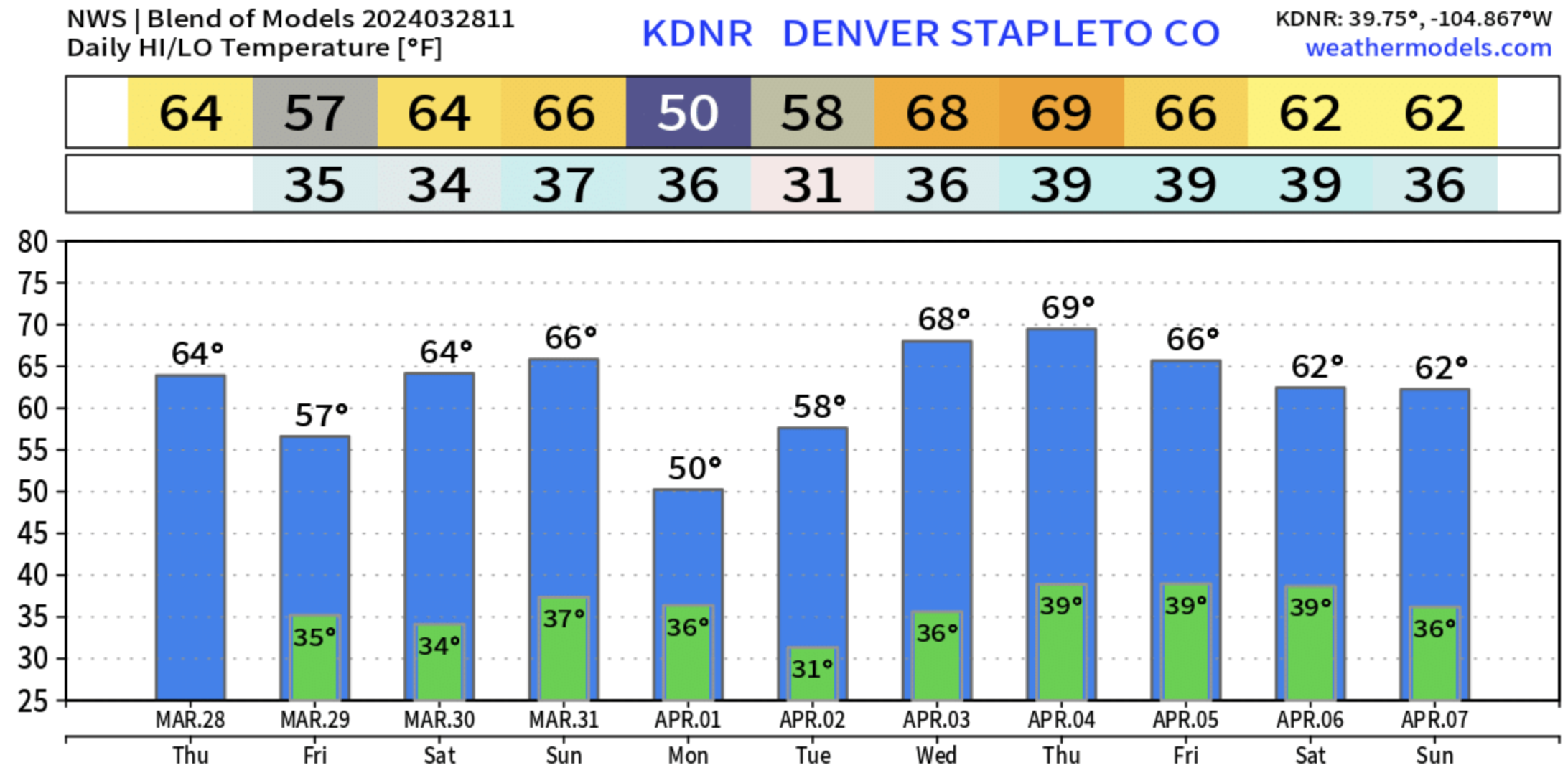
As you can see in the blend of models above, not an overwhelming cold signal when considering all the data together, but certainly cooler than Sunday, and perhaps some below freezing temperatures by Monday night along the urban corridor.
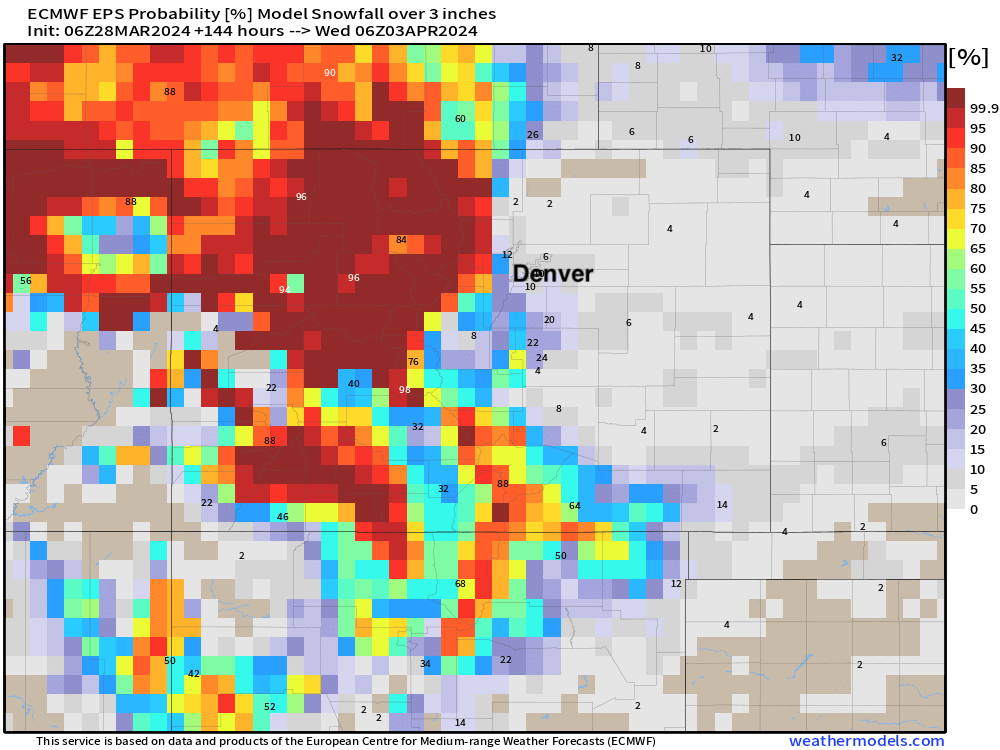
This system is looking a bit disorganized in the mid levels vs our last couple of storms, and with that it may struggle a bit in delivering impactful snow to lower elevations – but, it feels worth watch. Guidance shows a surface low setting up over southeast Colorado/TX/OK panhandles Monday morning, and at least a window for some upslope along the Front Range, with rain and snow (largely elevation dependent).
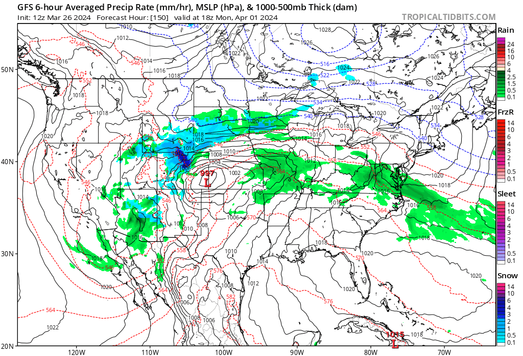
For those hoping for snow at lower elevations from this system, we've got some work to do. Right now odds for 3" of snow or more between now and next Tuesday night really favor the high country, though you can see some signs of life along the foothills and Palmer Divide.
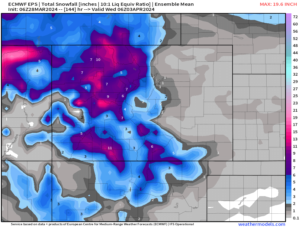
The latest ensemble mean produces somewhere between 0 and 2" of snow for the urban corridor, which seems like a good starting point until we get closer – but hey, some nice late-season snow for the high country through early next week!
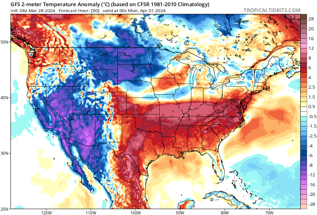
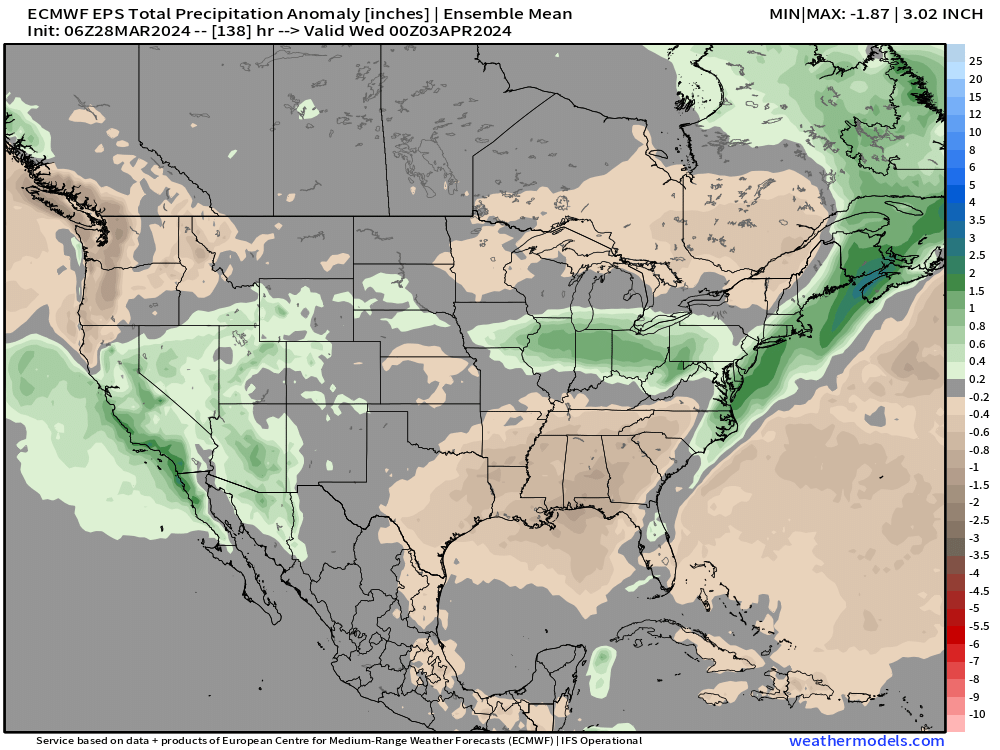
With above average precipitation across much of California and the Great Basin into the Colorado Rockies through the weekend. Love to see this!
More to come on that system next week. Again, watch for those scattered showers tomorrow, and let us know how you enjoy the mild temperatures this weekend! Let's see if we can hit 70!