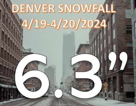
April storm's snowfall totals 3rd largest in a decade, what created this jet enhanced setup for deeper snow

As discussed in yesterday's snowfall forecast, we anticipated snowbanding to deliver heavy snowfall to parts of the Front Range, and that did indeed end up being the case.
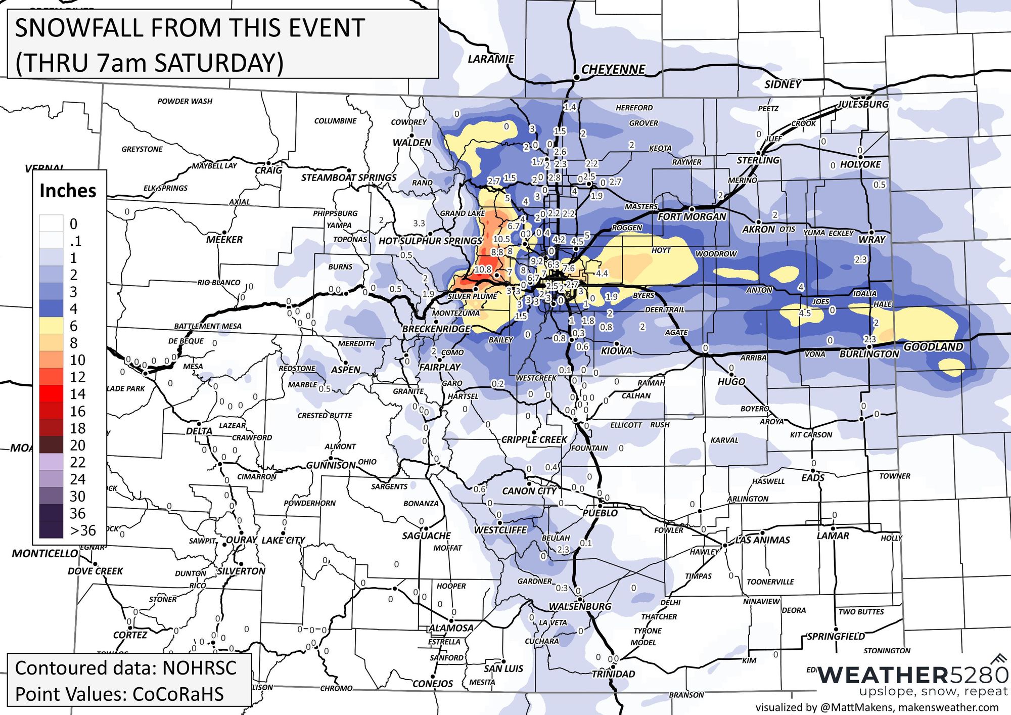
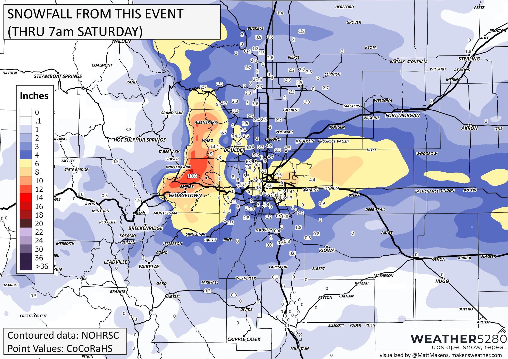
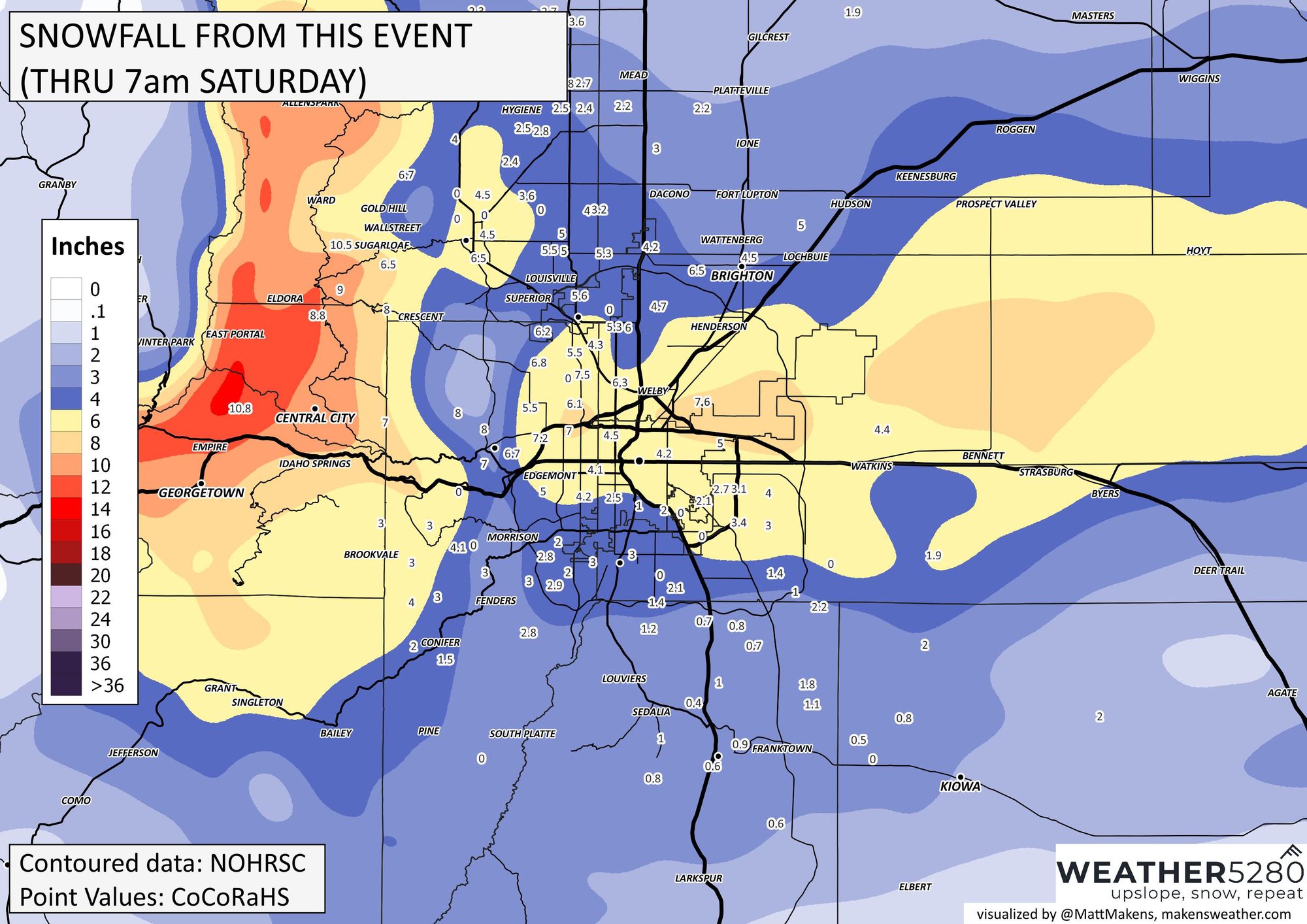
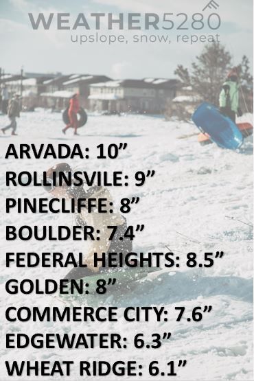
The recap: Here are totals through 7am:
Here are other totals, through mid-Saturday that have arrived:
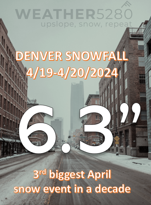
The History: For Denver officially, the 6am report is 6.3" which makes this the 3rd biggest April snow storm in a decade. In the past ten years, the highest storm totals for DIA are April 16/17th, 2016 at 12.1" and April 15/16th, 2021 at 6.9".
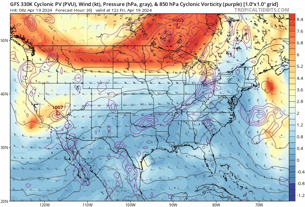
So, what created this event? That "jet banding" thing we talked about previously...
One of our main mechanisms for snow producing storms along the Front Range is what we call upslope: winds that push up against the Rockies and create the lift needed to produce precipitation, which in the winter usually falls in the form of snow. For the northern urban corridor that's typically a northeasterly or easterly wind, but that differs depending on where along the Front Range you are located.
With a classic cutoff low snowstorms, that upslope is deep – meaning we have strong upslope winds well up into the atmosphere and all the way down to the surface which help deliver ample moisture to the Front Range and often widespread, heavy snow along the urban corridor.
There are other ways to achieve heavy snowfall along the Front Range, however. When we are lacking deep upslope we depend on other methods of achieve areas of greater lift and instability and ultimately heavier snowfall. One of those ways is with a roaring jet stream overhead, and what we often refer on here as "jet-enhanced" or "jet-induced" banded snowfall. These types of setups may produce generally light snowfall across most of the area, with only narrow bands of heavier snowfall with sometimes little movement over many hours.
What is jet-enhanced snow?
In the jet stream, a "river" of high velocity air located between 250 and 300mb (or about 30,000 to 40,000 feet above sea level), there are pockets of locally faster wind speeds called jet streaks. These jet streaks can be greatly impactful on our weather here at the surface, both during severe weather season and during the winter season as well.
In a jet streak, there are areas of rising and sinking air, or areas of diverging and converging air. Where air diverges (such as the right entrance of a streak), the result is upward motion – often helping to promote severe weather during the warm season, or localized heavy convective snow during the winter season.
Here is the imagery from yesterday's post supporting the likelihood of snowbanding:
We often see these setups along a northwesterly flow aloft, but sometimes with a westerly or southwesterly flow as well. Sometimes, with a southwesterly jet and a low-level cold front like we saw this past week we see overrunning, which produces little more than light snow across Eastern Colorado, or even freezing drizzle (which we also saw this week). Sometimes, however, enough ingredients come together to produce big-time snow totals as well.
What's next? From here, we start a drying and warming trend for Sunday, but we could see some thundershowers approach early in the week:
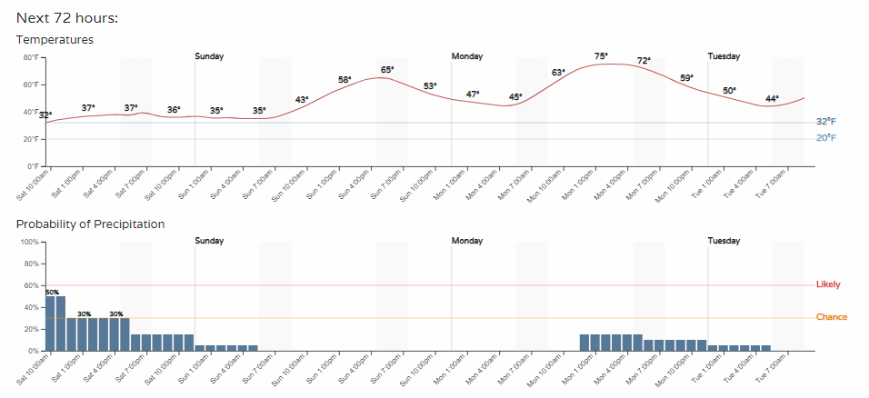
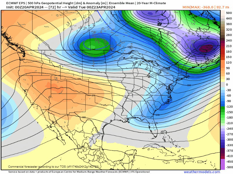
Temps will continue to warm as a stout ridge of high pressure moves in throughout the week. After that, we have a few questions on our next storm potential...
As you see at the tail end of that animation, a pretty potent low spins up (big blue blob) and moves our way– could spell another unsettled weekend - potentially snowy for some again. Time will tell.
We will have more on those storm chances in a future post. Enjoy the snow! And, don't get left out in the cold wondering what happened, stay up to date with our emails - forecasts delivered when there's something important headed your way.