The State of the Atmosphere: Sunday, January 18, 2015

The proverbial winter game that is mid-range model watching is in full swing right now. Global models are struggling mightily with this pattern, and with that, what once looked like a potential pattern shift this week now looks like a pattern blip. No, we're not throwing in the towel yet on this season, but instead will continue to preach what we have been preaching all winter: patience. January is not a particulary snowy month of us anyway, with just 6.6" on average. Through today, DIA has recorded 3.7" on the month. So, we kick the can down the road and see what happens.
As I mentioned in several comments on last week's post, the western ridge (remember last winter) was looking to be a bigger and bigger concern as the week progressed. Sure enough, it looks like at least for the time being, the ridge will keep much of the active/cold weather east of Colorado.
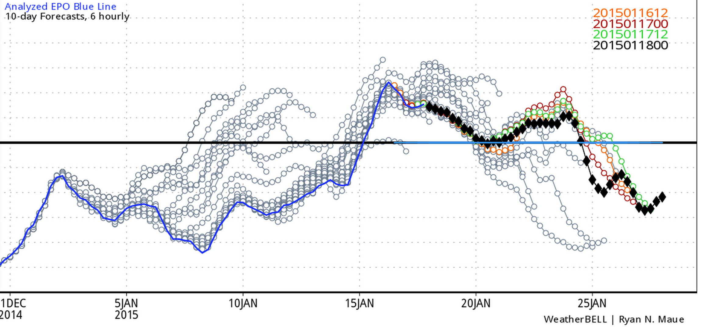
This is reflected in the teleconnections as well. What once looked like a cold signal for this coming week now looks "meh" – meaning we should see the end of 60-degree weather this week, but nothing too impressively cold either. Take a look at what one model had forecast originally for this week's EPO, strongly negative by the 20th. Now it pushes toward neutral, but doesn't drop negative until the following week.
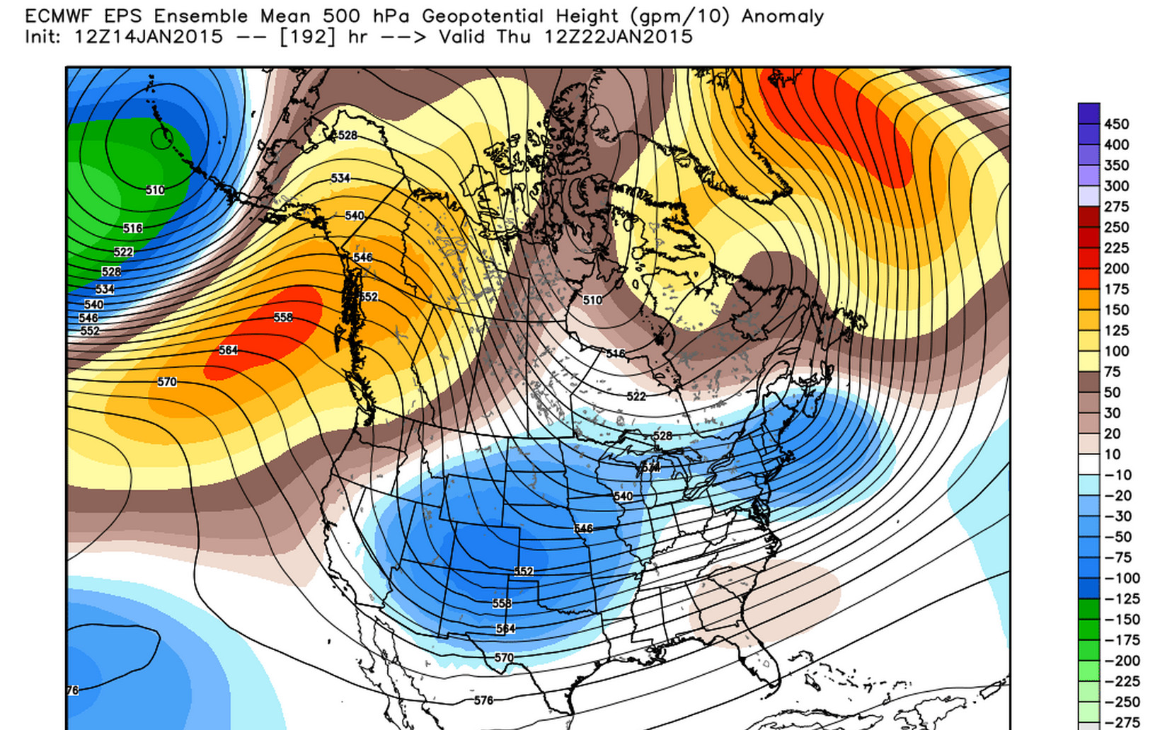
The ECMWF (WMO-Essential) 500 hpa geopotential heights looked much more interesting a few days ago for this coming week...
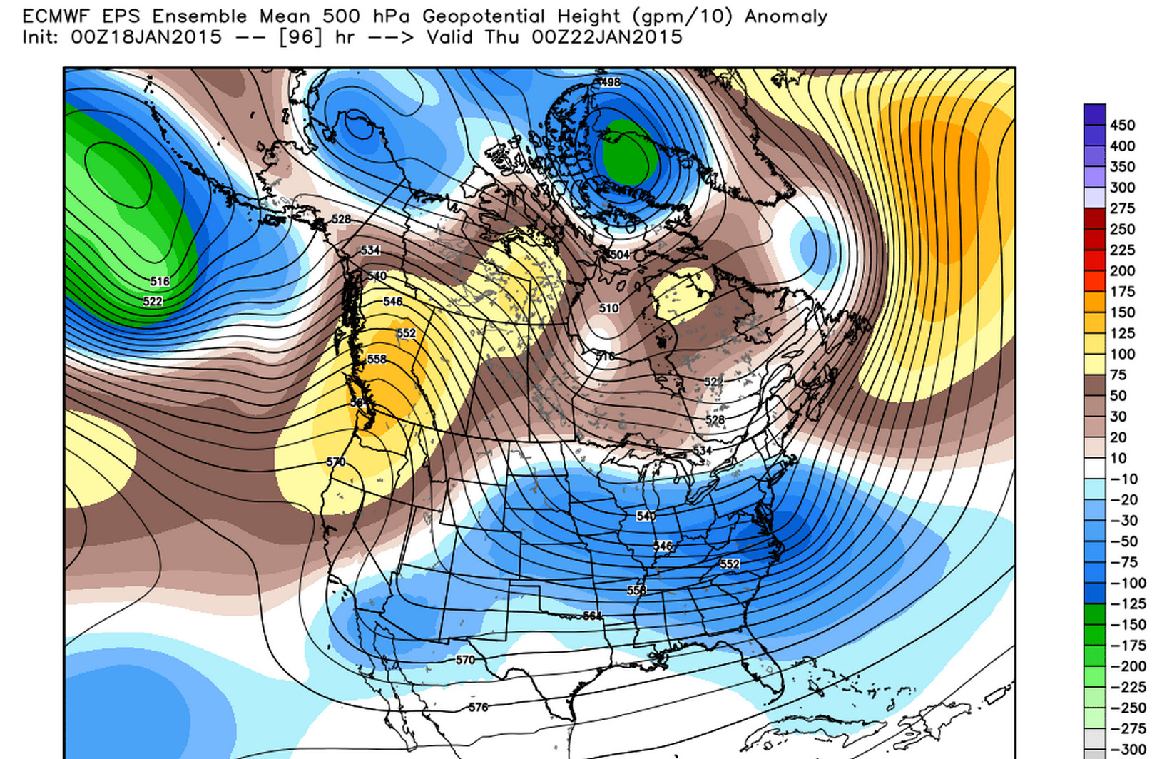
While the latest run looks like this... much broader, with greatest negative anomalies now in the east for the same period. This will be our midweek disturbance.
The week ahead
The week ahead will feature a slightly more unsettled pattern than we've seen over the last few days, but for the moment there are no big snow makers in the forecast.
One chance for snow comes Monday afternoon and overnight into Tuesday when there is a bit of upslope and some moisture to work with, but little accumulation is shown on any of the models. The GFS and GEM are mostly dry with this system, with the EURO showing some QPF across the metro area. However, even if the wetter solutions verify, rain could be the primary precipitation type.
We'll see another few waves push through over the week as well, each of which will bear watching. Current models show best chance for snow accumulation throughout the week occuring east, and south of Denver. The Palmer Ridge may manage a few inches this week, as well as a few spotty locations across far northeast Colorado. Extreme southern Colorado too may see some snow this week, with the best chances here being Wednesday and Thursday.
We'll keep a close eye on things and work to narrow down best snowfall chances over the coming week. This pattern generally isn't one to produce for Denver.
A few thoughts on extended outlook
I know a lot of folks (not everyone) that follow this site are eager for a good snow. Despite a rather grim few days of model runs, there are plenty of good indications that we'll see a more active pattern at some point this winter.
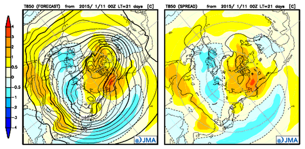
Here's the most recent run of the JMA, 850 temps for February progged to be cold across the eastern 2/3 of the U.S.
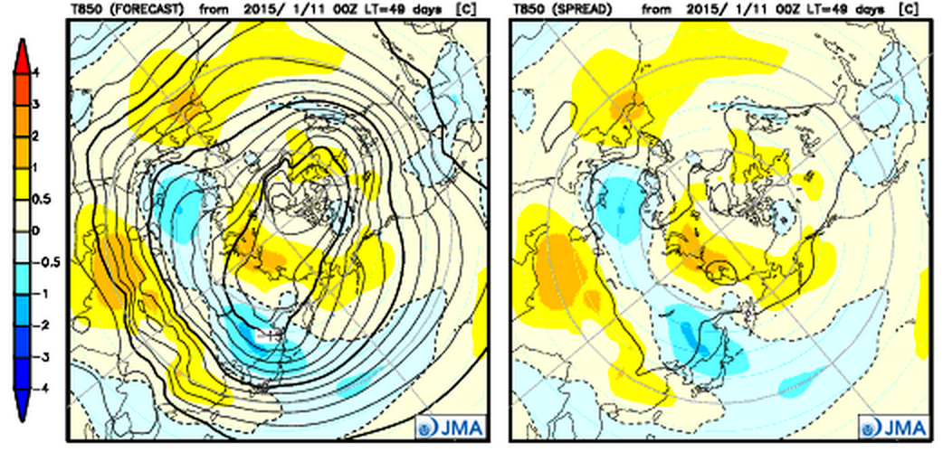
Jumping ahead to March, the model tries to pull the coldest temperatures west a bit, centered over Colorado and the southwest.
In the shorter term there's a lot of conflicting signals, and any given run is looking somewhere between interesting and not interesting at all. For now we're not putting a lot of stock in any of the medium range models until it becomes a little bit clearer where the general pattern is going. Time will tell...