Fire Weather Threat for Tuesday

A Fire Weather Watch is in effect for the plains and some of the Front Range Tuesday. This time, this is due to strong winds and low relative humidity expected statewide.
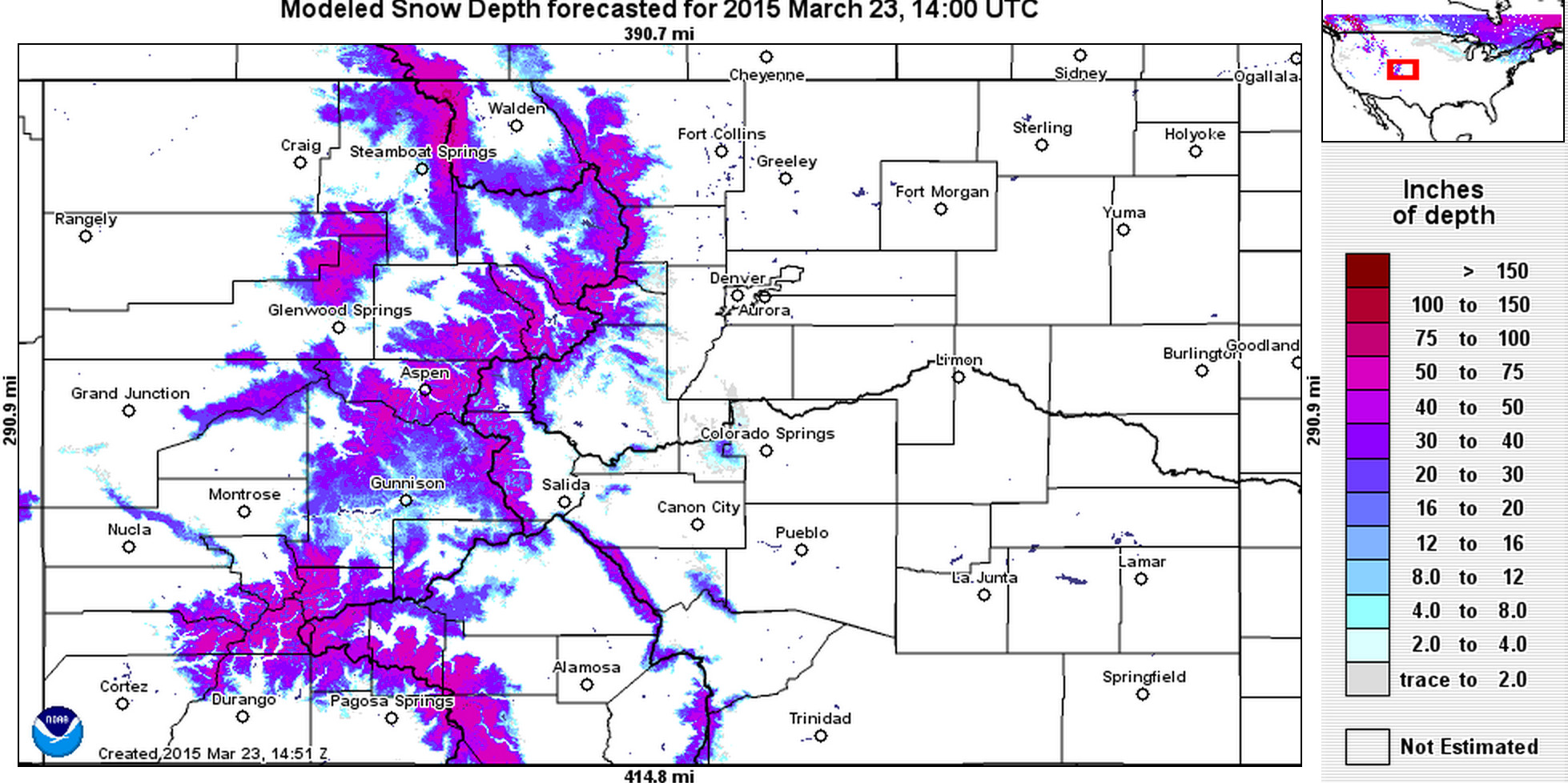
Despite the wind being a statewide issue, the fire danger is highest on the plains. This is due to its lack of snow cover, warm temperatures, and low humidity. The mountains still have a lot of snow cover so that prevents their fire threat, for now.
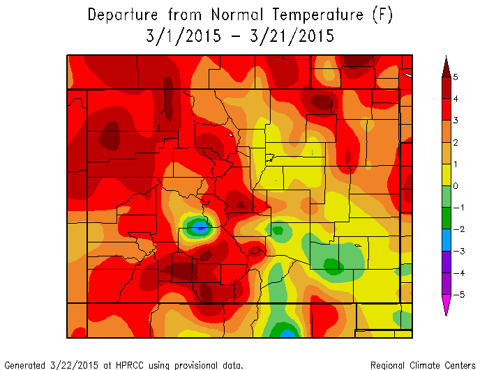
March has been a warm and dry month. The month's temperatures are averaging several degrees above the average.
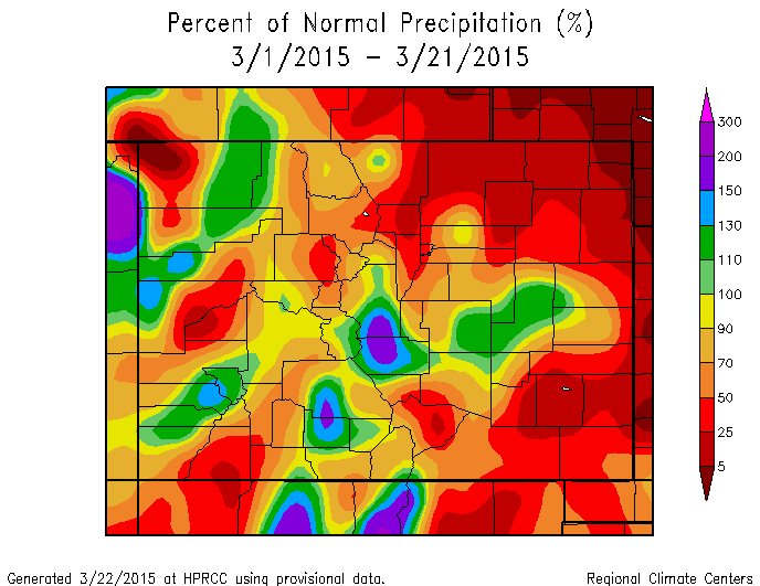
Meanwhile the month's precipitation is far below average.
We have seen several small fires already in March. Accidental human ignition is usually to blame this time of year. It's hard to imagine that the fire danger can become dangerous so quickly. Especially considering that December to February were quite wet for the region, and that northern Colorado is out of its long running drought.
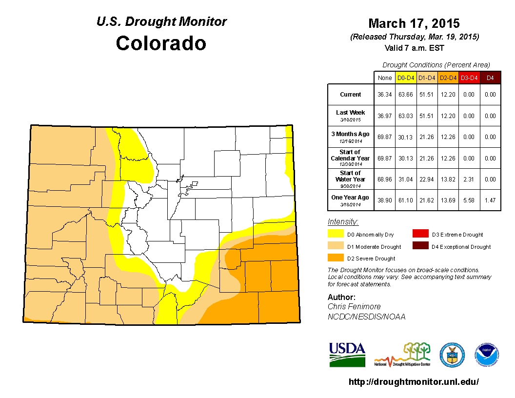
Long term drought doesn't really factor in this time of year. It's the need for frequent moisture, in the form of snow preferably.
Vegetation on the plains is dormant, for the most part. This means those plants are not taking in any water. So, dry plants with no snow on them (to act as a fire preventer) are easy fuel for a fire.
These conditions will be most dangerous Tuesday. Wednesday through Friday will be cooler, wetter, and less windy as we talked about in this week's SOTA.
As spring temperatures continue to warm, this fire danger will stay with us. The danger will decrease once the plants begin to grow again (taking in water) in April and May.
Continued rain/snow chances and cooler temperatures will help also. We will have a chance for some precipitation on the plains later in the week, but need a big spring storm.