A Change in the Weather Pattern for April?

After such an active last two weeks of February and first week of March, we have really been quiet and mild. With the exception of a weak storm or two, March has been the opposite of what I thought it would be. That being said, a dry March doesn't guarantee drought problems or excessive fire danger. A dry March and April changes that thinking though... Thus, we need April to produce for us.
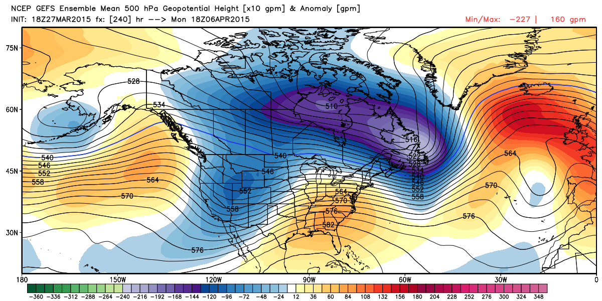
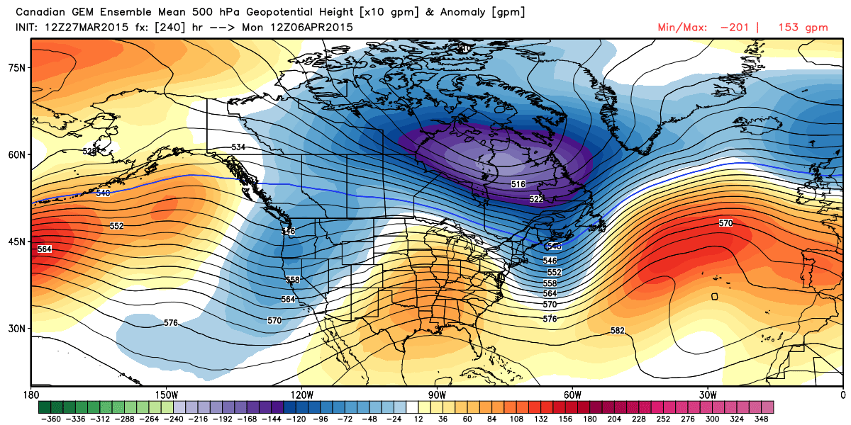
Lets take a peek at what the models are suggesting as we head into April. Aside from what appears to be a weak storm system late next week, our main attention is on the potential pattern shift thereafter. In fact, several different models are keying on a large trough developing over the Western United States just after Easter weekend. The maps below represent the upper level weather pattern that is forecast to occur just after Easter. Blue areas represent the potential trough and associated cooler/wetter weather that is possible.
GEFS Ensemble Mean 500mb Height Anomaly
Canadian GEM Mean Ensemble 500mb Height Anomaly
ECMWF Ensemble Mean 500mb Height Anomaly
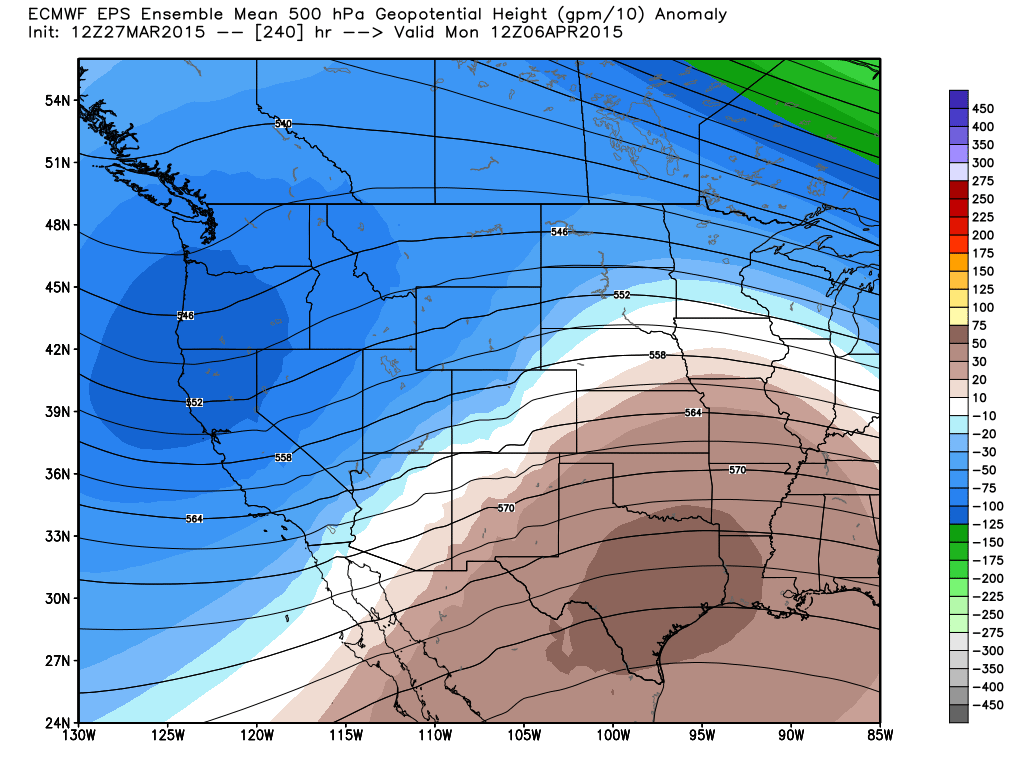
Notice the trough that shows up in all of the model ensembles. The trough that is being forecast by the models is in stark contrast to the monster ridge of high pressure that has dominated the Western U.S. and has continued to add to the drought problems in California. Why should we believe that the ridge will break down? Well, the three main models are forecasting such and the teleconnections are forecasting a change too.
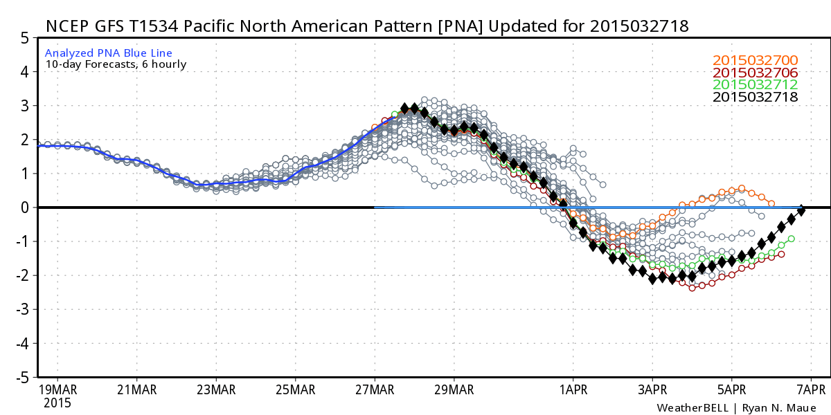
GFS PNA Pattern
GFS EPO Pattern
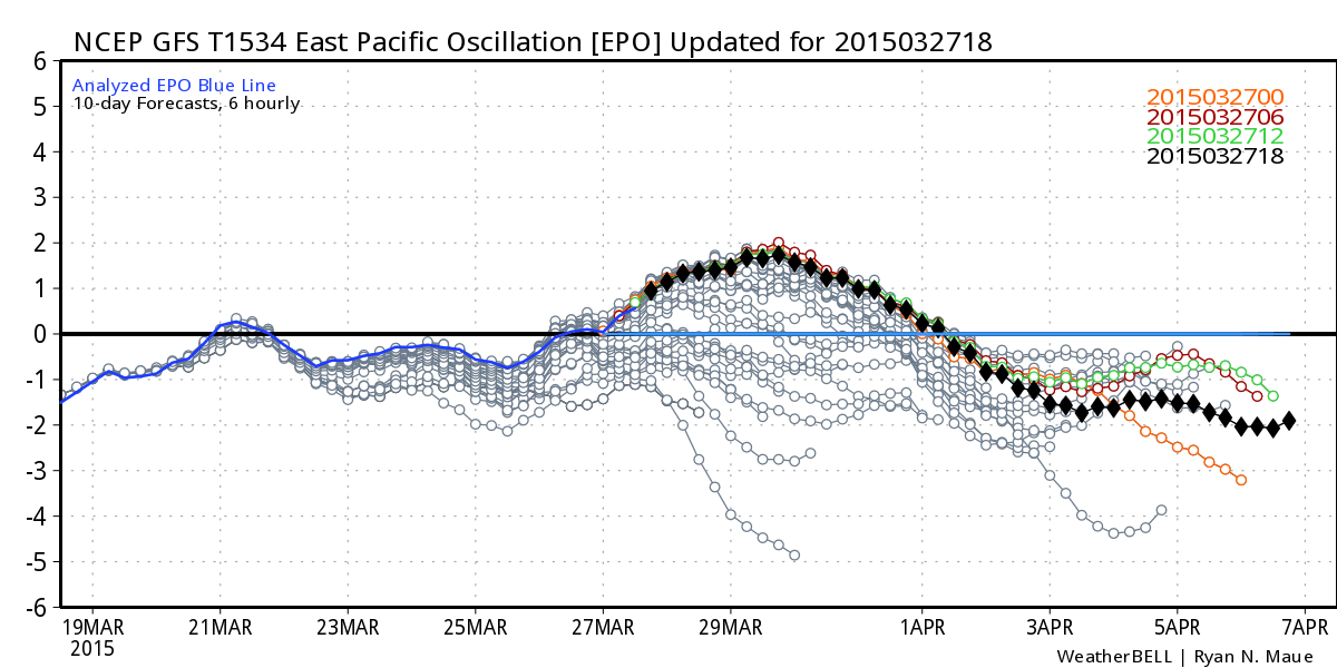
Both the Pacific North American Oscillation and the Eastern Pacific Oscillation are forecast to become negative in early April. This usually portends active weather in the Western U.S. and specifically here in Colorado. Does that mean snow and cold? Not necessarily...it could just be cooler with rain or a rain snow mix. Plus, given the right storm we could have severe thunderstorms to focus on too! However, we all know that April can produce some nice snowstorms so we can't let our guard down.
Given the benign weather of March and the very persistent pattern, you may think this is wishful thinking or "wishcasting". Nothing could be further from the truth...we are quite aware of the reluctance of the pattern to change and our expectations are low RIGHT NOW. However, this is likely the best chance we've had for a significant pattern shift in a long time. Certainly something we at Weather5280 will be tracking for you.