The State of the Atmosphere: Sunday, March 29, 2015

Fortunately, the snow Denver saw on Thursday was enough to dig us out of the top ten list of least snowiest Marches on record, an unfortunate list to make in Denver's snowiest month on average. At 2.9" of snow for the month, it looks like Denver when end March 2015 at #17 on the list of least snowiest Marches.
As Brian Bledsoe discussed yesterday, our focus now shifts to April, and the potential pattern shift as we get into the next month.
The final few days of March will feature much of the same we've grown accustomed to over the last 3 weeks. Highs through Wednesday are forecast to remain above (to well above) normal across much of the state, with an elevated fire weather threat for Monday and Tuesday.
Here are the forecast temperature anomalies for Tuesday. The darker reds mean temperatures well above normal, blues below normal. While Tuesday will likely be the warmest day of the next week, notice the colder temperatures working into the Pacific Northwest...
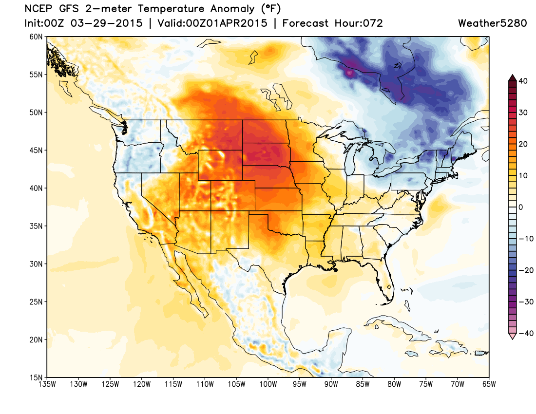
Those colder temps in the northwest are part of the next weather system due in late Wednesday night, possibly into Friday. Models over the last 24 to 36 hours have shown some signs of a colder/wetter solution, so this system certainly bears watching. Timing varies, with some of the faster solutions bringing changes in by Wednesday night, while others (like today's 12z GFS) are a bit slower with the onset, and keep precip going well into Friday.
The three big questions at this moment are around eventual track, intensity, and how much cold air there will be to work with. As we saw last Thursday, it's still that time of year that models can greatly underestimate the power of evaporative cooling, predicting rain when there is snow.
The biggest inconsistencies for now have been with regard to track. The GFS/GEM have generally had a northern bias, keeping most of the heaviest precipitation north of Denver and into Wyoming, with the EURO/JMA have been more consistently further south, given Denver a better chance for rain and snow.
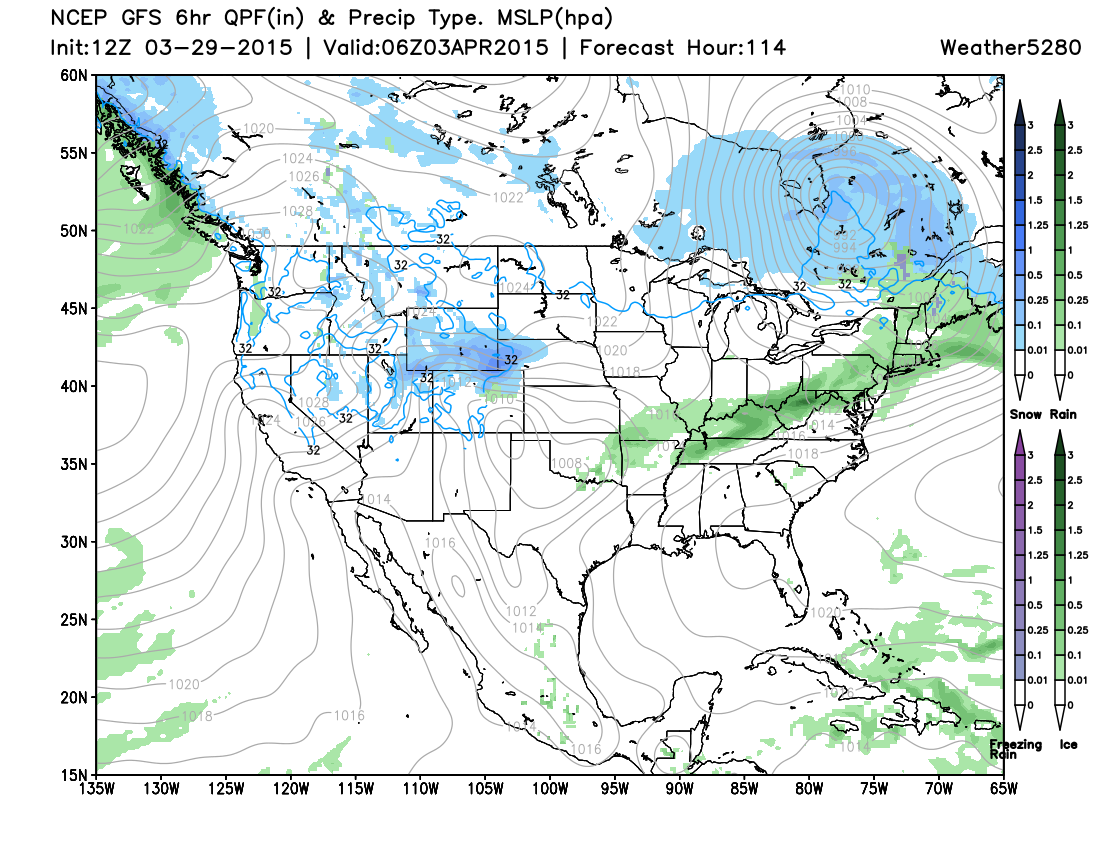
Here's a look at today's 12z GFS surface map for Thursday night. Note where the GFS is showing the core of cold and precip – north of Denver.
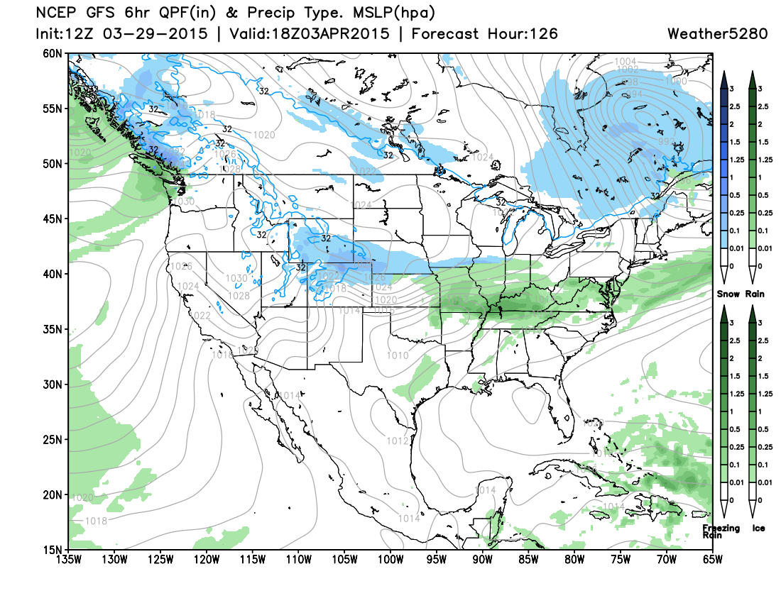
And by midday Friday, still some rain/snow over northeast Colorado, with core of precipt a bit further south, but lighter.
And the upper level pattern by early Friday morning...
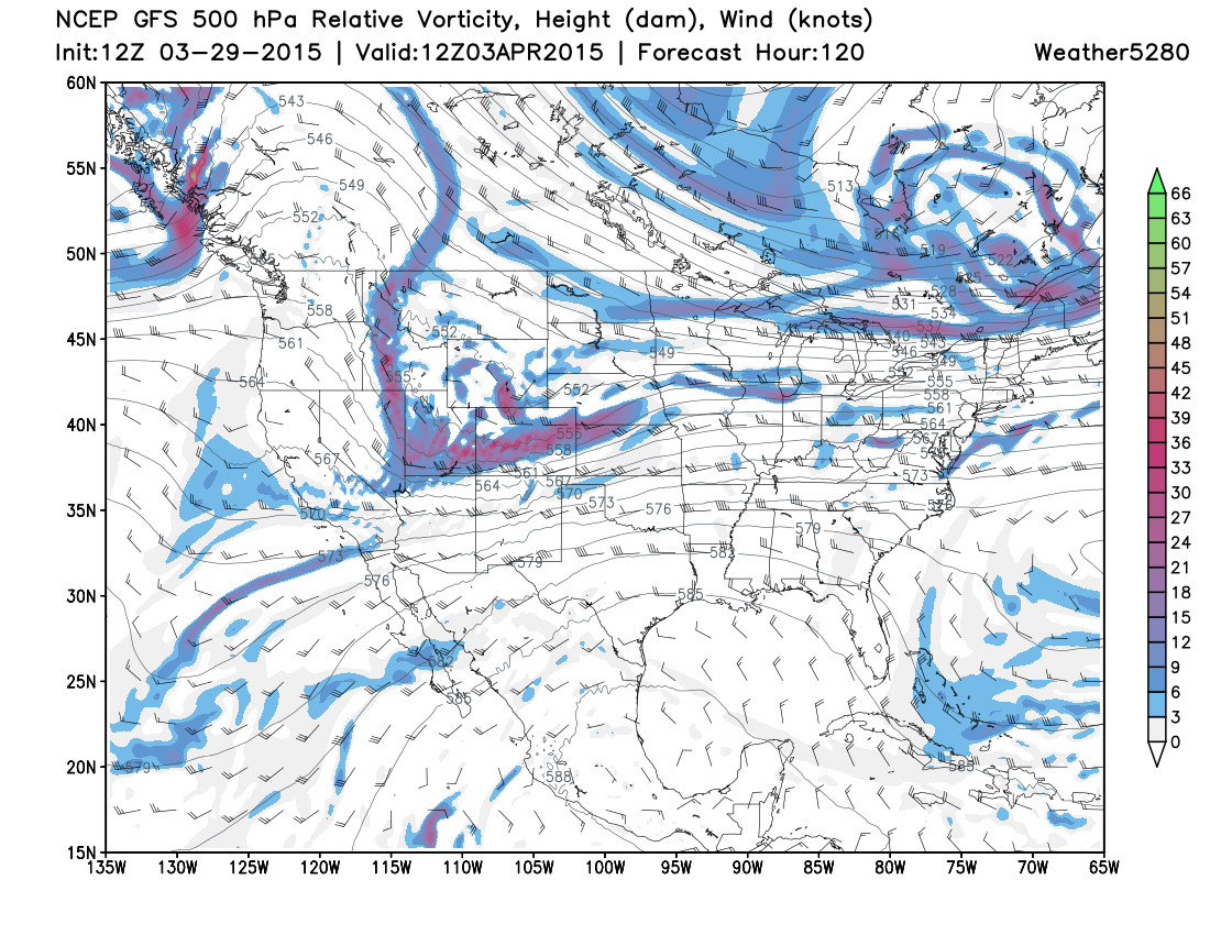
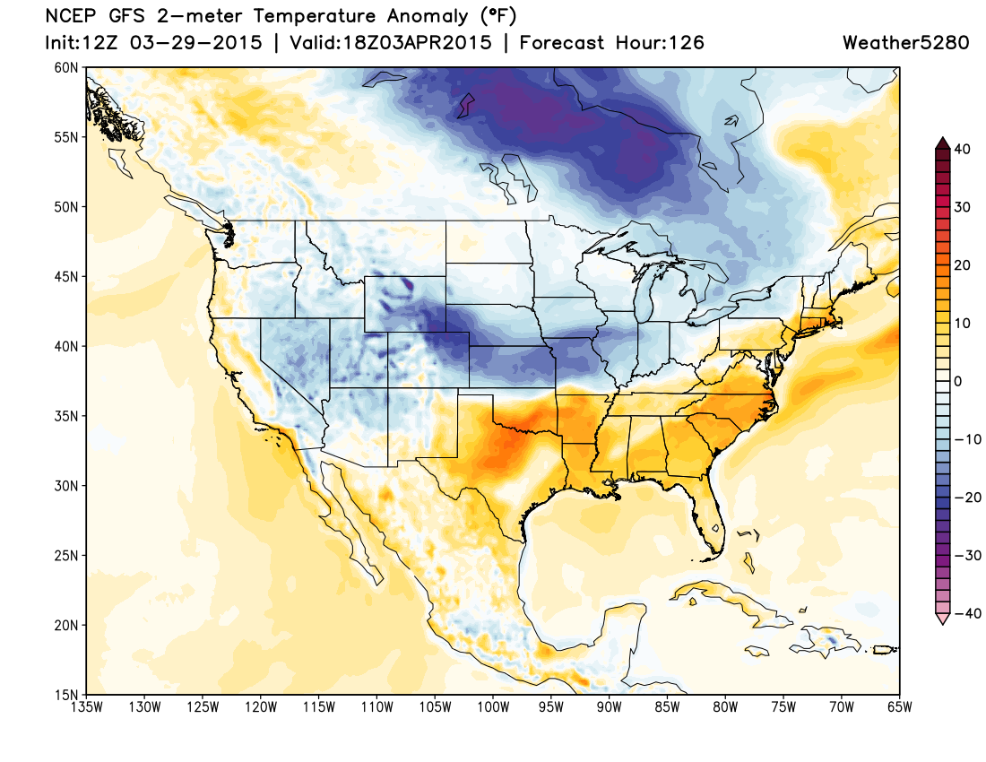
By Friday, the GFS shows the core of the cold over northeast Colorado, with temperatures well below normal, and lingering precip.
Eventual track will mean the difference in a chance for several hours of good precipitation (possibly snow) for the Denver area, or more of a cooler unsettled day, with little significant precipitation. All major models are showing a good surface low developing somewhere east of the Rockies Thursday, it's just about where that ends up.
Still lots of time to see how this one shakes out, but wanted to get the potential for a wet, chilly end to the week on the table. Temperatures will warm a bit as we head into Easter weekend, but as we talked about yesterday, the pattern looks generally cooler than it has been as we head into April.