El Niño Continues to Strengthen; Stage Set for Active Monsoon

Summer Forecast Update
For the past several months we've been calling for the pattern to stay wet and generally cooler than normal for the foreseeable future. From our past posts, you know that this is largely attributed to the ongoing and strengthening El Niño, positive/warm Pacific Decadal Oscillation, and to a lesser extent the "cooler" / less positive Atlantic Multidecadal Oscillation. The map below shows the current sea surface temperature anomalies:
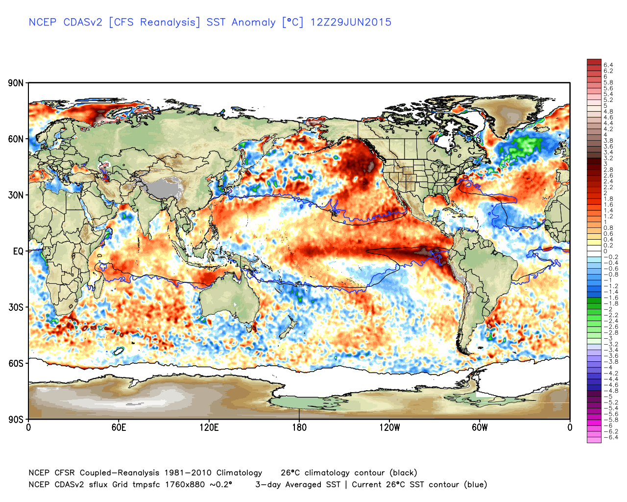
The red indicates warmer than normal water while the green and blue indicates colder than normal water. The signals in the Pacific are quite pronounced...positive PDO and an ongoing (and developing) El Niño. These signals will continue to drive our weather.
Summer El Niño Outlook
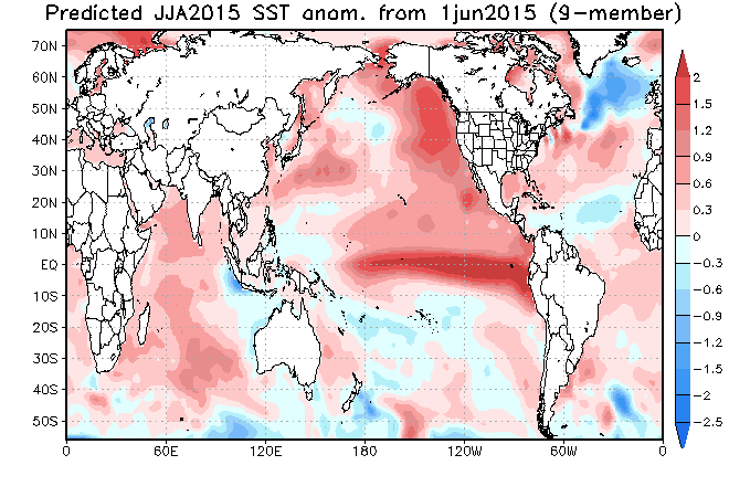
JAMSTEC Sea Surface Temperature Anomaly Forecast
July - August:
CFSv2 Sea Surface Temperature Anomaly Forecast
July - September
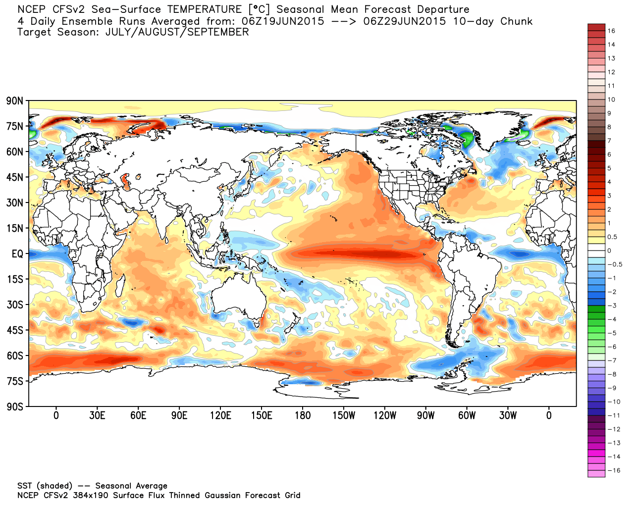
Based on the above maps, the both the JAMSTEC and the CFSv2 are forecasting a moderate to borderline strong El Niño by late summer. Not only an El Niño, but a "traditional" El Niño with the warmest water favoring the east-central equatorial Pacific Ocean. The IRI/CPC model consensus (dynamic model average in yellow, statistical average in light green) also shows a borderline strong El Niño by late summer, which will likely last at least into early winter:
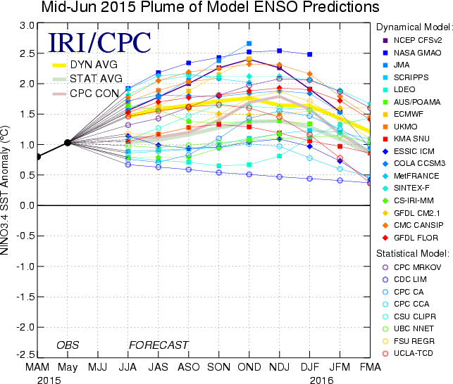
Given the state of the Pacific and the model forecasts, there is really no reason to think that the ongoing El Niño will weaken during the next several months. In fact, it will likely intensify. What does that mean in terms of precipitation and temperature? Not much change from our past thoughts.
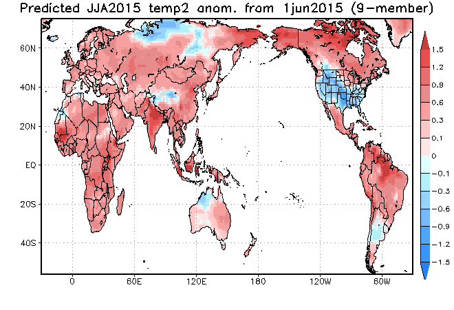
JAMSTEC Temperature and Precipitation Forecast
July - August
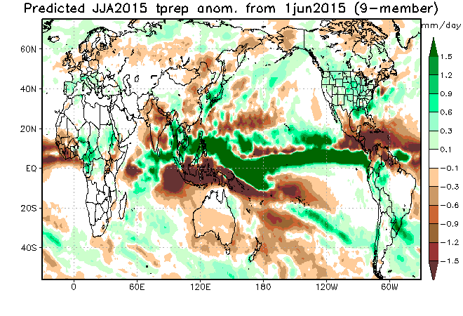
CFSv2 Temperature and Precipitation Forecast
July-September
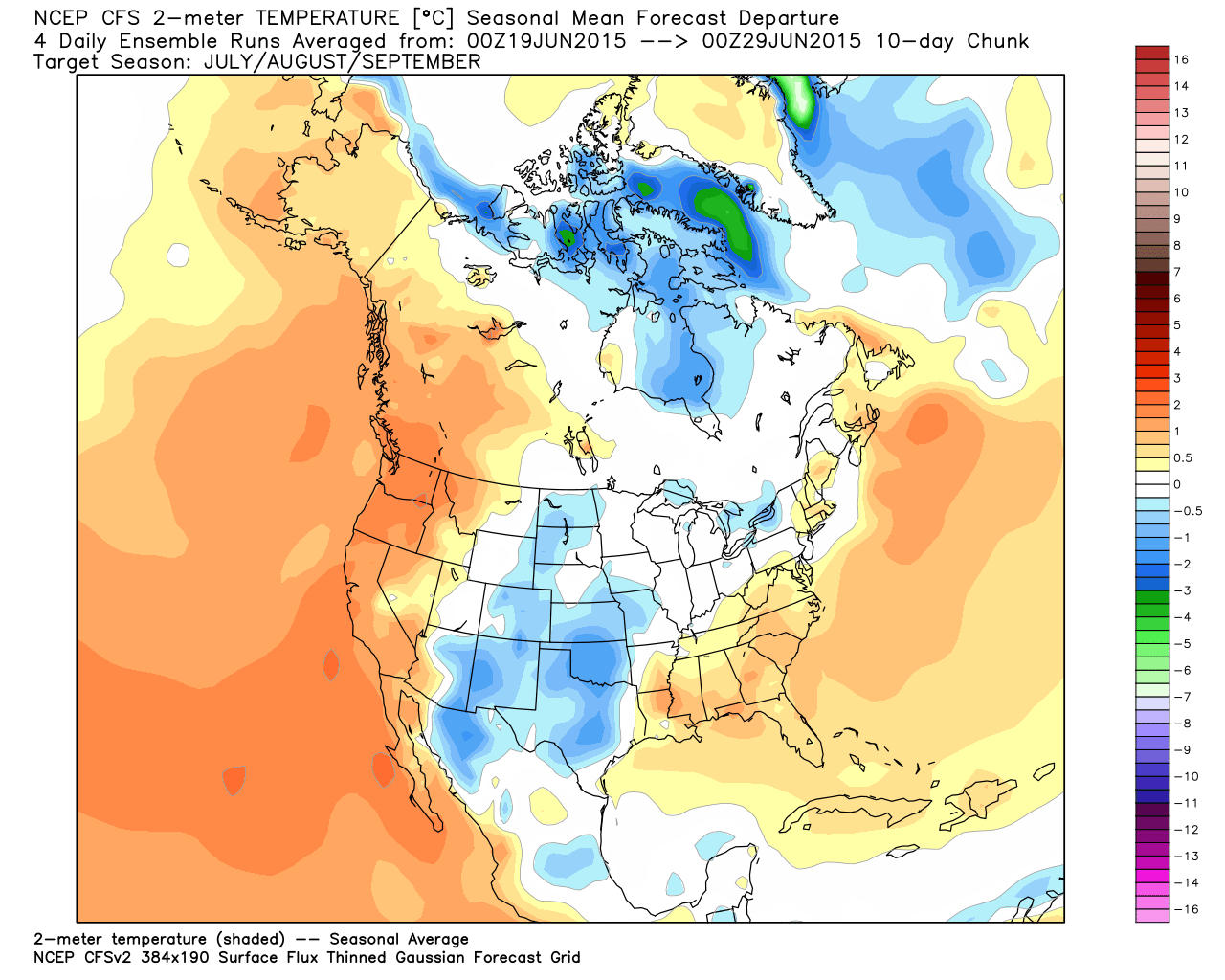
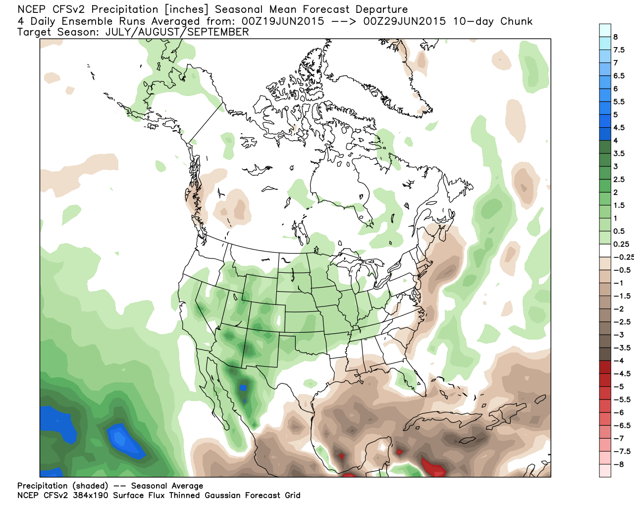
As you can see from the maps above, both the JAMSTEC and the CFSv2 are forecasting cooler than normal and wetter than normal conditions for the rest of the summer. This is likely due to an enhanced and extended monsoon season (which usually prevails in July and August) that will possibly linger into early September. Per many of our previous posts, the enhanced monsoon season, plus the added fuel from an active Eastern Pacific hurricane season will put us at a higher risk for bouts of flash flooding.
Weather-wise, May and June were very active for Colorado. In my eyes, it is simply amazing that we did not have a MAJOR weather disaster. Yes, we've had significant flooding, giant hail, and some tornadoes (most notably Berthoud), but nothing that was truly catastrophic on a large scale. Given the fact that our monsoon season will likely be a long one and an active one, our statistical chances of having a potential catastrophe (likely flooding) are higher than usual. If you frequent Weather5280, this is no surprise to you...we've been talking about it for months. Stay weather aware, know your safety plan, and be prepared to put it to use if need be.