The State of the Atmosphere: Sunday, October 4, 2015

After a record-setting hot September, the last two days have felt GREAT. Yesterday DIA topped out at 68° degrees, which is actually three degrees below normal for the date – a rare feat as of late. After two very warm days to start the month, Denver is running 7.9° above normal through the first four days of October. After today, and with temperature forecast to remain near and below normal this coming week, we should see that number begin to come down.
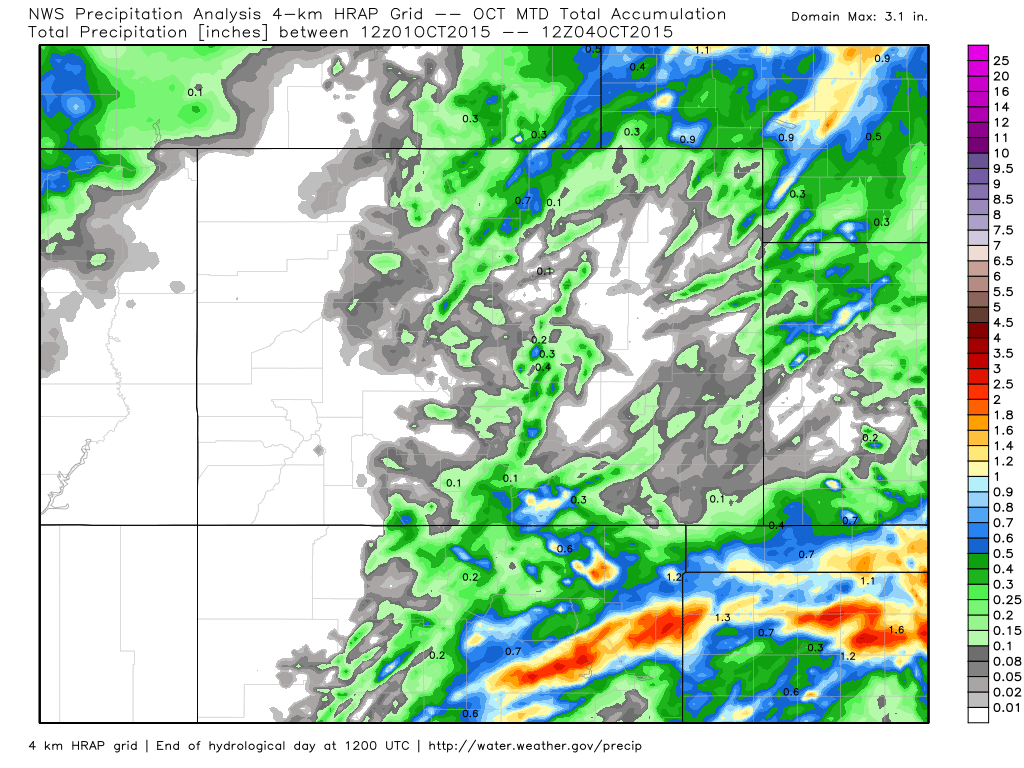
The weekend also brought pockets of showers and storms to the Front Range, with areas north of Denver finally seeing moisture after weeks of dry weather.
The week ahead
The week ahead looks to remain unsettled and on the cool side at least through Wednesday for Colorado.
An upper level trough now located over southern California will slowly track east over the next several days. Unfortunately model consensus has come into pretty good agreement with keeping this system pretty far south, which will limit precipitation for much of the state.
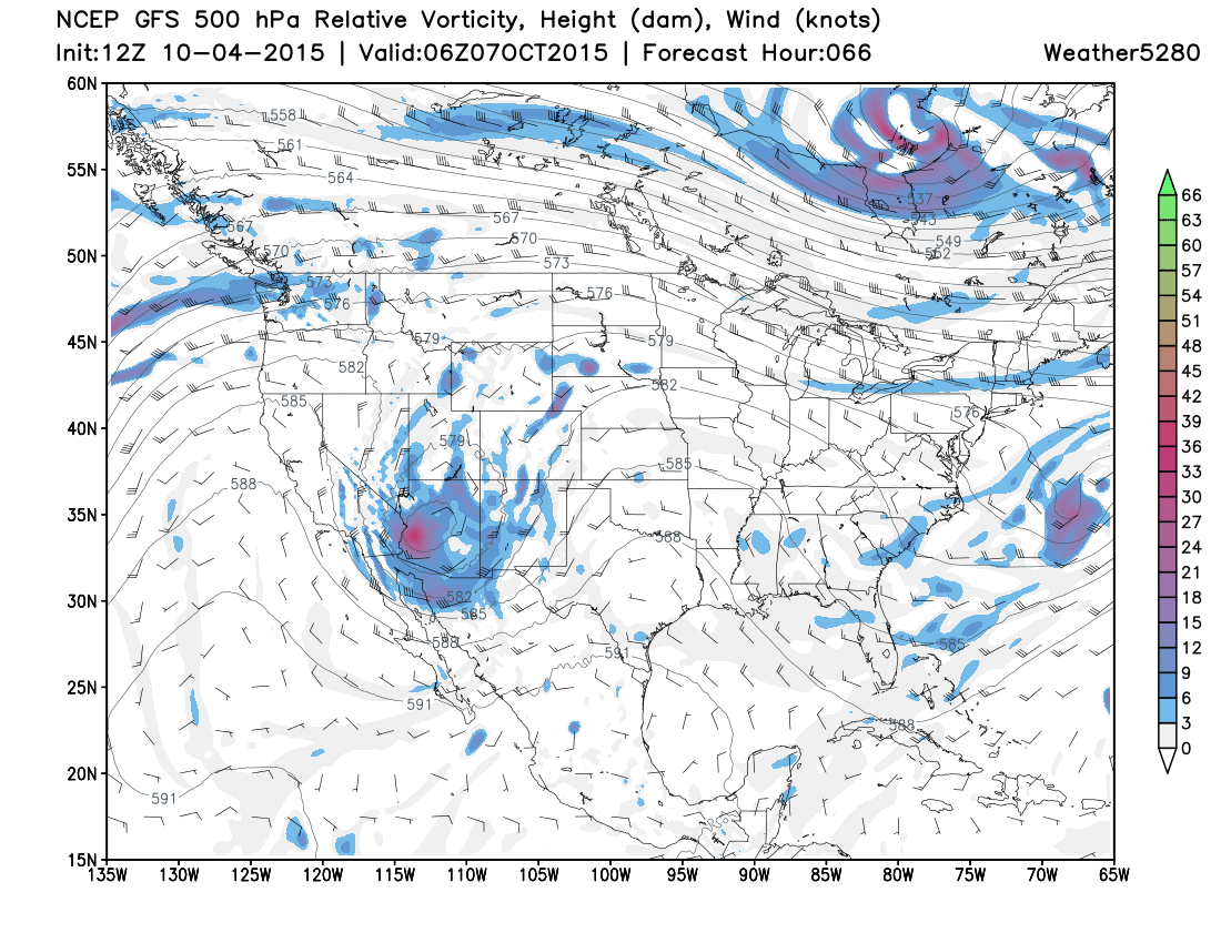
The same cannot be said for portions of southern California, New Mexico and western Texas where beneficial moisture is forecast – and unfortunately like a heightened flooding threat as well. For Colorado, the southwest corner of the state will see the greatest potential for appreciable precipitation, with certainly some flash flooding concerns if the wetter models verify. Snowfall levels will remain high with this system, likely over 10,000 feet.
For the urban corridor with will be a slight chance of showers and storms both Sunday evening and Monday, but our best chance for rain will likely come Tuesday afternoon and overnight into Wednesday. While the best lift will likely stay well south of the area, some convective storms look likely Tuesday. Current modeling projects the best QPF may be in the foothills west of I-25, though we do expect some of this storm activity to spill onto the Plains later in the day Tuesday. We'll keep an eye on things here, and pass along updates should the rainfall threat look anymore impressive than it does now.
Temperatures over the next week will remain relatively stable, with highs near normal through Thursday (upper 60s and low 70s), with slightly warmer temperatures forecast to return for the weekend. Overnight lows will be in the mid to upper 40s through the period.
Flooding in the Carolinas
I quickly wanted to touch on the historic flooding underway in South Carolina and surrounding areas. The forecast from the WPC Thursday called for upwards of 15" across much of South Carolina, a forecast that has held up and then some. Here was their forecast:
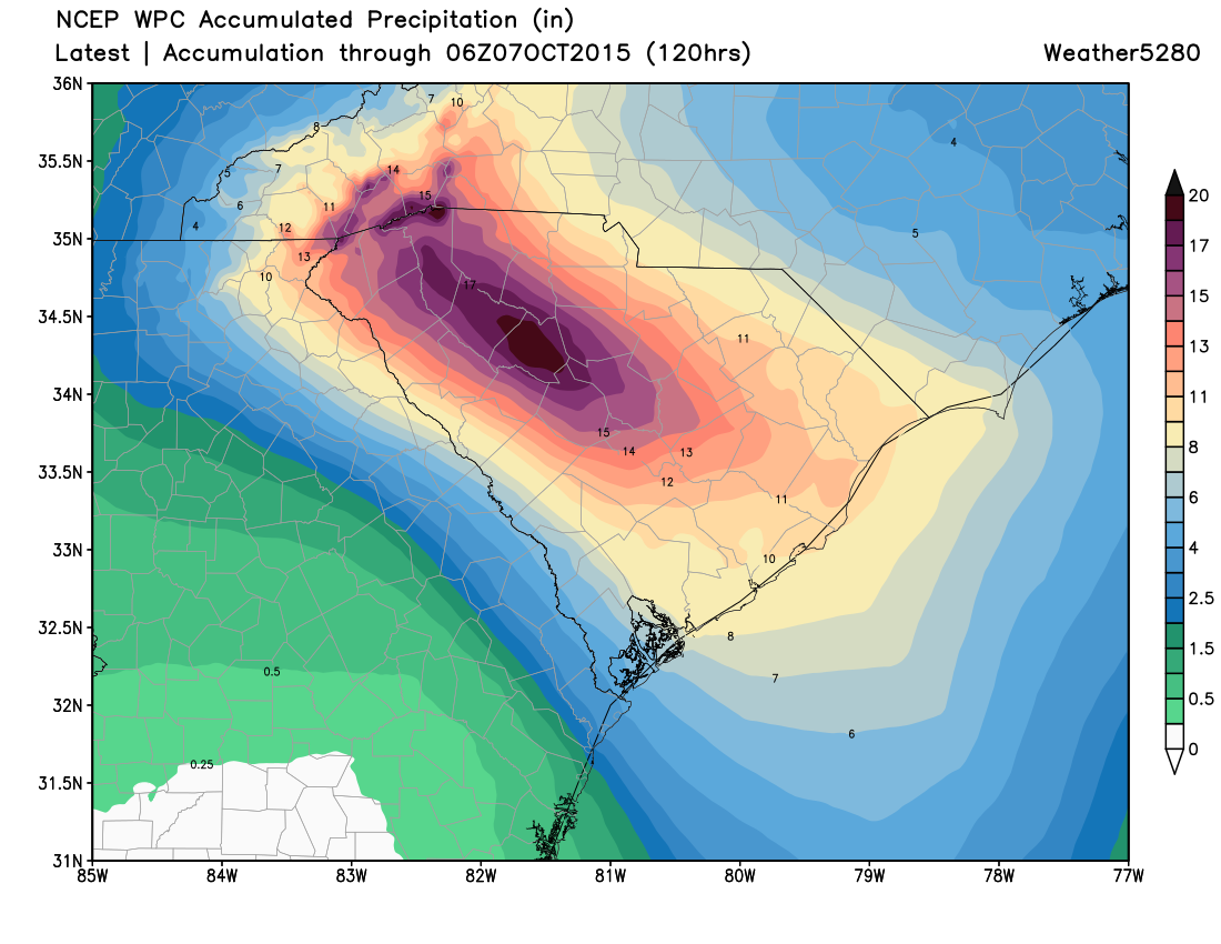
And sure enough, check out these three day precipitation totals across the southeast, which do not include the additional rain falling today, many locations exceeding 15" over the last 72 hours through early Sunday morning.

The firehose remains on today, many locations in the state forecast to see several more inches through Sunday night. The image shared below from Jeff Frame gives an excellent idea of the unbelievable training that has been taking place over the last 24 to 36 hours.
Radar loop of training tropical downpours across South Carolina leading to historic flooding. pic.twitter.com/ipmYE3tvyg
— Jeff Frame (@VORTEXJeff) October 4, 2015Picture: #Flood waters up to roof of homes #Columbia #SC: RT@SpigTcox: In Rosewood off of S. Beltline. pic.twitter.com/M5jyEVXP30 #SCFlood
— Johnny Kelly (@stormchaser4850) October 4, 2015Amazing water vapor loop of the upper low over the Southeast. #SEFlood #SCFlood pic.twitter.com/nZm6TEJZDp
— Brad Panovich (@wxbrad) October 5, 2015The heaviest rain is expected to subside toward Monday morning for the region, though the chance for showers and storms will keep the flood threat present through Tuesday before finally drying out.
First snowfall forecast contest!
Quick reminder to wrap things up, the contest to predict Denver's first measurable snowfall wraps up on Friday, so don't miss your chance to guess! First place prize is two lift tickets to Loveland Ski Area – who by the way, will start making snow any day now! Enter contest here.