The State of the Atmosphere, Sunday, November 8, 2015

Another chance for snow in Denver this week
Several weeks ago we discussed how the pattern was becoming more favorable for putting Colorado on the storm track – it was just a matter of if and when things would align properly for Denver to see snow too.
Over the last two weeks we've seen several good systems race across the state, bringing great snow to the mountains, and rain and snow to eastern Colorado as well, including Denver's first official snowfall last week. The problem, if you will, for Denver not seeing more snow has been two fold, at least. These systems have lacked a true cold signal for one, and two, the pattern has remained very progressive (too fast) to truly deliver east of the mountains.
The week ahead will feature another chance for snow in Denver, but may suffer from many of the same issues the previous systems have faced if you're hoping for a big snow. That said, the trend each week has been a little stronger and a little slower with each system, and this week appears no different. I think our chance for measurable snowfall in the city will be greater than it was on Thursday, but there are some elements we'll need to overcome first before this can happen.
The week ahead
Our next system will move in during the day Tuesday with a fairly quick chance for rain and snow coming overnight Tuesday into Wednesday.
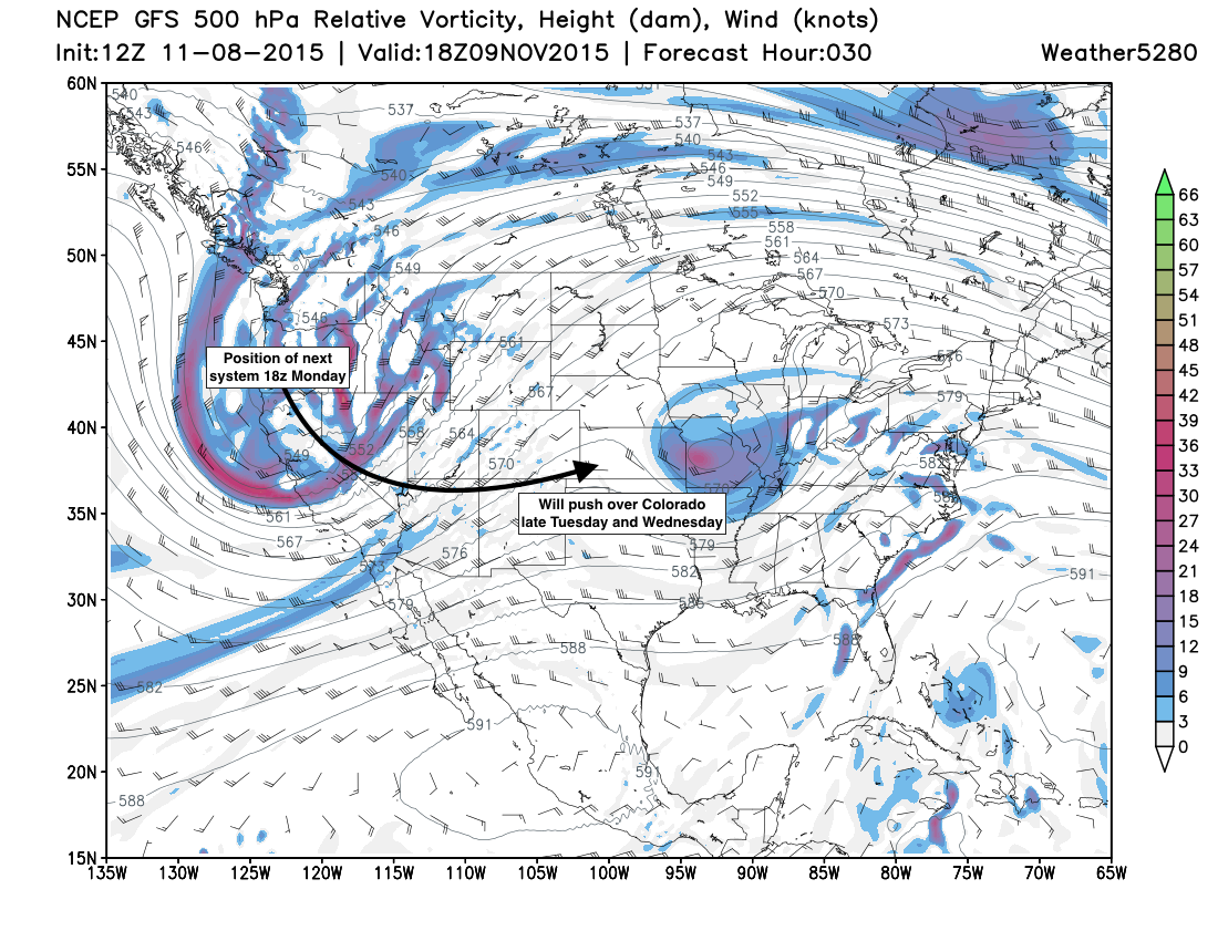
There are three key issues with this system and accumulating snowfall in Denver, of which we'll need to keep a close eye on over the next day or two to see how things eventually set up:
Temperatures. Temperatures are again forecast to start warm (too warm for snow) Tuesday evening, so how fast things cool down will be key in how much rain vs snow we see at lower elevations. The GFS, which ran a bit too warm with last week's storm, again doesn't have temperatures cold enough to support snow until after midnight Tuesday night, which depending on onset of precipitation, could eat into snowfall totals potential:
Speed. There's a lot not to love about the speed of this system. It looks like we'll have a 6 - 12 hour window for precipitation from Tuesday evening through early Wednesday morning, before this system races east of Colorado. With the right intensification this is plenty of time to produce accumulating snowfall in Denver, but requires more elements to align at the right time, or we miss our window.
Lack of good upslope. Models are in pretty good agreement with this system overall, and all are showing a notable lack of upslope flow for Denver – with a favored north/northwesterly wind during the height of the event. While there are other ways to get snow in the city, this should lend some pause, and may in the end mean snow favors points south/southeast of the city for better snowfall.
This appears to be fairly dynamic system which could overcome some of the lack of upslope, would would caution getting too tied to some of the snowier model solutions, when often they'll not compensate enough for lack of upslope, or even the dreaded downsloping wind for Denver. Models today are showing hints of this issue, with greatest snowfall across northern Colorado, some downsloping northing of the city, and better snowfall chances south and southeast of Denver proper:
Modeling
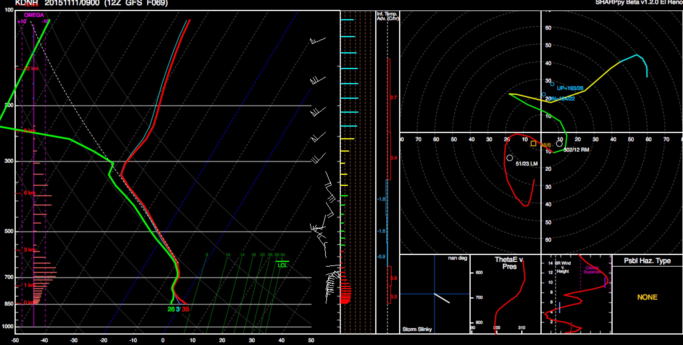
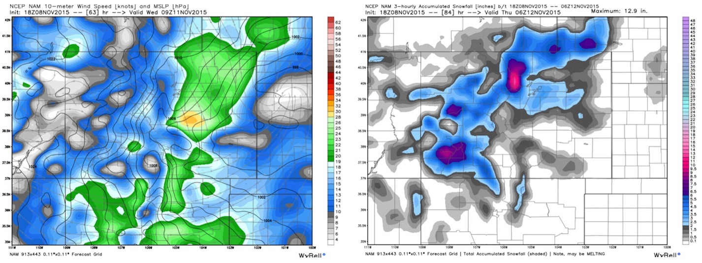
Models are in reasonable agreement with this system, all producing some accumulating snowfall to varying degrees across northeast Colorado from late Tuesday through midday Wednesday.
The EURO deterministic, like last system, has been struggling. It produced 14"+ for this storm a few days ago, only to back off completely for a few runs, and is back to one of the snowier solutions today. Its ensemble mean has been much more consistent, and suggests a few inches will be possible for KDEN, but nothing overwhelming.
The GFS has been very consistent for a week now, and has shown less snow than the Canadian/EURO have suggested at times, much like with last week (and we remember which won there). The issue with the GFS may be that it's running too warm Tuesday night, as it was a few degrees too warm with our last system. A colder solution = more snow.
The NAM is coming in somewhere in between the snowier solutions of the EURO and CMC and lesser of the GFS. I'm liking this, as I think it's picking up on downsloping concerns, and handling the speed well.
TL;DR
The TL;DR is: plan for another chance for snow this week, with a better chance for snow across the northeast Plains of Colorado as compared to the last few systems. The rain and snow will be quick hitting – in Tuesday PM, out by midday Wednesday, but the wind and snow potential may create several hours of tough travel across northeast Colorado, especially overnight Tuesday. As it stands, it looks like a decent band will push through northern Colorado Tuesday evening then sag south overnight. Depending on how all discussed above aligns, this could mean several hours of snowfall along the urban corridor by very early Wednesday, with snow and blowing snow pushing east of Denver early Wednesday.
We will hold off on a detailed snowfall forecast for Denver for now and plan on getting an update out tomorrow. At the moment this looks roughly like a 1 - 4" event for the most of the urban corridor, but... would like to see how models trend with temps as this system comes onshore in the northwest, and if we see any variation in speed/track over the next 24 hours. If things align right, a few inches of snow will certainly be possible, and if it rains again instead, well, I'll be sad.
Extended outlook
This has gotten long, so will be brief here, but despite much anticipation by some of the return and holding of the western ridge I think our active pattern continues for at least another week.
The system of particular interest may come in around the 20th. A long ways out, but models have been hinting at this for some time, and suggest we'll continue to slow trend of deepening, and slowing these systems that have been racing through here of late. If we can get some blocking and keep the bowling balls pushing into the west, it could be a fun next 10 days+.
Subscribe
If you're not yet subscribed to Weather5280, now is a good time to do so with the potential snowfall this week. To subscribe to Weather5280, click here.