Adjustments to Snowfall Forecast; Rain and Snow Starts This Afternoon

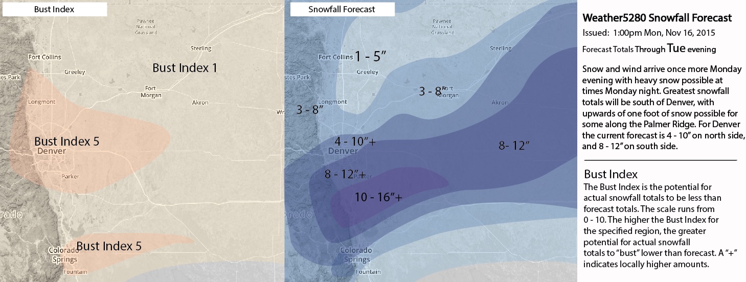
A brief update this afternoon with some final snowfall forecast adjustments. As we discussed last night, should the trend continue we'd likely be upping snowfall totals a bit today. Below you'll find our latest snowfall forecast map, which takes us from this evening through Tuesday.
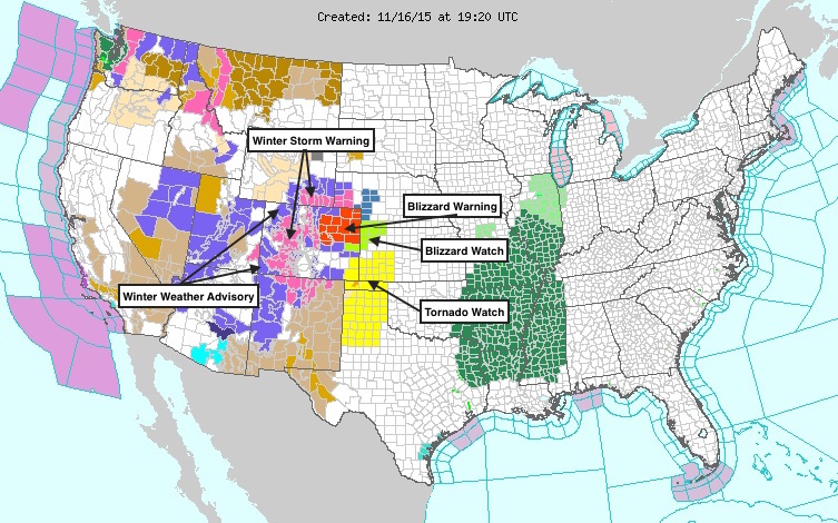
A Blizzard Warning goes into effect at 8pm this evening and extends through 2pm Tuesday for Denver. Winds from 20 to 40mph will reduce visibility, and cause considerable blowing and drifting snow. Gusts to 60mph will be possible. Travel is not advised overnight Monday into Tuesday, especially south and east of Denver.
There's little need for deep analysis here as the storm is upon us, and we've discussed in ins and outs of what we're looking at here for a week now. Models are in pretty good agreement, but we do see some fluctuation still from run-to-run. The EURO seems the most apprehensive (at least for Denver north), and has come down in totals everywhere at 12z from its big 00z run. This could be that it's better matching its ensemble mean, which as of last night was still about half of what its control was producing. There also remain big discrepancies in some of the hi-res models, as they try to place these steep gradients and deal with convection. Some of the hi-res models have differences of 15+" for various locations across eastern Colorado. Let's hope these early showers don't muck with moisture too much before tonight.
This is a very dynamic storm, and a very tough snowfall forecast. However things shake out, there's no doubt this will be a very active 24 hours across Colorado. Here are all the latest alerts for the state as of noon (yes, that's a Tornado Watch in southeast Colorado):
1pm Snowfall forecast
With heavy snow and wind expected across the Plains of Colorado extending east into Kansas, ranchers living in the high impact area of snow and strong wind should have all storm preps completed by Monday evening. Please use caution when traveling, and stay tuned to all the latest.
Please keep us informed with conditions where you are, we love to see your snow reports and images from the storm!