Thanksgiving Snowfall Totals; A Bit More Snow on the Way

Snowfall Thanksgiving day and night amounted to about 1 - 4" across the metro areas, with locations to the west receiving upwards of 5", as forecast. Our station in Denver recorded 3.25" as of Friday morning, with Denver International Airport recording 1.3" for Denver's official measurement.
The fresh snow over the city was beautiful, here was the view from high above Cheesman Park on Friday morning:
The city looks beautiful with all the fresh snow, don't you think? How much snow have you seen where you live? #cowx #Denver #Colorado
Posted by Weather5280 on Friday, November 27, 2015
Snowfall totals Thur through Fri
Snow totals map should look pretty close to our forecast, a sharp west/east gradient from 5 - 6"+ west, to a Trace - 2" east of I-25.
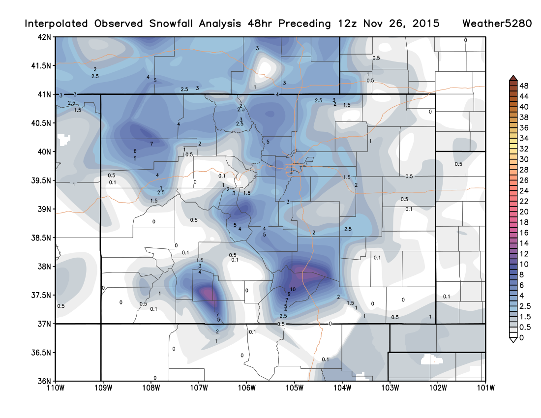
Here are some totals from around the region with their forecast amount (Thursday through Friday evening):
- Denver (Weather5280): Total: 3.25", Forecast: 1 - 4"+
- DIA (Official): Total: 1.3", Forecast: 1 - 3"
- Boulder: Total: 5.7", Forecast: 3 - 6"
- 4mi E For Collins: Total: 5.4", Forecast: 1 - 4"+ (Bust!)
- 6mi NW Denver: Total: 4.2", Forecast: 1 - 4"+
- Loveland: Total: 4.6", Forecast: 1 - 4"+
- Wheat Ridge: Total: 6.9", Forecast: 3 - 6"
- 2mi N Longmont: Total: 2.4", Forecast: 1 - 4"
Cold through the weekend, more snow possible
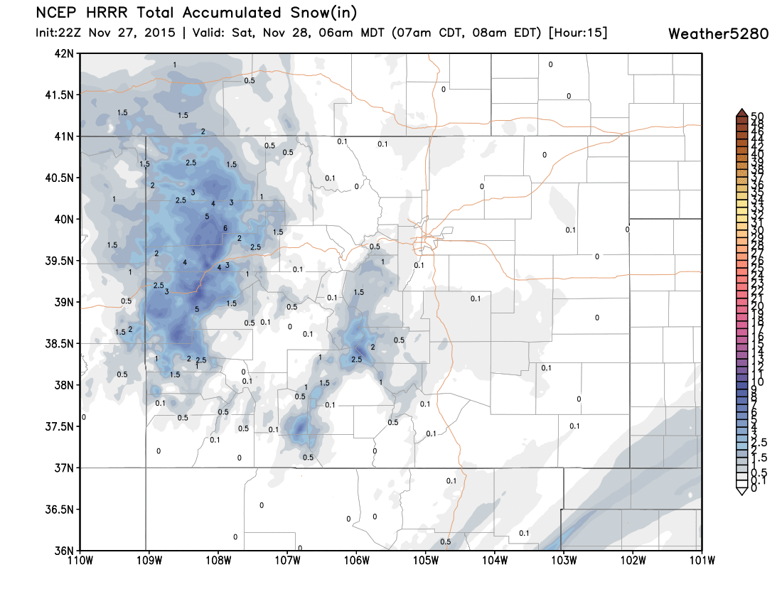
As discussed at length this past week, the cold and unsettled weather sticks with us through the weekend, with scattered snow showers and a wintry mix forecast for tonight and Saturday.
Snow totals tonight and Saturday will be light, likely a coating to an inch across the metro. The latest HRRR shows very little measurable snow through 6am, with better snowfall working into western Colorado tonight:
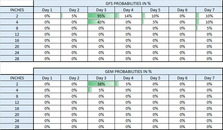
By Sunday evening and overnight we may see a better chance for accumulating snow to return to the urban corridor as the upper level feature to our west finally progresses east. Some disagreement remains with where the best energy passes overhead, so some models produce 2 - 4" Sunday evening into Monday, while others are virtually dry, keeping the snowfall well east of the metro area. Here's a look at snowfall probabilities from the GFS and GEM models for Sunday, big differences here:
For now we'll broad-brush a chance for light snow by Sunday evening, with some accumulation possible in the city by Monday morning. For the moment this looks like a Trace - 3" event for the metro area, but we'll track things over the next day or so and see if this looks any different as we get closer.
Monday the cold unsettled weather finally moves east of the area, with a warming and drying trend through midweek.