Long-Range Forecast Update: Quiet Pattern Sets in; Wet Spring Ahead?

Let the great meltdown begin! After a great snowstorm this past week, many folks are wanting some warmer weather. Well, if you are one of those people that wants warmer weather, this is certainly going to be the weather pattern for you. In fact, it is likely going to be one of those weather patterns that produces some of the nicest weather we've seen in a while. Why do I think this? Let's take a look...
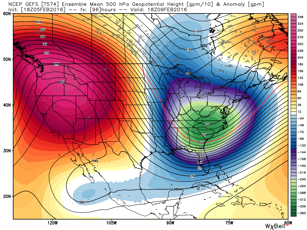
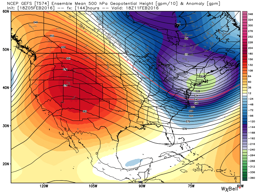
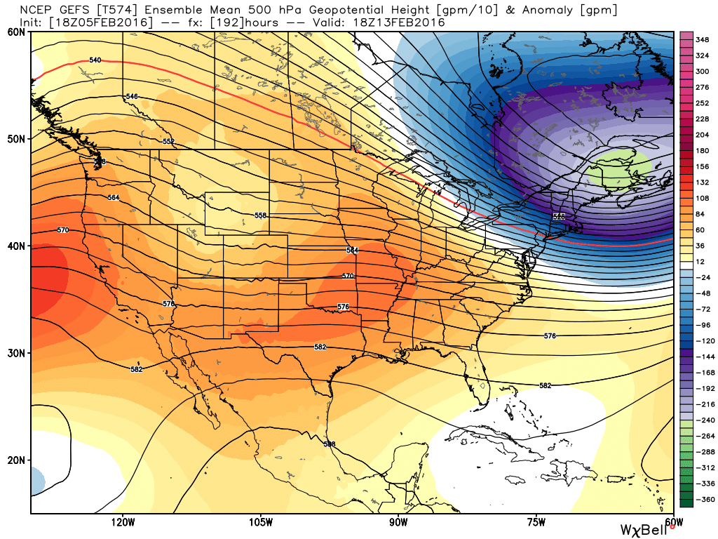
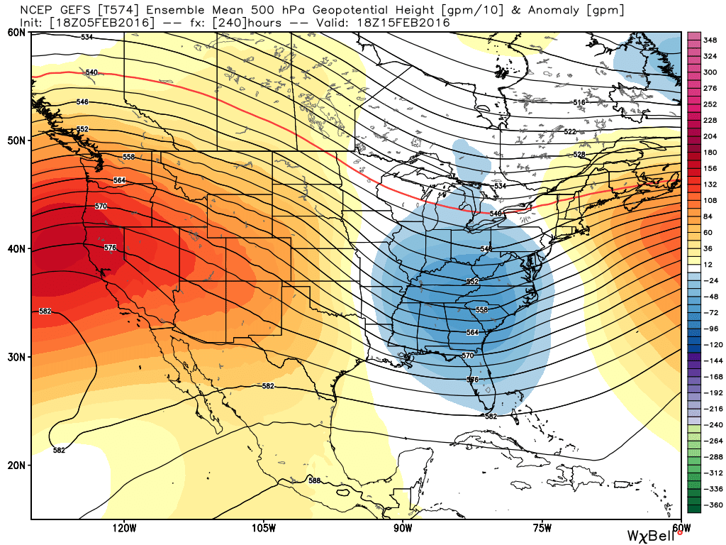
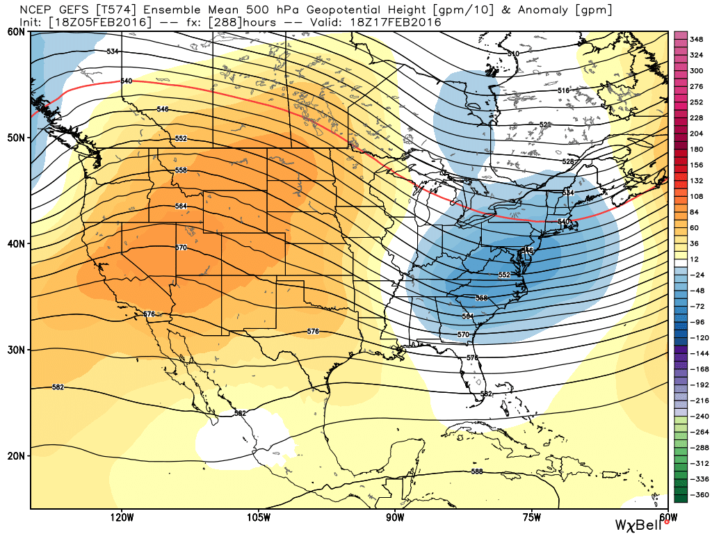
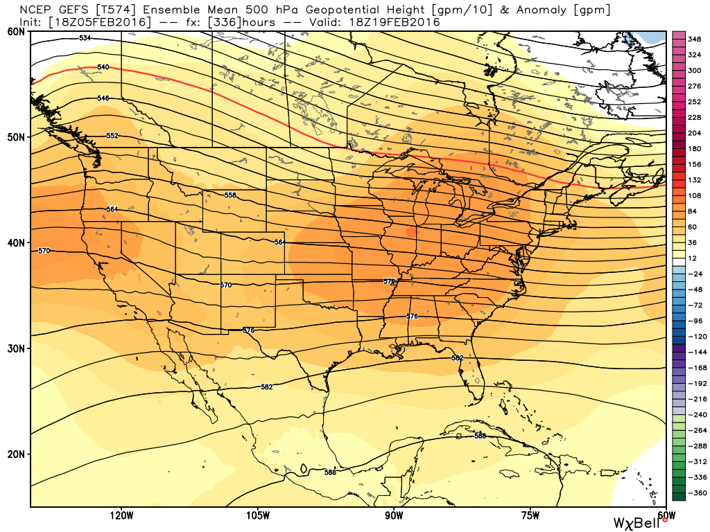
GEFS Ensemble Mean 500mb Maps:
Tuesday:
Thursday:
Saturday:
Monday:
Wednesday:
Friday:
Sunday:
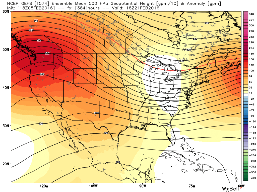
For those not familiar with these types of maps, the orange and red colors indicate higher than normal heights in the mid levels of the atmosphere. This usually is due to ridging and warmer/drier than normal weather results. Conversely, the blue colors indicate lower than normal heights in the mid levels of the atmosphere. This usually is due to troughing and colder/wetter than normal weather results. For Colorado, the GFS and other models are forecasting a lot of "orange and red" in our neighborhood for the next several days.
Given the fact that the GFS isn't the only model on board with this, it gives me high confidence in a pretty boring and gloriously nice next several days. You can see the persistence of the ridge, because when it does get knocked down a bit, it builds right back. Patterns like this are usually pretty tough to break down, so the snow lovers that want more snow, are simply going to have to wait a while. Which brings me to my next point...
Late February and Beyond:
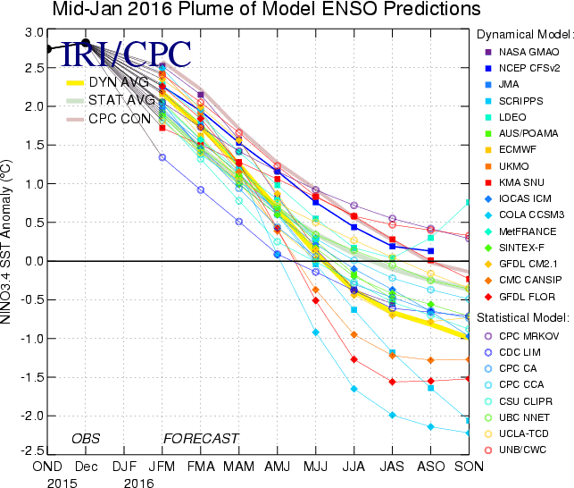
The latest IRI ENSO Plumes continue to show the current strong El Niño weakening rapidly. In fact, the plumes from mid January show it weakening even more rapidly than the plumes from mid December (when I wrote this). It is this weakening that traditionally allows the storm track to become increasingly more active for Colorado. However, it is a slippery slope... If we lose all influence from El Niño too quickly, then the tendency for dryness and drought building takes hold. I do think we have a window of opportunity for some wet weather, but as I have discussed before, I think it remains much more brief when compared to last year at this time.
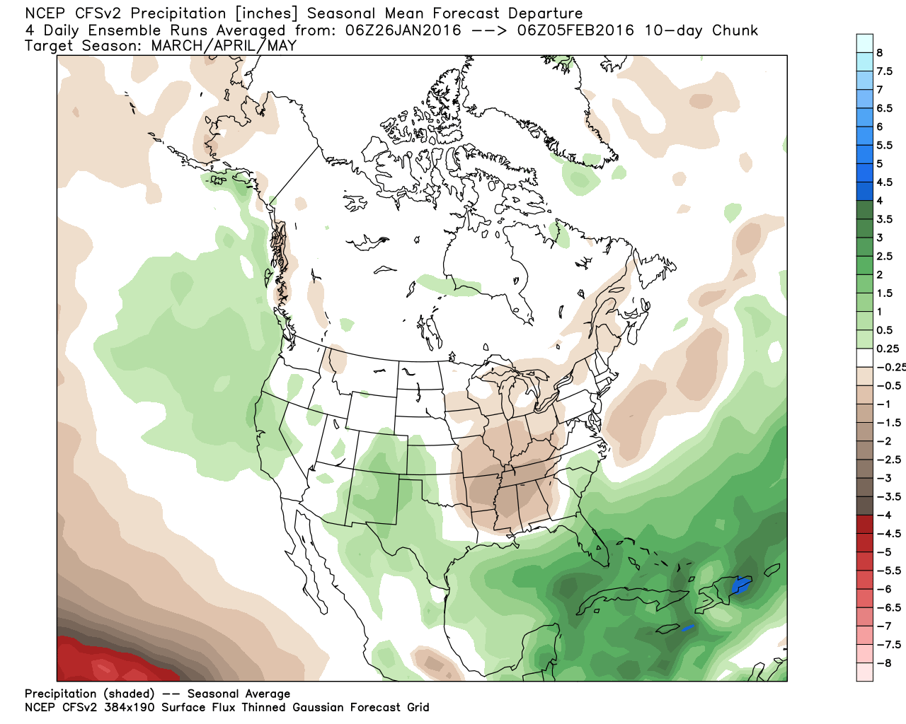
CFSv2 Precipitation Forecast March-May:
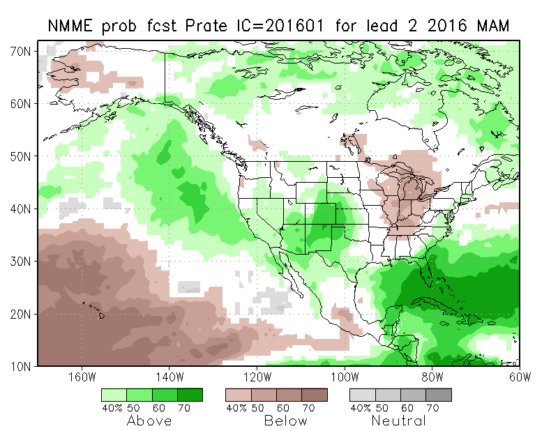
NMME Precipitation Forecast March-May:
JAMSTEC Precipitation Forecast March-May:
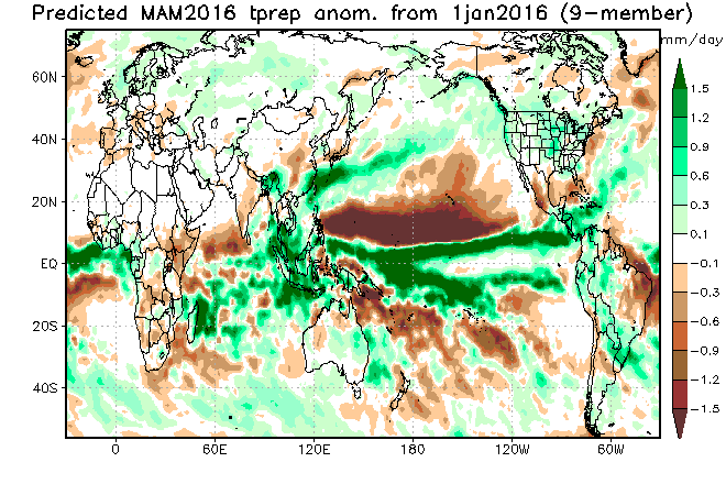
Green obviously means wetter than normal conditions are likely, while brown means drier than normal condition are likely. You can see that the model consensus is to leave Colorado in the green. Given that we will still likely have some "decent" El Niño influence through most of the spring, I don't have a reason to disagree with the models. KEEP IN MIND, THIS DOES NOT MEAN IT WILL BE ALL SNOW OR EVEN MOSTLY SNOW. The later we get in the year, sun angle and longer days play a big role in temperatures. During the spring, a degree or two makes all the difference in the world between 12" of snow or 2" of slop mixing with rain – just look at the last two years.
Cautionary Tale of 1998
The Super El Niño of 1997 and early 1998 is a good example of what can happen when an El Niño event collapses too quickly. Below is a series of maps that show precipitation anomalies during the first half of 1998. The December-January Oceanic Niño Index was 2.1 in late 1997 and early 1998. The May-July Oceanic Niño Index was -0.1. I believe it was this rapid collapse of that particular event that lead to quite a precipitation difference from February of 1998 to June of 1998 in Colorado and the Southern Plains. The maps below show precipitation anomalies for during the above mentioned time. Again, blue/green means wetter than normal, while yellow/red means drier than normal.
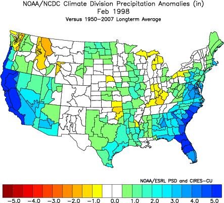
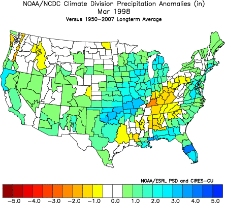
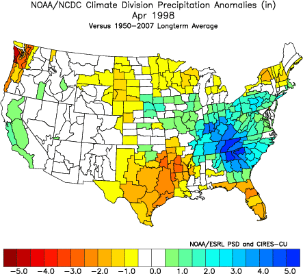
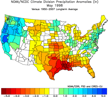
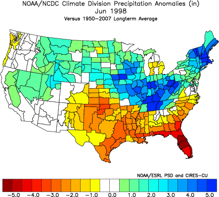
Things were going pretty well through March. After March, was a problem, especially after so many areas had seen such good moisture in the previous months. From an agricultural perspective, that dry spell couldn't have come at a worse time.
I am not saying that is exactly what will happen as this El Niño fades. As I have said before, I think we will likely still be ok with moisture through the spring. But after spring, I remain very concerned about what the summer, fall and winter will bring as we likely steam toward a La Niña event. But you knew that already, as I have been yapping about for quite a while.