Thursday PM Update: Warm End to the Week and a Look Ahead to the Weekend

With the majority of the weekend's snowfall now melted, it's but a distant memory. Now, Mother Nature is gearing up for a different scenario entirely – does sunny warmth sound good to you? It does to me. And, she may even throw in a couple of thunderstorms for her thunder-fans.
70s Return
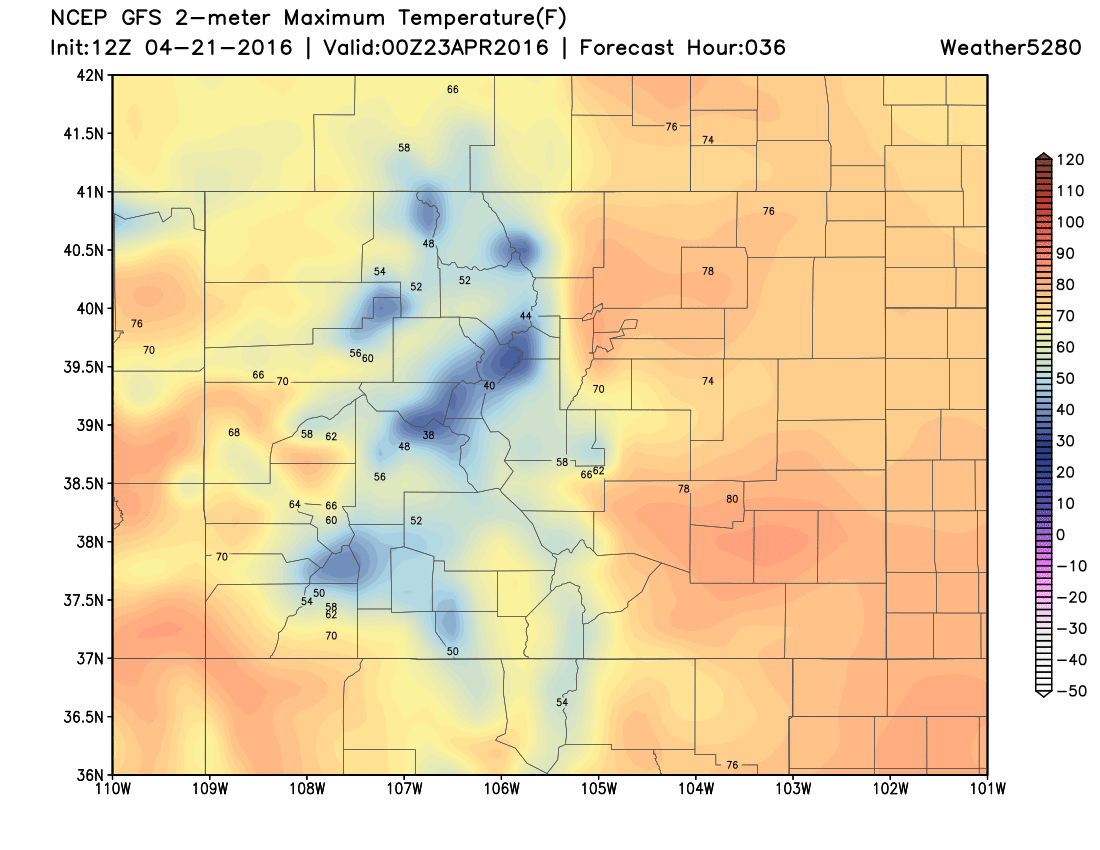
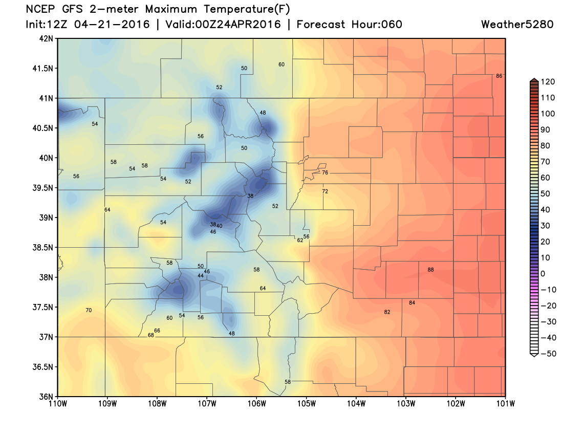
So far this year Denver has had 11-days into the 70s; the warmest being 77 (April 14th). We will tally on a couple/few more 70s as we close out the week and get into the weekend. Mother Nature is sending us a warm signal, at least until early next week.
Here are afternoon temperatures for Friday and Saturday:
Storm Chances
The overall pattern is quieter through Monday. The atmosphere is in a bit of a 'breather' moment as our last system still slowly churns east of us, and the next for us is developing over the Pacific Ocean.
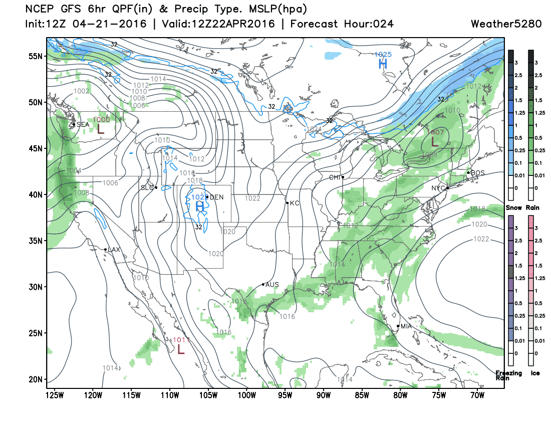
Under this "dome" of quieter weather we possibly can see a few thunderstorms/showers popping up, but not much with any organization to them.
However, next week will likely tip the into a stormier pattern. The longer term modeling has been persistent in keeping a trough pattern(stormy) over the western U.S. to close out April and begin May. The European and Japanese modeling indicate a wetter pattern, as well as the American climate model, CFSv2, which is shown here.
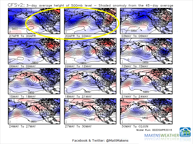
The top two panels represent next week. The blue coloring over the Western U.S. indicates a middle atmosphere that's shorter than it is on average. Shorter means colder and potentially wetter.
Different From the last system
As you begin wondering if this next system will have the same impact as the last one, let me say first and foremost that it's too early to be calling for accumulation amounts of either rain and snow, and cold for that matter.
Having said that there is still one comparison that I can make, even though early on; the prior slow moving system that sat over our region for days and this incoming system that will be faster.
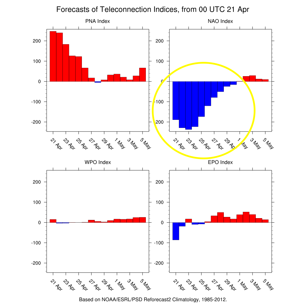
The last system was part of a slow pattern – a pattern "blocked" by a cold Atlantic Ocean that slowed everything down – over the U.S. Next week's system will be part of a faster regime as the Atlantic comes out of its cold phase (less of a blocking phase).
You can see that trend here in the top right area indicated a cold northern Atlantic signal warming again. Last weekend was a very cold point in the northern Atlantic.
Bottom line. Enjoy the warm days ahead. Next week can turn unsettled, cooler, and wetter for us. We will have a deeper analysis into next week in our State Of The Atmosphere coming up this weekend. For now, let's all enjoy the sun!