The State of the Atmosphere: Sunday, August 21, 2016

If you haven't noticed, Mother Nature is getting us ready for fall. For the third week in a row, we tracked a late week cold front (or series of fronts) that increased rain chances and dropped temperatures.
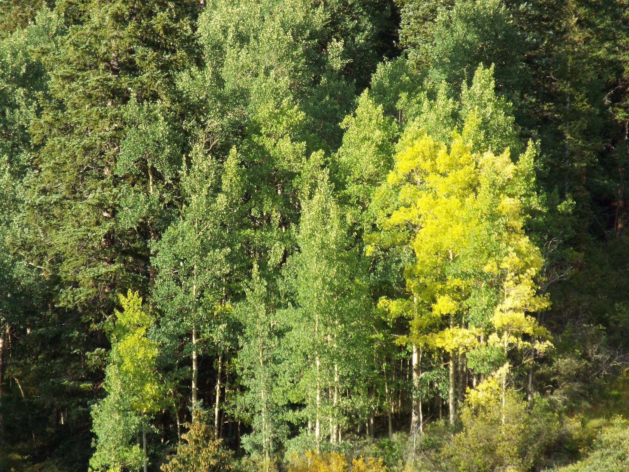
Those beautiful fall colors are just around the corner, with hints of change already appearing in the high country near South Park:
Last Week
This past week's cold front was the most impressive yet. We caught some rain, more than needed near Colorado Springs, though, and temperatures dropped to a near-record low.
Denver on the week was as hot as 92° on Monday and as cold as 47° – within 1° of a record low – Saturday morning. Plus, we recorded a whopping 0.02" of rain officially at Denver International Airport. Yes, detect the sarcasm.
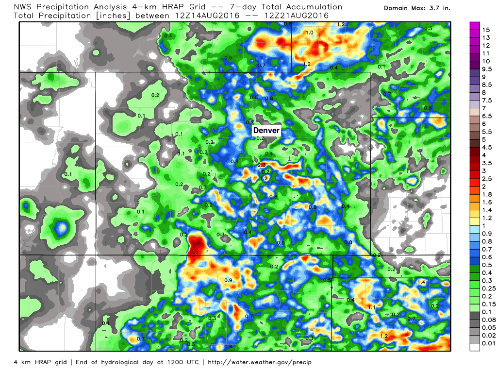
Around Colorado Springs, however, there was nearly 2" of rainfall from the late weekend system. This caused flash flooding and fell on areas that have been pretty wet relative to all other metro areas this summer. Here's the week's rainfall amount, with the highest amount near the Springs and some good rain for the west side of Denver and from Fort Collins to Greeley.
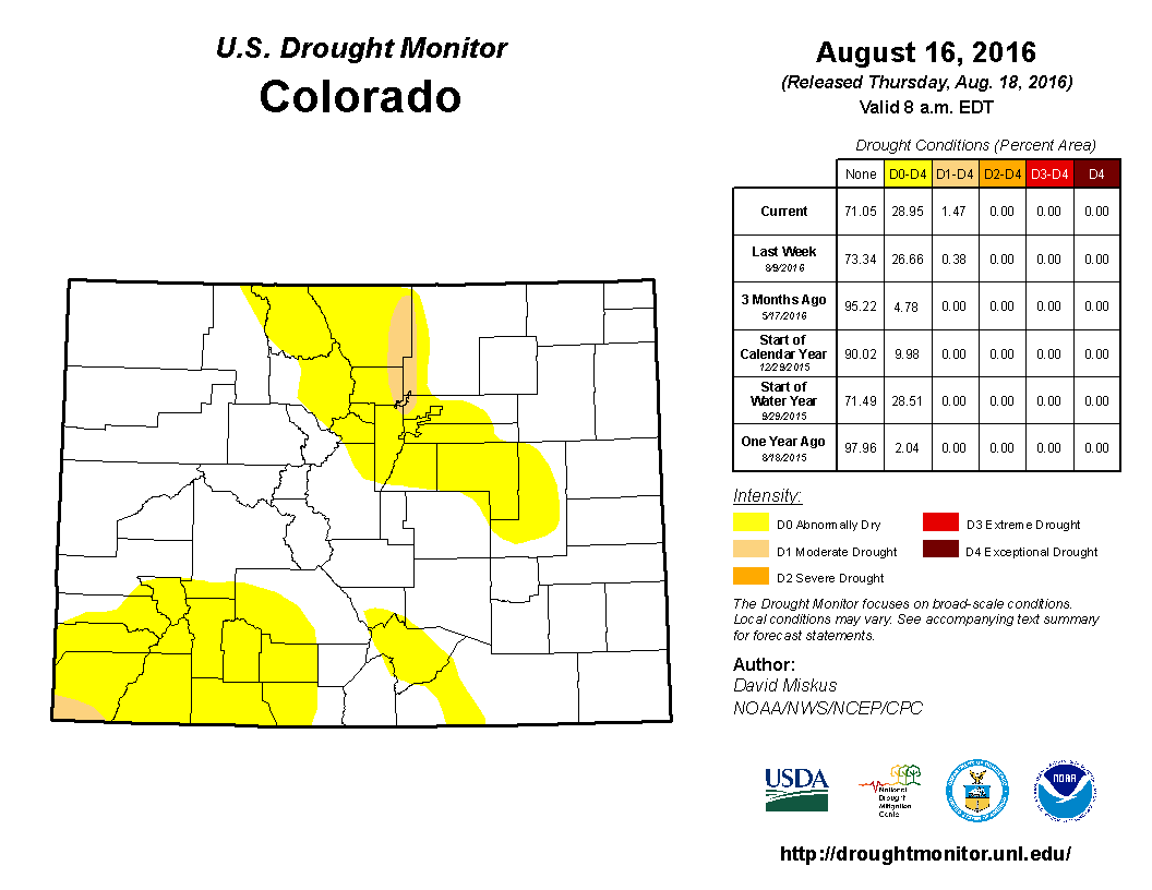
Overall, though, the pattern remained pretty dry. You can see the northern Front Range is now into the second tier of drought conditions as indicated in this week's Drought Monitor update:
The week ahead
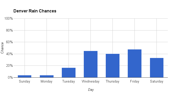
The outlook for this week looks much the same in terms of a hotter start than finish and rain chances increase toward the middle and second half of the week, at least kind of.
We need rain, not rain chances. Sadly, we are stuck with the latter for the majority of areas.
For Denver, the Sunday ensemble model runs of the GFS (American model) and GEM (Canadian model) show some rain chance increases for Tuesday through Thursday, but certainly not getting us to a guarantee or even high enough for most of us to turn our sprinkler systems off for awhile.
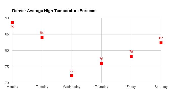
With the increased rain chance comes some cooler temperatures. Here's just a quick look at what metro area average high temperatures may be for this week:
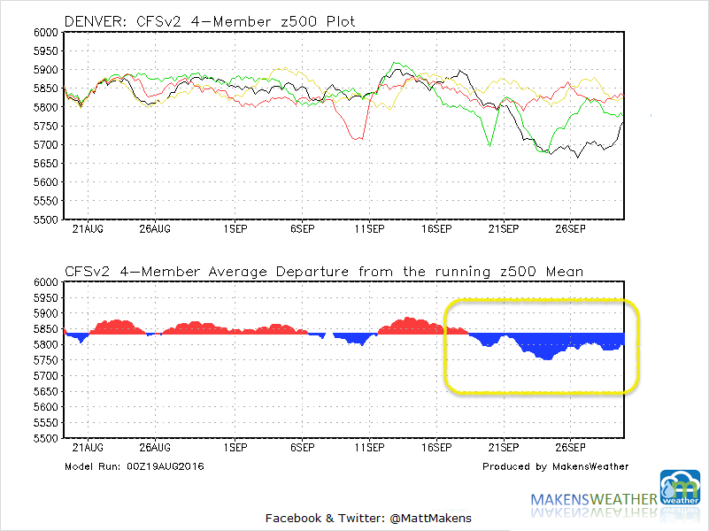
With each passing week, we have seen at least one cold front. These fronts will continue as the weather pattern shifts into autumn. For a dramatic shift in the pattern, we are awaiting the ocean temperatures too cool more so in the northern and eastern Pacific.
This may happen by the middle to end of September to send us the first dose of 'real' fall weather. That's being depicted in the CFSv2 climate modeling for Denver. The blue shades in the running time series indicate the chance for cooler and potentially wetter weather:
We continue to have internal discussions at Weather5280 regarding the fall outlook. We will keep you posted on that as we determine a clearer direction for the weather pattern this fall and winter.