7 Innovations Since the Last Time a Major Hurricane Made Landfall in the United States
By Ian Livingston and Brendan Heberton
Hurricane Wilma in October 2005 was the last major hurricane to make landfall in the United States. That storm came ashore in Cape Romano, Florida as a Category 3, with sustained winds of 120 mph. It caused an estimated $35.6 billion (2016 dollars) in damage and killed more than 60 people.
Times have changed a lot in the 11-year period since Wilma. The change has arguably come at the quickest pace in history, at least when it comes to information sharing.
With this in mind, and as hurricane Matthew takes aim at the Florida coast, let’s take a look at some of the new innovations that have changed the weather world since 2005.
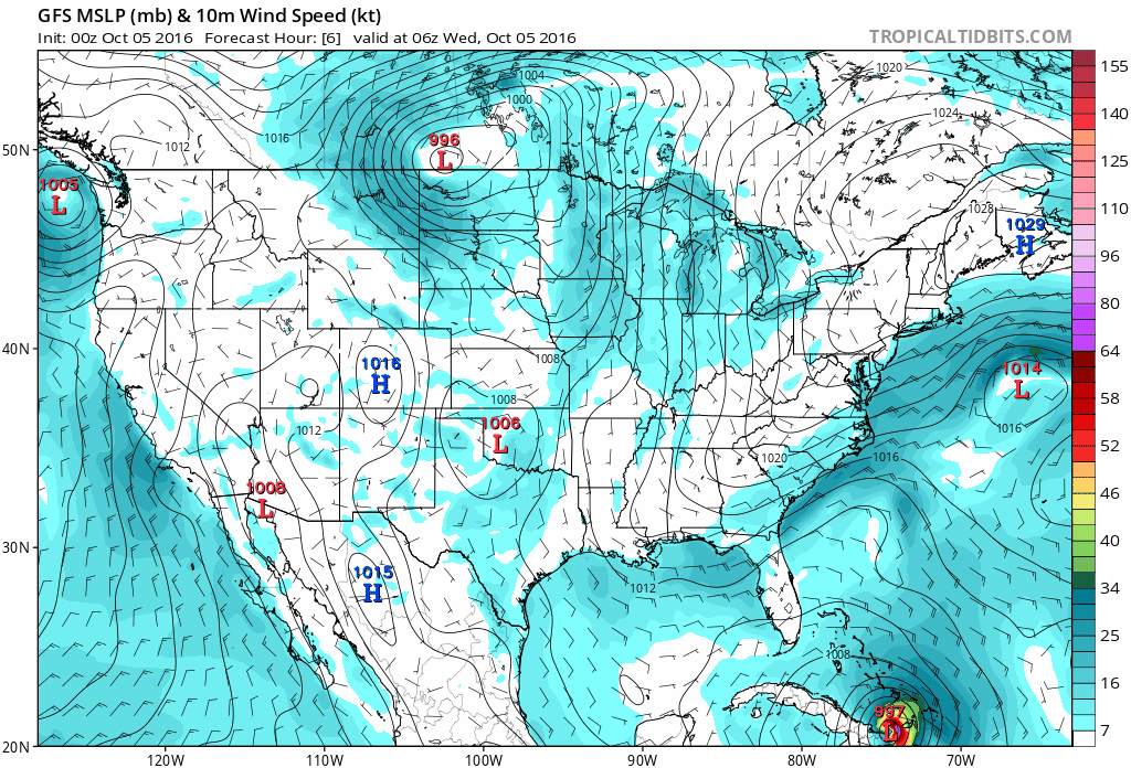
1. WeatherBell, TropicalTidbits, and all the pretty colors 🎶
Weather geekery was at its finest the other night. It seemed almost every weather watcher in the country stayed up to watch what has got to be one of the most remarkable runs ever from the American global weather model called the GFS.
Without one of the internet's favorite meteorological map makers Ryan Maue and his revolutionary site in WeatherBell Analytics, advanced weather modeling may not be as widely shared as it is today. An impressive list of other sites has come along since, each bringing unique features to an ever-growing table of options.
2. There was no #Matthew
Within two years of the last gusts from Wilma, the iPhone arrived. Ancient history, right? You don’t need us to tell you that smartphones changed the world. Even Twitter’s hashtag revolution was still to come during Wilma, and Facebook was a baby. Ancient history. The dark days.
Along with the countless benefits of this new world, communication in the media and weather community is an increasing struggle. In many ways, there’s now too much data. There’s also little doubt that the hashtag and ubiquitous GPS capabilities will bring relief to the worst hit areas much sooner than was seen in the year of the last major hurricane.
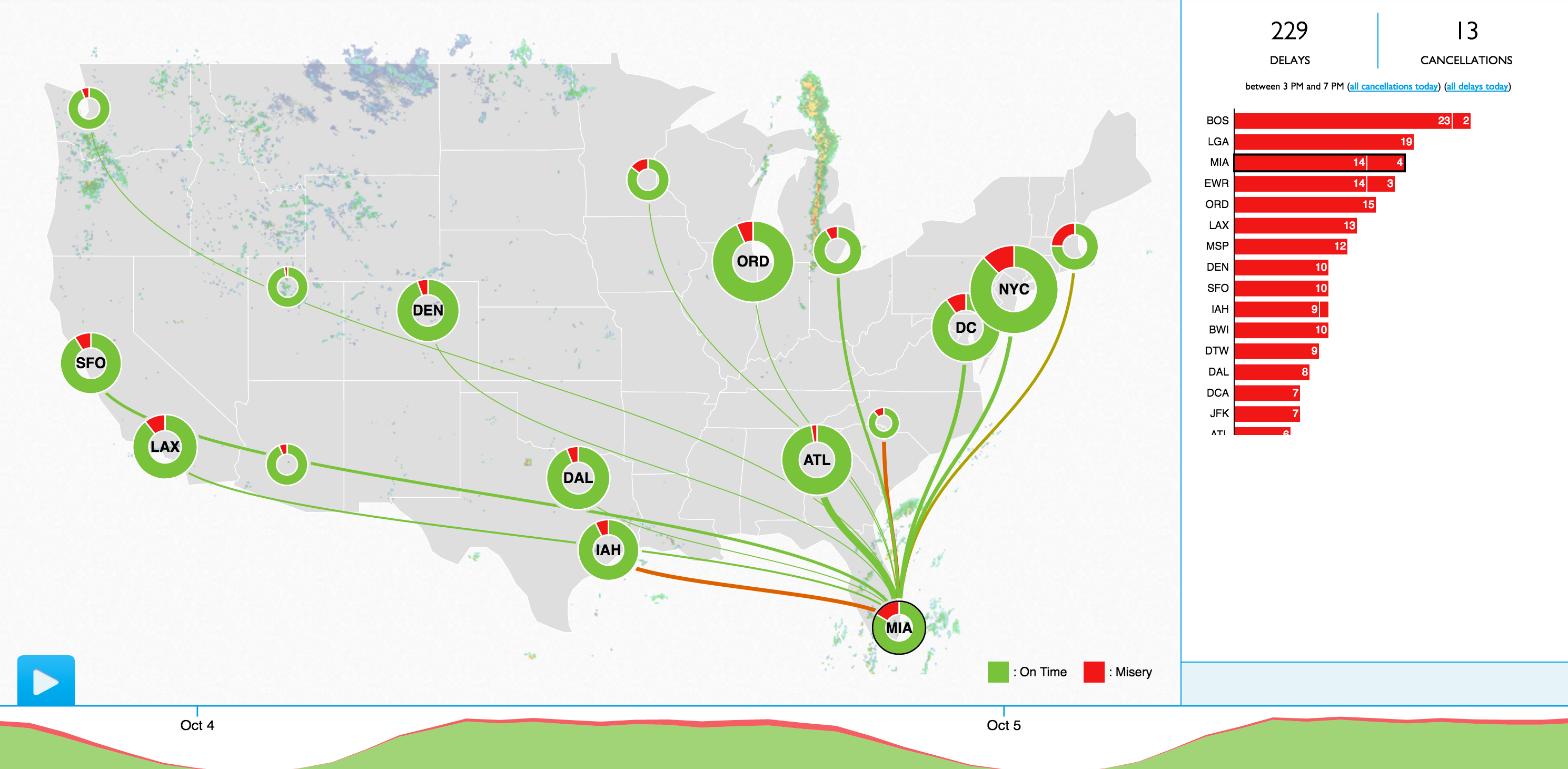
3. Misery Maps
Those traveling to the broader southeast (don’t go to impacted areas!) over the next several days are likely bracing for a travel headache and many canceled plans. In 2013 FlightAware was founded and created their "Misery Map." It shows flight delays and cancelations from all the country's busiest airports.
Another way to watch how travel is being impacted is through Google Maps and their traffic feature. It’s even become something of a proxy to figuring out a storm’s boundaries. Although, in this case much of the traffic is people on their way out before the wind blows. Power outage maps will be big, though.
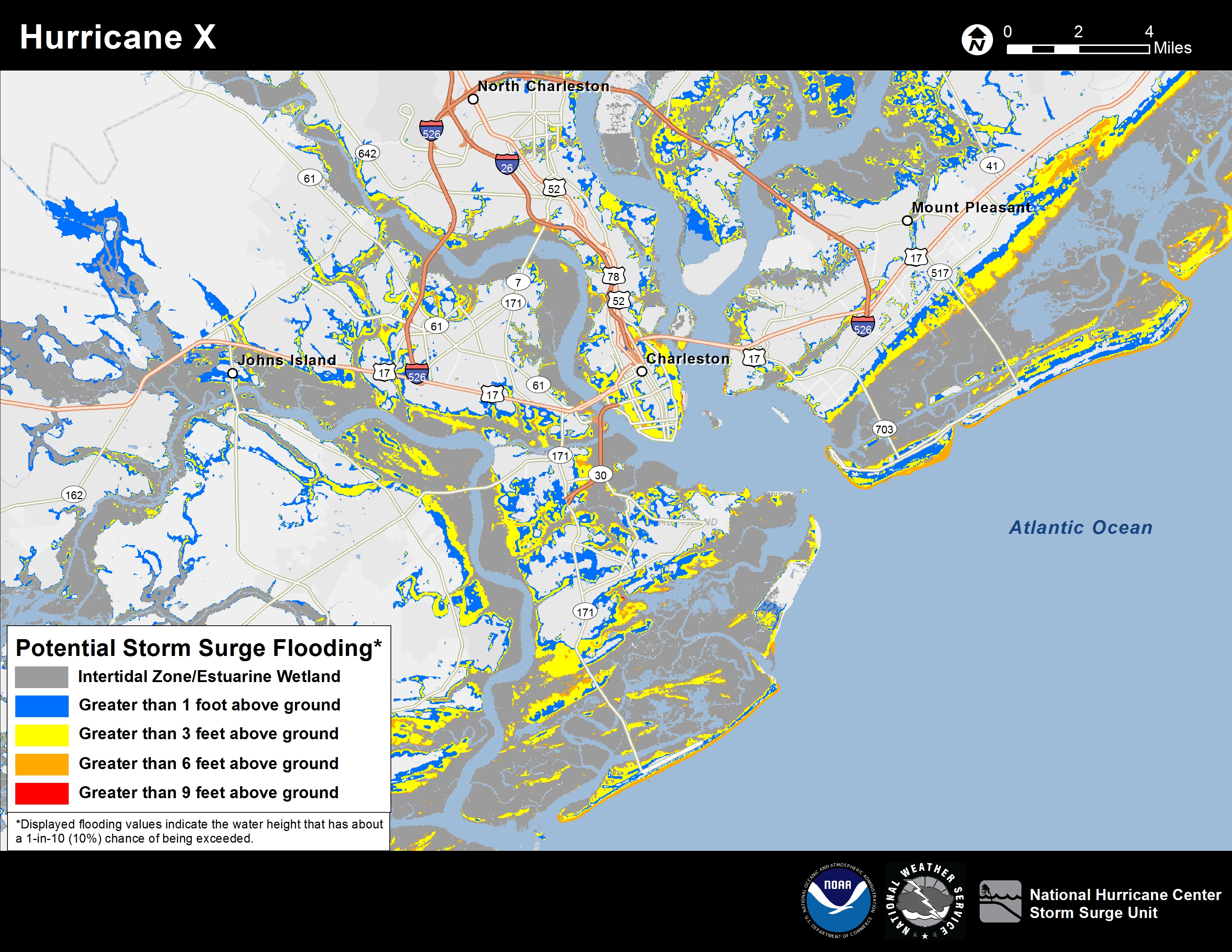
4. Storm Surge Warnings
Even during a quieter time for hurricanes since Wilma, storms such as Sandy have reminded us about the problem of storm surge. This is a rise in sea level associated with the storm. Think of it as a tsunami. One that keeps on coming. This year the National Hurricane Center is issuing storm surge warnings for the first time ever. They’re also putting out high resolution and detailed potential storm surge maps.
Surge is often the most destructive and deadliest aspect of tropical cyclones, but also has traditionally not received its deserved awareness in a world dominated by big wind. New products are getting the word out. So are interactive ways to watch the impact.
5. A long list of apps and maps
The world of weather apps has exploded in recent years. In 2005, apps might not have even been a word (we kid! sort of...). While many apps are just "trash apps" that serve to confuse as much as inform, Dark Sky continues to do some interesting things around forecasting and visualization. It’s also recently come to the Web.
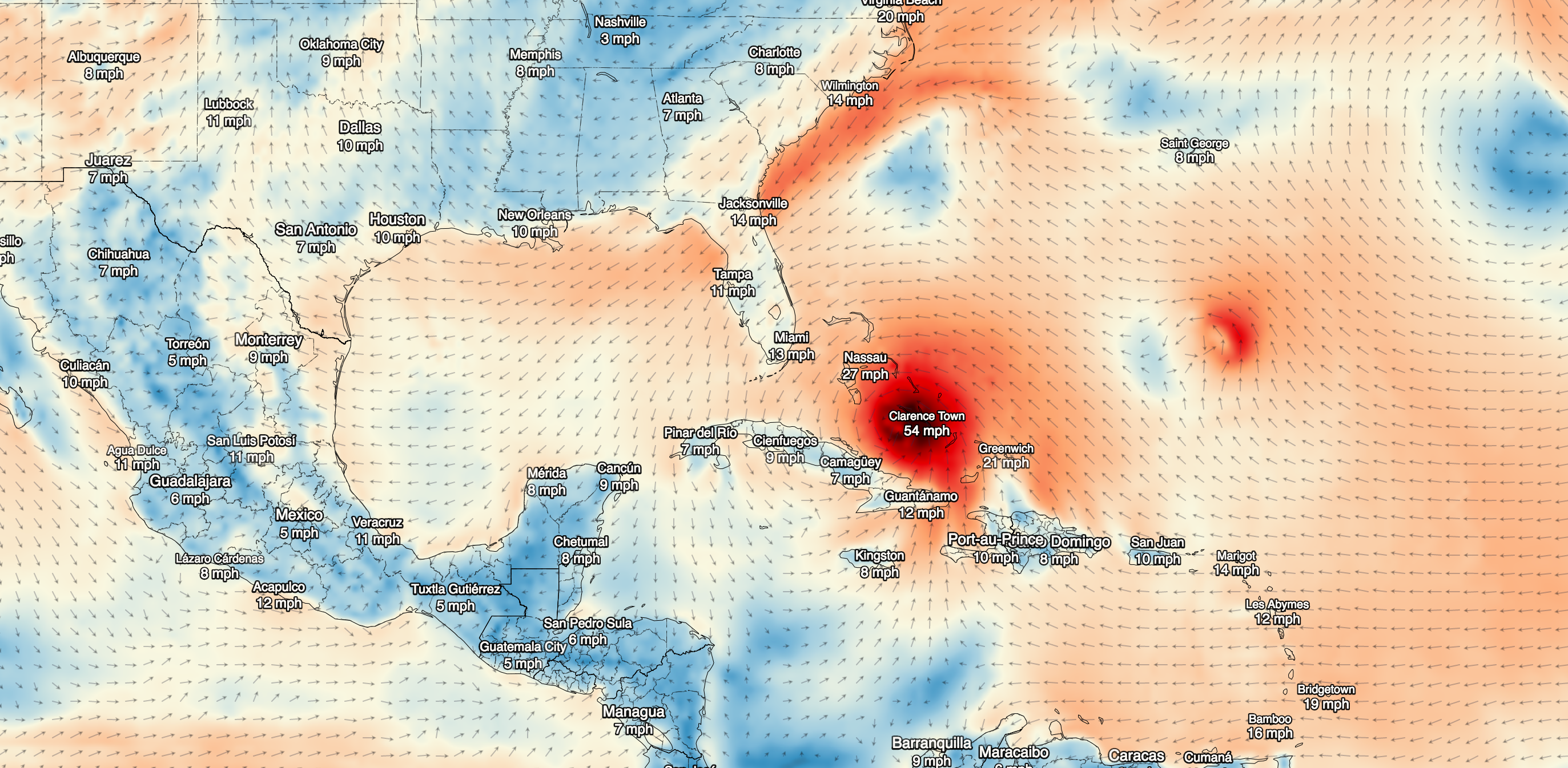
Don’t forget the wind maps. You’ll see a lot of the wind maps. Like the original, or some of the ones that came later. Also Wundermap, and NWS EDD while you’re at it. We could go on…
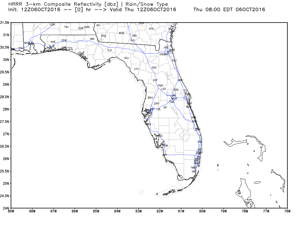
6. HRRR!
Along with those pretty maps, more and more weather modeling has come along for meteorologists and weather geeks to obsess over. Do you need to see new data every hour? Animated futurecast radars? The HRRR has you covered.
Publicly released in 2014, it’s a short-term model that makes waves for its prescience. The HRRR is the cutting edge of U.S. weather modeling. There are also a number of other new short-range models, some run by individuals and schools. It’s a shame they’ll be pumping out scary scenario after scary scenario in the days ahead.
7. Consumer and weather drones
Drones are one of the most game-changing inventions to ever come along, and we’re just getting started. The consumer aspect is still quite new, although military and other applications certainly predate Wilma. Get ready for near-instant aerial video, something that used to take days at best and weeks or months in some cases.
And let’s not look past the real deal. Among the reconnaissance and research planes in the skies over Matthew, a Global Hawk has been roaming. Drone missions into tropical systems are still quite new. They will undoubtedly help solve answers that have perplexed us for year thanks to their extended loitering capability.
Live tracking different planes sampling in and around #Matthew - //airbornescience.nasa.gov/tracker @NASA @NOAA @ABC7News @ABC7Brian pic.twitter.com/mIHRLALieq
— Alex Liggitt (@ABC7Alex) October 5, 2016
**8. ???** We’ve surely missed or overlooked a few big ones since Hurricane Wilma struck our shores. Let us know in the comments!