Snowfall totals exceed expectations in some areas, as summer in November comes to abrupt end

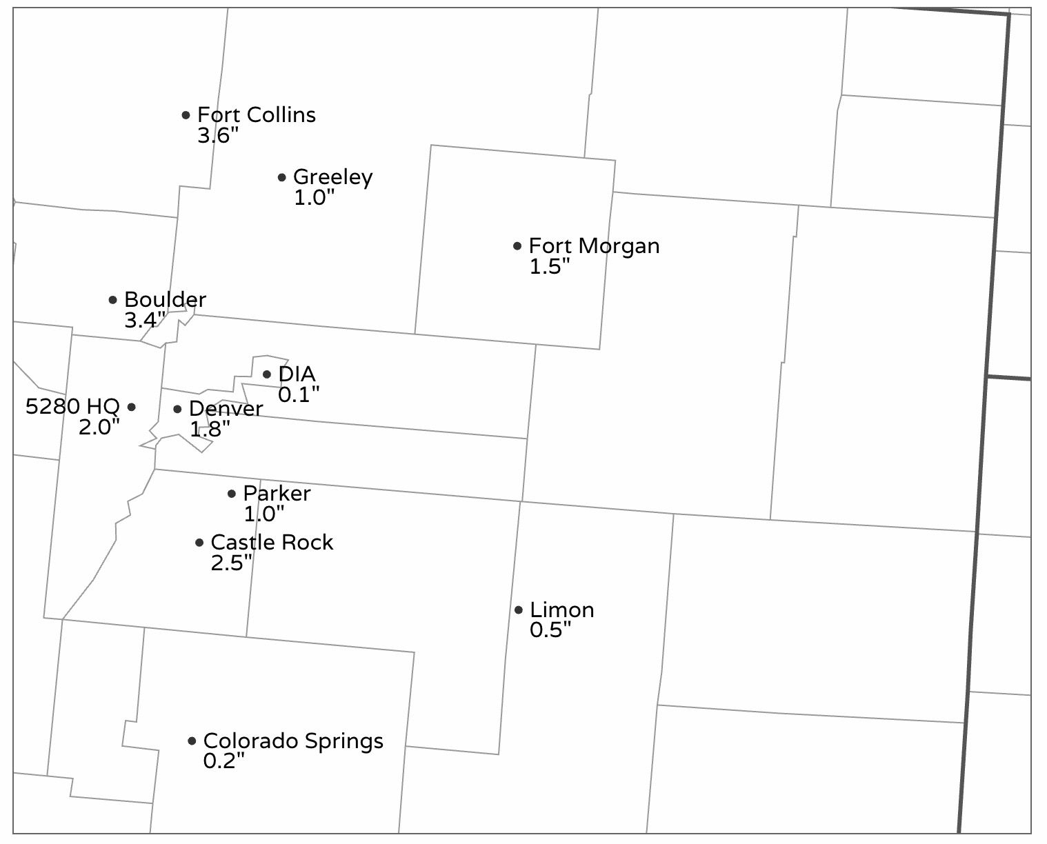
Yesterday's snow piled up a bit higher in some spots than we anticipated in our forecast issued on Sunday. Yes, we said some areas could pick up 2" or so, but even with that mention we came in a bit low for Boulder and Fort Collins it seems, thanks to a couple of bands of moderate snowfall Monday afternoon and evening.
Our gamblers definitely perked up a bit yesterday from where they were, but still the 3" totals a few areas were well outside the most probabilistic outcome from Monday's event. In Boulder the greater totals potential was well enough couched, but clearly the band from Loveland, through Fort Collins, to Wellington over-performed.
Our station on Denver's west side picked up 2.0" of snow on the nose. Many locations across the metro did about as expected – more inline with the Trace to 2" totals that the data suggested we'd see as of Sunday.
Here's a look at totals across the region as of 7am this morning:
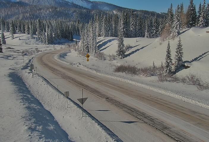
And a beautiful blanket of deep snow across Southwest Colorado this morning as the sunshine returns!
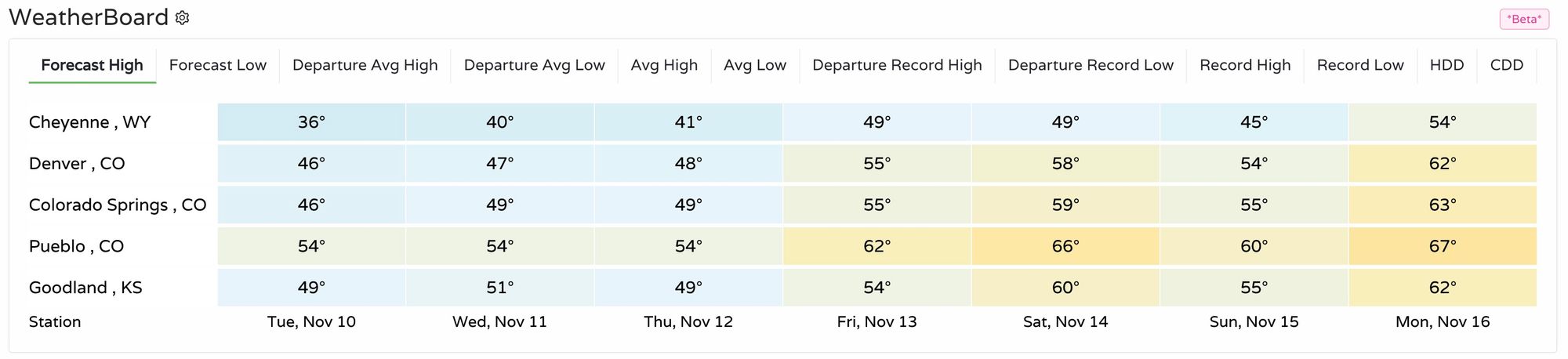
Temperatures will be warmer today than yesterday across the region with more sunshine in the forecast, but still quite chilly overall. Highs in Denver will reach the mid 40s, with mostly 30s and 40s across Northeast Colorado and the surrounding region:
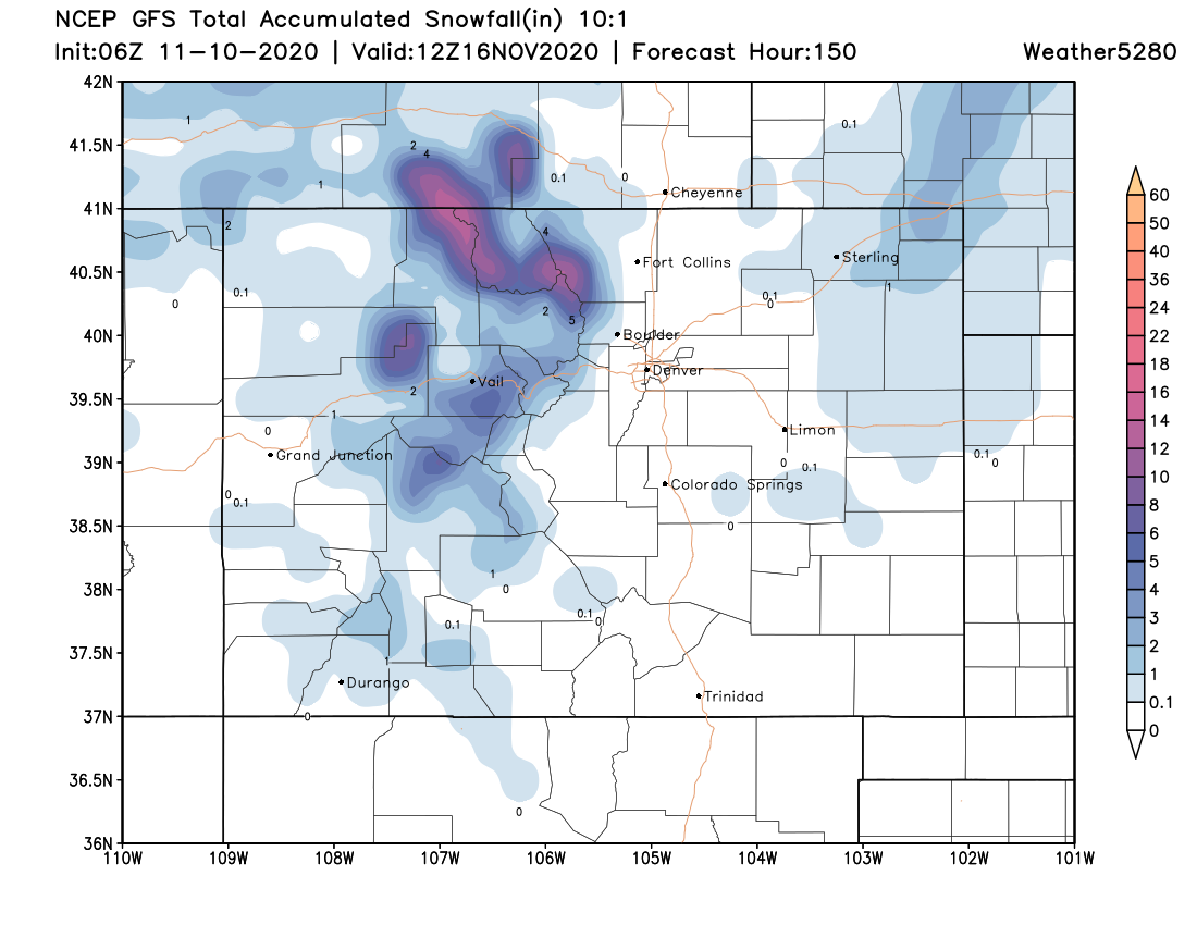
As for additional snow, we aren't expecting much east of the mountains through the weekend. The forecast from the GFS below shows last night's snow coming to an end across the far Northeast Plains, but otherwise no snow through Sunday night across the Plains. The Northern Mountains, however, will see on and off snow through the weekend, which should add up to several inches in some locations by Sunday night: