
Tuesday and Wednesday turn much cooler, windier, and a bit snowier for a few
A weather system is on the way for the next couple of days. The first impact will be the wind, followed by cooler temperatures and some areas of snow.
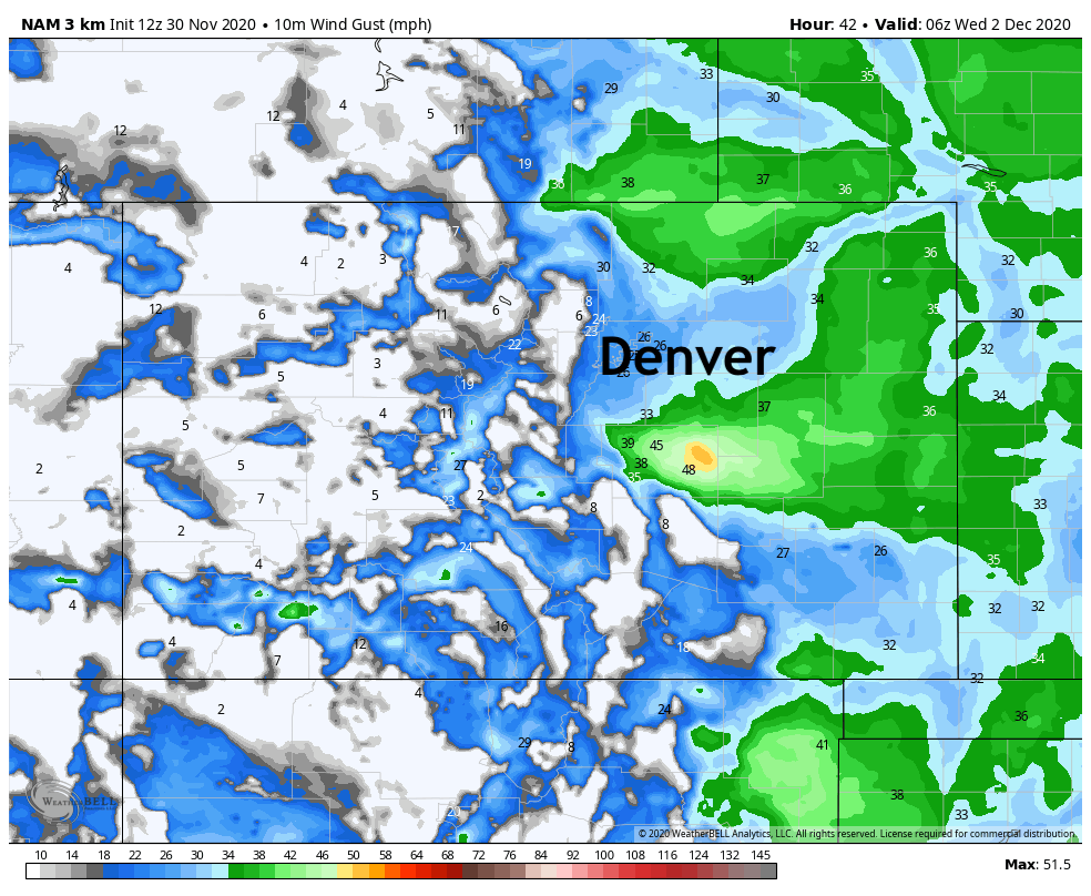
As the system arrives Tuesday, wind will ramp up over the plains throughout the day and will continue into Wednesday. Likely, the strongest wind will be over the Palmer Divide and Cheyenne Ridge.
Here we have wind gusts Tuesday night at 11 pm.
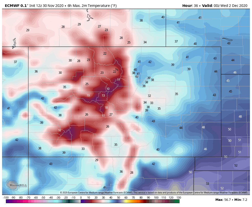
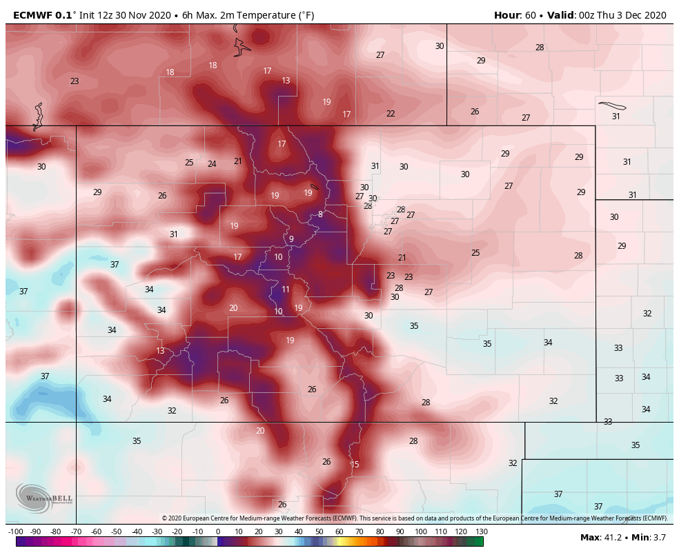
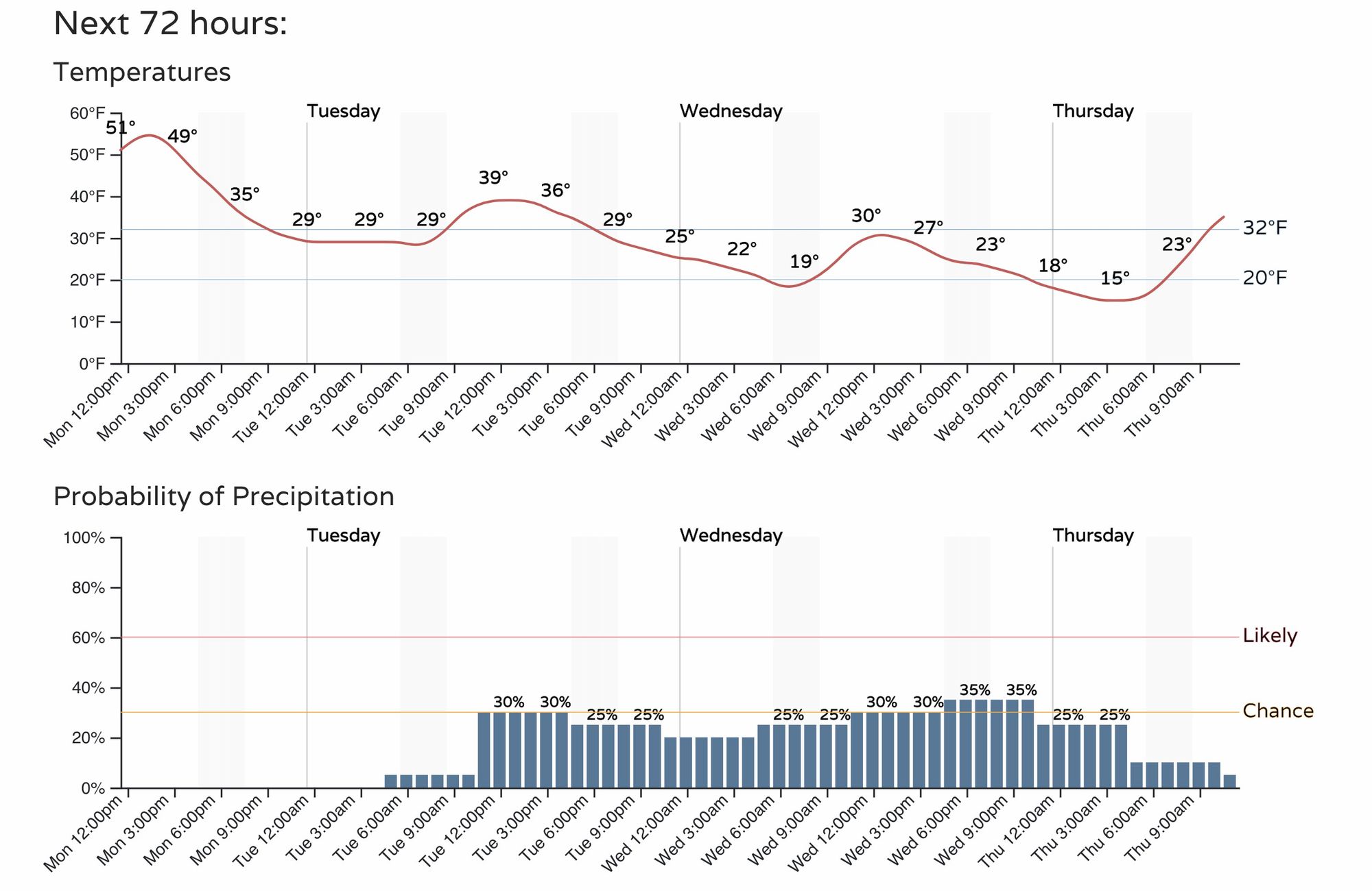
This wind will blow in cooler temperatures, so that Tuesday will drop by 15 to 20 degrees from Monday, and Wednesday will struggle to reach the 30s for highs.
Tuesday afternoon max temperatures:
Wednesday afternoon max temperatures:
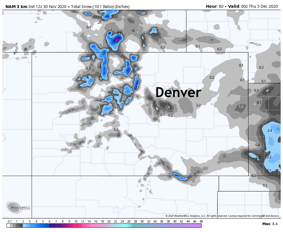
Now let's turn to the third impact, snow. Some areas will indeed see some snowfall but there is an agreement amongst the majority of model projections to suggest that snow won't amount to all that much for most of us. The snow chance of snow will begin Tuesday afternoon, and will stay with us through Wednesday, with passing showers and flurries possible through the entire period.
An example is shown here, which indicates some snow in the mountains and a bit of snow on the Palmer Divide. However, most of the state will lack notable new snowfall.
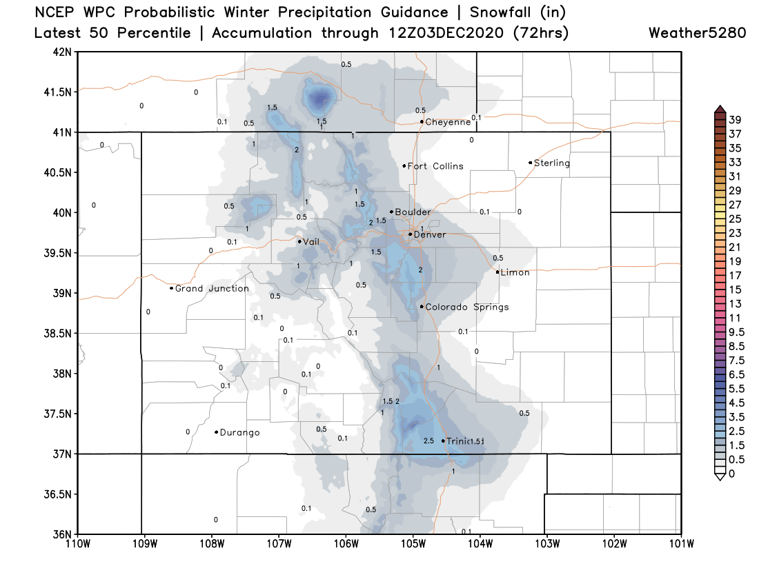
A look at the 50th percentile snowfall guidance from the WPC shows a similar idea – generally light snowfall, but perhaps a Trace to 2 or 3" across the greater metro area, with the greatest totals west of I-25.
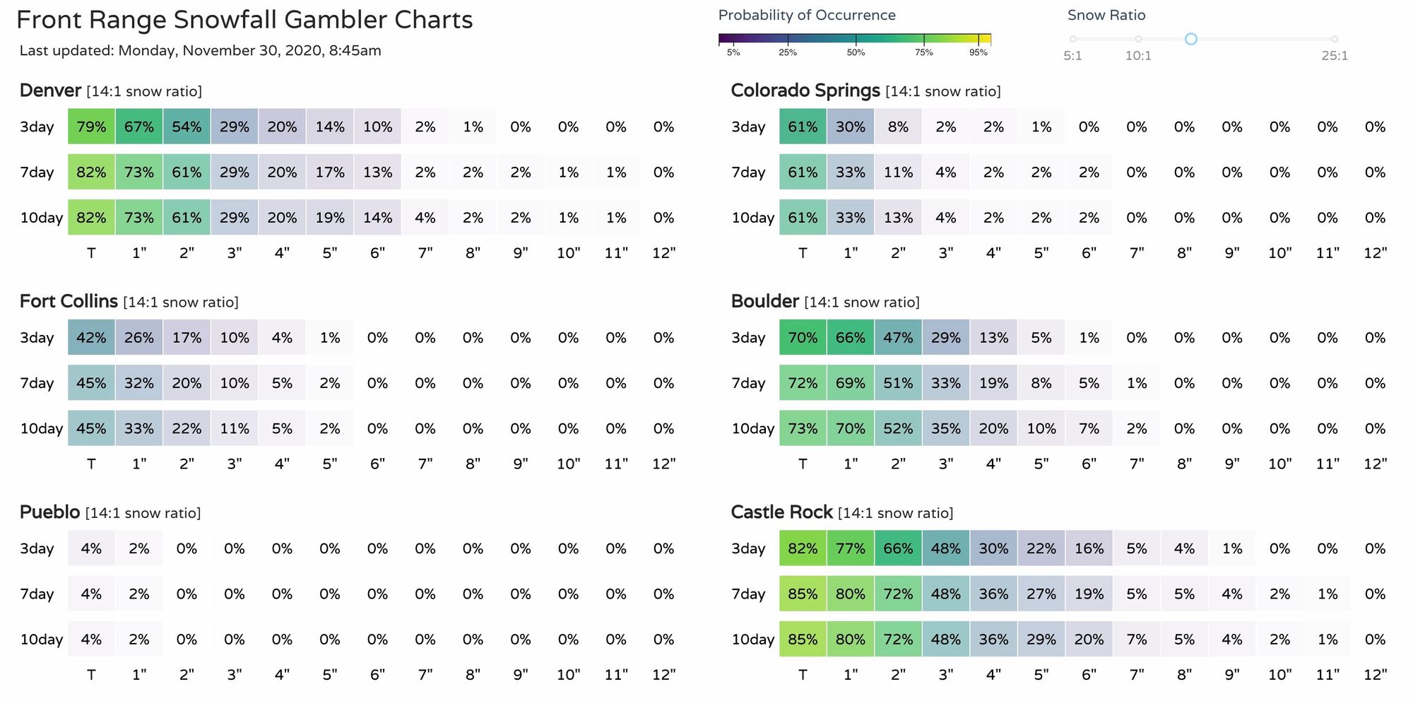
Our Snowfall Gamblers charts indicate the foothills and Palmer Divide are the favored zones for snowfall in all recent data as well:
The main impact here is a windy, colder one for Tuesday and Wednesday with off and on snow showers moving through from Tuesday afternoon through Wednesday night:
Where we do see the more organized snow showers we will see some slick roads at times over the next couple of days. Those in the mountains, 285 in Jefferson County and I-25 through Douglas County, to name a few routes will potentially become slick.
We'll provide you another update Tuesday as the system arrives.