The State of the Atmosphere: Sunday, December 6th, 2020

The state of the atmosphere remains quite quiet across the region as we head into the second week of December. As we outlined for our Insiders last week, the first half of the month is expected to remain so, barring an over performing storm due in late this coming week.
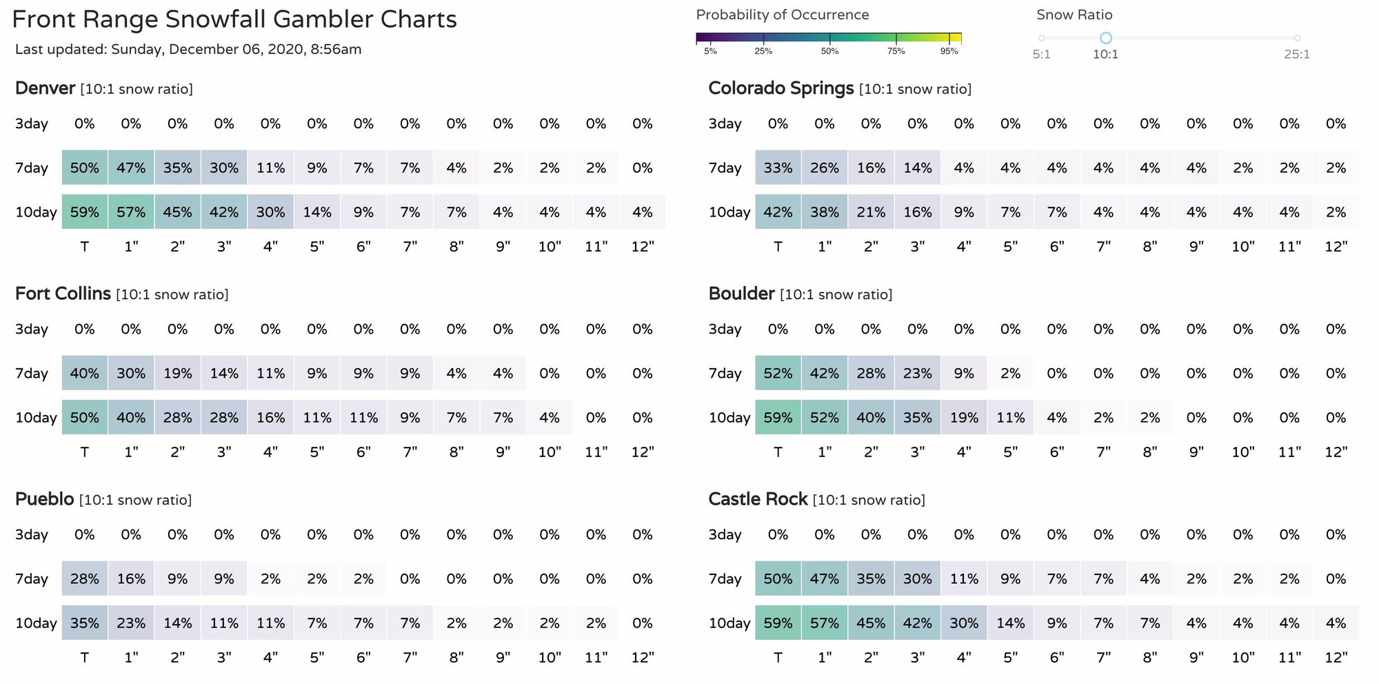
We continue to track those changes set to arrive by Thursday evening or so, but there is not yet evidence this system will over perform across the region – instead it is expected to cool us down from what will be a very mild week otherwise, and introduce perhaps some snow to parts of the state as well. The gamblers show life in the 7-day range, but... not convincingly so just yet:
Until then, look for continued mild weather to dominate the pattern. Temperatures through Wednesday will be absolutely stunning for the second week of December. Highs across the region will be in the 50s and 60s each afternoon.
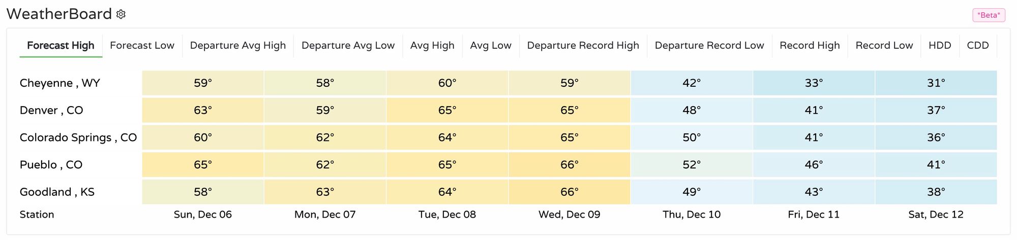
Despite this outlook, most locations won't near record-warmth territory, with the exception of Colorado Springs which will try to tie its record high of 65°F on Tuesday afternoon. Still, with lows in the upper 20s for many of us, the upcoming four days will be a far cry from the type of cold we can see this time of year – a time we've seen some of our coldest outbreaks on record. Denver's forecast low Tuesday night of 27°F for example, will be some 47° degrees warmer than the record low of -20°F for the date, and 8.5°F warmer than the average low for the date.
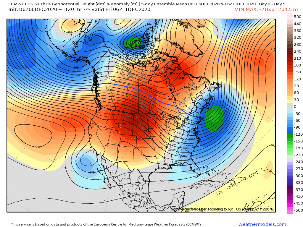
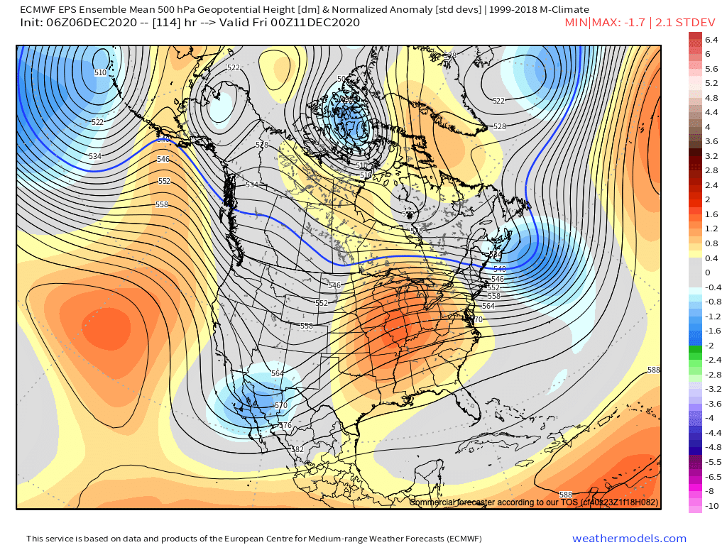
This is all thanks to dominant ridging that will remain in place over the coming days. Below is a look at the average 500mb forecast pattern through Friday morning. The ridge overhead our dominant feature, with a trough off the Eastern Seaboard:

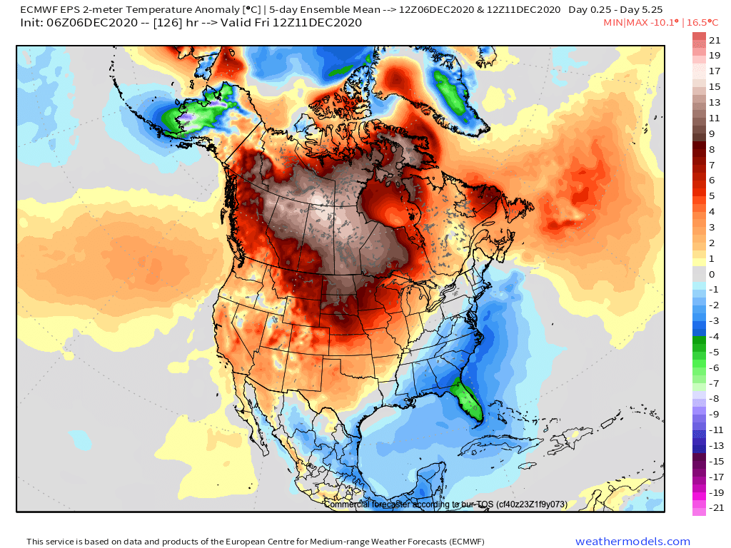
Which, not surprisingly, will equate to temperatures well above average over the next five days outside of the Southeast and East Coast:
Changes arrive Thursday
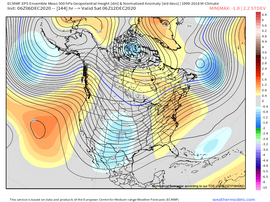
By Thursday afternoon or evening we start to see those changes we've been talking about arrive. If we look at the 500mb pattern at this time we see a trough moving in from the west, and the greatest positive highest now east of our area:
The trough moves through Friday and Saturday, putting us under a chillier flow aloft and moving those highs closer to average for Thursday, and then below average through the weekend.
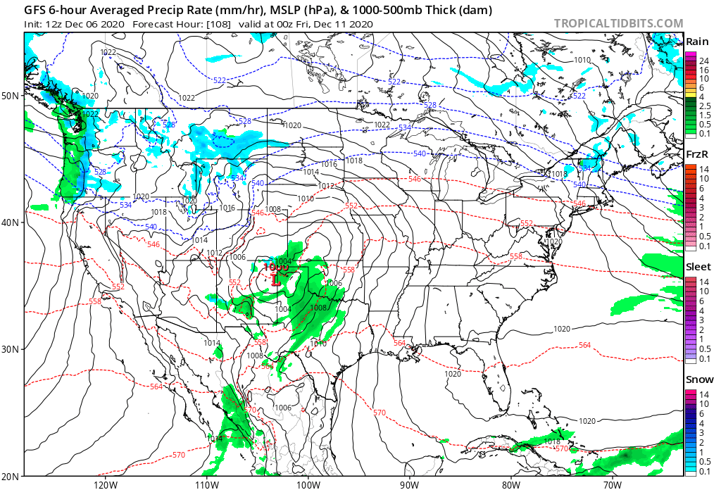
At the moment, most models have the system rather disorganized as it moves over Colorado Thursday night and Friday, before it becomes more organized and strengthens over the High Plains on Friday. This isn't the case with all data runs, but for the most part seems to be the most likely scenario at play.
Here's the GFS forecast for Thursday evening, with a low forming over northern New Mexico or the Texas Panhandle. You can see moisture around the low, as well as some snow and cold air up northwest of the state:
By Friday morning the low has quickly ejected northeast, with heavy rain and snow (on this model) forecast across the Plains east of Colorado:
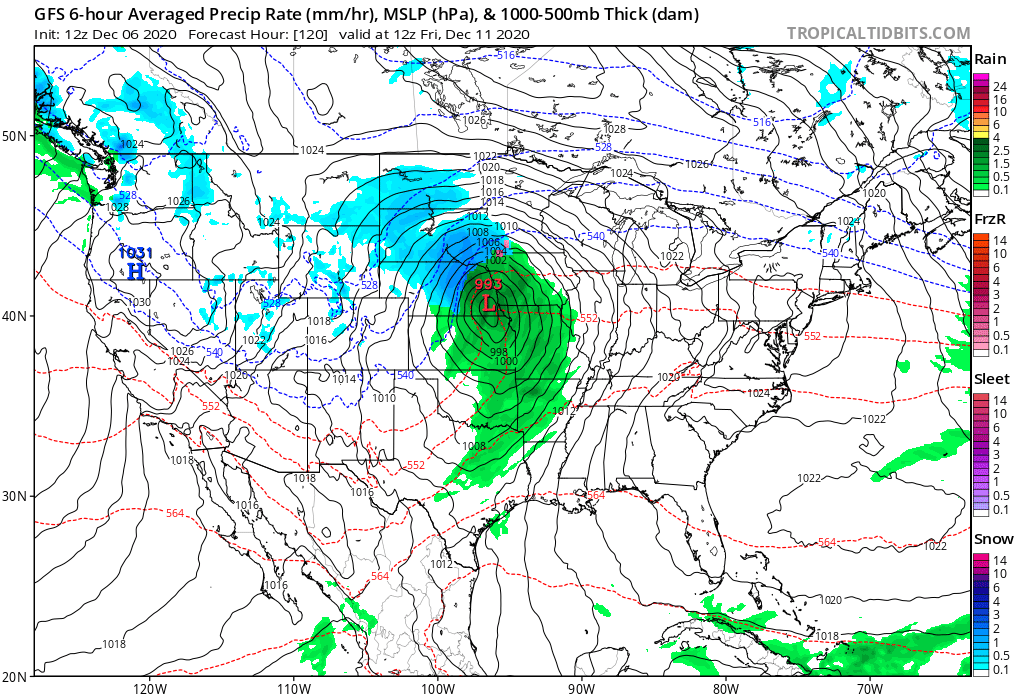
Should this track hold, we won't be talking much rain or snow around here, but instead a quick change to chillier weather with perhaps some snow showers around by Friday but not much more. A more southerly track would put us in a better spot for a bit more meaningful snow chances, but right now that would be the outlier solution.
For the latter half of the weekend we expect temperatures to remain chilly across Eastern Colorado under the influence of a northwesterly flow aloft. Another system may swing through during the middle of the next week as well, but confidence is low in the medium range.