Here comes the rain! (And snow, and wind, and hail)

We continue to track our next round of wet weather, due to arrive in the form of potentially strong storms this afternoon and continuing off and on as rain and snow overnight into Monday for many, especially those along and west of I-25.
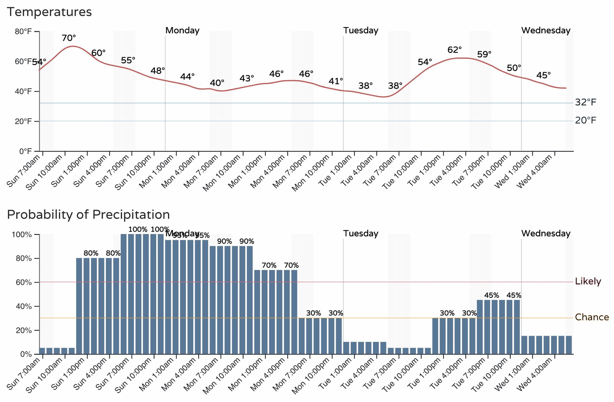
The hourly timer for the Denver area shows the chance of showers and storms will increase quickly by early afternoon (perhaps even a bit sooner for some) and will continue through the overnight hours and through a chilly and damp Monday.
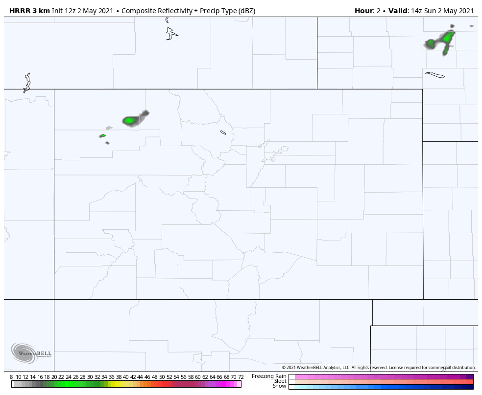
If we watch the progression of time in the forecast from the HRRR below, we see that storms that develop this afternoon along the Front Range foothills will progress pretty quickly eastward, where they could become severe across the plains this afternoon – generally along and east of I-25 would be the greatest threat for damaging wind and hail.
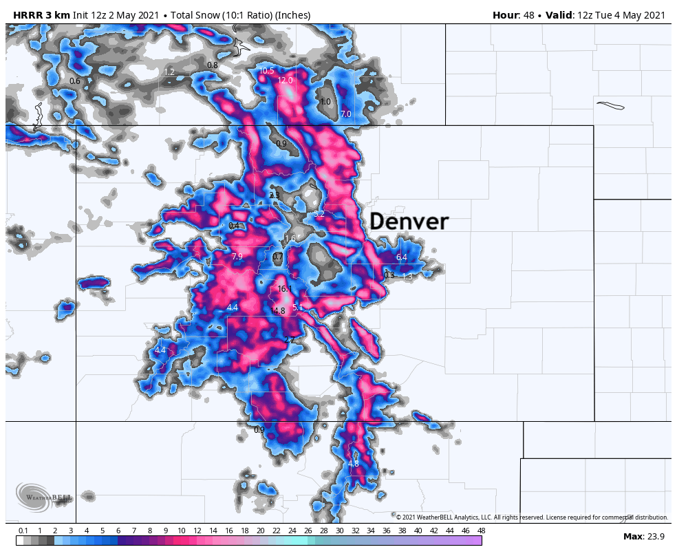
After this initial push of stronger storms, we see rain and snow develop across the Front Range mountains, foothills, and urban corridor – this is where the focus of the heaviest precipitation will be much of tonight and Monday.
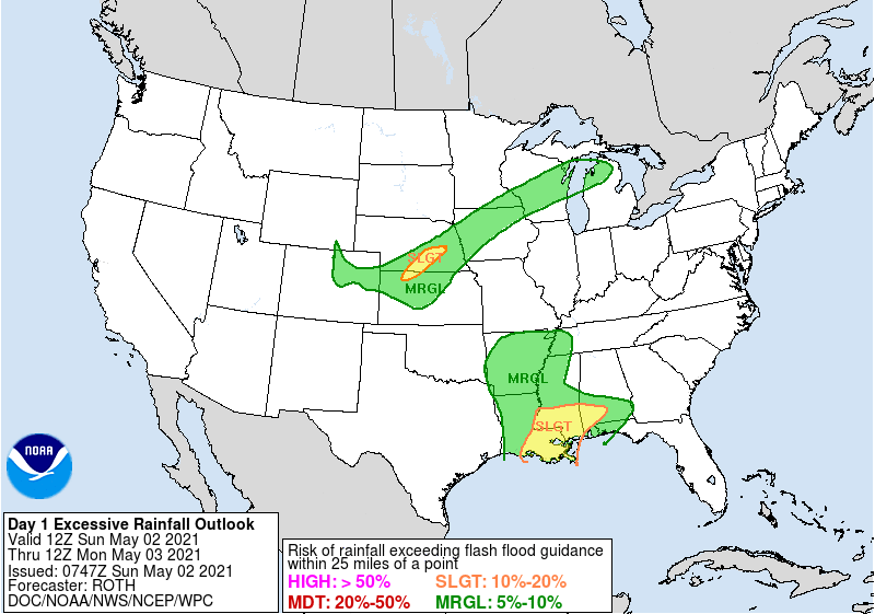
Again, some of these storms this afternoon could turn severe. The map below shows where the greatest potential is for this to occur, generally along I-70 east of Denver extending into central Kansas. Strong winds and hail will the greatest risk with these storms.
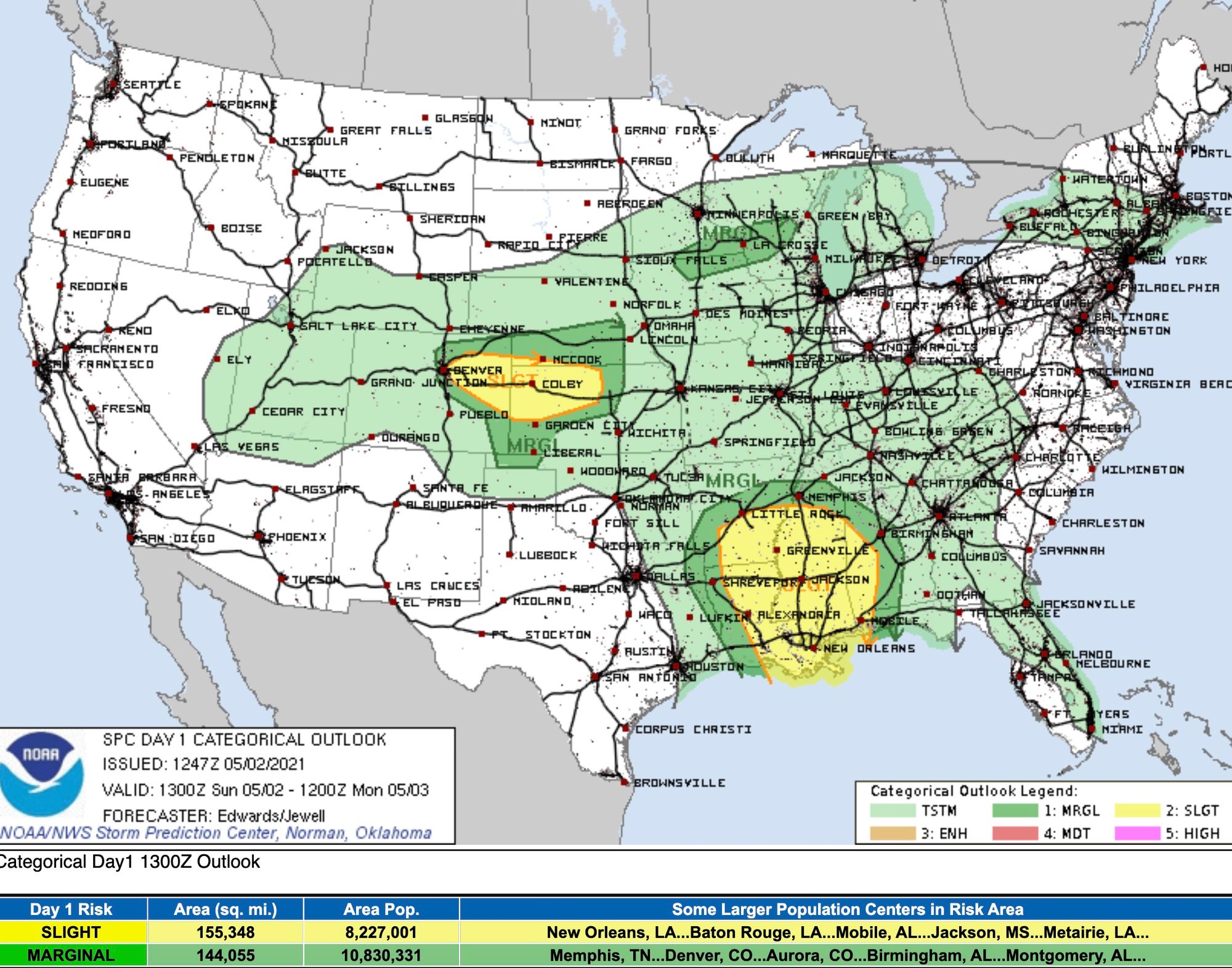
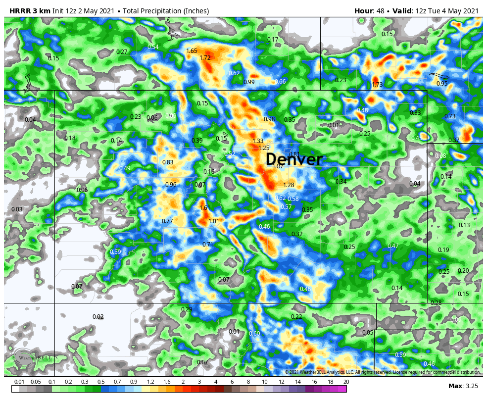
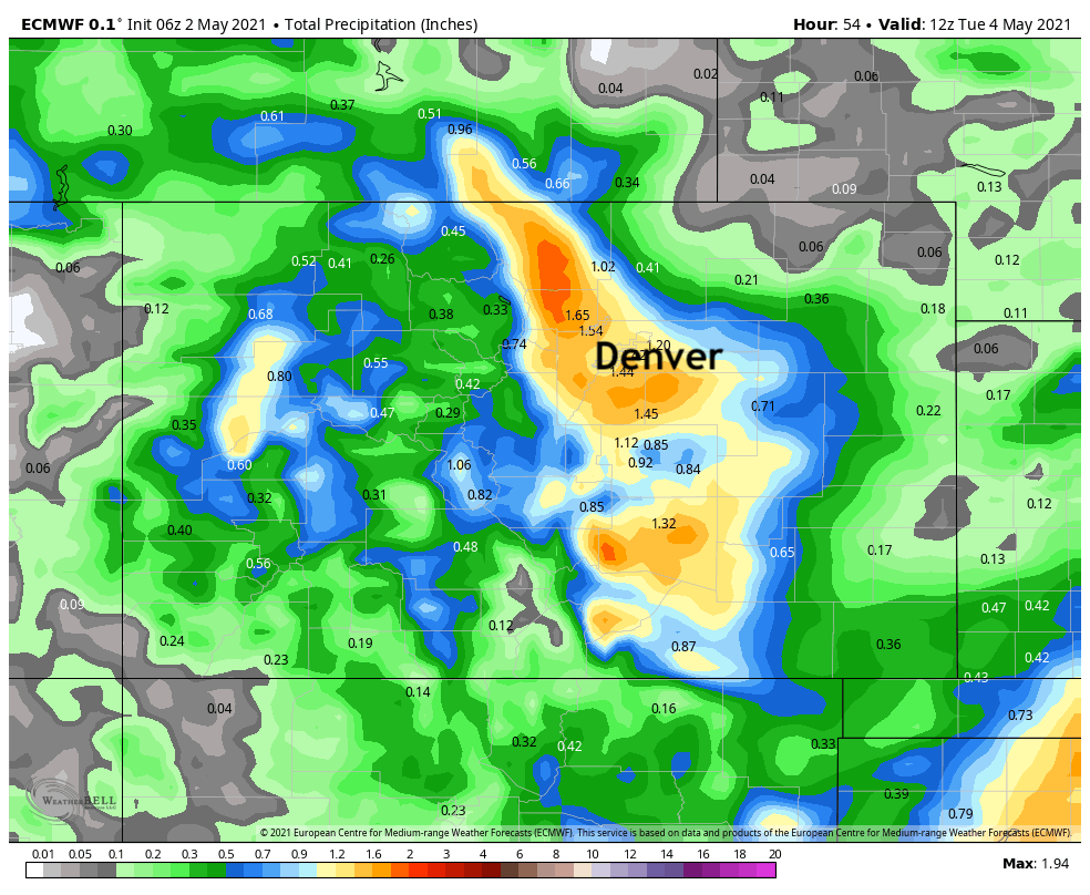
Models are actually in pretty good agreement with the placement and amount of greatest precipitation totals expected today and Monday, with upwards of 1" possible along the Front Range and urban corridor, with more spotty coverage across the Plains.
Here is the latest precipitation forecast from the HRRR (animated above):
Which sits pretty well with the latest EURO as well:
Like our last system, most of what falls at lower elevations is expected to stay as rain, or perhaps a rain/snow mix depending on your elevation. Like our last system, the biggest question will be if changeover occurs across the Palmer tonight, and if so how much snow manages to accumulate – perhaps a few inches in spots.
Looking at the NWS hazard map, we see a Winter Storm Warning goes into effect tonight for the Front Range mountains, where 7 - 14" will be possible by Monday night. An Advisory is in effect for the higher elevations west of Colorado Springs. No highlights have been issued for lower elevations.
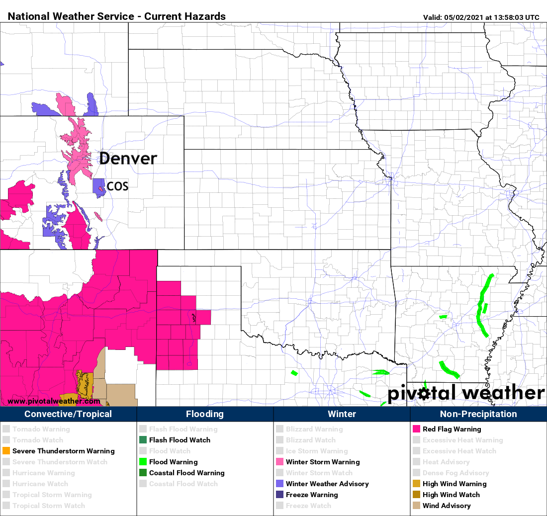
Here is the Warning statement from the NWS:
WHAT...Heavy snow expected. Total snow accumulations of 7 to 14 inches possible, heaviest amounts along and just east of the Continental Divide. Lower amounts expected west of the Divide.
WHERE...Rocky Mountain National Park and the Medicine Bow Range, and The Mountains of Summit County, the Mosquito Range, and the Indian Peaks.
WHEN...From 6 PM this evening to Midnight MDT Monday Night.
IMPACTS...Roads will likely become slick and hazardous. Travel may become very difficult due to heavy snowfall on roadways.
The HRRR tries to pull some accumulation across the Palmer south of Denver, but most models did the same last week and we only saw minimal snow accumulate at the tail end of the storm. Best guess is most of this stays at higher elevations, but crazier things have happened, so good to be aware of the potential if you live above 6,500 feet or so between Denver and Colorado Springs.
Looking ahead
The chilly start to the week won't stick around long. Tuesday and Wednesday highs should climb back into the 60s along the urban corridor, with 70s and 80s back in the forecast by late week as ridging reestablishes itself across the region.
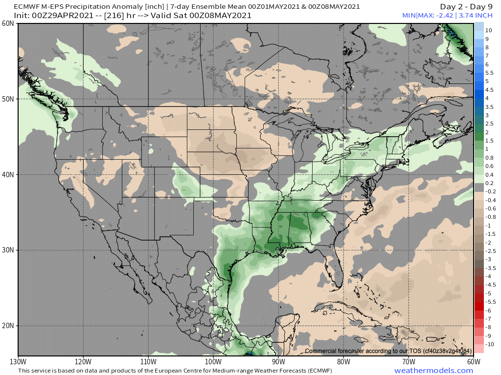
The seven-day precipitation anomalies, ending this coming Friday evening, will not surprisingly feature above average precipitation for much of Eastern Colorado, especially along the Front Range:
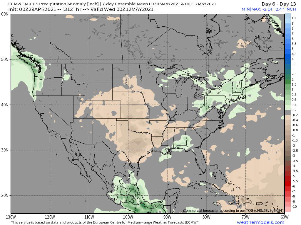
The following seven days, start Tuesday and ending Tuesday evening May 12th, looks to possibly feature a drier period for Colorado and much of the plains states. We'll see, don't be shocked if wet weather returns early next week too given the pattern. Models have been back and forth a bit here, with the current EURO looking drier, but at times this model too shows another system moving through.