With a cool and wet end to week possible, who's likely to see a late season snow?

Today's tone is a bit more optimistic that we'll see some moisture around here by the end of the week, though the details remain unsettled. It's likely we'll see continued variation in the modeling as we get closer to Friday, as convection this time of year muddles computer modeling, and the largescale pattern remains hard to pin down.
Models overall recovered quite a bit from their drier runs yesterday.
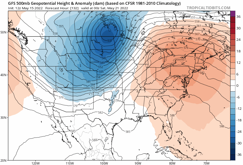
Yesterday's data was consolidating energy with this system well north and northeast of our area, where today we see a more elongated trough, with more trailing energy to the southwest – similar to what models had been forecasting as of late last week. Should this trend continue (or hold) we'll see a better chance of some areas picking up meaningful moisture along the urban corridor/Front Range from late Thursday night through Friday night.
This incoming late-week trough does look like it'll really cool us down as well, with highs in the 40s and 50s on Friday across Northeast Colorado. The latest Euro operational model shows a high of just 44°F in Denver! That of course is well below the average for the date of 74.7°F, and would put us in the ballpark of the record coldest high for the date which is 39°F set back in 1939.
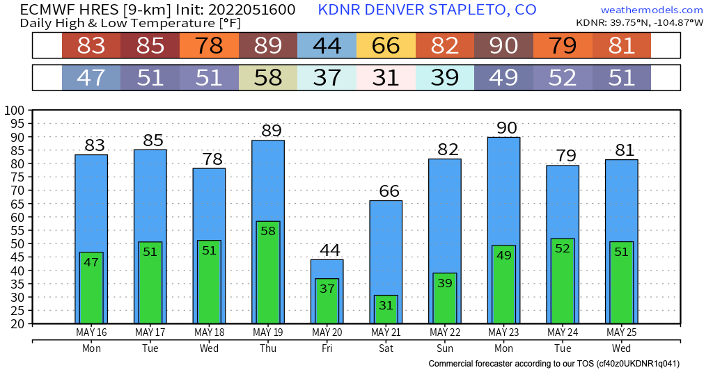
The ensemble mean is warmer, but still a chilly day, topping Denver out at 52°F on Friday, and bottoming out at 35°F by Saturday morning (vs the 31°F(!!)) on the operational model shown above.
Brr!
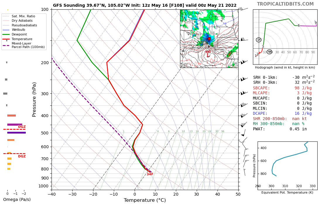
The latest GFS run is even colder, showing temperatures in the mid to upper 30s by late Friday afternoon along the urban corridor, with SNOW falling all the way down into the city proper. 👀
While we do think it's not outside the realm of possibility that we see snowflakes in Denver on Friday, the likelihood of anything sticking in the city still looks low, and would have to overcome a month+ of heat and high sun angle. The Euro, from this perspective, looks much more reasonable – with a couple of inches showing up for the foothills west of Denver, and even along the western Palmer Divide.
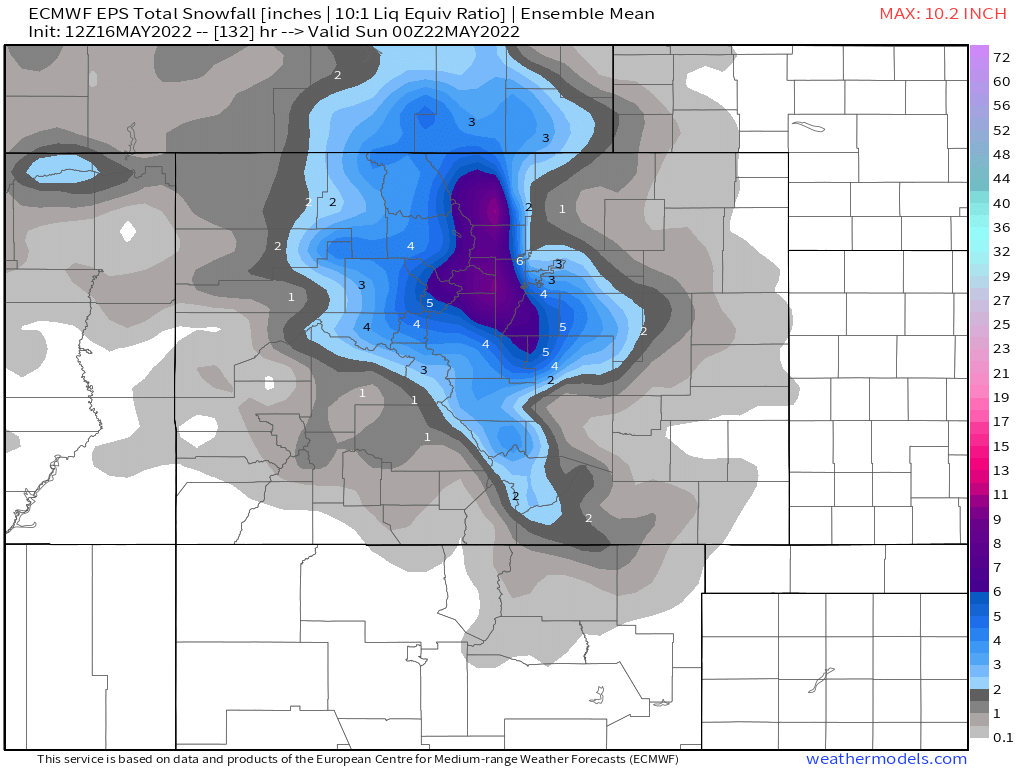
The EPS mean snowfall forecast has like everything else trended snowier today again as well. Now with 2 - 3" in Denver (again, what will actually stick?) but some 6"+ totals in the grids west and southwest of Denver!
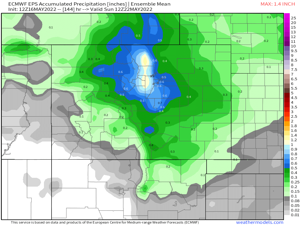
This puts the mean precipitation totals back up to 0.5 to 0.8" across the Denver area, with and inch showing up west of Denver, Boulder, and Fort Collins:
Hard to make sense of much of this given the time of year and how warm we've been. If the bulk of the precipitation falls Friday evening/overnight then some of the greater snowfall totals start to become more possible, especially at elevation, where daytime snow would have a hard time doing much.
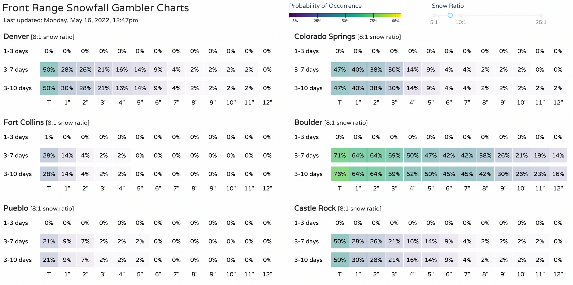
We dusted off the snowfall gamblers today, and here's where they sit:
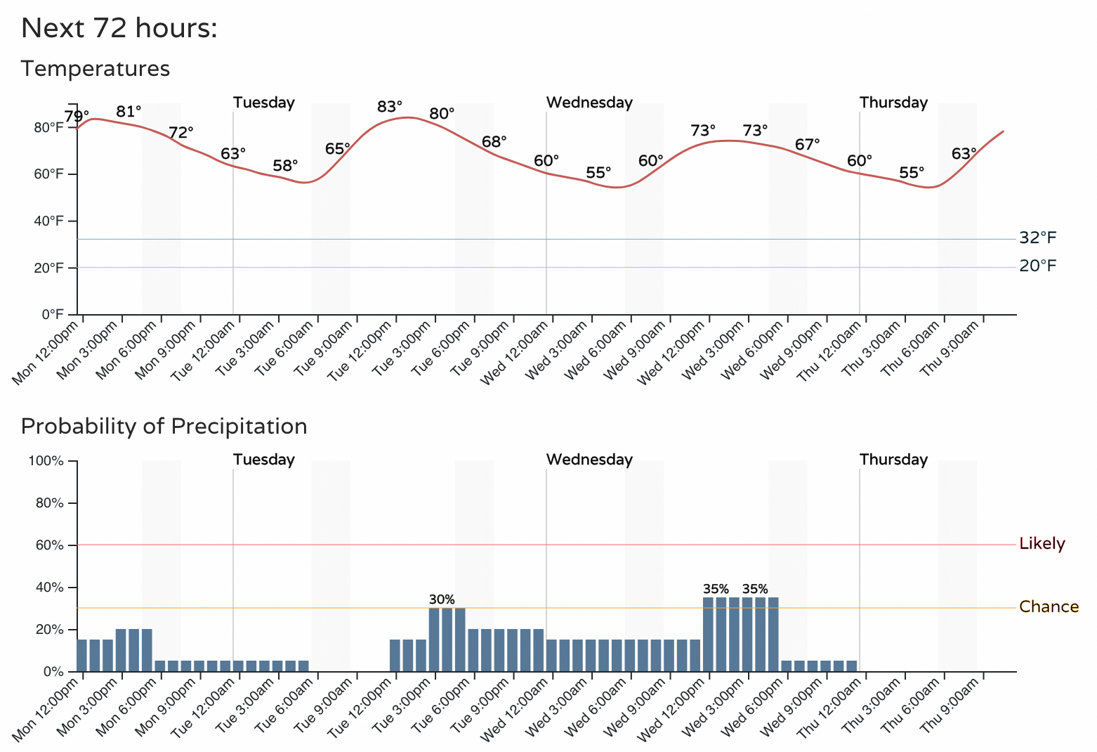
Until then, we continue to track mostly warm temperatures across the region and those daily storm chances. Thursday currently looks like the warmest day of the week ahead of the trough, with highs near 90°F for the urban corridor, with the chance of afternoon storms today, Tuesday, and Wednesday before a drier day (and higher fire danger) on Thursday.