Heavy thunderstorms hit the Front Range, and more on the way for Colorado

Wednesday saw the power of some late-night thunderstorms around the metro areas.
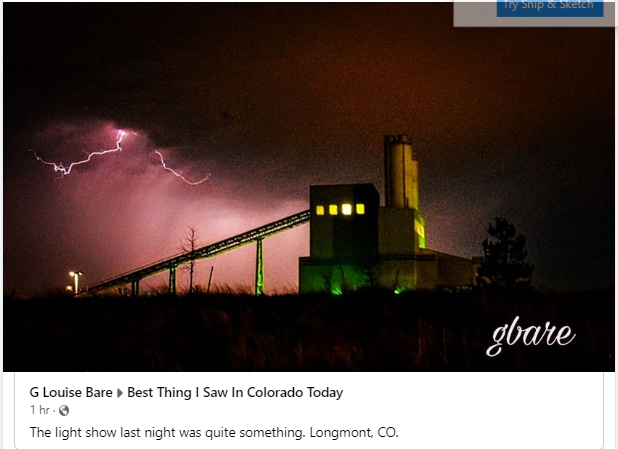
Here it was south and west of you near Masonville/West Loveland. pic.twitter.com/VpXOQRhi9z
— Kevin McSweeney (@kmcsween) July 28, 2022
Impressive hail of approximately tennis ball sized lingering over 45 mins after the storm east of Fort Collins! Personally some of the largest I have seen in Colorado, only 5 mins from home. Archived radar at location of stones. #cowx @NWSBoulder lat/lon 40.615/-104.935 pic.twitter.com/ZZACFjYmsl
— Michael Charnick (@charnick_wx) July 28, 2022
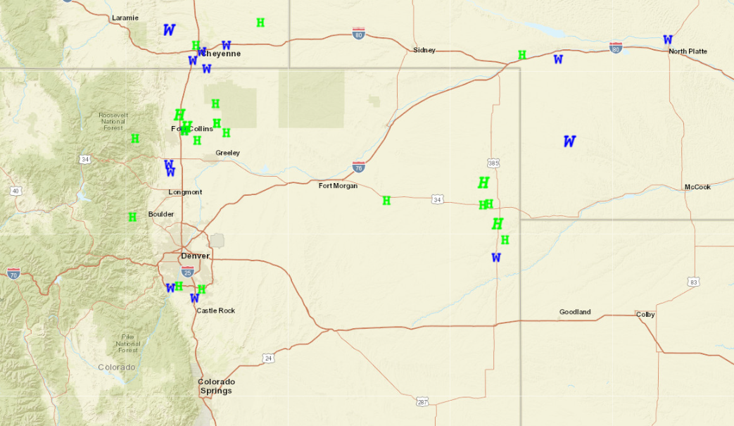
Here are the storm reports around the region from Wednesday (W for wind, H for hail).
Does this happen again?
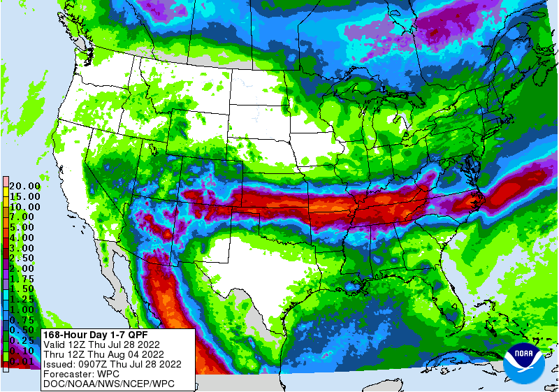
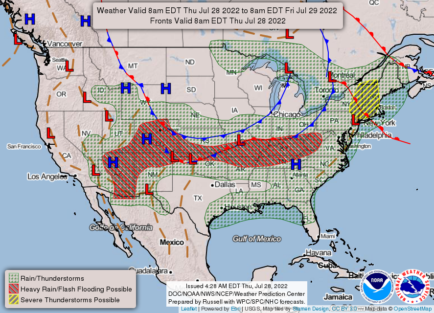
A steady moisture supply continues flowing from Mexico across the Southwest into the Central Rockies, contributing to recent heavy rain and thunderstorms.
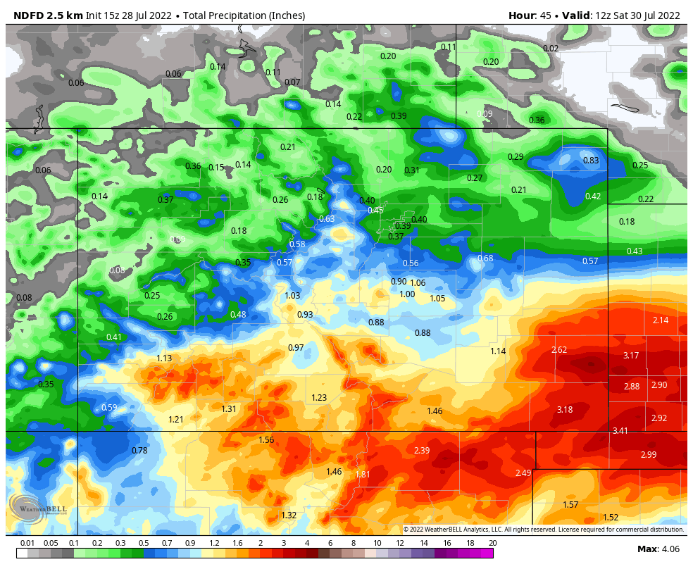
The estimated precipitation from Thursday to Saturday morning:
These thunderstorms are forming largely over areas with increasingly saturated soils, leading to increased chances for flooding.
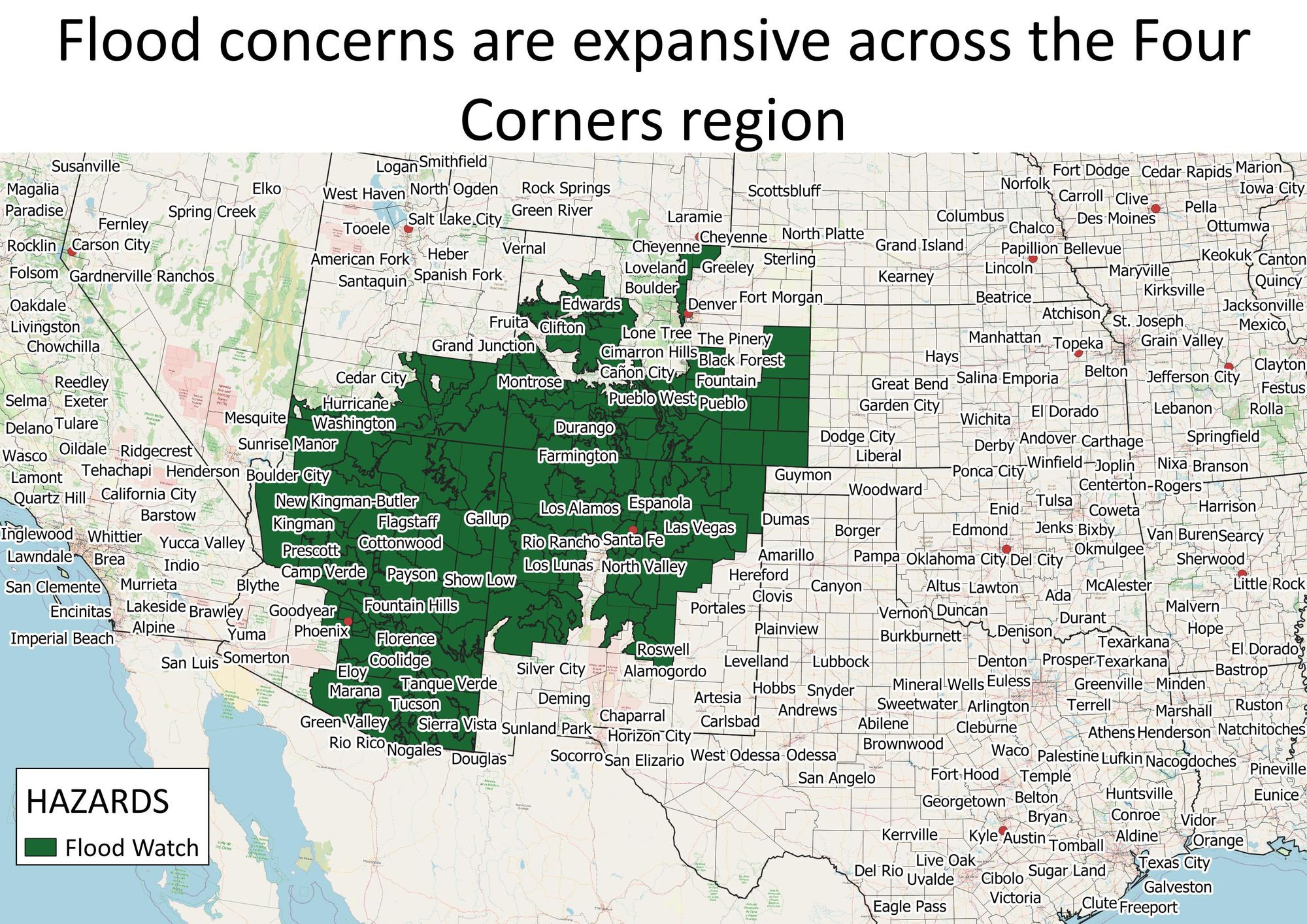
Thursday, a stalled front over the region combined with this moisture will result in slow-moving thunderstorms capable of producing flooding.
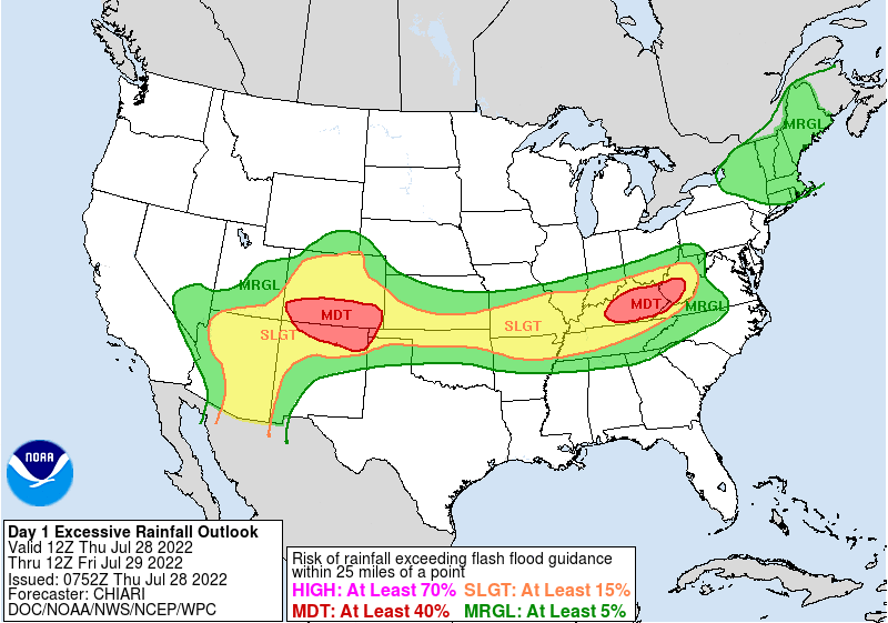
A moderate risk for flash flooding has been issued in southern Colorado, northern New Mexico, and portions of Oklahoma and Texas.
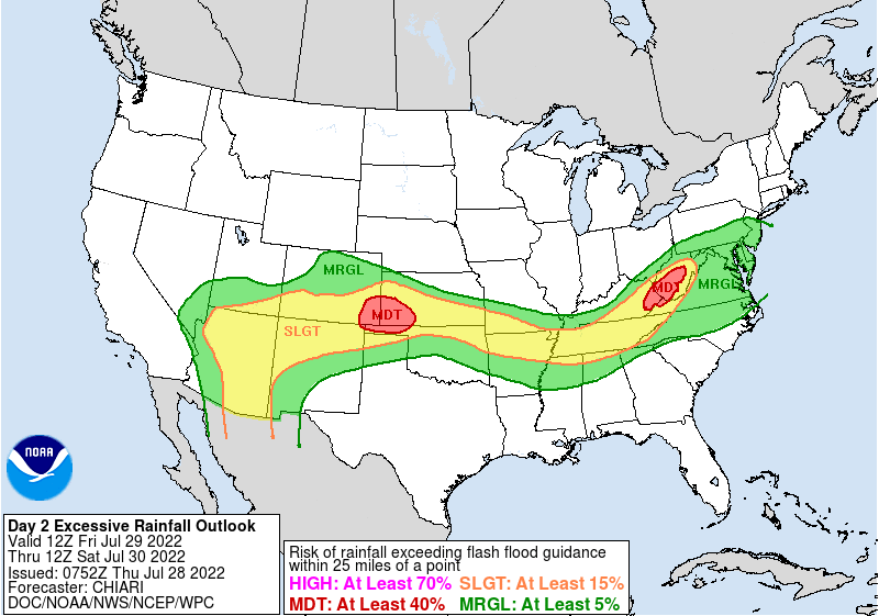
Friday, there is a moderate risk for flash flooding for parts of Colorado, Kansas, and Oklahoma.
If we look specifically at the Denver area, we have the hourly planner for the next three days.
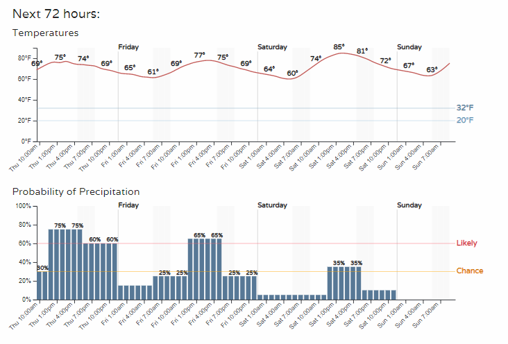
Those are some hefty rain chances coming Thursday afternoon. You can customize your location for these hourly planners, and it will always be displayed for you right on the homepage.
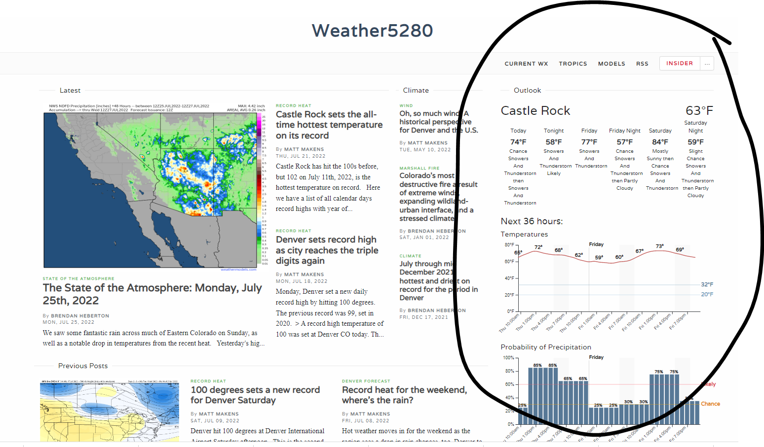
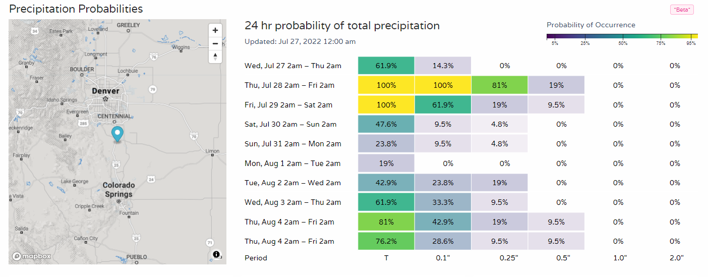
Or Insiders can map-click for daily rain chances that will look like this:
And, I'll leave you with a bit of history:
July 28 is a very important day in the history of our office: the anniversary of the Fort Collins flash flood and soon after the birth of @CoCoRaHS. With a risk for flash flooding nearly everywhere in CO today, make sure to stay weather-ready and turn around, don't drown! #cowx https://t.co/e2nRtwpT73
— ColoClimateCenter (@ColoradoClimate) July 28, 2022