Denver Weather: Mountain snow may clip parts of metro areas later Thursday including Colorado Springs

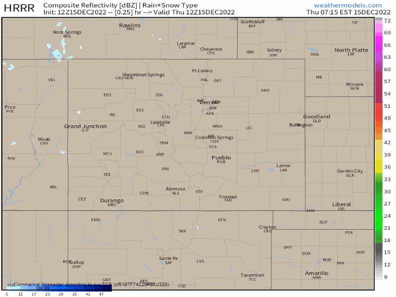
Snow for the mountains today, and part of that may slip onto the Palmer Divide this afternoon. Areas in Douglas, Elbert & El Paso Counties have the highest chance to see some, but really anyone along the Front Range can see some snowflakes today with any cloud cover peeling off the mountains.
Here's an animation of estimated snow showers through Friday night, but the vast majority of snowfall is happening today and only lingering snow in the mountains for Friday.

That little blip of snowfall we see over the Palmer Divide between Denver and Colorado Springs is the portion of snow that could clip the metro areas; the timing of this is shown here.
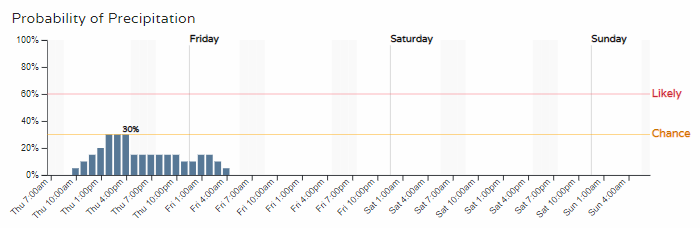
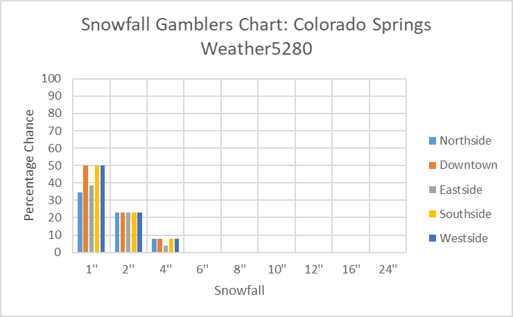
You can see those chances don't climb very high so we are talking about a slight chance of this occurring. Here's some snowfall data specific to El Paso County.
In map form, the estimated totals are as follows:
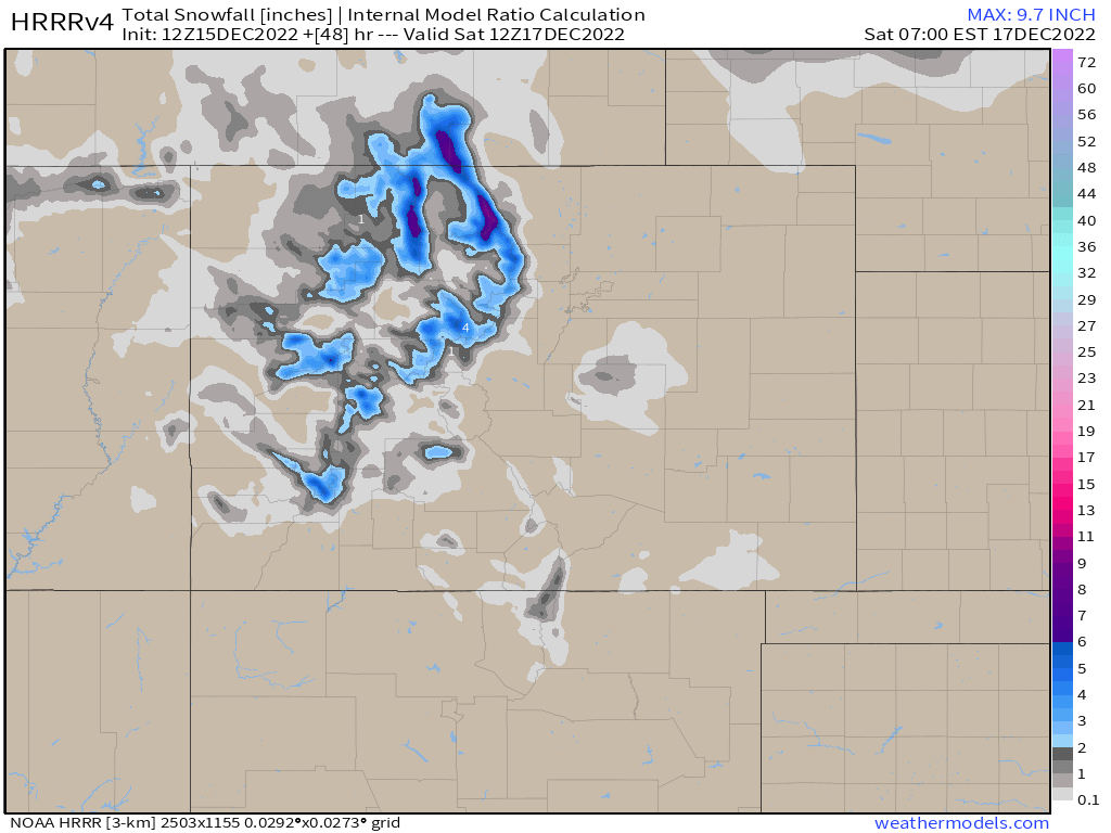
That leaves parts of the northern mountains to have 6+" today, and a trace to 2" for anyone in the metro areas or plains where the snow may attempt to fall.
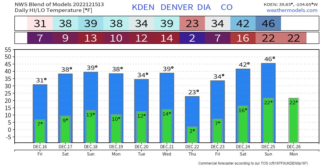
Temperatures today are going to stay cool again before a bit of a warmer stretch for several days. You'll likely hear and see a lot more about cold next week, around Thursday, as modeling for that time period brings in very cold temperatures for Northeastern Colorado and some cold into Denver too.
We talk about that in the latest video on cold and snow for Christmas, we've bookmarked this video where that discussion begins:
We will have more on next week's cold in a future post, today we wanted to give you a heads up about the chance of snow coming later today for some folks on the Front Range.