Denver weather: Frigid temperatures return with chances for snow and icing this weekend

Enjoy these Friday temperatures, and some sunshine, as we melt off a touch from recent snows, but get ready for chances of both snow and some icing throughout the next several days as the next arctic push moves in.
Here's the hourly planner for Denver, showing today's warmth and then the temperature drop that is expected throughout the weekend. Along the bottom are the chances for showers.
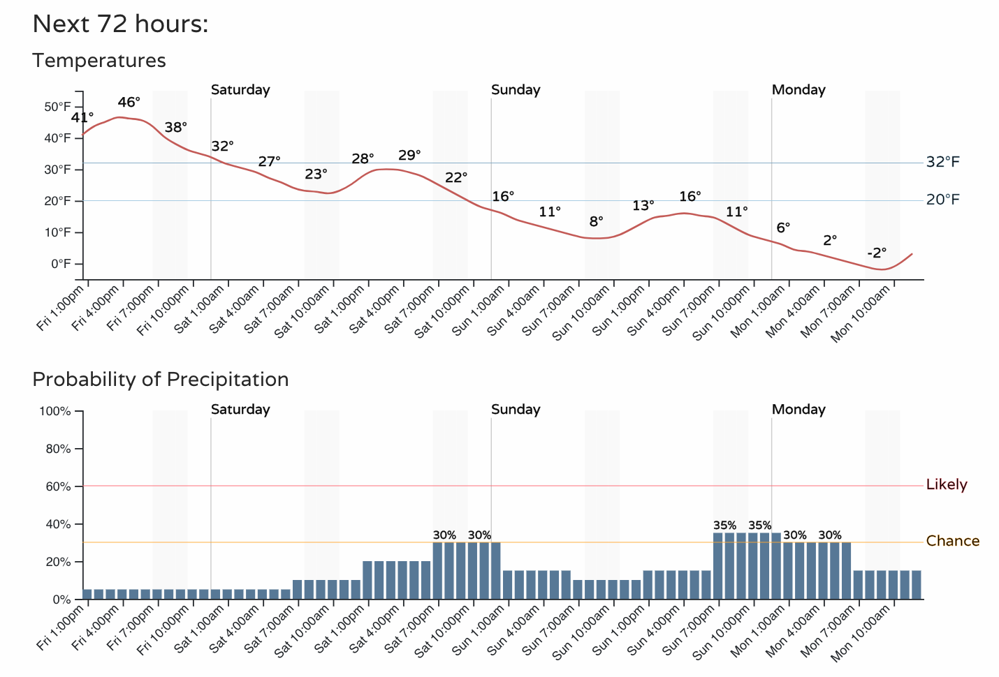
Yes, that's a slide from 46° to -2° in the next 72 hours. Will we be sliding on new snow and ice, too? Let's discuss...
First off, here's an animation which shows rain (greens) and snow (blues). The view is the entire western U.S., and the time is from late Friday through Wednesday.
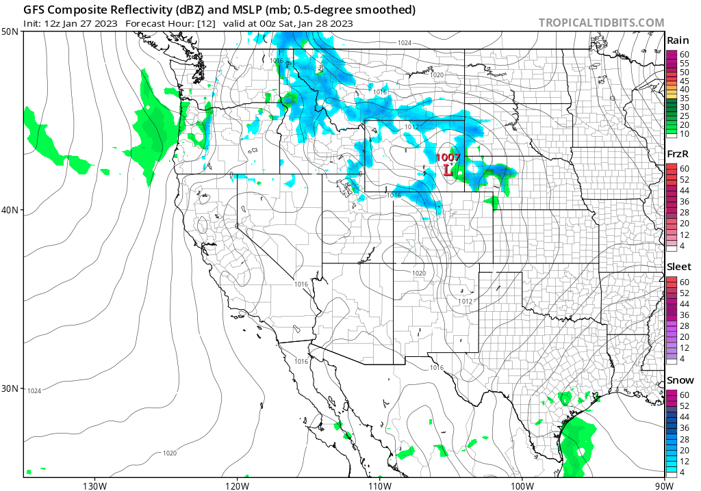
For most of us within that view, there isn't a concentrated weather effort. For Colorado in particular, we have some scattered showers to move through occasionally but lacking a strong focus for anywhere other than our northern mountains. With that, precipitation totals will be scattered.
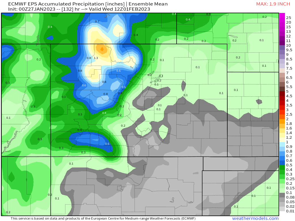
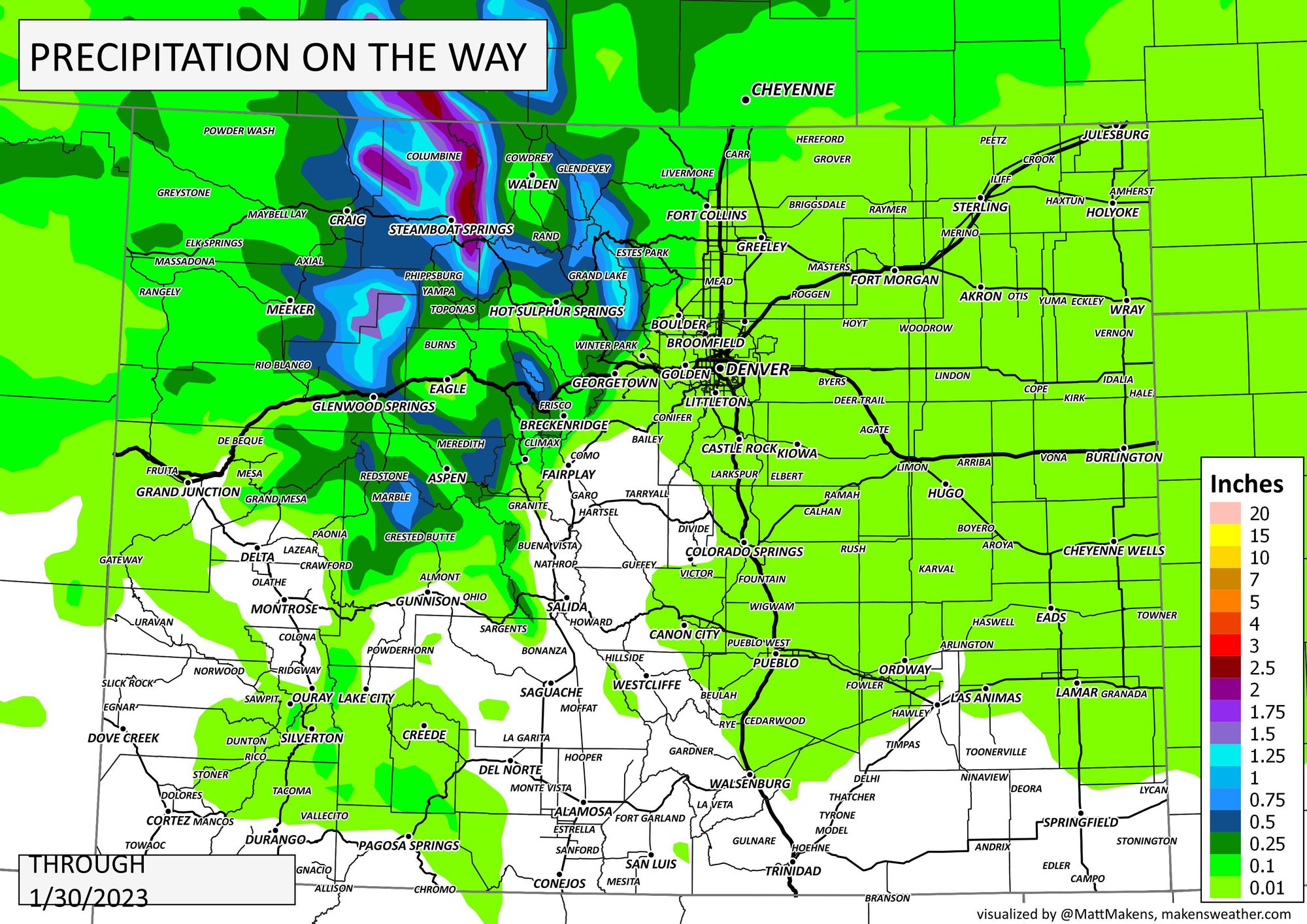
Here's a model image of the estimated precipitation totals, then I'll have a clearer one to follow with city locations and roads. It helps to see the definition of a model's output before I make it "prettier" ;-) In either case, there's about 0.01 to 0.15" of water coming to the Front Range – potentially.
The forecast:
For those of us east of the mountains, there's a little bit of moisture that will be snow chances and a touch of that may include icing from fog.
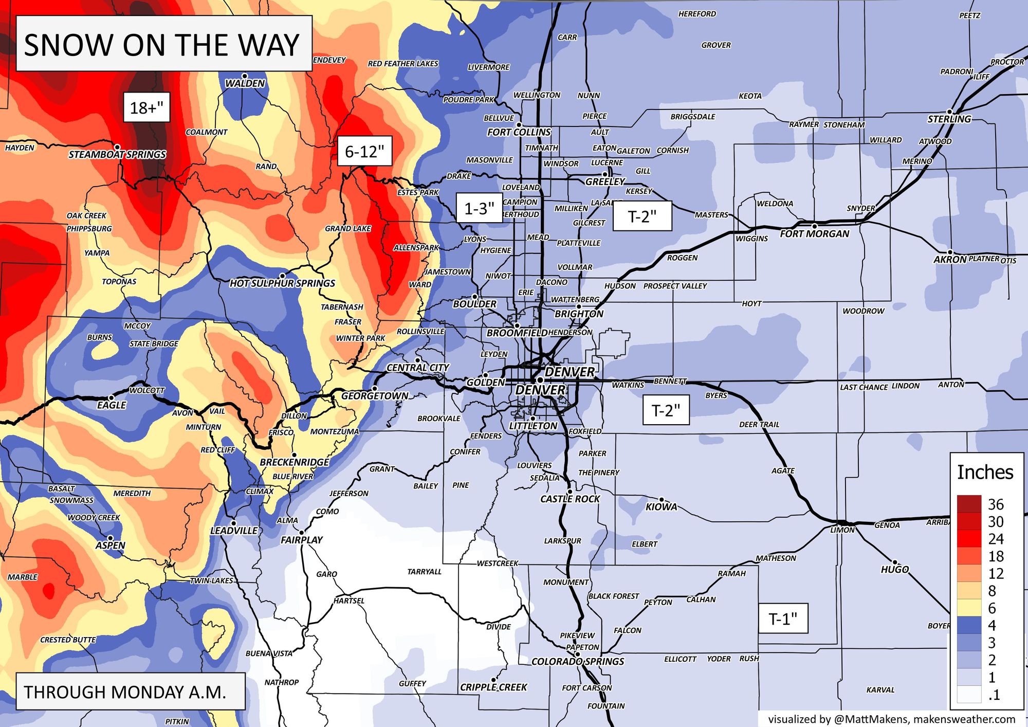
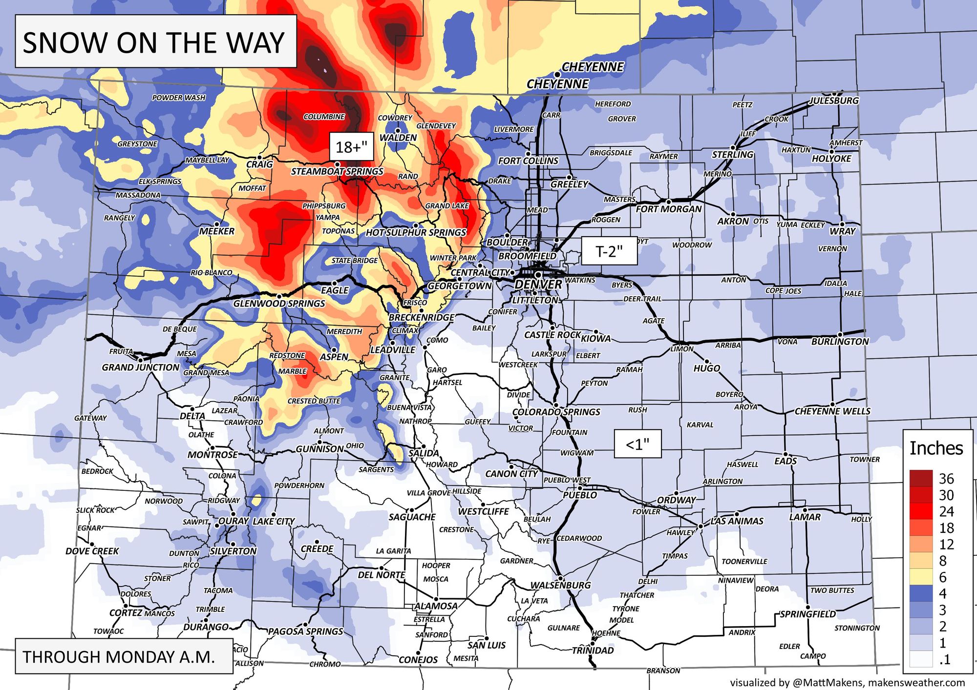
Per snow chances, there'll be two periods of highest chances, late Saturday and then again late Sunday. I'll combine the entire period into one snowfall map. First you'll see the state's view, then the Front Range:

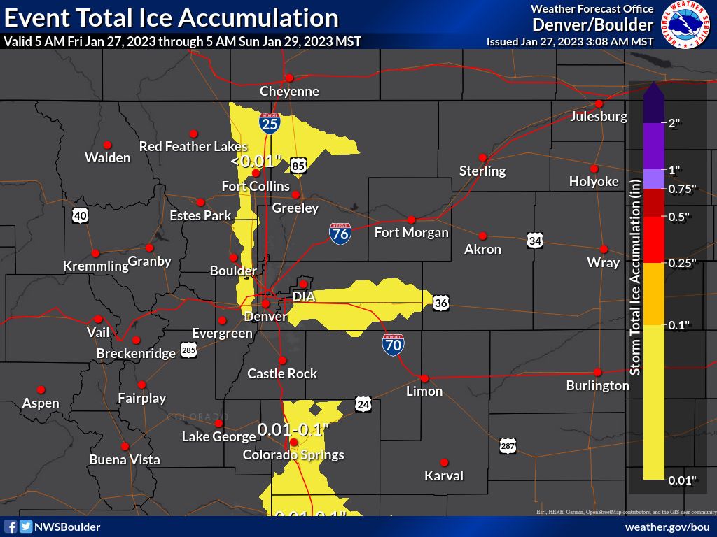
When it comes to icing, we will have an easterly wind kick in. You won't miss it as that's when low clouds and fog will come in from the Plains and setup right against the mountains to trap us for awhile. This will provide a setup for icing in some places. Here's a general idea of where that's more likely, although all of us in the fog stand the chance for ice.
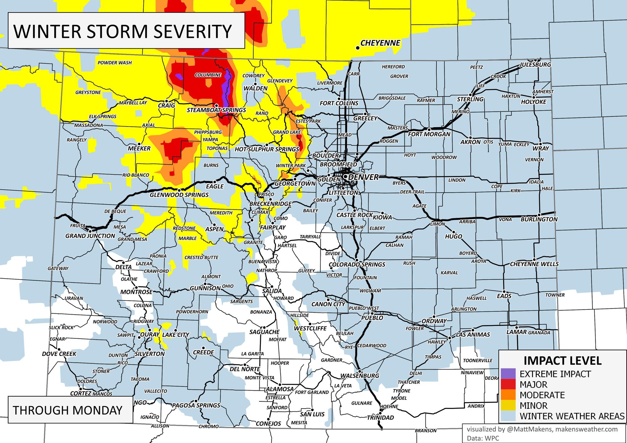
In total, we will have some travel impacts, but due to limited totals – as it appears now – those hazards are also spotty, and remain concentrated in the higher terrain of northern Colorado and into Wyoming:
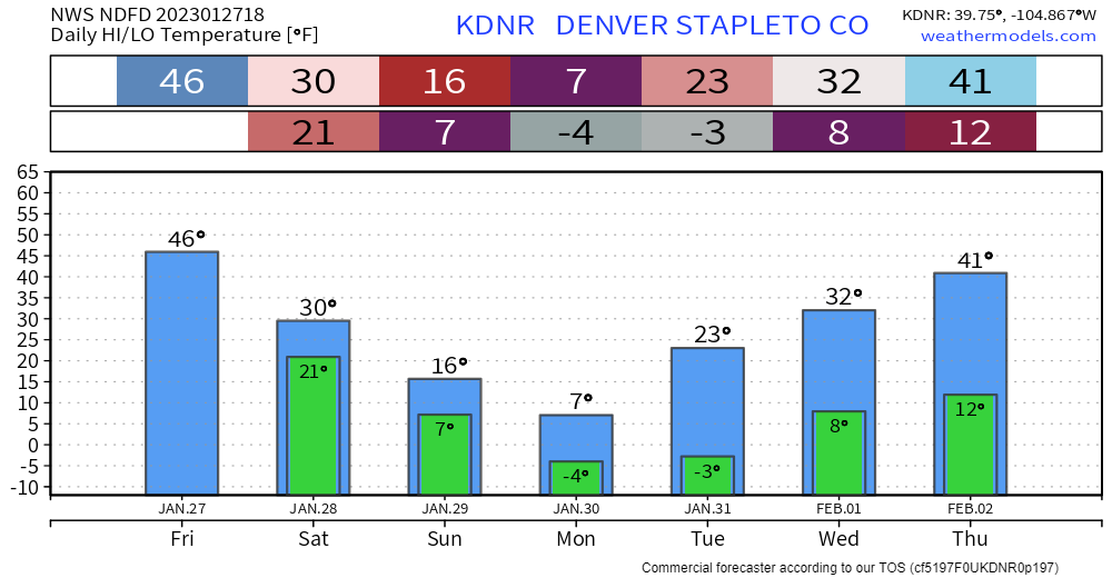
As we go through the weekend, we will be chatting more about the COLD that is on tap early next week. For example, here are the daily highs/lows for Denver.
Don't get left out in that cold, subscribe now for our emails... we shoot you a note when we post a forecast that needs your attention. Click here!