Cold Front Hits Friday, Some Snow for the Weekend

Although spring just started, it's not quite time to turn off the cold front "pipeline" just yet. The winter weather pattern continues and will send another shot of cold air and snow chances at the state Friday. Keep in mind that although the calendar says the season changed, March and April are our snowiest and second snowiest months, respectively.
Although not much energy to work with, a cold front will move through overnight to drop Friday's temperatures some 20 plus degrees from Thursday. The front will arrive early in the day with increased wind and thicker clouds.
The morning drive will be fine Friday, still dry at that point. The snow will develop later in the day over the north-central mountains before developing in areas of the Front Range by late day through Friday overnight into Saturday. Friday evening ski traffic will have some snow to drive through, and potentially some of us in the low country will have some rain or snow for the evening too.
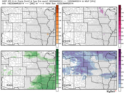
The greater metro area will have the best chance for snow Saturday into Saturday night, tapering off in time for a drier Sunday. A quick additional snow will hit Monday.
This first snow could produce a few areas of accumulation. The north/central mountains will again have the most snow, as they have all winter (see winter recap). The highest slopes could have about a foot of snow this weekend, meanwhile the Front Range will have another 0 to 3 inch chance with a few outliers of 4 or 5 inches in the immediate foothills and on the Palmer Ridge.
Another round of data arrives tonight which will help narrow in where the heaviest snowfall will occur over the weekend. We'll be tracking all the latest, and offer updates as needed as this storm continues to evolve and eventually pushes through the state.