Thursday PM Update: Chance of Storms Returns

As we mentioned earlier this week, the chance for rain and storms is back in the forecast after a brief break for northeast Colorado. Already this afternoon we've seen an increase in cloud cover and a few isolated storms develop across the region. Our best chance for rain will come between now and Saturday, before drier weather returns Sunday, if only for a few days it appears.
These storms will be widely scattered, and precipitation will vary greatly by location over the next three days as is typical this time of year. Temperatures will also cool a bit for Friday with highs back in the 70s for most locations, before warming back into the 80s for the weekend.
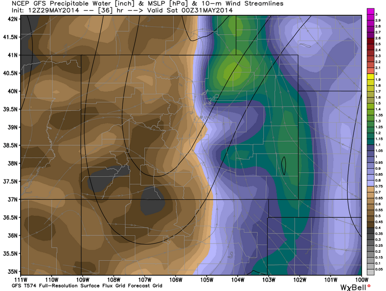
There will be plenty of moisture to work with over the next 72 hours: rain chances will come in waves, this afternoon and tonight, then again Friday and Saturday. Precipitable water (amount of liquid at surface should it all fall as rain in a given location) for Friday is quite healthy across eastern Colorado across all models. The GFS has values in excess of 1 inch for much of the plains.
Tonight and Friday
We'll go with scattered storms for the metro area and eastern plains this evening and overnight into Friday. High resolution models continue to bring a good push of storms off the Front Range this evening, with a possible secondary push overnight tonight. The greatest threat will be periods of heavy rain and gusty winds with any storms that do develop.
The airmass remains unstable over the forecast area Friday, and with that we'll have a good chance for more storms to develop. That said, we're expecting the severe threat to be low Friday, with the greatest risk again being heavy rain and wind.
The flooding potential will need to be watched, depending on exactly how things set up over the next 24 hours. A good number of flood warnings and advisories are already out for north and north central Colorado with the mountain snowpack melting rapidly, so should storms set up over these locations, this will definitely enhance the flood threat. Please stay alert to local media and NWS for latest flood alerts.
Saturday outlook
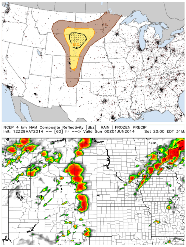
We're watching for the potential of a few stronger storms Saturday, though right now many high resolution models try and keep best development east of Denver. The Storm Prediction Center has issued a slight risk for severe weather Saturday to reflect this. As this is still a ways out, we'll watch carefully for now and update as needed. Here's a look at the SPC severe weather probabilities and NAM simulated radar for Saturday afternoon. Notice the good line of storms just east of the metro area.
Sunday looks to dry out a bit, but some models continue to keep a chance of isolated to widely scattered storms in the forecast across eastern Colorado. We'll keep tabs on things this weekend and pass along updates as needed.