Best Chance of Weekend Snow Comes Saturday Night

Snowfall Forecast
As Matt has explained over the last several days, this weekend's system won't be a big snow producer for eastern Colorado, but some snow will be possible – with the best chance at accumulation now appearing to be tonight into Sunday. You can read more about this system in yesterday's post, but for now here's a quick look at snowfall potential through Sunday.
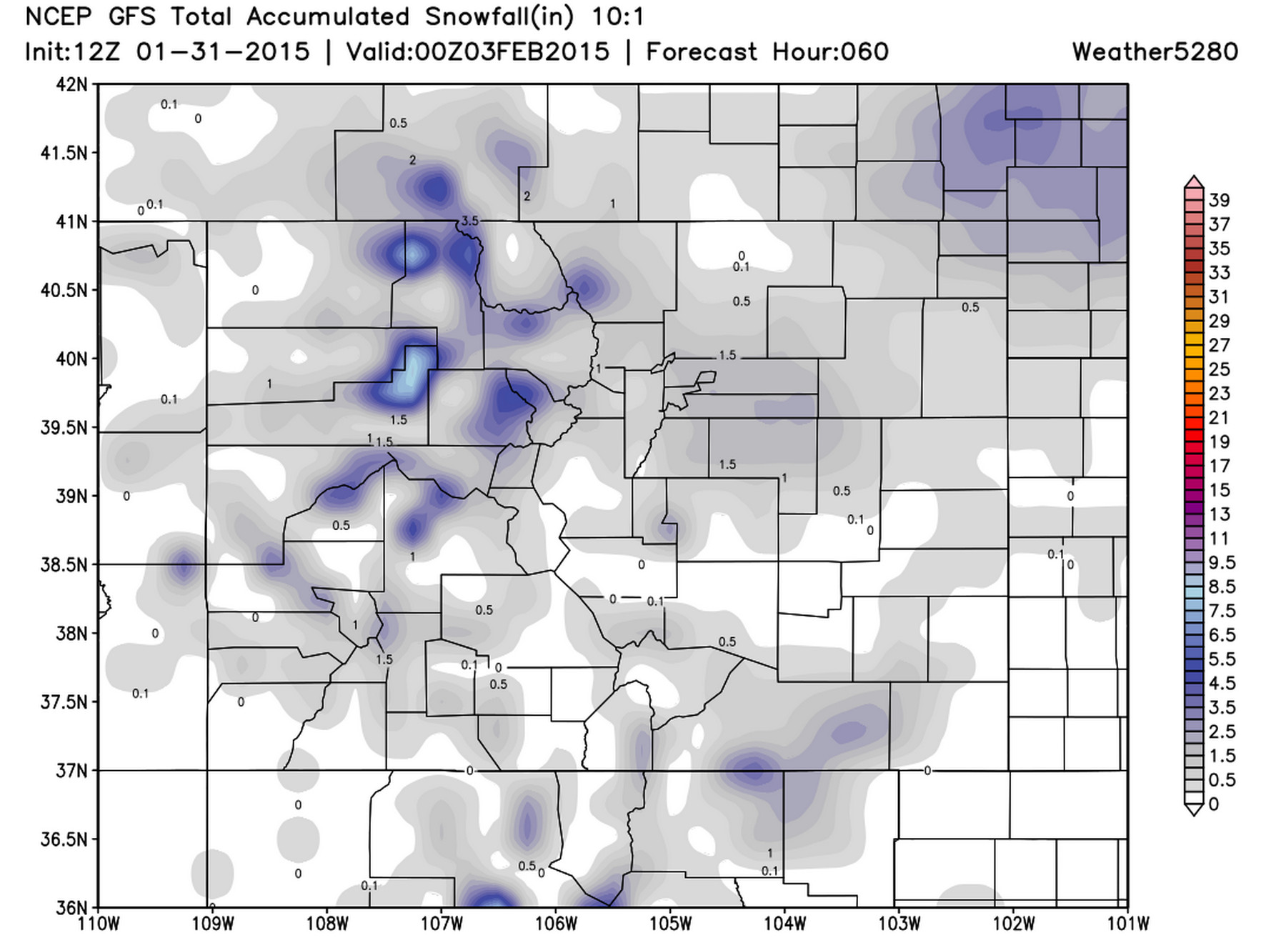
Snowfall across northeast Colorado will generally range from 0 to 2", with a few locations picking up 1 to 3" before drying out Sunday. Generally speaking, Denver's southern and western suburbs will have better potential for snow to accumulate Saturday night. Some folks will see very little or no snowfall at all with this system, while others may see mostly rain – especially earlier in the afternoon/evening Saturday.
Here's a look at the 12z GFS for snowfall across Colorado. Light snowfall totals across the Plains.
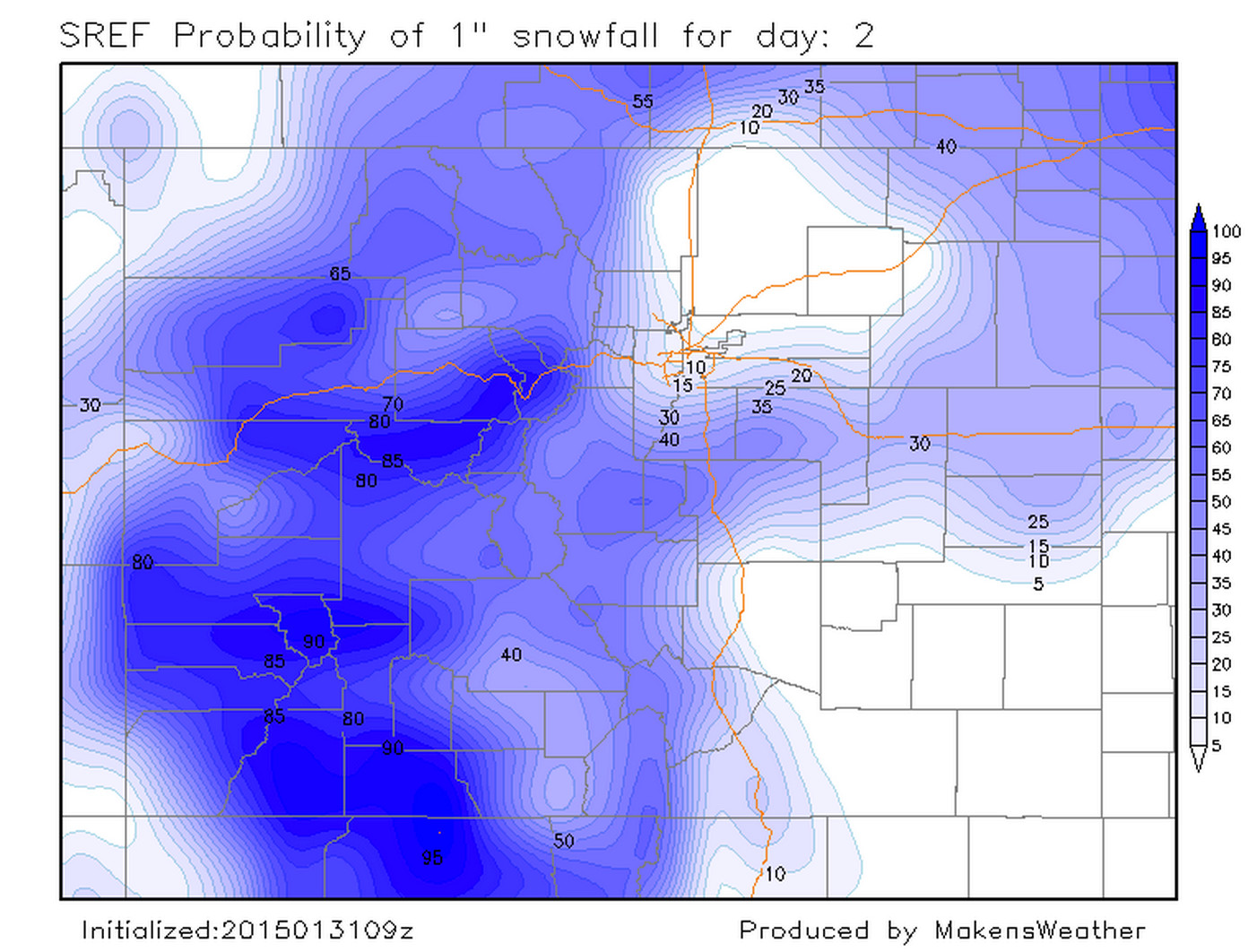
Here's a look at SREF probabilities for 1" of snow, greatest over Palmer Divide, and foothills west of town.
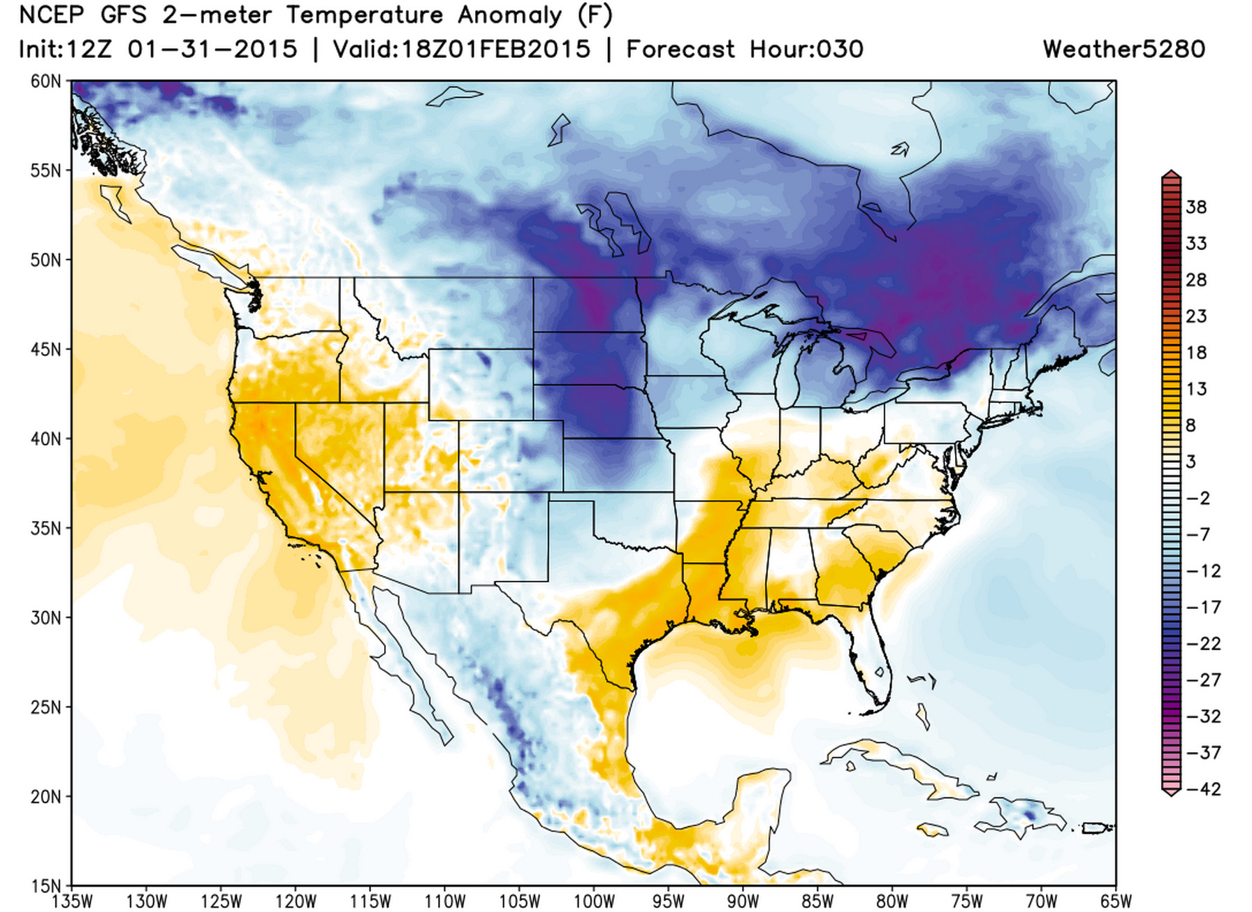
Last thing to keep in mind is very warm air and ground temperatures, meaning any snow that does fall will have trouble sticking, especially over warmer paved surfaces. While precip during the day may fall as a rain/snow mix, most should be snow during the overnight hours.
Behind the passage of a cold front today, Sunday will also be colder. Highs in the 30s are likely across the Plains, with below normal temperatures for much of Colorado.
Midwest Snow
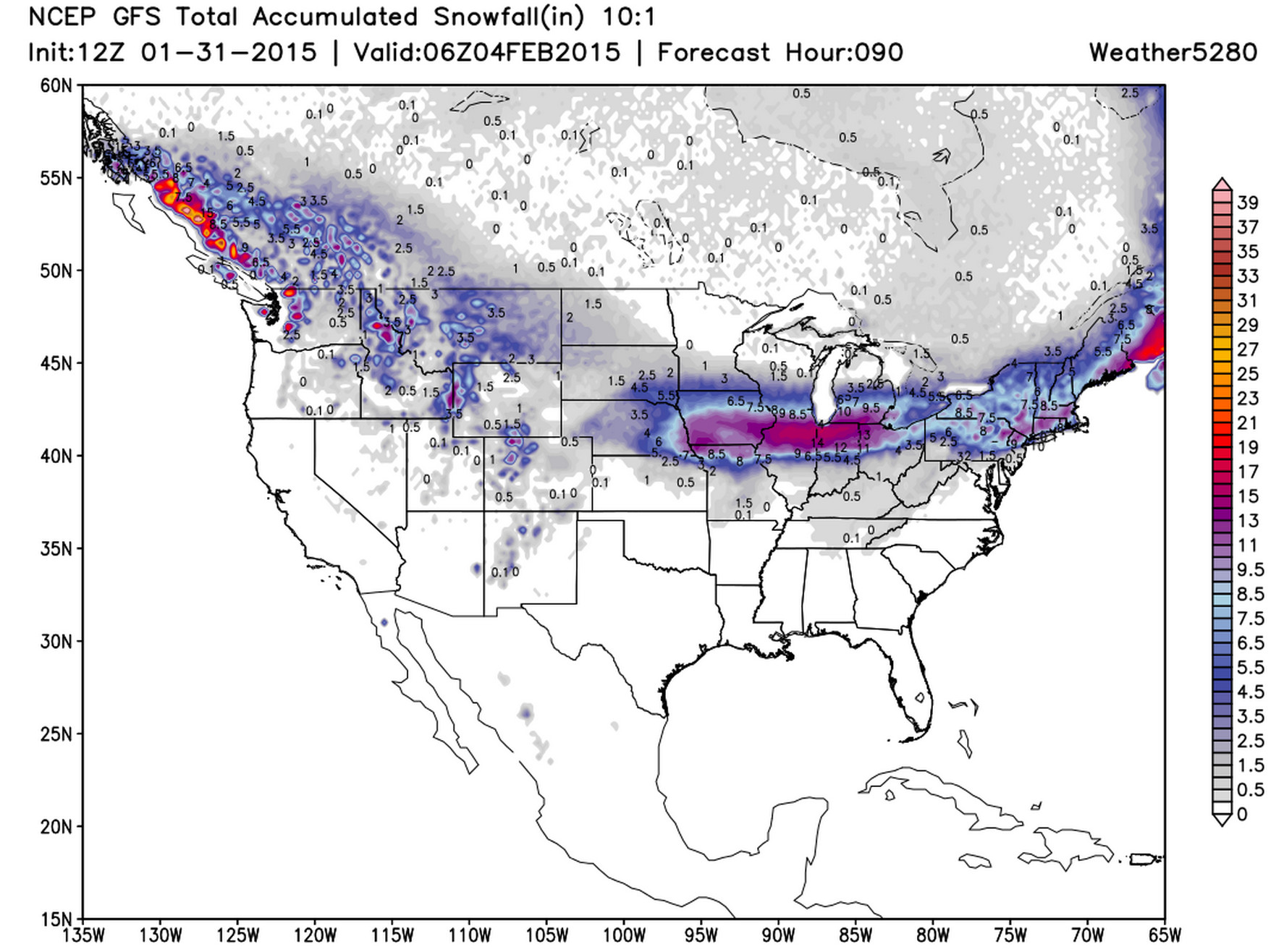
The big snow from our system will fall across the midwest this weekend. Snowfall totals in excess of 12" will be possible across northern Illinois and Indiana before the storm pushes east giving New York, Connecticut, and Massachusetts another moderate snowfall event Sunday into Monday.