The State of the Atmosphere: Sunday, February 1, 2015

Heavy snow blankets portions of metro area
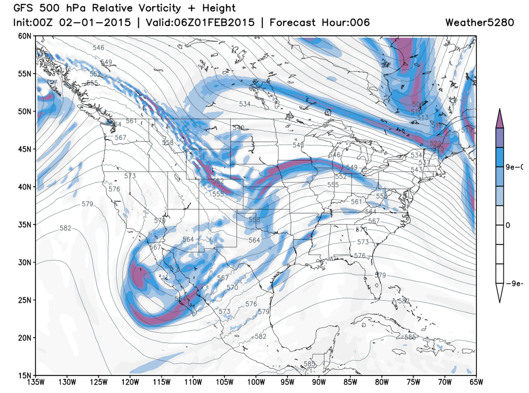
No doubt a huge forecast "boom" for many from northwest of Boulder southeast across the Denver metro area. Somewhere around the middle of the day yesterday it became clear this scenario was on the table as models (particularly the UKMET) started jumping on a swath of heavier snowfall. An overachieving snowfall event is kind of nice for a change of pace.
We talk a lot about jet-induced banded snowfall as the kind of curveball that can throw uncertainty into what is otherwise a fairly straight-forward forecast. Last night, case and point. The combination of this jet max, convection (yes!), just enough upslope, and a good amount of moisture led to one of the bigger snowfall events of the season for some.
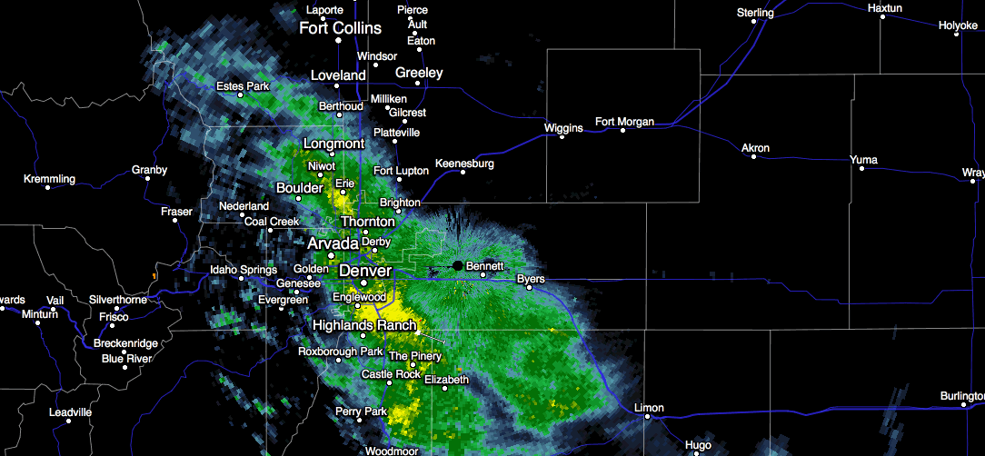
Here's a look at the heavy snow band between 11:45pm and 12:30am last night. Yellows indicate heavy snowfall. Notice the persistence in direction and location.
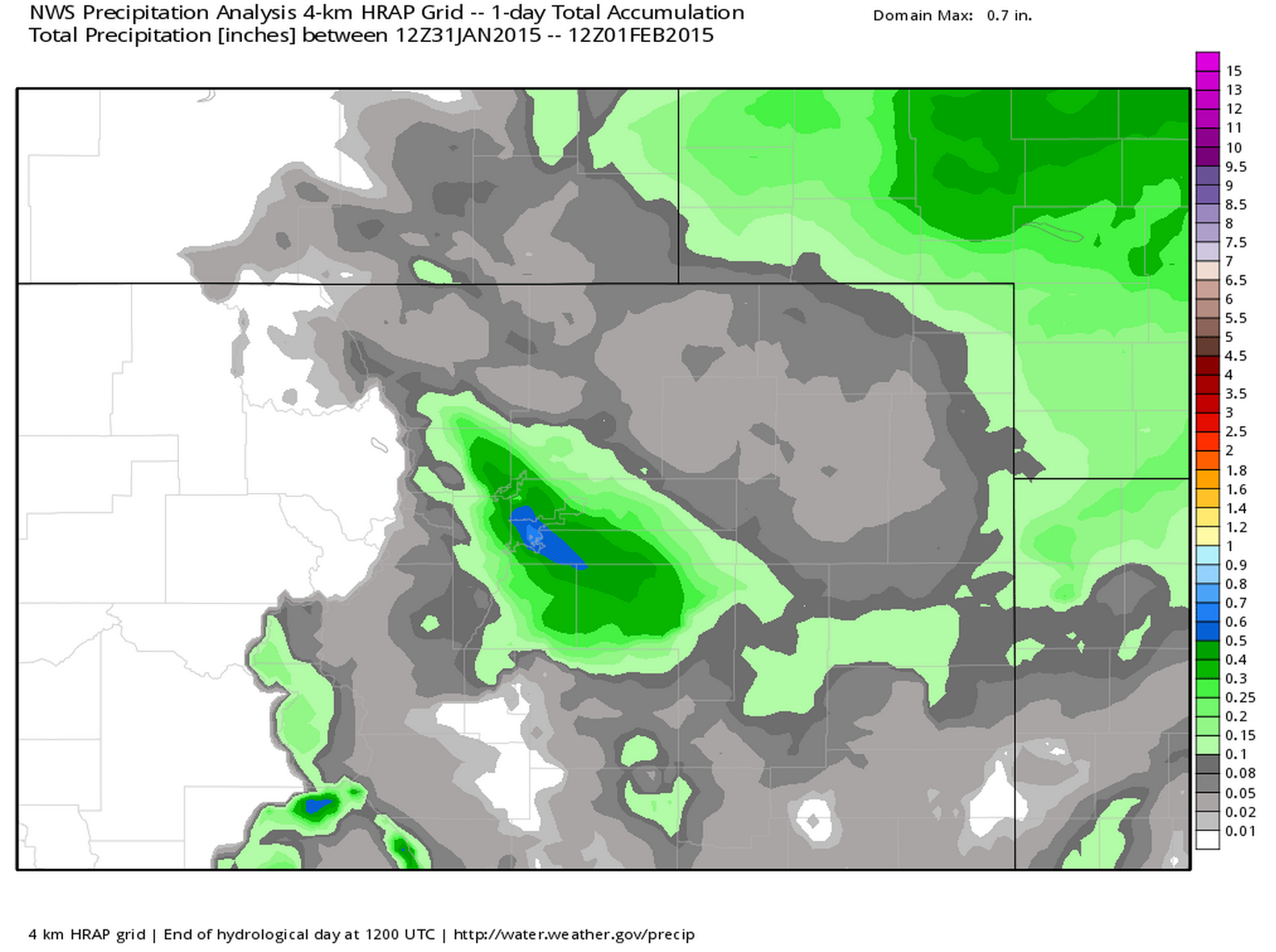
Now take a look at the NWS precipitation analysis for the last 24 hours. This shows very nicely where the heavy snow band setup last night, and while Denver saw a good amount of snow – many others across the forecast area saw <1" of snow -- including Fort Collins and Greeley.
Snowfall Reports via NWS Boulder
- 9.0" 5mi E Boulder
- 7.5" 11mi SE Estes Park
- 7.4" Broomfield
- 6.6" Northglenn
- 6.5" Centennial
- 6.5" 3mi SE Denver
- 5.2" Central Denver (Weather5280)
- 4.8" 2mi SW Boulder
- 4.3" Thornton
- 3.0" 7mi W Arvada
- 2.3" 3 SW Longmont
- 2.9" 2 E Castle Rock
- 0.2" 4mi SW Fort Collins
Have a snowfall total of your own? Add to comments below!
The week ahead
Things calm down a bit for eastern Colorado as we head into the new week. A strong northwest flow will dominate our weather through midweek, which means good mountain snow for the northern and central mountains. After a chilly Sunday we'll see temperatures climb back into the 50s Monday in Denver to near 60° Tuesday. This, unfortunately, also means the return of the wind for Front Range communities.
Wednesday will be our next shot of snow across northeast Colorado as our next cold front pushes into the state. The tendency here by the models has been to keep the best chance for snow up north across the Colorado/Wyoming border, though at times some models (particularly the GFS) has sagged better lift farther south – giving Denver a much better chance for snow. Despite not a huge amount of model support, this has been my storm to watch over the last week (unfortunately not last night's!), so we'll see how things come together over the next few days.
Another 'heat wave' on the horizon?
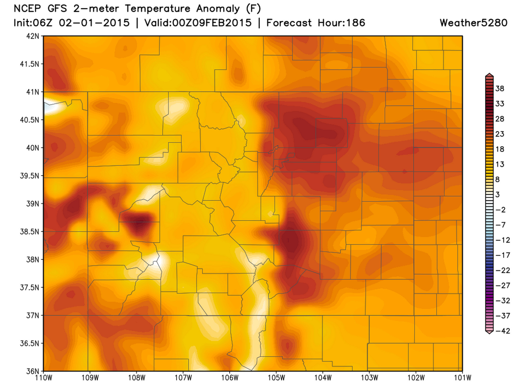
Beyond Wednesday there's pretty good consensus that we warm things up across the west, and really much of the country heading into next weekend. The unbeatable western ridge is forecast to strengthen as we head into the weekend with highs climbing back into the 60s and possibly 70s for eastern Colorado by the end of the period.
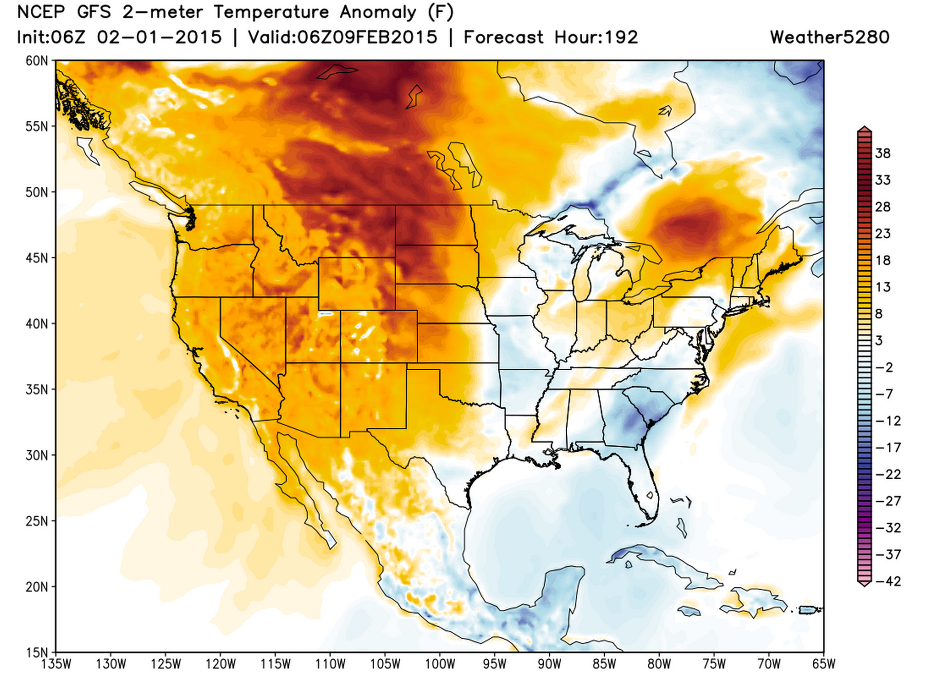
If correct, the GFS indicates Denver could see temperatures upwards of 30 degrees above normal by next Sunday.
Whew. A little bit of everything in this week's State of the Atmosphere. Happy February!
Reminder: Weather5280 Meet Up February 26