Snow Likely Wednesday Before Big Warm-Up

The next round of snow for northeast and north-central Colorado is set to get underway this evening and extend through much of the day Wednesday. Denver's best chance to see some snow will come from early Wednesday morning into early afternoon.
A good mountain snow
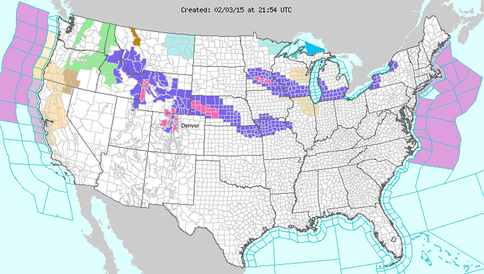
The northern mountains of Colorado will be the big snow and wind winners with this system, with 8 - 14" forecast for the northern Front Range mountains (pink) and 10 - 18" further west across the Elkhead mountains and Flattops. Winter Storm Warnings and Advisories go into effect at 6pm this evening, and extend through 6pm Wednesday.
Eastern Colorado
The forecast is a bit trickier across eastern Colorado. It appears as though the accumulating snowfall threat will be greatest north of I-70 with this system. Conditions should improve heading south on I-25 out of Denver, with little to no snow forecast south of the Palmer Divide.
For Denver we'll broad-brush 1 to 3" of snow at this time and adjust if needed. Snowfall chances and totals will increase as one heads north towards the Colorado/Wyoming state line, with the heaviest snow east of the Rockies expected to remain north into Wyoming and Nebraska. As for Denver, those northwest of town stand the best chance at seeing the most snow out of this system.
Like with our Saturday storm the wild card will be a heavier band of snowfall messing with forecast totals. The threat appears less likely than with our last system (at least for Denver) as the best jet dynamic should stay north of the metro area. Should things shift a bit further south than currently forecast, Denver will see higher-end snowfall, further north would mean more of a coating to 1" snowfall.
Temperatures
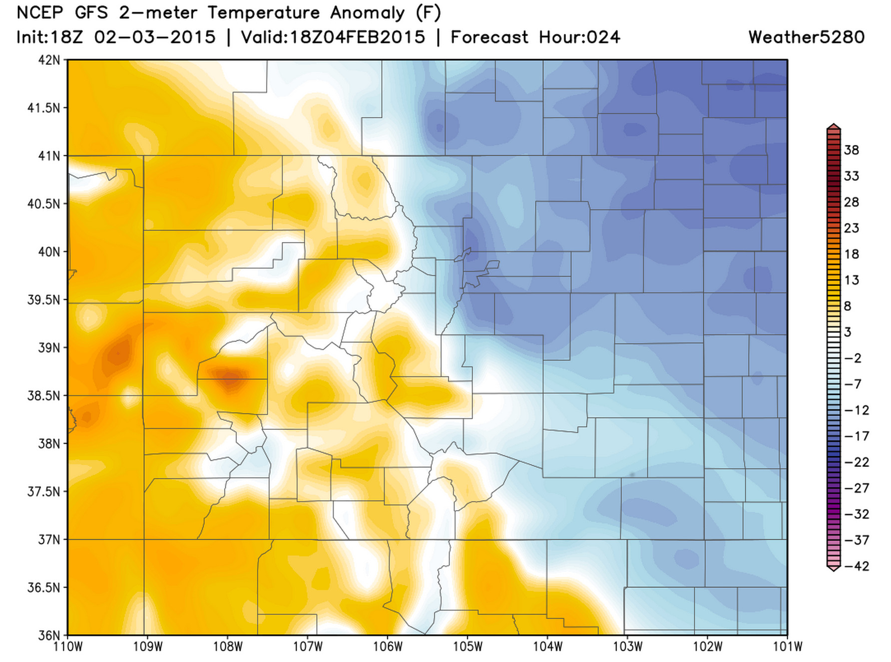
Temperatures Wednesday will be much colder too with the passage of the cold front tonight. Highs in the 60s today, with lower 30s and falling temperatures on the way for Wednesday.
Here's a look at 2-meter temperature anomalies by 18z Wednesday, much colder across northeast CO.
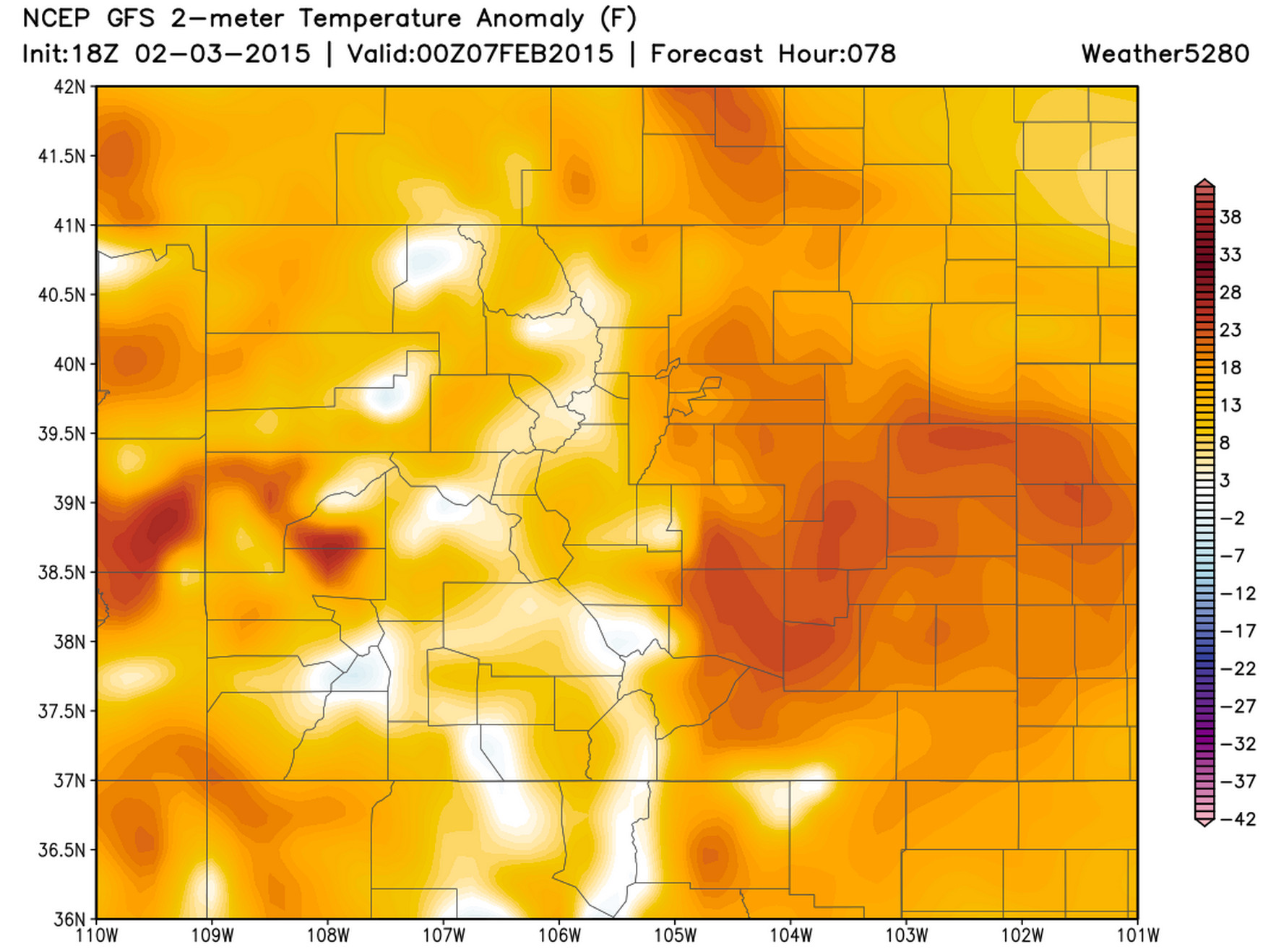
These cold temperatures will be very short-lived, however. We're still tracking a big warm-up which means temperatures back into the 60s to end the week, and possibly warmer by the weekend! Here's how things will look by Friday, with temperatures back well above normal statewide.