Tracking Late Weekend and Early Week System

I had a college professor, an old Air Force weather officer, who was probably the most sensible forecaster I have ever met. He made it quite clear that when it comes to snow forecasts, anyone that gives their accumulation forecast more than a couple days in advance must love the taste of crow. In my experience, I completely agree with him.
Let's talk about what we can actually predict this far in advance. The system is on track to move through the region Sunday through roughly Tuesday. That is the timeline of largest impact on Colorado and Denver.
This system is looking very similar to most we've seen this season. Its strength and track dictated by the persistent U.S. winter pattern – a ridge over the west and trough over the east. Colorado has been caught, most of the winter, in the dynamically more stable area of this pattern. This system will again be a bigger impact to those just east of us.
It's composed of an upper level trough (subject to much change the past few days) and a surface cold front. Since the strongest storm depiction from Wednesday's model runs, the global models GFS, ECM, and GEM have weakened the projected trough. They have also weakened the cold air advection to impact us. The U.S. wave pattern is simply too entrenched still to change much.
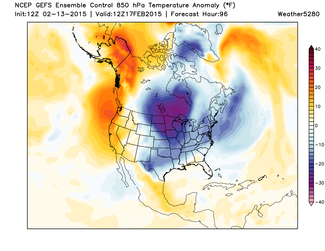
GEFS ensemble control now keeps greatest temperature anomalies east of Colorado with this system:
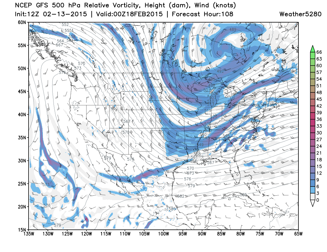
By Tuesday, greatest troughing is well east of Colorado:
There's nothing in the teleconnections to suggest that the current model thinking isn't more accurate than what it was Wednesday. Without a significant trough to move overhead, we need our snow to be produced by something else – a cold front produced upsloper.
This is no stranger to us this season. Most all of our snow in the metro areas (exception Colorado Springs with more southern upslopers) this season has come from Canadian cold fronts that drop down from Cheyenne and Sterling, giving a few hours of upslope to the Front Range hence our periodic snows. Denver's greatest snowfall remains below 6".
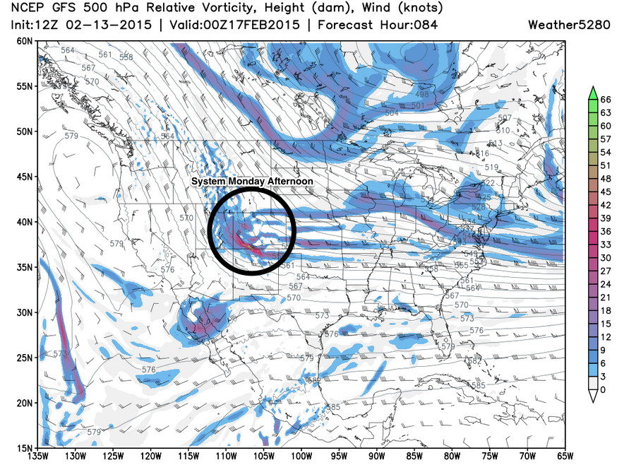
This system appears to be a Canadian cold front upsloper arriving Sunday and sticking around through Monday. The modest upper level trough that's there will keep the snow chance somewhat prolonged, and should be deep enough to support the surface front in keeping us colder than average for a couple of days. The coldest air, it appears, will stay east of Colorado once more with this system, where troughing will be deeper. The cold front, not the trough, remains the main focus of the impact which isn't necessarily a bad thing for snow lovers.

Remember that fantastic snow band event a few weekends ago when the city had 9" on one side and nothing on the other? That was a frontal upsloper with a twist. That had the added benefit of a screaming jet stream moving overhead at the exact time the front arrived. The combo was a great snow for many neighborhoods. I'm not ruling that out for this system just yet, so keep it on your roster.
Let's not consider the jet induced snow banding for the moment. Statistically speaking, NAM and GFS bring us another typical snowfall for the season. The GFS probability of reaching 0.25" of precipitation (2.5 to 5" of snow) remains 10-20% in its ensemble. SREF output is nearly the same this morning, although I prefer the SREF within 60 hours as I've seen great fluctuations this season in its output beyond 60 hours. This being out 72 to 81 hours is a bit early for me to add a lot of consideration to SREF.
Let's consider the jet induced snow banding now. If we can somehow move a H700/H500 jet streak closer to the Front Range, we may be in better shape for a heavier snow. Although looking through the upper level wind patterns, this is also a low probability based on current modeling. However, I like how the GFS is developing a jet maxima over Colorado on Sunday into Monday at H500. And my fellow 5280-mates think I'm the pessimist...ha! (please detect my sarcasm).
A long ways to go here still, and models are almost certain to fluctuate as we head into the weekend. Medium range models continue to look more interesting than they have in a long time (which isn't saying much) heading into the end of February. We'll see.
We'll keep a close eye on things and pass along updates as necessary. Stay ahead of the changing weather and subscribe to weather5280!