Denver Forecast: Chance of Rain to End The Week

We'll cool things down a bit today and Friday with a chance for some rain and rain showers up and down the I-25 urban corridor. The best chance for rain will be overnight Thursday into Friday, with temperatures 10 degrees or so cooler Friday in Denver.
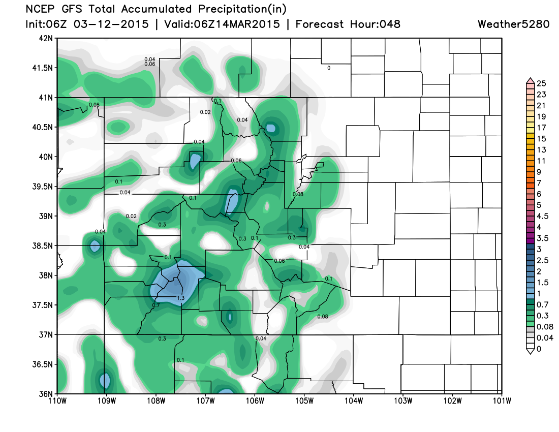
Here's a look a the 48 hour accumulated precipitation forecast from the GFS. Rain coverage will be spotty, with some high-res models showing pockets of greater rainfall than reflected here in the GFS. Generally speaking, Denver's chance for rain will be about 50% Thursday night, and 30% on Friday, with greater chances closer to and in the Front Range foothills.
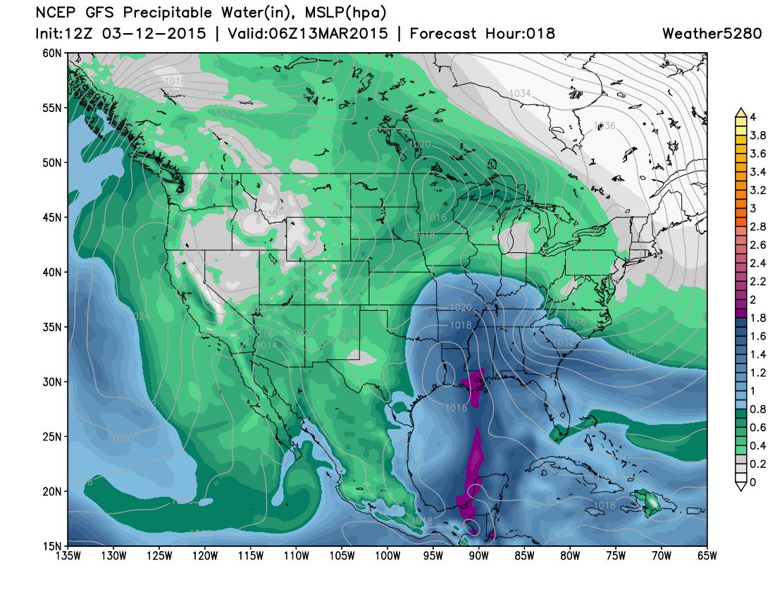
There will be some good moisture with this system with PWAT values >0.5" across northeast Colorado Thursday night.
Several inches of snow will be possible for the central and southern mountains with this storm as well, but warm temperatures mean most precip should fall in the form of rain at lower elevations.
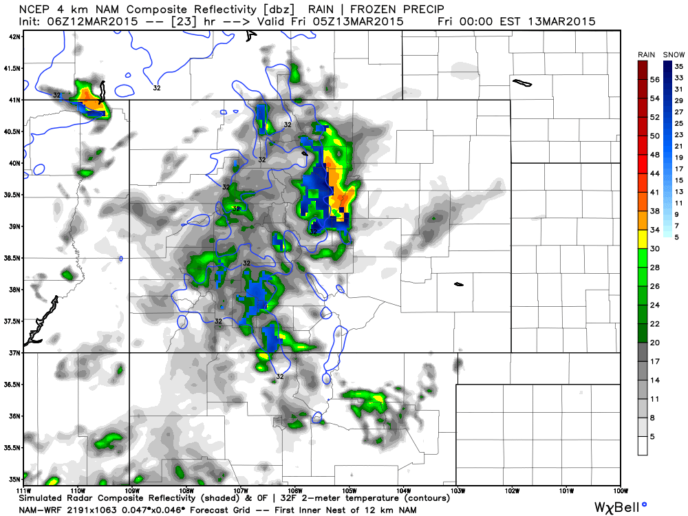
Here's a look at the 4km NAM simulated radar for 10pm tonight, it has best precip accumulation along the Front Range foothills through Friday. Notice some mixing of rain/and snow at higher elevations west of Denver as well. While most precip will be light, some of the high-res models indicate some convective activity Thursday evening, which could lead to locally heavier showers.
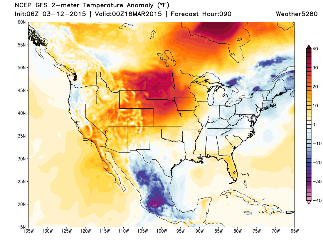
The 'cool down' will be short-lived as we'll be back in the 60s by Saturday, with highs likely breaking the 70 degree mark on Sunday. Forecast temperature anomalies Sunday afternoon will be 20 to 35 degrees above normal for the high plains, including eastern Colorado.