Chance of Storms by Thursday Evening; A Look at the Weekend

In this week's State of the Atmosphere we discussed the return of the storm threat by the end of the week, with the potential of something more significant in the medium range. Here's a quick update on both.
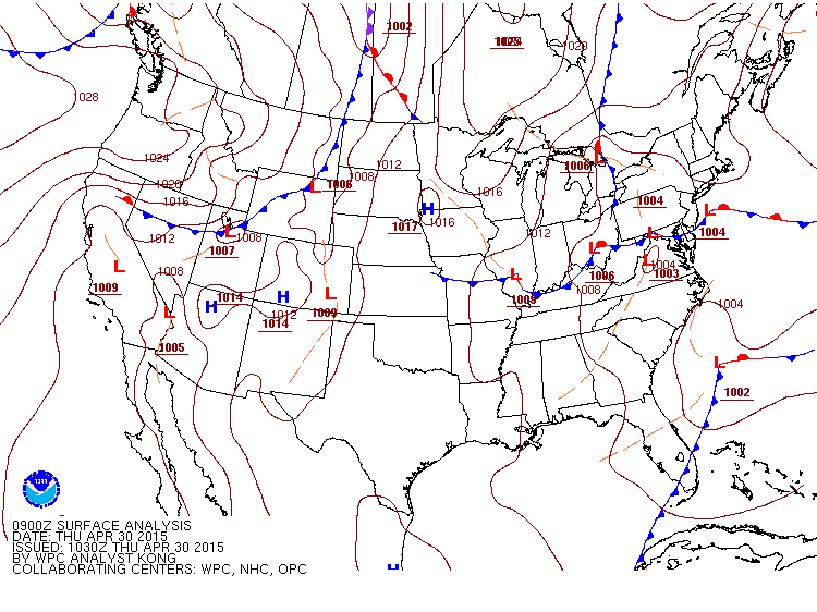
Temperatures today will be quite warm across eastern Colorado before a cold front moves in later this afternoon and evening . With the passage of the Front we expect some convective activity to develop across the Plains, which will mean a chance for storms late in the day and overnight Thursday. Here's where the cold front was positioned Thursday morning, northwest of Colorado:
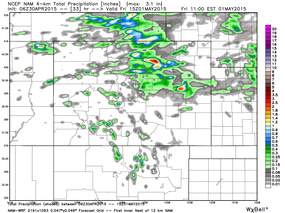
The severe threat with this storms will generally be low, but some hail will be possible. The greatest impacts with these storms will be localized heavy rain. Here's a look at the latest 4km NAM precipitation forecast through 9am Friday. Note the localized areas of heavier rainfall, while the locations may shift around a bit, it gives a general idea of what we're watching for tonight.
Friday and the weekend
The chance for storms will return again Friday afternoon. Friday will also be about 10 degrees cooler than today behind the passage of the cold front. Again the severe threat looks low at this time, but isolated storms may become strong – producing wind, rain and hail.
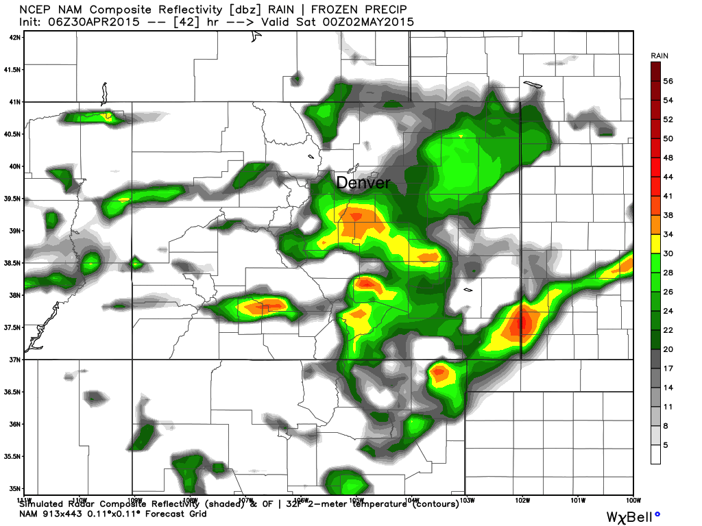
Latest modeling puts the greatest chance for storms Friday across east-central and southeast Colorado, with about a 40% chance of storms for Denver. Here's a look at the NAM simulated radar for Friday evening, showing a few strong storms across the state.
We'll keep a chance for storms going this weekend. For the time being, Saturday's chances look much lower than today and Friday, with a bit better chances returning for Sunday. Temperatures will also warm as we head into the weekend with highs forecast in the mid 70s both days for Denver.
Next week
Next week may feature more than one good chance for widespread precipitation across the state. For now we'll focus on the Monday - Wednesday timeframe, while keeping an eye on the following weekend.
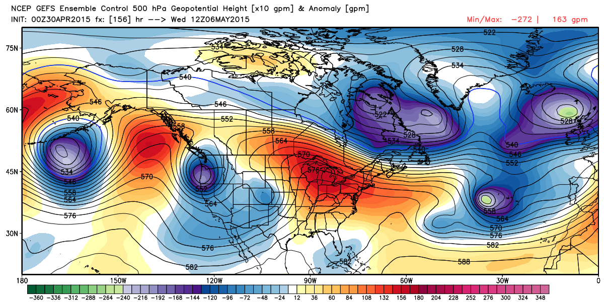
The EURO/GFS/Canadian all have an upper level feature over the Baja Sunday and Monday, and eventually track it northeast over Colorado through Wednesday. An interesting setup the models are hinting at with a blocking high to the east. Here's where the GEFS has the low Monday evening (deeper blues over the Gulf of California):
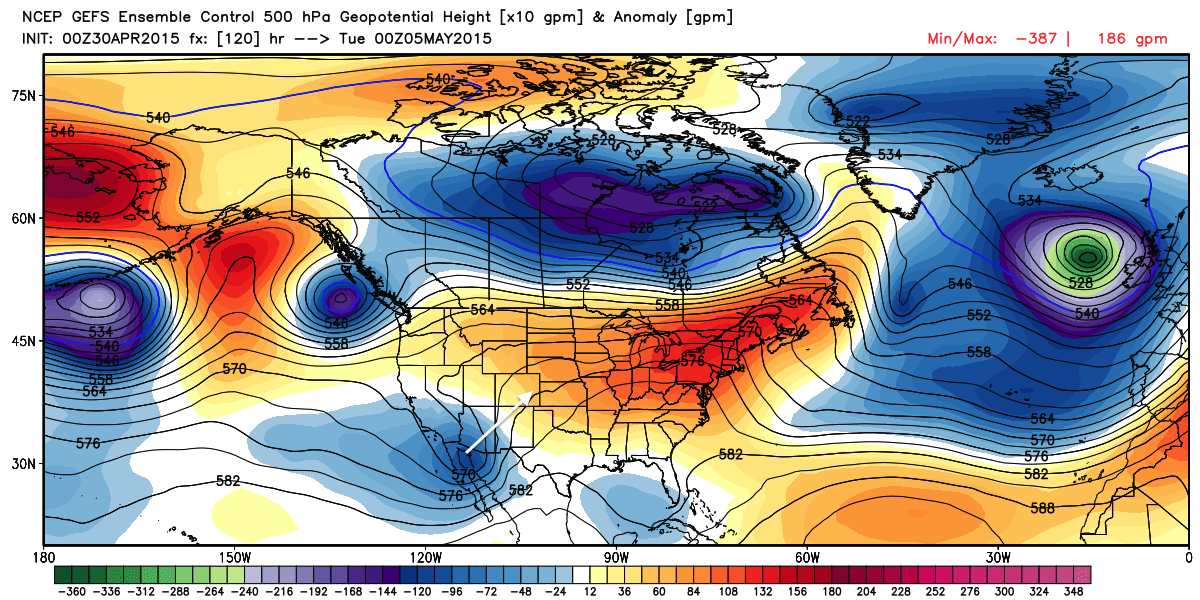
And by Wednesday you can see it's progressed northeast and is positioned over eastern Colorado.
Now, plenty of time to see how things are going to set up, but given decent model agreement we'll continue to increase the chance for precip across the state during the Mon-Wed timeframe. Should things align as they currently look like they may, expect the severe weather threat to increase during this time, and more beneficial moisture for the state.
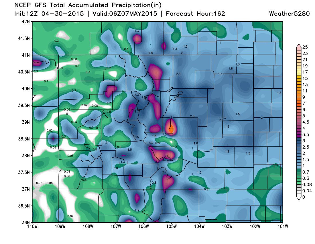
A look at the latest GFS shows just how much moisture models are trying to produce between now and next Wednesday – anywhere from 0.5 to 3" across the Plains. While pockets of this come tonight and over the weekend, much of this QPF is forecast for the Mon-Wed period.
A lot to track! Subscribe to Weather5280 to keep up to date on all the latest.