The State of the Atmosphere: Sunday, May 31, 2015

Wet and cool May comes to an end
The month has ended much quieter than how it will go down on paper. Historic Front Range rain, and cold will go into the books for May.
It'll surprise you to read that officially Denver will not be in the top 20 for wettest Mays. The month ends with 3.74" officially at DIA. Here's the list for the top 10 wettest Mays in Denver:
- 8.57 1876
- 7.31 1957
- 6.12 1969
- 5.06 1973
- 4.95 1935
- 4.88 1998
- 4.88 1898
- 4.79 2011
- 4.77 1967
- 4.67 1995
The 20th spot belongs to May, 1989 when 3.83" of precipitation was recorded. This May, DIA sat in a relative "bubble" of lesser rain than its immediate surroundings.
This interactive map can show you how much fell in your neighborhood.
Further, the month will end historically cool. This was Denver's 12th coolest May ending 4 degrees cooler than the average at a temperature of 53, tied with three other years: 1950, 1898, and 1882. Here are the top 10 coldest Mays on record:
- 48.7 1917
- 50.0 1995
- 50.1 1935
- 50.3 1907
- 51.4 1983
- 51.5 1992
- 52.0 1946
- 52.6 1967
- 52.7 1924
- 52.8 1943
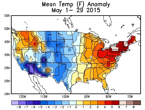
The month certainly didn't end cool and rainy. It ended with sunshine and heat. DIA hit 85 today, making it the warmest day of the year so far and warmest day since October 15th. Just a few storms developed, as they do this time of year.
Warm week ahead
Today's weather really makes it a good example for much of the week ahead. 80s and isolated/scattered storms are expected daily.
This will be the case until late week and the weekend, when a weak trough will approach from the west. Yes, we've described many such troughs early in May. Those that brought us all that rainfall, and cooler temperatures. However, this one is weak and will bring unremarkable changes.
The GFS ensembles indicate a trough not much deeper than the average 500mb height for the next two weeks. And, it is the only trough reflected for the next two weeks.
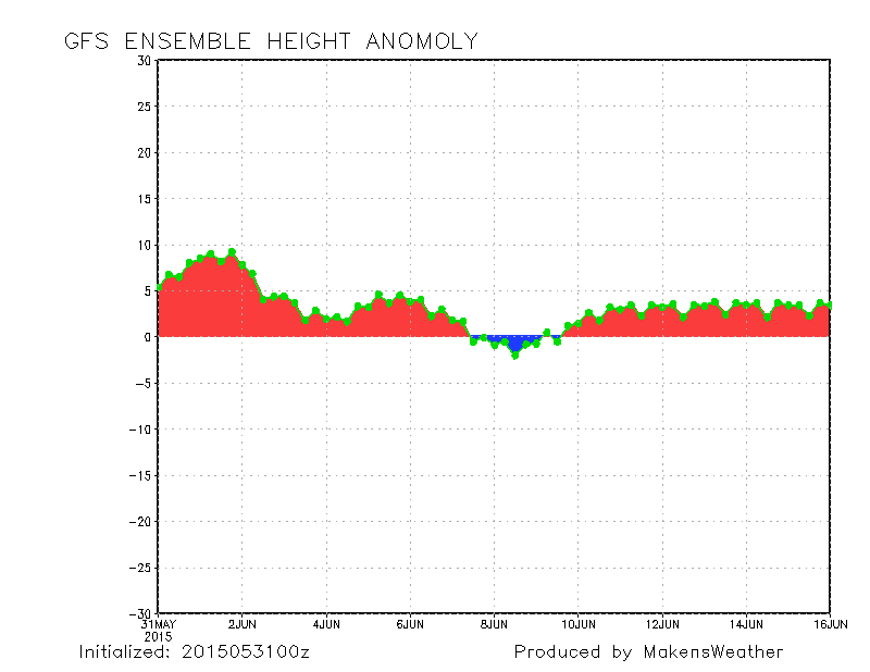
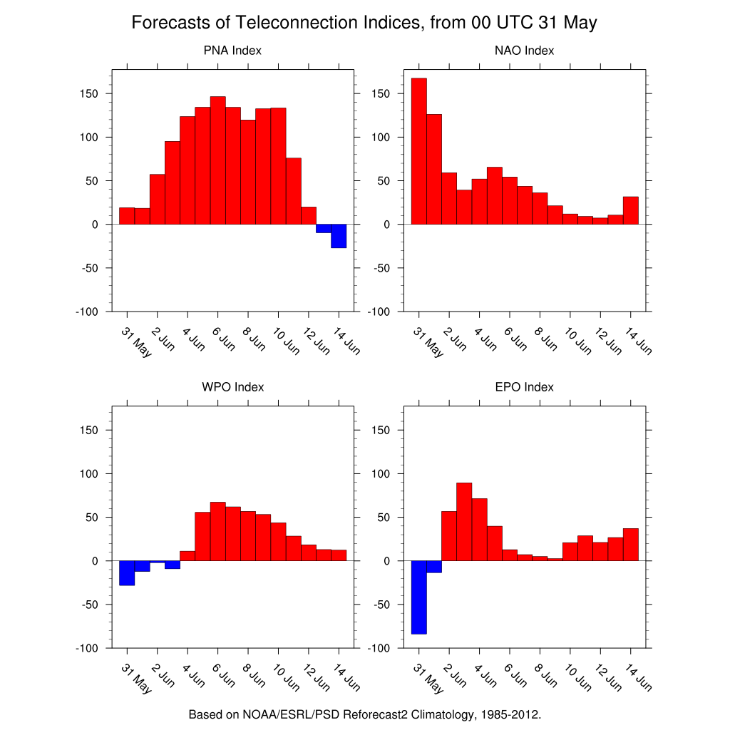
The weakness of the trough is projected in GFS, GEM, and ECM. Further, that weakness is fully supported by the teleconnections. The PNA remains in a warm phase, and the EPO/WPO remain in warm phases. Those three factors alone give confidence in a weak trough.
With that trough, we expect a slight dip in temperatures until it passes early next week. That slight cool-down as daily storm chances ride a little bump higher around the weekend time frame.
The biggest impact of that system will likely be for the eastern plains. A higher number of thunderstorms, and stronger ones, for that area will mean a greater chance for the most rain statewide.
There may be day-to-day severe storm chances, too. If a day poses a threat, we will let you know about it here on the site. Certainly, however, with highs into the 80s any storm could pose a damage threat from either hail or wind. Plus, we are entering the peak of tornado season. For now the SPC has eastern Colorado under the Marginal risk for severe storms over the next two days, with potentially greater risk across northeast Colorado Wednesday.
Meet up Thursday, hope to see you there!