The State of the Atmosphere: Sunday, June 14, 2015

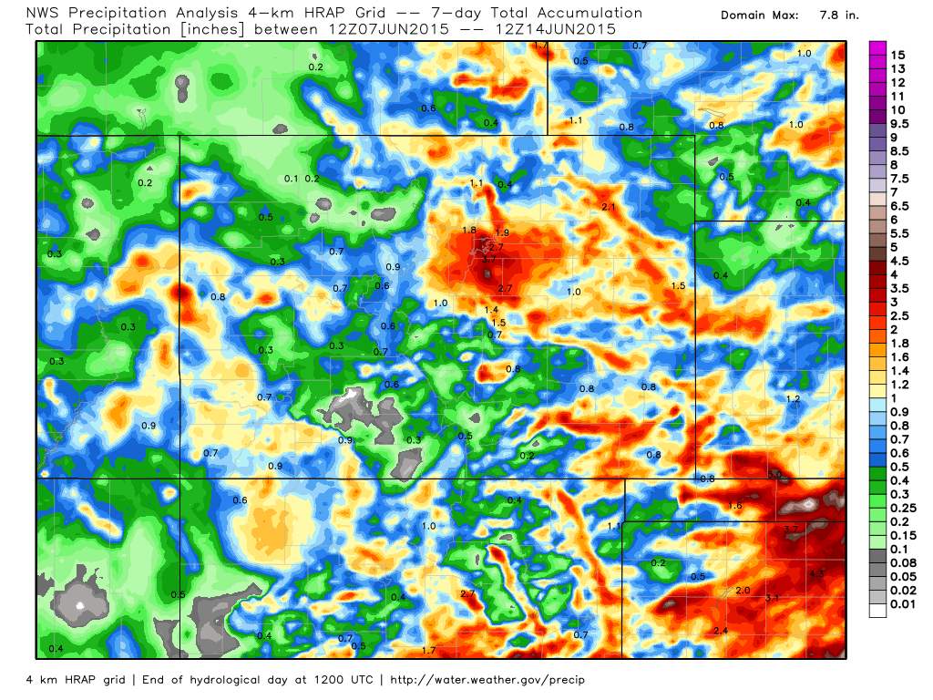
What a beautiful Sunday it's been coming off another week of very wet, and very active weather across the state. Seven day precipitation totals across the state show the greatest precipitation bullseye again over east-central Colorado, though portions of western Colorado and southeast Colorado also did very well:
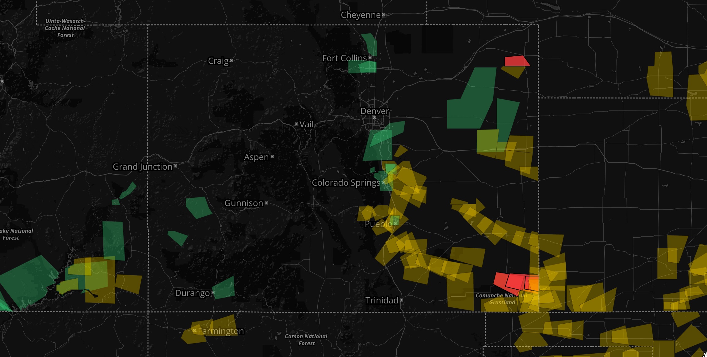
The heaviest precipitation for the Denver area came from Thursday into Friday the past week. The two day total at the Weather5280 station in downtown Denver was an impressive 2.80" of rain. The map below shows all the Flash Flood Warnings (green), Severe Thunderstorm Warnings (yellow), and Tornado Warnings (red) issued between 00z Thursday and Friday night.
Over the weekend we dried out a bit, outside of a good line of storms Yesterday which dropped several inches of precipitation in a few locations northeast of Denver. Today we topped out at 86° downtown, and so far the only storm development has been across extreme northeast Colorado.
The week ahead
The week ahead looks very much in line with the pattern we've been seeing – warm temperatures and decent storm chances day-to-day. For the time being it looks like the greatest rain/storm threats will come at the start of the week with a drier/warmer finish, but frankly it feels a bit foolish to completely rule out storms on any day of the next seven given where we're at.
Storm chances will be relatively low the rest of the day for the greater Denver area, with greatest storm development out across the Plains. An approaching cold front due to arrive overnight may spark a few storms along the Front Range foothills and I-25 urban corridor, with an increase chance for showers across the region by early Monday morning.
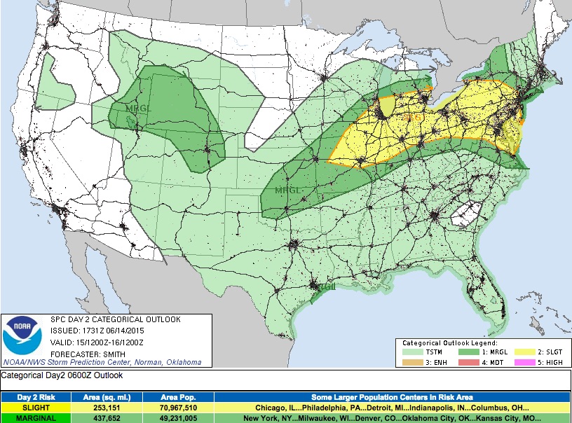
Monday's highs will likely be the coolest of the weekend behind the cold front overnight. Highs Monday in Denver will likely stay in the 70s with a good chance of storms across eastern Colorado. A few storms in and near the foothills Monday may become severe, with hail being the primary threat. The SPC currently has Denver in the Marginal risk area for Monday, we'll see what if any adjustments they make to this tonight. Latest hi-res models show sufficient CAPE by Monday afternoon to support a few stronger, more organized cells.
Some disagreements in the models in just how much rain we see Monday, but PWAT values are forecast to again climb to near or >1" by late in the day Monday across the greater metro area. General agreement is that the foothills west of Denver and Palmer divide stand the best chance at seeing appreciable moisture, though any storm that develops Monday should be a relatively efficient rain producer, capable of producing heavy amounts of rain in a short amount of time. Please stay weather aware.
The pattern for the remainder of the week looks fairly typical of what we might expect this time of year, with a better chance for storms than normal given how much water is around. Highs will climb back into the 80s by Tuesday, and should stay there or possibly warmer by Thursday and Friday.
As for severe weather, expect at least a chance for some strong storms both Tuesday and Wednesday, with a lower chance by Thursday and Friday. Currently the SPC has eastern Colorado in the Slight Risk zone for Tuesday severe chances, but I suspect they may increase that risk with the next update as a few storms Tuesday could certainly be severe. We'll get through Monday's setup and address Tuesday as needed.