The State of the Atmosphere: Monday, September 14, 2015

It's been a slow six weeks around here, with sparse delivery of State of the Atmospheres recently as the state has been rather predictable: clear, warm, and calm.
The start to September for the eastern two thirds of United States has been a hot one, and not surprisingly, Denver is currently running several degrees above normal for the month. Officially, the temperature is running 4.2° F above average through the first 13 days of the month.
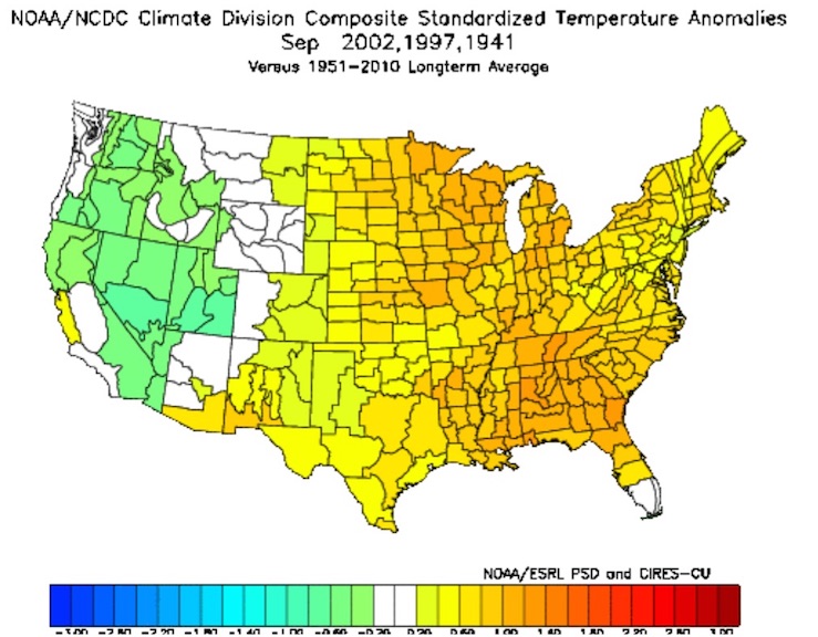
Many of the analogs Brian Bledsoe discussed recently in his article on the CPC constructed analogs also featured very warm Septembers, especially for the eastern two thirds of the United States. Let's consider three of these analogs: 2002, 1997, and 1941 which combined produced a composite standardized temperature anomaly map which looks a lot like this month:
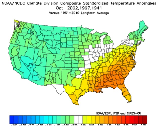
But then look at what happened in October for those years, the cold grew to include much of the middle of the country:
Unfortunately, this is contrary to what much of the modeling has at this point for October. The latest CFSv2 is "torching" the U.S. next month, with nary a below-normal temperature forecast to be found. The JMA, while not as warm, also has a ridge over Colorado, at least to start October, so we'll see.
These certainly aren't perfect analogs for this month, but as we've discussed at length finding a very good match this year is challenging. The biggest issue with the three analogs above are they are much wetter across the southwest than we've seen so far this month. To date, most of the country is running at or below (and even well below) normal for precipitation this month:
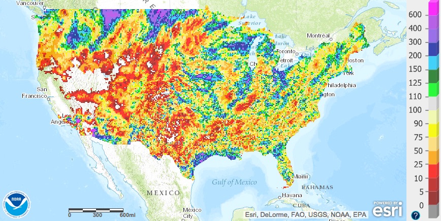
Big issues when looking at precipitation for the same analogs used above for temperatures, no?
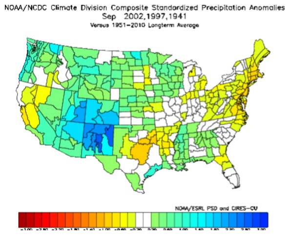
Yes, and no. The biggest differences are in the southwest U.S. where precipitation deficits are running much higher this year than in the analog years. That said, the month is not over so we'll see if we can't reverse that a bit. A look at the CFSv2 would suggest above normal precipitation for the southwestern states through the end of the month, which would help reverse these numbers a bit. Meanwhile, it forecasts temperatures to remain warmer than normal (overall) east, and cooler west.
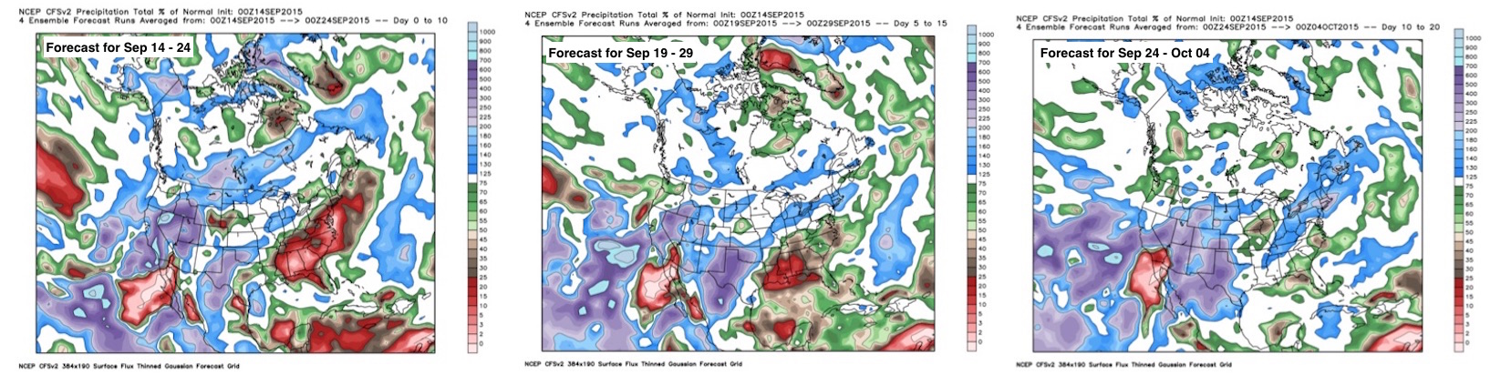
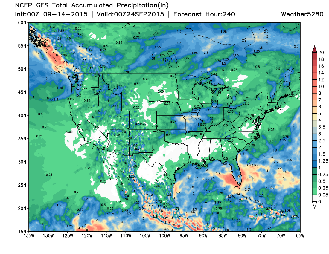
You'll note here, that northeast Colorado (Denver included) is forecast to remain at or below normal for precipitation through much of the rest of the month according to this model, while other western states see a bit more moisture return. The global models have been seeing this too, with better moisture over the next ten days to the west, while eastern Colorado remains on the dry-side for now:
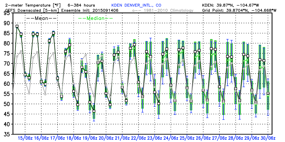
Despite the outlook for Denver and much of eastern Colorado continuing to look more or less dry over the medium range, we should see some relief from the hot-hot heat by week's end. The latest GEFS shows this forecast cool down by Friday. The mean temperature here doesn't even break 70 on Friday, though this is likely overdone given we've been running warmer than the models have projected most of the last few weeks.