Halloween Forecast To Escape with a Scare; Overall Pattern Wintry in the West

On Sunday, we discussed the importance of the track regarding our next system, which is due in at the end of the week. A further north scenario would have favored more rain and snow across eastern Colorado, while a further south solution would result in a drier system for the metro areas.
Consensus has come around to the latter of the two scenarios, with an unsettled end to the week, but no big snow for Halloween – great news for those trick-or-treaters!
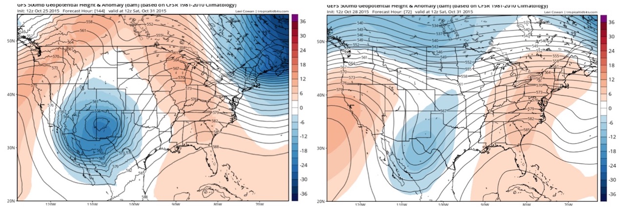
Below is the GEFS run from Sunday (left) compared to today's 12z run (right), both valid early Saturday. Notice the difference between the two. Saturday's anomalies were much more impressive with a well defined cutoff upper level low. Today we see the trough remains open, with much of the energy too far south for major impacts across the state.
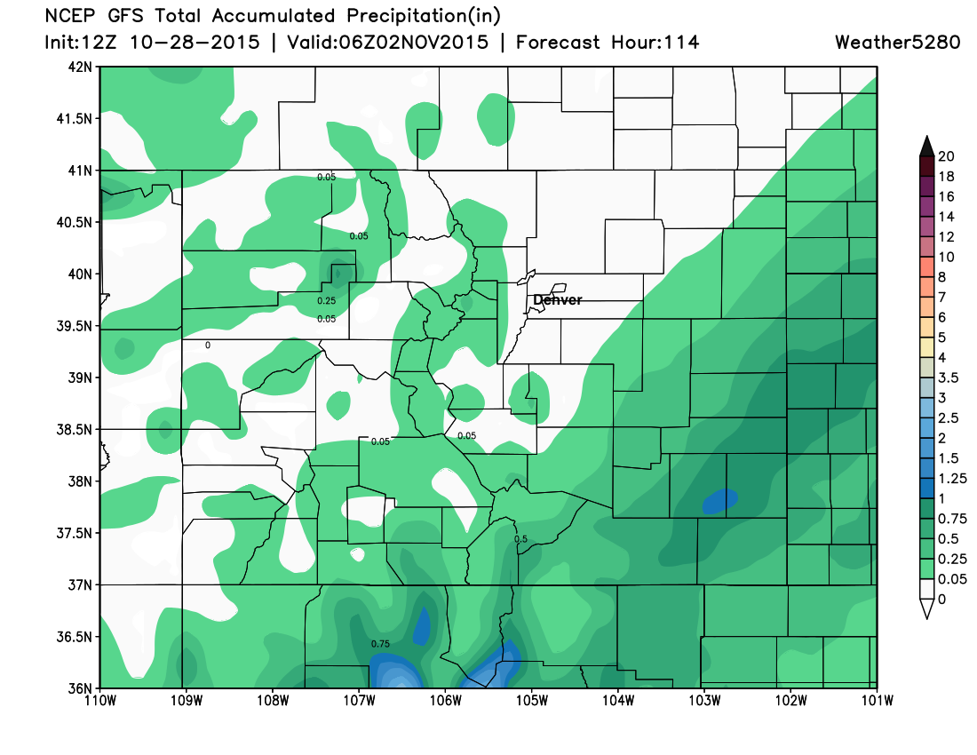
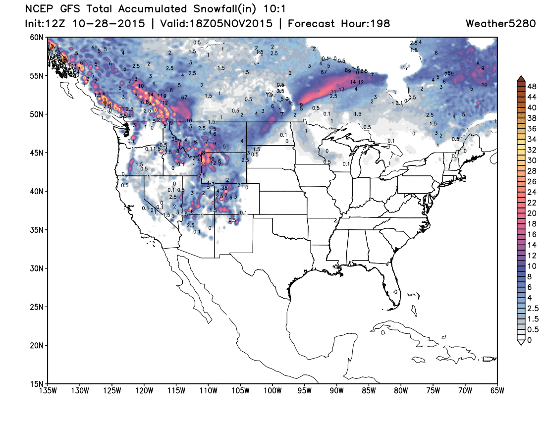
That's not to say we won't feel any impacts from this system. Friday looks to be the coolest/most unsettled day of the week, with conditions improving but staying cool on Saturday. While we have showers in the forecast for Denver Friday (for the time being anyway) it looks like the greatest rain and snow threat will be across southern Colorado, with southeast Colorado standing the best chance at any appreciable moisture by Monday. In fact, today's 12z GFS shows no QPF for Denver through Sunday (below). For Halloween day, look for highs in the low 60s for Denver, with overnight lows in the upper 30s to low 40s.
Medium range thoughts
Frankly, the models have been pretty horrible of late. While I'm inclined to lean toward the GFS for the time being (it never had the Halloween snow, while the Canadian/EURO did), it's having issues as well. That being said, we talk a lot about the pattern here on 5280, and that it's not about getting tied to one operational run of one model, but understanding what's going on in the bigger picture, recognizing when the pattern supports storms, and then zeroing in on which storms may eventually impact the region. We like the pattern in the west right now, but will Denver get in on the goods?
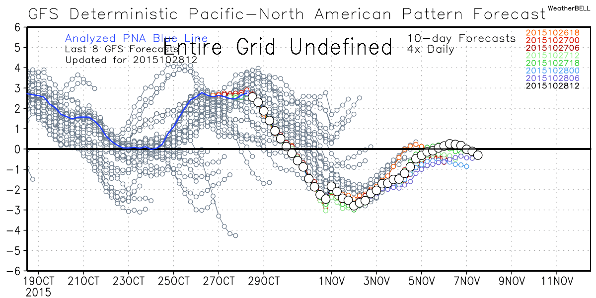
One thing we see showing up pretty consistently is a -PNA to start November, of which we haven't see much of this fall. The PNA almost went negative last week (remember our rain storm), but has been positive since. Both the GFS and EURO now show the PNA going negative next week, with the correction appearing to be toward more negative than forecast rather than visa versa as it has been of late.
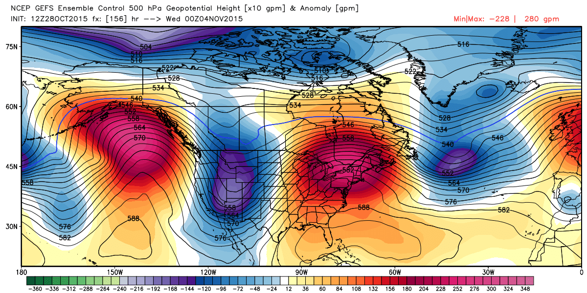
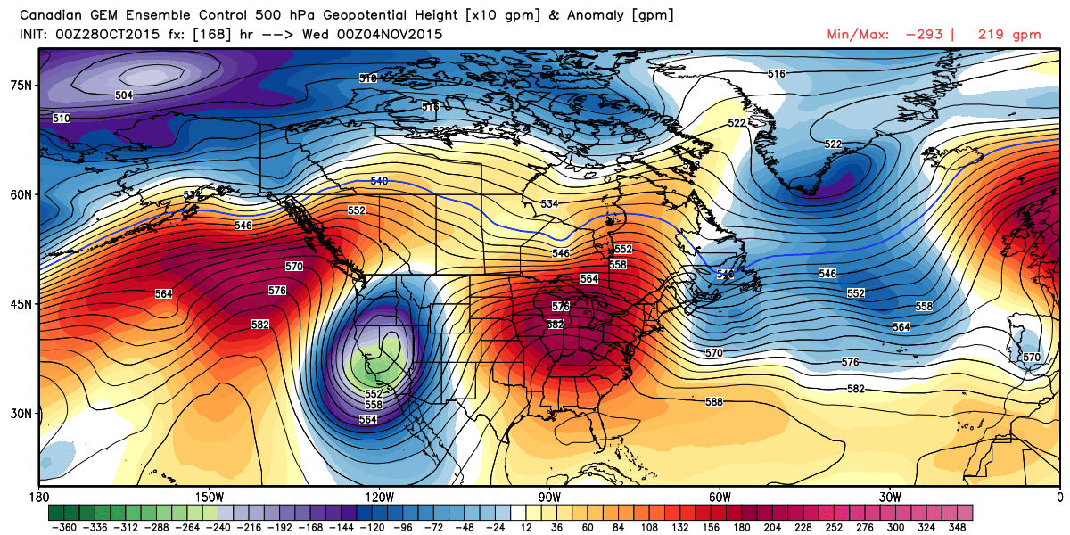
Couple that with pretty good agreement between all the global models for bringing in a big western trough next week and confidence grows. Here's a look at the 12z GEFS 500mb geopotential height for 00z next Wednesday, trough in the west (blue), ridge in the east (red):
And the Canadian ensembles:
And with that we see a pretty snowing/chilly week ahead for the western states:
Now, does that equate to a big storm for Denver? Maybe, maybe not. Take a look at last night's operational 00z model run from the GFS (left) compared to today's 12z run (right) just twelve hours later. One produces a very light snowfall for eastern Colorado late next week, the other buries pretty much the entire state under heavy snow. Did I mention the models are struggling?
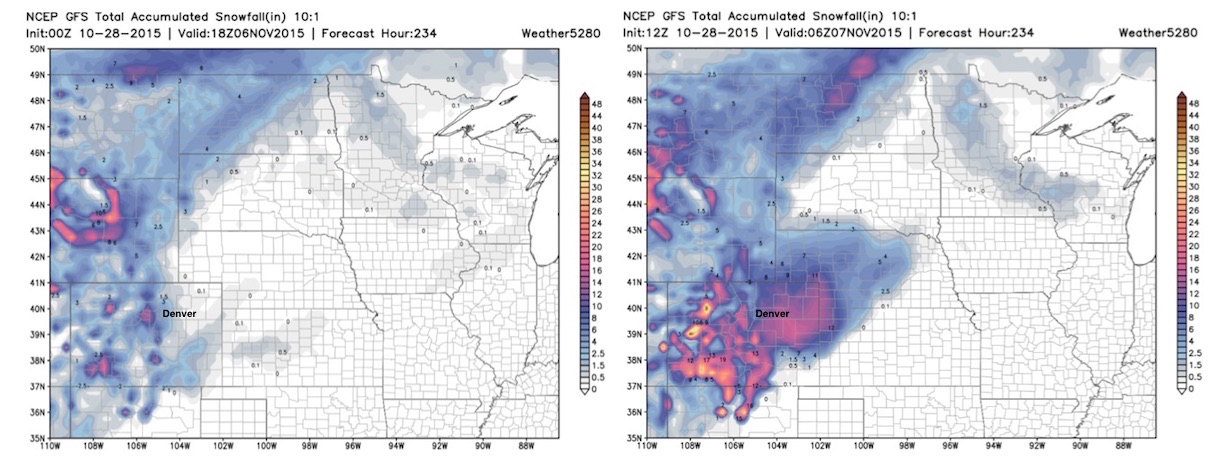
Here's a good example of why leaning heavily on one operational run to the next is a bad idea. While the ensembles have been struggling too, they all support wintry weather in the west next week. Ensemble support for a system producing snow for Denver specifically late next week look less convincing – at this time.
There's a lot of time to watch how this pattern evolves, and while confidence remains very low in that we actually see a storm materialize for the Front Range next week, the overall pattern is far more supportive of this scenario than any other time this early season. Someone in the region will likely see a good snow by the second half of next week, whether that's Colorado or a neighboring state remains to be seen.