Winter Forecast Update: Analogs and Models

I am not going to spend much time on the main drivers with this update. We have talked about them at length in previous posts, and I think you pretty much know what they are. We've touched on analogs in previous posts too, but not in a lengthy fashion. The main reason for that is that there really isn't a "perfect" analog when it comes to referencing the next several months.
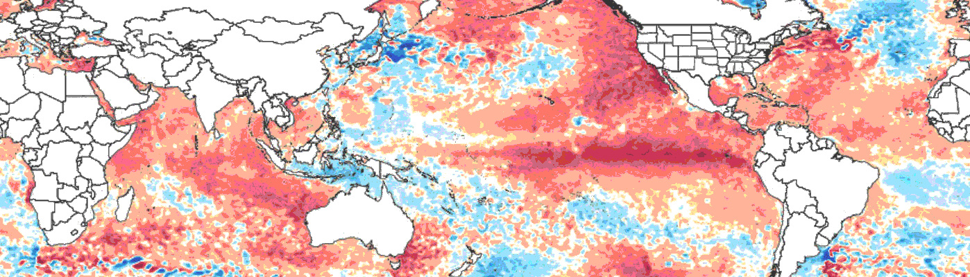
Of the analogs chosen, those years with a strong El Niño, a positive PDO, and a positive AMO will be weighted the heaviest. Potential analog years prior to 1950 that I actually like: 1877-78, 1887-88, 1930-31, 1940-41 and 1941-42. However, as I have mentioned before pre 1950 data is a bit more questionable. Post 1950 analogs that I continue to like: 1957-58, 1965-66, 1986-87, 1991-92, 1997-98, 2002-03, 2009-10, and 2014-15. My favorites from that second set: 1957-58, 1997-98, 2009-10, and 2014-15 (ascending, not favored order). Something that we have talked a lot about internally here at Weather5280 is breaking down the "winter" (entire snowfall season) forecast into two parts...early and late. So, with the favored analogs here is what occurred during those years:
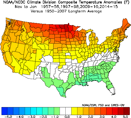
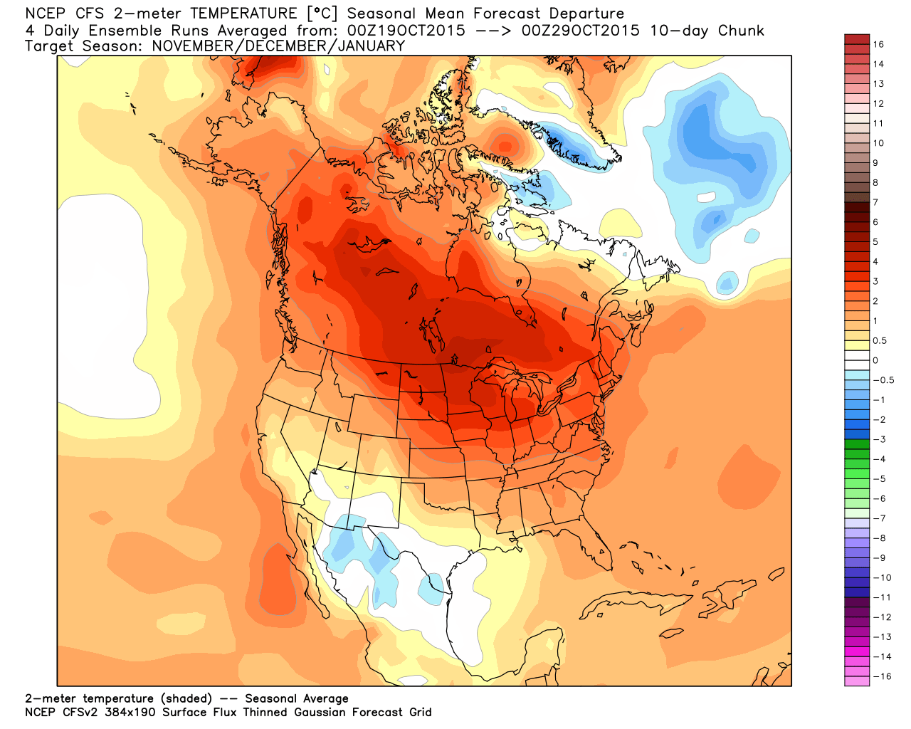
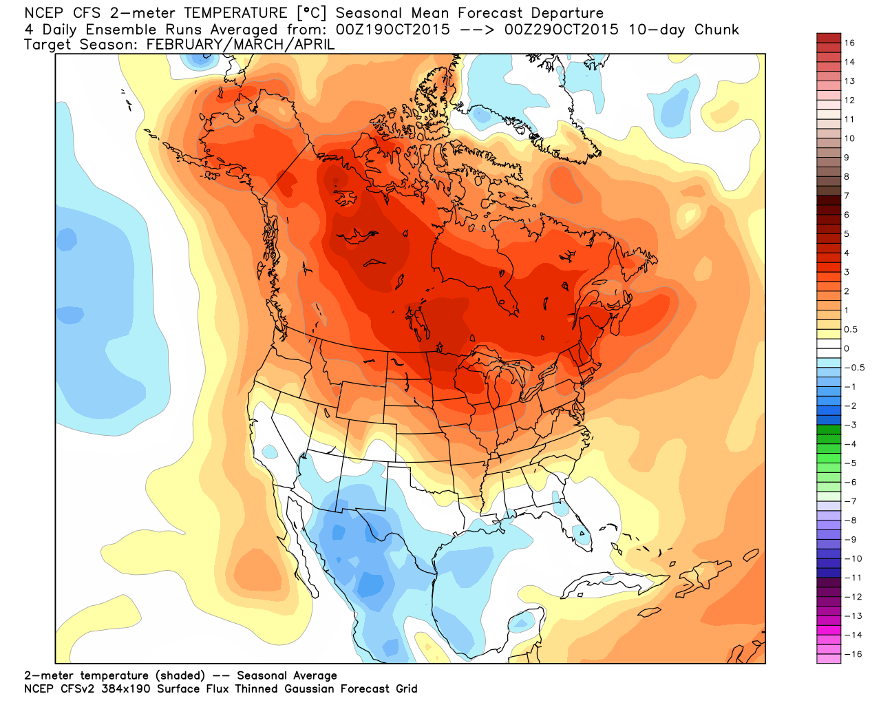
Temperature Analog
November through January:
February through April:
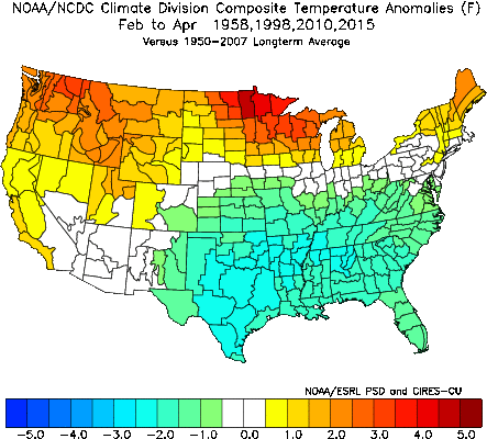
For a large part of Colorado, you can see that there is a tip toward warmer than normal temperatures during the first half of the winter. For the second half of the winter the state averages out to about "normal" with the colder than normal trend favoring the southeast part of the state.
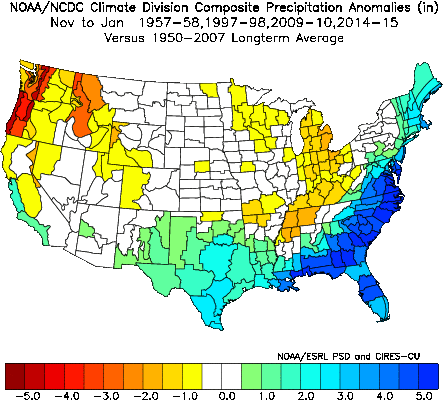
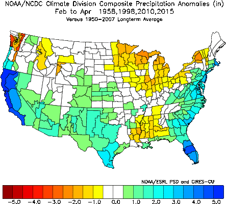
Precipitation Analog
November through January:
February through April:
I know this likely won't be perfect, but it really fits with how I think the upcoming winter is going to pan out. Maybe a decent storm in November, then a quiet and fairly warm December and January. When we get into late February, March, and April, I think our weather will turn colder and wetter. However, please keep in mind that wetter late February through April doesn't necessarily mean it will all be snow. Remember, 2014-15 is in the analog list. My above theory also has quite a bit of model support:
CFSv2 Model Temperature Forecast
November through January:
February through April:
CFSv2 Model Precipitation Forecast
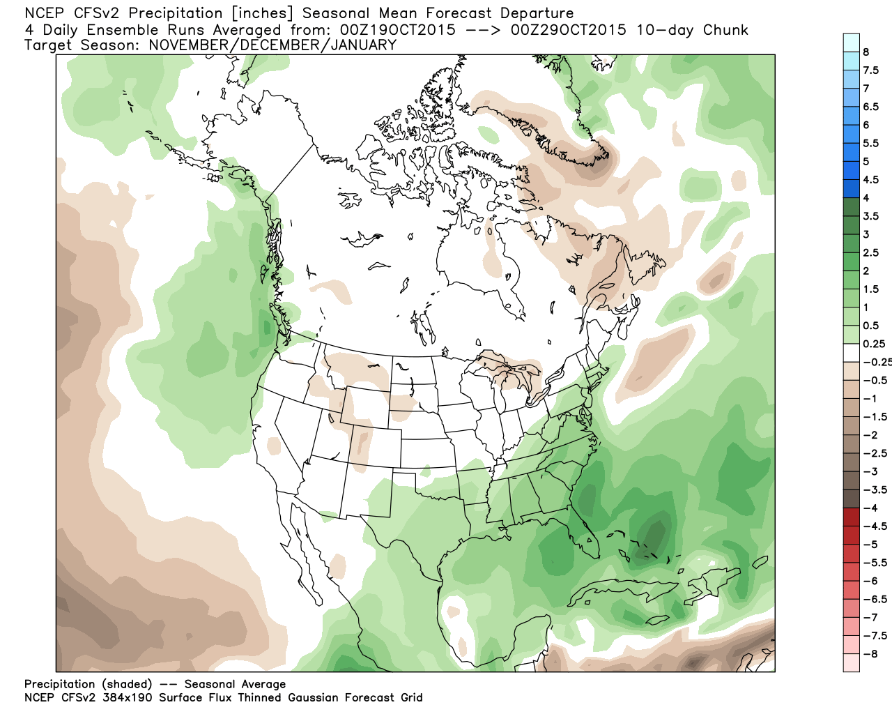
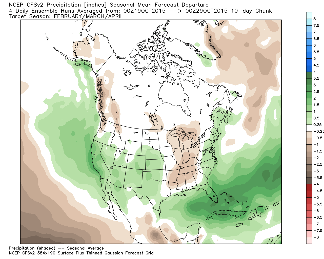
While the CFSv2 Model never really screams colder than normal for Colorado, you see the trend to cool off the southeast part of the state in the February through April timeframe...ala the analogs. It also has the first part of the winter either normal to slightly drier than normal, with the second part of the winter noticeably wetter.
North American Multi-Model Ensemble Temperature Forecast
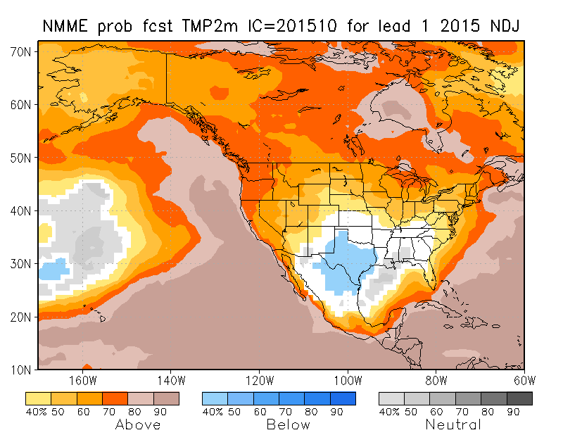
November through January:
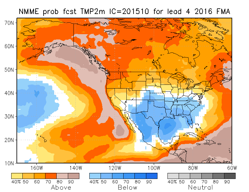
February through April:
North American Multi-Model Ensemble Precipitation Forecast
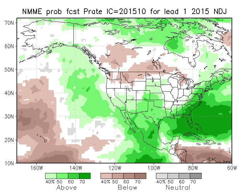
November through January:
February through March:
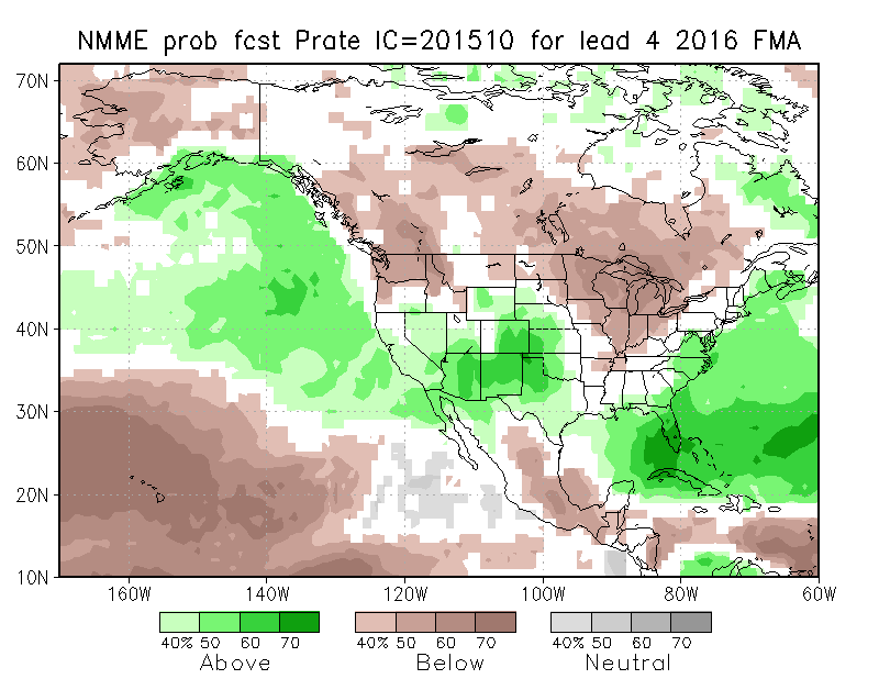
The NMME pictured above also follows the selected analog forecast pretty well. Normal to warmer than normal first part of the winter, with the second half not being as warm with a tip to colder than normal temperatures for Eastern Colorado. The precipitation forecast has it wet for the whole winter, with the strongest wet signal showing up for Colorado during the second half of the winter. Not sure I agree with that first part of the winter being wet, unless we do get a big storm. Remember, the models do not discriminate how that wet signal is spread out...could be one big storm, or could be wet the whole time.
There are other models out there too, such as the JAMSTEC that is forecasting it to be a cold and wet winter from start to finish. I just don't see how we are going to get the cold air and be able to sustain it for the whole winter. Will we get cold shots here and there? Of course, even last winter which ended warmer than normal we had some very cold spells. Plus, I think the most active part of the storm track will be just to our south during the first part of the winter season.
As you have heard me say before, our best shot at colder than normal and wetter than normal weather favors the time when the strong El Niño weakens. This El Niño will weaken during the late winter and spring, possibly paving the way for a very stormy period for all of Colorado. Until then, the first half of the winter will likely be the most active for the southern quarter of the state.
My favored analogs do offer some decent snow for Denver...generally normal to a bit above normal:
1957-58: 57.1"
1997-98: 72.1"
2009-10: 60.6"
2014-15: 57.8"
I think that Denver will end up in the same range before winter 2015-16 is done. However, I believe that most of that will come during the back half of the winter. If that happens, we do run the risk of temperatures being too warm and rain mixing with the snow. That could hurt totals somewhat. Whatever happens, you know it will be interesting...it always is.
If you're not already, be sure to subscribe to Weather5280 today for all the latest updates delivered to your inbox.