The State of the Atmosphere: Sunday, November 1, 2015

October: Above average temps, above average precip, below average snow
Yesterday we wrapped up yet another above average month for temperatures, with Denver recording its sixth warmest October on record with an average temperature of 56.5° F, a notable 5.3° above average for the month.
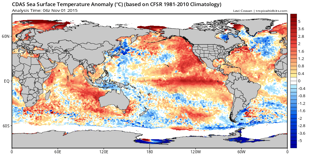
In many respects this should come as little surprise. The Pacific is warm right now, too warm. Specifically, the water right off the west coast which helped bring a snowless October last year. 2014-15 remains in our top analog list, despite the presence of the strong El Niño.
For precipitation we'll also end the month above normal in Denver, thanks really to just one good rain event and that's about all. Denver's average first snowfall occurs on October 19th, so we're certainly over due. Last year, which was also a remarkably warm October, Denver didn't record its first measurable snowfall until November 11th. You'll remember one (of the many) struggles we had last season was temperatures – rain instead of snow – which was certainly the case last week. So, we enter November still awaiting our first snowfall. The latest date of Denver's first snow on record is November 21st, set in 1934.
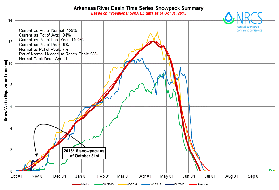
For the mountains, the news is slightly better, despite a very slow start to the month snow-wise. Snowpack in October went from virtually zero and below average mid-month, to ~average to end the month statewide:
The week ahead
As we discussed last week, this coming week may very well feature a chance for snow in Denver. Those chances, however, are looking low at this point.
We'll be fighting several factors with two systems forecast to impact the state later in the week. From storm tracks, to speed, to temperatures, to strength, it'll take some work to get measurable snow in the city.
Last week models were trying to bring a deep cutoff low across the southwest, with some runs producing quite the snowstorm for Denver. The ensemble support for this was minimal as we discussed, and since then the global operational models have trended toward a faster, more open solution, with less snowfall at lower elevations across eastern Colorado.
Setup
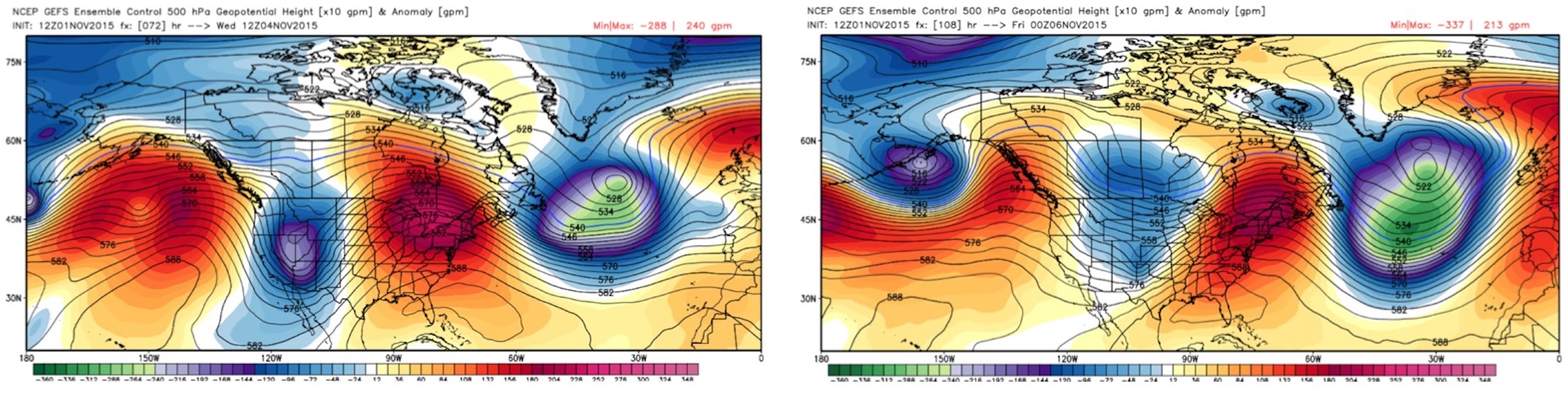
By Wednesday we see our temperatures start to cool as a big upper level trough dig into the western states. It then it quickly traverses east/northeast across Colorado by Thursday, with little opportunity slow down, deepen and close off. Looking at the images below, notice that by Thursday evening (right) the purples are gone, and the system looks less compact, with much of the greatest anomalies well north and east of Colorado.
The second system that may bring another chance for precipitation (rain and snow) across northeast Colorado will be another quick-hitting disturbance late Friday into Saturday. This too has little ensemble support, but both the GFS and EURO are showing it, so worth a mention. Should this system dig a little deeper and slow down a little, it could be we see another chance for snow as we head into the weekend – but again, not loving the look of it right now either.
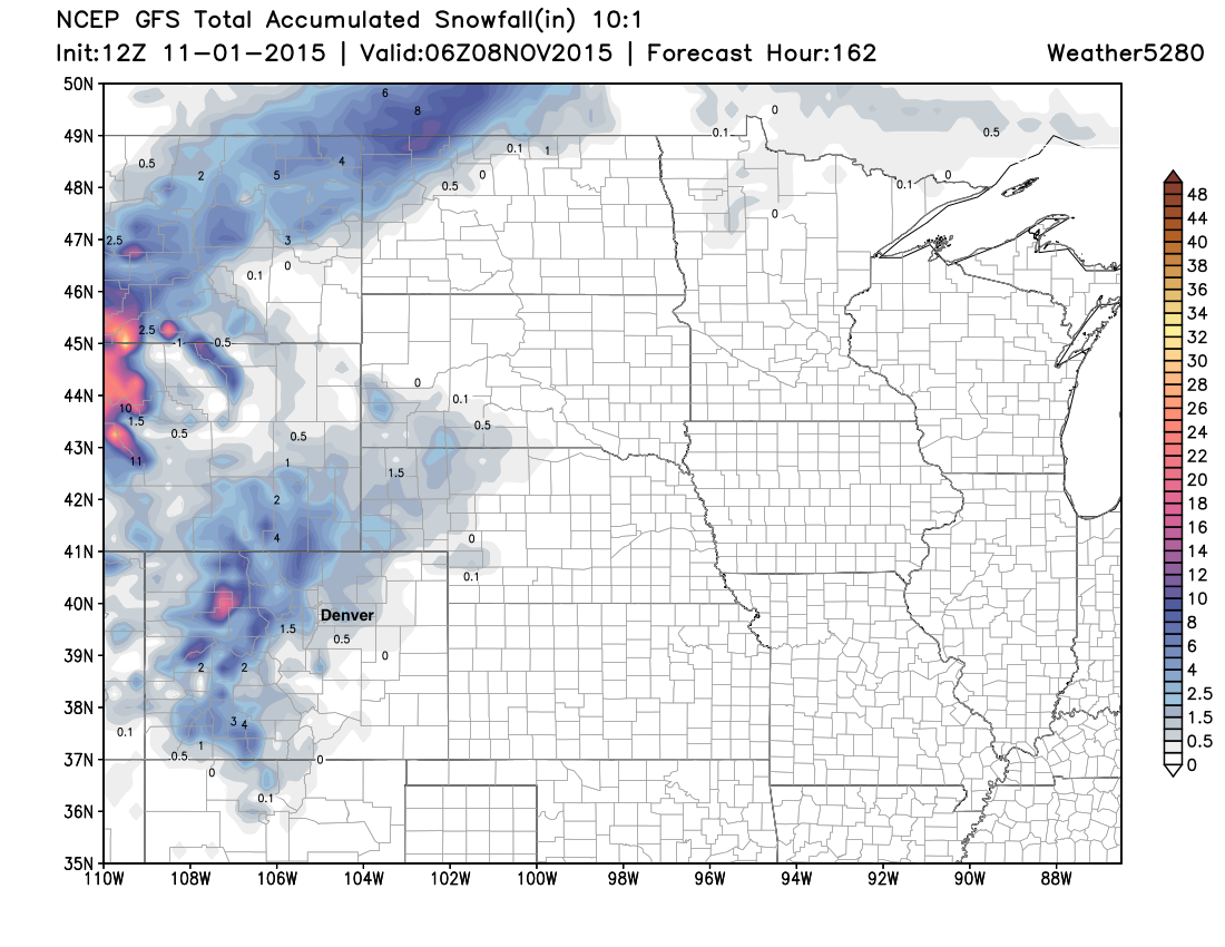
Below is a look at the 12z GFS snowfall forecast through the weekend. Mountain snow looks like a sure bet this week, but what happens across the Plains is in greater question. The EURO looks similar, though is a bit more gung-ho with the second system, and therefore brings a bit more snow to the Palmer Divide and Front Range foothills.
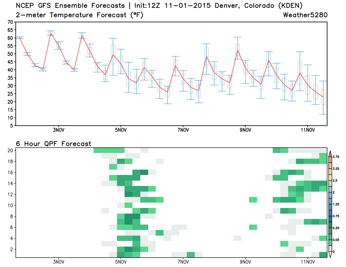
A look at the GFS ensemble forecast shows this cool down for the second half of the week, and the precipitation chances too. Considering where we are in the season, these temperatures (even the low end) aren't that cold, and none of the members are showing that much precipitation.
We'll need to watch both of these systems over the coming days and see if either tries to get a bit more organized. For now, plan on a chilly and unsettled second half of the week, with possibly even our first flakes of the season at lower elevations.
If you're looking for that big snow... Beyond this week I think the door remains open for a system or two to finally bring a wintry change to the area, but there's nothing all that convincing in the pipeline. The ensembles continue to show troughs moving into the west, with even a few runs finally latching onto some colder air late in the second week, but nothing yet I'm willing to hang my cap on and say "yep, that's the one".