Tuesday PM Update: Mountain Snow; Changes for the Plains Too

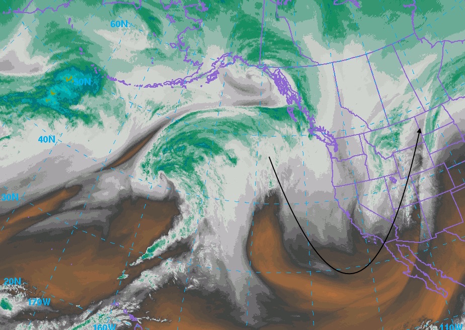
We're already feeling the effects of our next system on the way in the form of gusty winds ahead of a big upper level low over southern California today. On satellite the big dip in the jet stream is very evident, with cooler temps, rain and snow for the western U.S. over the coming days.
For Denver, and much of eastern Colorado, this meant one more day of temperatures well above normal, and dry (very dry) conditions. A Red Flag Warning was in effect for all of southeast Colorado Tuesday, with extremely low humidities, gusty winds, and warm temperatures creating prime conditions for fires.
Our focus will gradually shift from warm and dry to cool and unsettled, especially across the mountains of Colorado as we head into Tuesday night extending through Thursday. This system is forecast to bring good snow to the high country, but won't deliver much for the Denver area as discussed in this week's SOTA.
Here's a look at the 12z GFS snowfall forecast through Saturday. Notice that the heaviest snowfall favors western Colorado above 8,000 feet. A Winter Storm Warning goes into effect this evening for the higher terrain of western Colorado, and remains in effect through Thursday morning. If you're travel plans take you west over the next 24 - 36 hours, please plan accordingly.
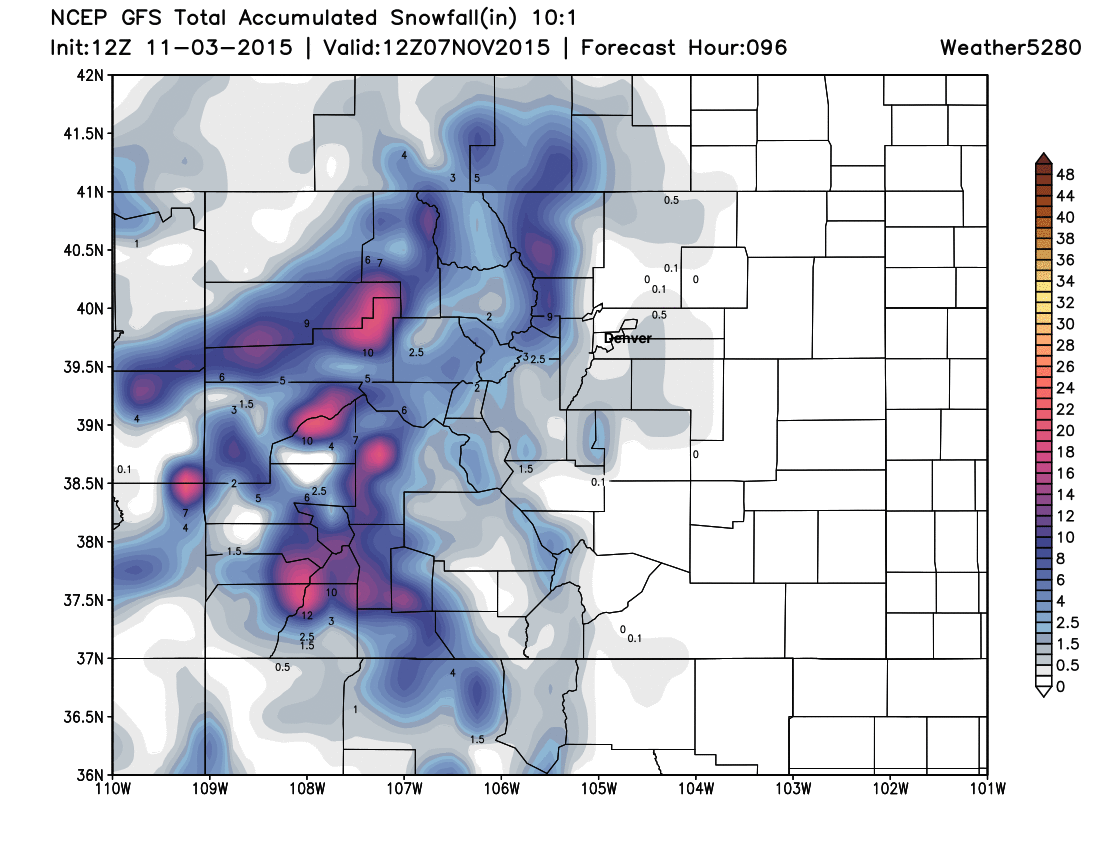
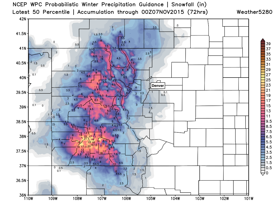
For Denver... well, it's not producing much. The EURO looks similar, though it brings about 2 - 3" to the Palmer Divide and southeast Denver suburbs, where the GFS has Trace - 1". Given the EURO ensembles look much closer to the GFS, will hedge toward the lower amounts for now. If we look at the WPC probabilistic snowfall forecast we see a very similar look:
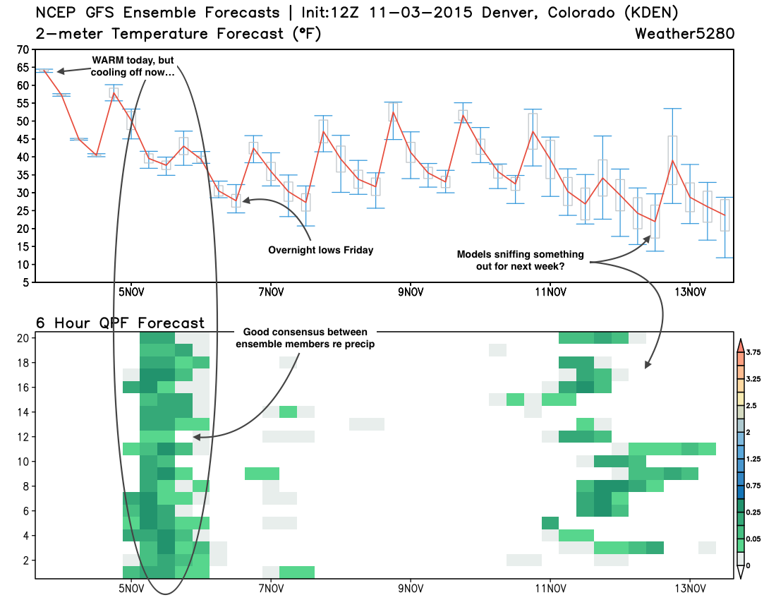
So, will we see our first flakes of the season in Denver? That remains a big maybe. Will we record our first measurable snowfall of the season? That remains an even bigger maybe. I'm inclined to believe we'll see some snow at lower elevations, how much (if any) of that sticks is another question. Temperatures look borderline at best Wednesday night into Thursday morning to produce snowfall in the city.
In any event, this will be a big change from the weather we've experienced over the last several days. Highs both Thursday and Friday look to stay in the 40s for the Denver area, with overnight lows dropping into the mid to upper 20s by Friday night. I also like the chances for most of northeast Colorado to see some precipitation during the Wednesday evening - Thursday midday timeframe, though not an overwhelming amount.
We'll keep an eye on how things evolve over the next 24 hours and post any updates as necessary. As it stands, we likely won't need to pass along much, but if our snow chances look to increase – we'll be sure to get an update out Wednesday.