Heat Is on to End Week; Tracking Changes by Sunday

Temperatures well above normal to end the week, but changes coming
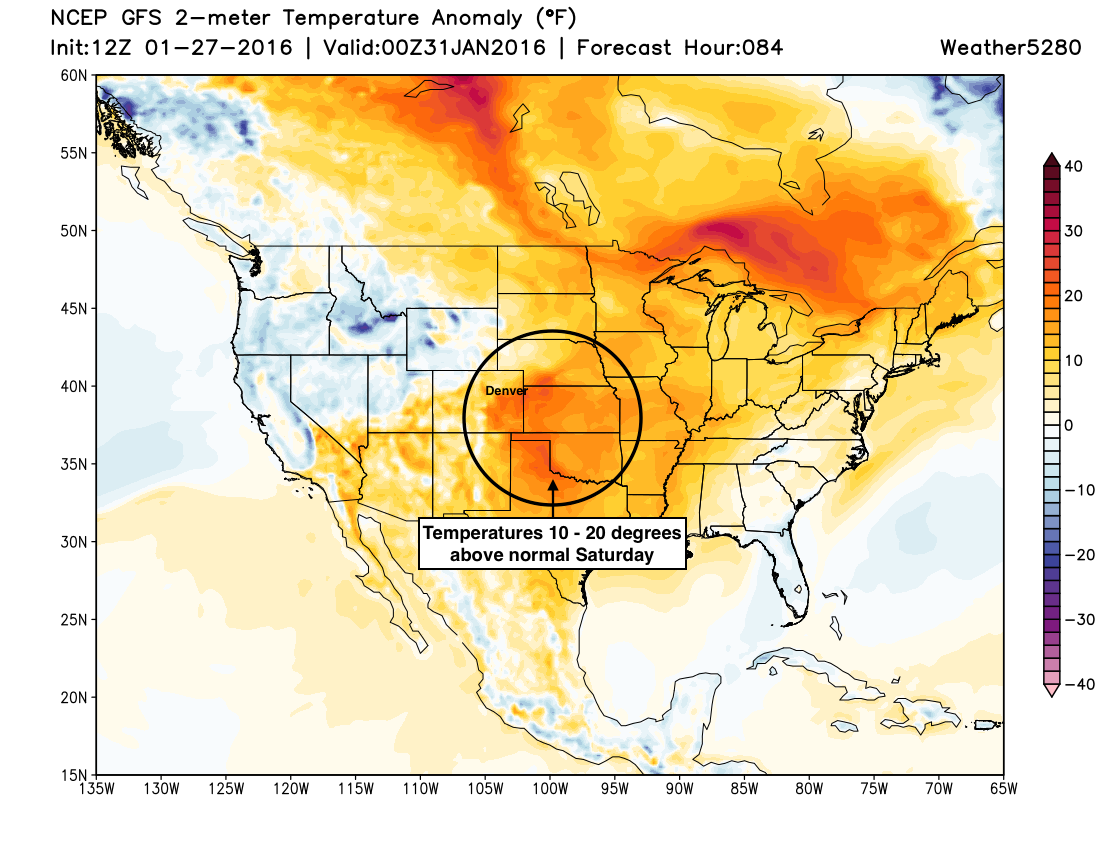
First, a quick update on the very warmer weather on the way to end the week. As we discussed on Sunday, temperatures will soar above normal Thursday through Saturday, with many locations across eastern Colorado seeing the 60 degree mark before all is said and done.
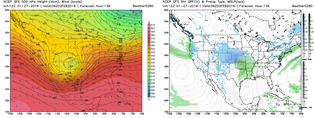
By the weekend we'll need to shift our focus back to winter weather, as global models continue to indicate a potent winter storm will develop over the Great Basin Saturday and Sunday, before moving east early next week and intensifying over the Plains.
The question of course is what that means for eastern Colorado, and the answer of course is complicated. It's simply too soon get too specific on various solutions, despite some folks floating numbers around today.
There's good agreement in the modeling that something is coming out, but as we're still four-five days out, there is lots of variability in forecast track occuring, which of course means dramatically different scenarios for say... Denver.
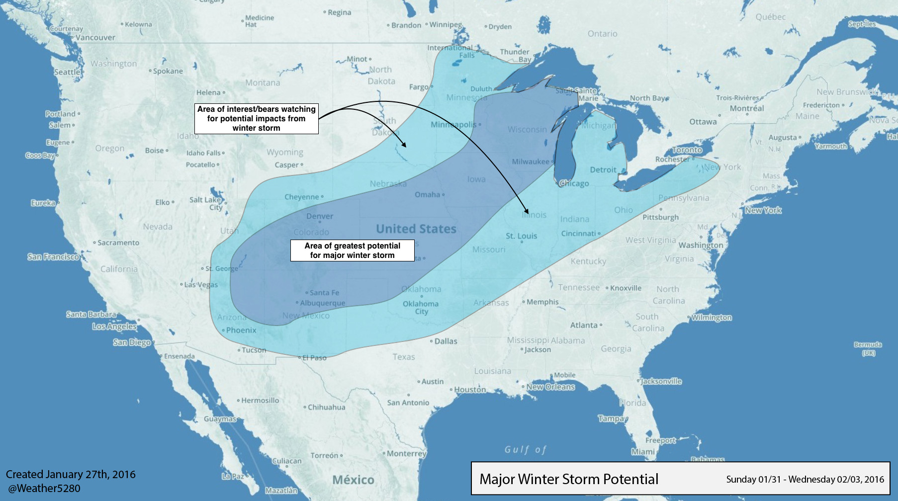
The map above shows where we see the greatest potential for a major winter storm next week – that is, heavy snowfall accumulation and likely blizzard conditions from eastern Colorado and on into the Plains/Midwest by the middle of the week. For now, we've placed Denver at the northern end of the greatest potential, as we fear the tendency may be for this thing to get pull south, rather than north – if it's going to miss.
We do think most of Colorado stands a chance at getting in on the action from Sunday through early next week, as global ensembles support a favorable storm track for snow across the state. That said, the devil is of course in the details, so it's likely that some locations (especially across eastern Colorado) will likely get "robbed" depending on eventual track. So, until we get a better handle on how this thing will progress, we'll be talking in broad terms, and tracking mid-level evolutions through the next few days.
Wednesday takeaways...
- Warm end to week. Headlines may be talking snow, but we have several very warm days ahead, so get out and enjoy!
- Confidence growing in winter storm, somewhere. It's looking like a strong winter storm will impact the region by late in the weekend and early next week, though many uncertainties remain.
- Impacts will likely mean heavy snow and blizzard conditions wherever this thing ends up going. If you live in New Mexico, Colorado, Wyoming, Nebraska, Kansas, northern Texas, and eventually points east – you'll want to pay attention to the forecast as we head into the weekend. Farmers and ranchers in these states need to be prepared for the return of hazardous winter conditions.
- For Denver, the POTENTIAL is certainly there for a major winter storm, but the Bust Index (if you will) is very high. Biggest concern (if you're hoping for snow) should be a shift south with the main ULL feature Mon/Tue, and likely models like the ECM overdoing snowfall/overruning potential Sunday. For what it's worth, the EURO ensemble mean has been running at about half of what its deterministic model has been producing for snow in recent days. So, caution in getting too ahead of reality here.
- We're here for you. There will no doubt be a lot of talk in the coming days, so we'll do our best to keep the updates coming and keep you well ahead of any storm potential storm that may be brewing. If you're not a subscriber to Weather5280, now is a great time to do so.