Colorado's Snowfall so Far and Snowpack Update

We updated you on the Western U.S. snowpack last week. We have had a big system since, so let's see how things are now following the Groundhog Day Snow, focusing on Colorado and how much snow we've had this season.
Colorado currently has more than the average water content in all of its river basins.
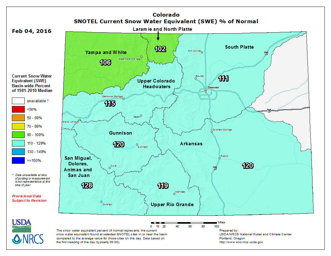
The extreme southwest has the best average of 128% of average as of 4 February.
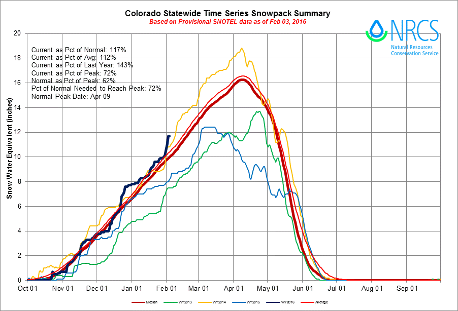
This is a better water-situation than the state has had recently. Notice that we currently (solid black line) have more snow water than the average (red) and more than we have had the past few years.
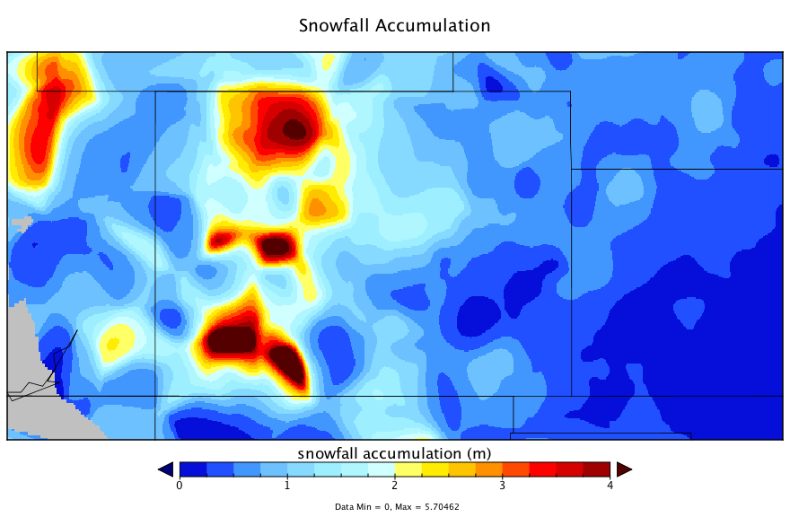
Okay, so we are ahead of average but how much snowfall have we actually had so far? Good question. The state has some impressive totals topping the list. The top three locations are Cedaredge with 298" on the season, followed by Crested Butte (208") and Steamboat Springs (187"). These are the reported amounts from the CoCoRAHS network of reporters.
You can clearly see those three bulls-eyes of snowfall so far this season. The blue area of higher totals that stretches eastward across the middle of Colorado is the Palmer Divide.

To find the total season snowfall (through 4 February) closest to you you can use this interactive map. *note, I have seen some "bogus" reports that do not match their surroundings. I think you will see those as they clearly standout. I will try to get through this CoCoRAHS data to eliminate those reports.
As you interact through the data you will clearly see that southern metro areas, such as Castle Rock, have had a lot more snowfall than Denver or points to the north.
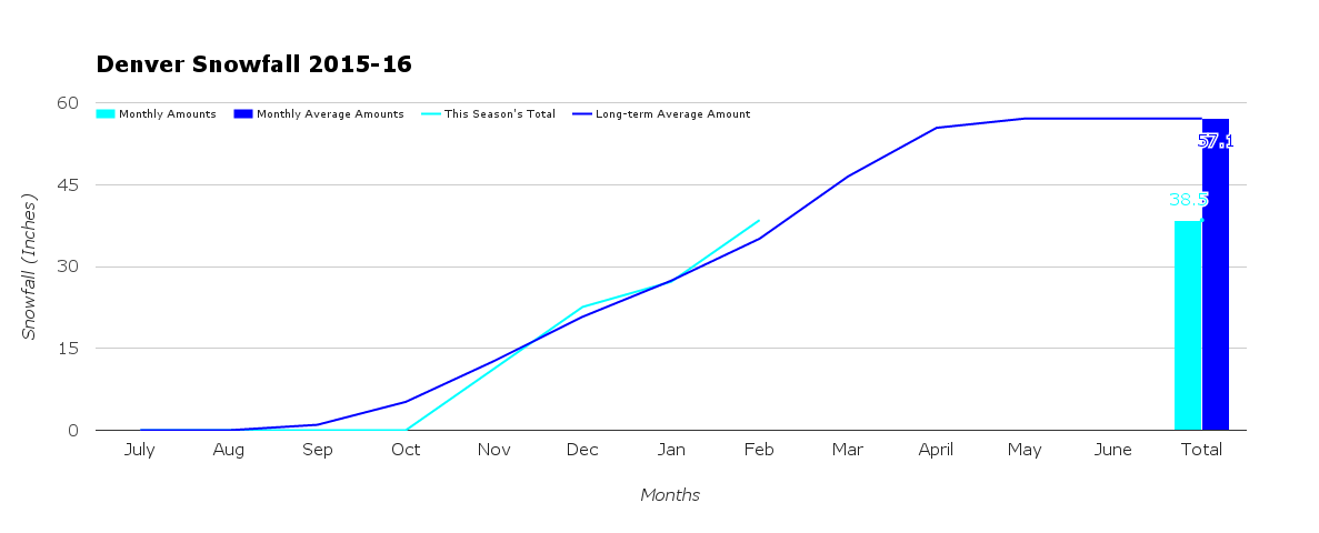
Again, Denver is officially ahead of average (by only a few inches) on the season with 38.5" so far.
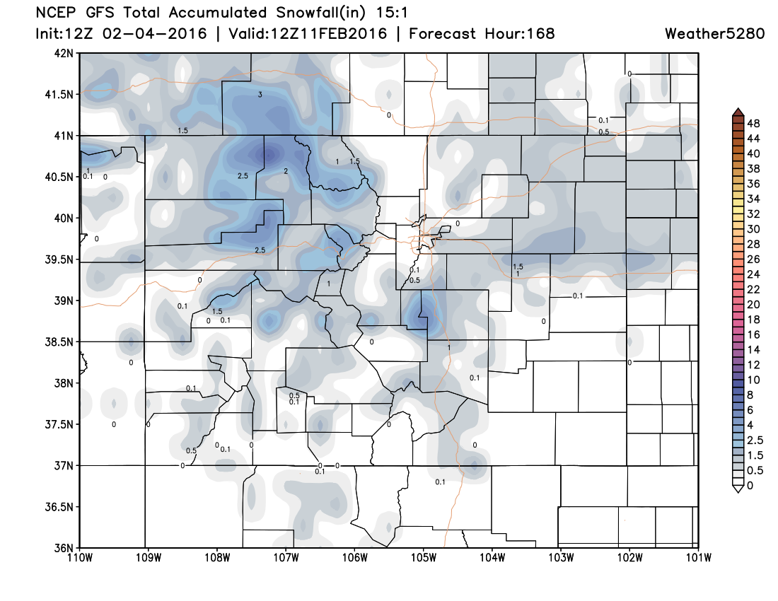
We are not too likely to see the snowfall totals change much over the next week with little snowfall activity headed our way through the middle of next week. A look at the snowfall projection through next Thursday morning is a dismal outlook for snow lovers.
We will be watching for a potential system closer to the 15th. At least, there are some indications of one by then.