The State of the Atmosphere: Sunday, February 14th, 2016

Happy Valentine's Day! Colorado is celebrating with the wind, some clouds, and snow, in some areas.
Cloudy morning in Castle Rock. pic.twitter.com/qxxIlrxGkF
— Matt Makens (@MattMakens) February 14, 2016
The weather change that you have felt and seen today is part of weak weather-maker that is grazing the region. This system is not very strong and will be clearing the state soon.
If you looked at the satellite imagery of today's system you clearly saw the cloud cover:
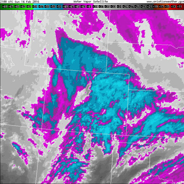
But, look at the radar to see what's actually beneath that cloud cover and there is not much falling:
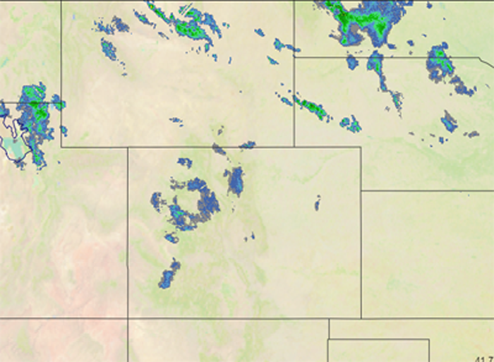
The mountains will benefit the most from that little bit of radar activity you see in the central areas. Copper Mountain had periods of good snowfall today, and can expect 3 to 6", most likely, when all said and done.
Big flakes fall hard.
Posted by Copper Mountain on Sunday, February 14, 2016
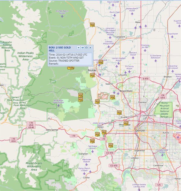
The wind has been more prevalent than radar echos, that's for sure. Reports lined up along the foothills were impressive for gusts over 60mph, and one near Gold Hill topped the list at 91mph.
The wind will be decreasing through the night and early in the week. However, foothill and mountain locations will be subject to gusty wind during the week, from time-to-time. We may all have a windier day later in the week again, too.
Snowcast
That bit of mountain snowfall will try to make it onto the plains with some flurries to snow in very few areas tonight.
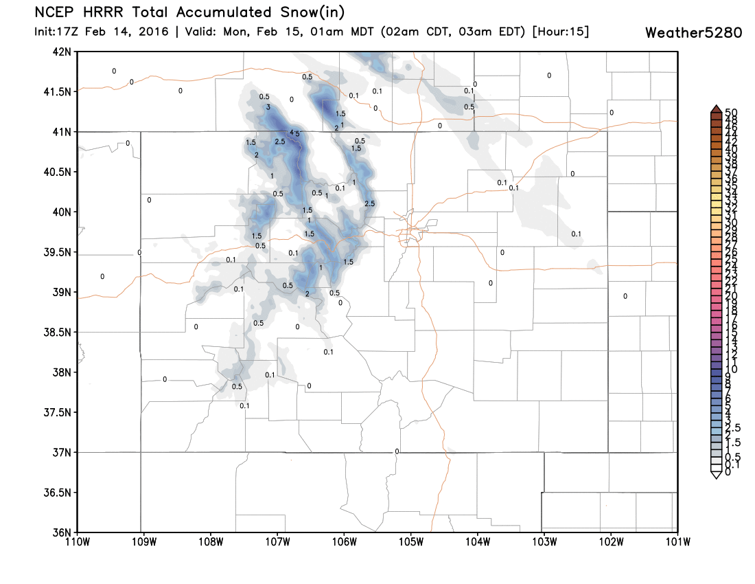
The northeastern plains would be the most likely zone for that light snowfall or rainfall, considering the warm temperatures.
Warm, very warm, week ahead
Speaking of warm temperatures, that's exactly what we will have this week when this system clears out overnight. 50s for Monday, with less wind, and then 60s and some 70s for the rest of the week.
This may leave you wondering what happened to an active weather pattern. We have a very persistent ridge (dry, warm zone) positioned over the western U.S. and it shows very little desire to leave us anytime soon. For now, it appears the last two weeks of February may be more active with a couple of systems that could potentially move through. There isn't huge confidence in that as there remains model disagreement.
There is greater support for a weather-active March, though. The MJO (atmospheric wave pattern) will support a more active storm pattern late February and for early March. The long-range climate models support an active March also.
Until then, enjoy the warmth as it certainly won't last. We certainly will have more active SOTA write-ups in the not so distant future. There may be a storm or two to track in next week's update.